East Leake Conservation Area
East Leake Conservation Area Appraisal and Management Plan March 2023

Contents
1.1 Conservation Areas
1.2 The Purpose of a Conservation Area Character Appraisal
1.3 The Planning Policy Context
2 East Leake Location and Landscape Setting
2.1 The East Leake Conservation Area
3.1 Location and Historic Activities
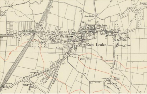
3.2 Historical Mapping
4.1 Plan, Form and Layout
4.2 Landmarks, Focal Points and Views
4.3 Open Spaces, Trees and Landscape
4.3.1 Open Spaces, Trees and Landscape SWOT Analysis
4.4 Public Realm
5 Buildings of the Conservation Area and Key Characteristics
5.1 Building Types and Activity
5.1.1 Building types and Activity SWOT Analysis
5.2 Key Characteristics and Building Materials
5.2.1 Key Characteristics: Main Street - Zone 1
5.2.2 Key Characteristics: Station Road and Brookside - Zone 2
5.2.3 Key Characteristics: Main Street 1- 17 and 2 - 94 - Zone 3
5.2.4 Key Characteristics: The Green and The Nook - Zone 4
5.2.5 Key Characteristics: Bottom of Castle Hill, along Costock Road - Zone 5
5.2.6 Characteristic Zone Map
5.2.7 Building Materials and Local Details
5.3 Key Characteristics SWOT Analysis
5.4 Listed buildings
5.5 Key Unlisted Buildings
6.1 Introduction
6.2 National and Local Policies and Guidance
6.3 Article 4 Directions
6.4 Building Design
6.5 Publicity and Knowledge Transfer
6.6 Public Realm
6.7 Boundary Treatments
6.7.1 Walls and Fences
6.7.2 Hedges
6.8 Buildings at risk
6.9 Enforcement
7 Appendix 1 – Listed Buildings (as of December 2023)
8 Appendix 2 – Conservation Area Boundary and Townscape Appraisal Map
1 Introduction
1.1 Conservation Areas
Rushcliffe Borough Council has an obligation under Section 69 of the Planning (Listed Buildings and Conservation Areas) Act 1990 to review, from time to time, its Conservation Area designations.
A Conservation Area, as defined under Section 69, is ‘an area of special architectural or historic interest the character or appearance of which it is desirable to preserve or enhance’.
East Leake Conservation Area was designated in November 1973. Prior to this re-appraisal of 2023, the East Leake Conservation Area was also reviewed in August 2006 and published in 2008.
This appraisal was adopted in September 2024.
Section 71 of the Planning (Listed Buildings and Conservation Areas) Act 1990 highlights the local planning authority’s duty to formulate and publish proposals for the preservation and enhancement of the conservation areas. This document, therefore, aims to identify and
reaffirm (or redefine) the special architectural or historic interest of the area which warrants its designation.
Conservation Area Appraisals are not, and never have been, tools for to fossilise a place against change, instead, the processes of change which allow places to grow and evolve are recognised as being unavoidable, and it is also recognised that change can be a positive and desirable force. The designation instead allows greater scrutiny and control to manage change to positive effect and to ensure that any changes which require planning permission do not harm, and ideally serve to actively enhance, the existing character of the place.
East Leake Conservation Area: Summary of Special Interest
East Leake still boasts various green spaces and mature trees (especially along the Brook), a Friendship Garden, playgrounds,
a balance pond, a Glebe and a memorial garden, all of which contributes to the rural mixed character of the area.
There are a number of key unlisted buildings, with many original features.
Boundary treatments are respectful to the open spaces and contribute to the rural mixed character.
1.2 The Purpose of a Conservation Area Character Appraisal
The purpose of a Conservation Area Character Appraisal is to:
- Identify and record the special interest of the Conservation Area to ensure there is public awareness and understanding of what is
worthy of preservation. - To define and reassess current boundaries to accurately reflect what is now perceived to be of special interest.
- To identify opportunities to safeguard and enhance the special interest of the Conservation Area.
It should be noted that the content in this document is not a comprehensive account of every significant building, structure, tree, wall, feature, or space. Therefore, any omission should not be assumed to imply that they are of no interest.
Generally, the character and appearance of a Conservation Area will be preserved or enhanced by:
- Providing controls and regulating development through the planning system.
- Applying the extra controls that designation provides over demolition, minor development, and the protection of trees.
- Environmental enhancement schemes and possibly providing financial assistance for the repair and restoration of specific buildings.
- Encouraging public bodies such as the local highways authority or utility companies to take opportunities to improve the street scene through the appropriate design and sensitive sighting of street furniture (and retention of historic features of interest), or the removal of eyesores and street features that have a negative impact such as overhead wires.
Summary of Key Issues
Key Issue 1
The shops in the centre of the village at the T-Junction of Main Street and Gotham Road detract from the character of the Conservation Area. It would be desirable that any potential development reflect the architectural quality of the wider conservation area and not merely be a slight enhancement to what exists currently.
1.3 The Planning Policy Context
This appraisal provides a firm basis on which applications for development within the East Leake Conservation Area would be
assessed. It should be read alongside the wider development plan policy framework produced by Rushcliffe Borough Council and other
National Planning Policy Guidance documents. The relevant documents include:
- Rushcliffe Local Plan Part 1: Core Strategy, with a specific focus on:
- Policy 10 (Design and Enhancing Local Identity) [in part]
- Policy 11 (Historic Environment)
- Rushcliffe Local Plan Part 2: Development Policies, with a specific focus on:
- Policy 28 (Conserving and Enhancing Heritage Assets)
- Policy 29 (Development Affecting Archaeological Sites)
- The National Planning Policy Framework (NPPF) (Revised -2023)
- The National Planning Practice Guidance (2015 - Subject to Continual Review)
- By Design: Urban Design in the Planning System – Towards Better Practice (2000)
- The Planning (Listed Buildings and Conservation Areas) Act 1990
- East Leake Neighbourhood Plan 2018 - 2028
East Leake Conservation Area: Summary of Key Issues
The shops in the centre of the village at the T-Junction of Main Street and Gotham Road detract from the character of the
Conservation Area. It would be desirable that any potential development reflect the architectural quality of the wider conservation area and not merely be a slight enhancement to what exists currently.
2 East Leake Location and Landscape Setting
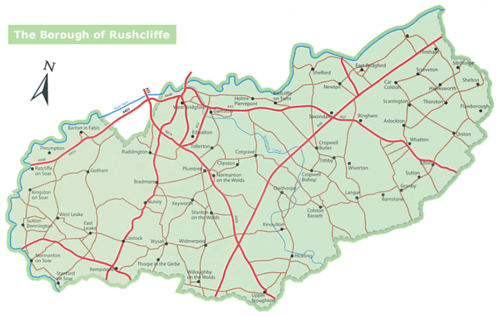
Rushcliffe Borough forms the southern tip of Nottinghamshire which borders Leicestershire. It is predominantly a rural Borough that contains a mixture of city suburbs, market towns and villages. Rushcliffe is located about half a mile South of Nottingham city centre, with the River Trent forming the majority of its northern boundary and the River Soar defining its western boundary.
The A46, a distinctive Roman Road, runs through the centre of the Borough and leads to Newark in the North and Leicester in the South. In the northern half of the Borough, the A52 forms Nottingham’s primary transport link to Grantham and the East of England. Junction 24 of the M1 and East Midlands Airport are located about 1 mile from the western border.
East Leake is one of six of the borough of Rushcliffe’s larger villages and civil parishes. East Leake is located in the Southwest of the Borough and sits between the A46 and the M1. While it is located within the administrative boundary of Nottinghamshire, East Leake is closer to Loughborough town centre than Nottingham city centre and has a Leicestershire postcode.
East Leake is contained within a bowl of hills. The East Leake Neighbourhood Plan stress the importance of maintaining the rural aspect of the village by preserving views of the surrounding ring of green ridges from within the village, including the Conservation Area.
The wide, green roadside and the large number of established trees create a calm atmosphere on the entrance into East Leake from Station Road/West Leake Road. The allotments, burial ground, Scout hut, Midshires Way Campsite and Alpaca Farm are all located on this entrance to the village and add to the rural ambience of the area.
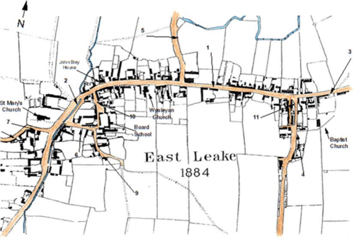
Historically East Leake had five approach roads from the North, East, West, Southwest and South - see Figure 4 which shows these in 1884. Despite expansion of the village the five entrances are all still via minor roads or lanes through countryside, emphasising East Leake’s historical rural setting.
The Gotham Road entrance to East Leake shows the development of the gypsum industry in the 19th century. The railway halt near the existing gypsum works originally facilitated transport for the products. The post second world war housing development, Rushcliffe estate, indicates the need for new housing after the war and the emphasis on dwelling for workers in the gypsum mining industry. This is an example of a BISF (British Iron and Steel Federation) estate of steel framed prefabricated houses erected around the country from 1946, refurbished to extend their use.
Meadow Park along with the Kingston Brook runs close to the conservation area in the Northeast which gives this edge of the conservation area an open feel. Meadow Park was designated as a Local Wildlife Site in June 2024.
2.1 The East Leake Conservation Area
The East Leake conservation area includes the historic core of the settlement, which developed around the Sheepwash Brook. This historic core which includes St Mary’s Church is now mostly surrounded by large areas of modern housing on most sides.
The Conservation Area still boasts various green spaces and mature trees (especially along the Brook), a Friendship Garden, playgrounds, a naturalised area designed for flood alleviation basin, The Glebe and a memorial garden, all of which contributes to the rural mixed character of the area.
There are 13 listed buildings within the conservation area, and there are a number of key unlisted buildings, with many original features, which contribute to the character of the area.
Conservation Area Boundary covers 23 hectares (approximate)
Number of Grade I listed buildings 1
Number of Grade II* listed buildings 0
Number of Grade II listed buildings 12
A full list of East Leake Conservation Area’s Listed buildings can be found in Appendix 1
Details accurate as of December 2023
3 Historical Contexts
The earliest evidence of settlements existing in the Leche area date from the time of the Roman occupation of Britain. Following the withdrawal of the Roman Legions circa 410 CE, the area, would have come under Viking influence, becoming part of The Danelaw and later Mercia. The name Leake originates from the old English (Anglo-Saxon) word for a water meadow (‘Lecche/Leche’). When the Normans recorded the state of the nation in the Domesday Book (1086) there were 38 landholders recorded in Leche, which encompassed what became the separate communities of East and West Leake, with a total population estimated to be 200 persons (including dependents and those with no rights to land). This large holding, with a church and mill was considered to be one of the more prosperous recorded in the Domesday Book. It was subsequently divided between two of William the Conqueror's principal followers, who in turn sub divided it into a number of land holdings.
East Leake was originally a nucleate village with farmsteads grouped around the church and a source of water, the Sheepwash Brook. Remaining evidence of both ridge and furrow cultivation and water meadows suggest that the farming was of a mixed nature. There is also evidence of orchards, particularly along Station Road/West Leake Lane.
The centre of community life would have been the church and the Green, with its still existing animal pound. In 1221 Henry III granted a Royal Charter to High Despenser to hold a weekly Thursday market and an annual fair in Loughborough. By the terms of charters like this it was illegal to hold a market or fair within a 6-mile radius of the town granted this charter. As East Leake is within six miles of Loughborough, it was never granted a Charter Fair or Market for the exchange of goods.
The village centre was initially at the junction of three main trackways. At the existing T- junction, the trackway from Cortlingstock (Costock) to Loughborough, was joined by one from Gotham and Bunny as it is at present. There is a suggestion, on an early map, that there was a shortcut from near The Stonebridge to the Green. The Costock-Loughborough trackway made a left turn at The Green, before turning right along The Nook, then proceeded up the hillside to the old Rempstone Road. From here it continued to Stanford upon Soar and Loughborough, a route which can still be partly followed on footpaths and lanes. The other route was Woodgate, which initially followed the course of the Sheepwash Brook, then turned up the hillside to intersect the hillcrest track from Sutton Bonington to Rempstone, now Rempstone Road, which was superseded by The Ashby Turnpike, now the A6006. Woodgate continued over the crest of the Wolds to Normanton upon Soar and the river crossing. With the construction of the Great Central Railway in the late 19th Century the hillcrest track from Sutton Bonington to Rempstone was diverted from its original straight course, which passed one of the village windmills.
Station Road was likely to have been a minor trackway serving Hall Leys Farm, outlying fields and orchards, with some large houses gradually being built along it, particularly after the coming of the railway. The part of West Leake Lane/Road within East Leake parish bears marks of being post the 1798 Act of Enclosure.
The Parish boundaries were consolidated under the Act of Enclosure, when the population was estimated at around 1,000. The Enclosure act led to new farms away from the village centre, some of which still remain as farming units. The land associated with the village centre farms was gradually sold away from the ‘steadings, which have subsequently become desirable residences, with outbuildings being converted for domestic occupation.
To some extent, the boundaries of the village followed prominent features, such as the Kingston Brook, hence the irregular nature. The 1851 Census recorded a population of 1148 which increased to 1,500 by 1941. The village grew rapidly from the 1950s and today the population is around 9,000.
3.1 Location and Historic Activities
The geographical location of East Leake has provided the opportunity for many industries to flourish, including weaving, framework knitting shops and basket making, which have all been major industries within the village across hundreds of years (late 16th Century to mid-20th Century).
As a part of the weaving process, which was recorded in East Leake during the late 16th and early 17th century, cloths were washed and spread out to dry between posts and held on by iron tenterhooks. This took place in fields between the Bosworth’s farmstead and the Kingston Brook. Metal detector explorations have, so far, been unsuccessful in finding any tenterhooks in the fields.
A deed of 1757 records framework knitters at 10 – 12 Main Street.
A framework shed close to the graveyard on the Baptist Chapel remains close to its original condition today. This was firstly used for weaving then converted to a framework shop.
Basket making and wicker baskets was a profitable craft in East Leake between 1830 and 1960. The basket making industry spanned 130 years (1830 to 1960) and was assisted greatly by the central location of the Kingston and Sheepwash Brooks, as they allowed for the creation of water pits and for the Osiers, a type of Willow tree, to be planted near to the workers’ cottages and workshop.
A ropeworks was established in the village in the early 20th Century.
The middle of the 19th Century was known as the golden age of farming, with 20 farmers employing 79 workers in 1851 and one fifth of the population relying upon farming (50 out of 250 households).
The extensive deposits of gypsum close to East Leake have been mined for plaster for the past 155 years (since at least 1870). Unlike farming, weaving, framework knitting and basket making industries, the gypsum industry remains strong today.
The last major rail line into London was built in the late 19th Century and East Leake was one of the stations on this route from Sheffield. The arrival of the railway brought jobs to the area and also led to an increase in population, with commuters travelling to work in Nottingham and Loughborough (many of the large houses along Station Road were built for this purpose).
The Station Road/West Leake Road development was directly associated with the coming of the railway in the late 19th century with the railway bridge, atop of which was the station platform, and the railwaymen’s cottages at the further end of West Leake Road. The railway enabled the basket works, among other industries, to flourish.
Buildings along West Leake Road were erected on an ad hoc basis over the next seventy or so years.
The railway would have also brought new building materials to the area, such as Welsh slate for roofing and a more nationally standardised style of brick (before railways, bricks were usually made locally or regionally). Standardized bricks were made locally at Lord Belper’s brickworks at Brickyard Lane and Bunny Hill.
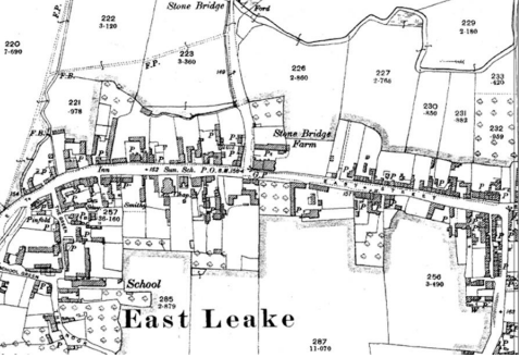
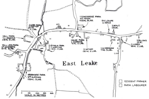
During the Second World War, a decision was made to expand East Leake and over a period of 50 years, the population increased four-fold to 6,108 (2002 Census). Figures 1, 2 and 3 show the linear form of the village in 1810+, 1884 and 1910 and Figure 4 shows how this form has been lost and surrounding landscape has been replaced by large housing estates. East Leake is now one of six large villages in the Borough of Rushcliffe and is predominantly a commuter settlement that could be described as having rural historic core
with modern extensions that are suburban in character.
3.2 Historical Mapping
4 Spatial Analysis
The relationship between open spaces and the built form within a conservation area can be central to its character. This section describes the village’s layout, highlighting the significant views, landmarks and historical focal points. The contribution of open green spaces, trees and other natural elements to the conservation area’s character is also described within this section.
4.1 Plan, Form and Layout
The distribution of manors and freeholders and the patterns of land ownership greatly influenced how East Leake appears today, arising from the village’s agricultural, industrial and political heritage. In the Domesday Book East Leake had a population of just over 200 with two overlords, the Leakes and the de Ferrers. By the 14th Century taxation lists show twelve wealthy farmers and two new lords of the manor.
The growth of East Leake from the centre around the Church gives a good indication of the farming and industrial development of the village. As an ‘open’ village land was owned by a number of different individuals who sold it to incomers and speculators who built cottages, mostly to be let to framework knitters and their families. The village expanded linearly along what is now Main Street.
Many examples of remaining ridge and furrow sections of the original open fields can still be seen around the village, with two particularly fine examples designated as “local green spaces” in the East Leake Neighbourhood Plan - Mill Field to the south and the Townlands Trust land between Gotham Road and the railway.
The medieval pinfold can be seen on The Green. Reflecting the steady expansion of Great Leake, the church was gradually enlarged. Over time, the original patterns of ownership changed and splintered as the population continued to grow.
In modern times the Townlands Trust (1637) and John Bley School (1723) charities helped village development. Basketmaking and framework knitting (see section 3.1) provided new employment opportunities while the Baptist and Methodist chapels (1757 and 1798 respectively) reflected these changing social needs.
1798 brought enclosure of the old open fields, with now, 50 separate landowners (some in outlying farmsteads) plus the church land and that of three chantries.
Below is a map that describes the current plan, form and layout of the village/town.
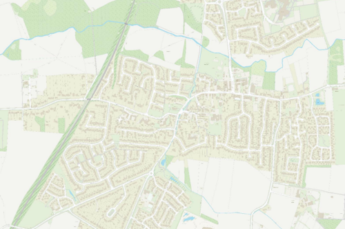
This map is reproduced from Ordnance Survey material with the permission of Ordnance Survey on behalf of the Controller of Her Majesty’s Stationary Office © Crown Copyright. Unauthorised reproduction infringes Crown Copyright and may lead to prosecution or civil proceedings. Rushcliffe Borough Council - 100019419
4.2 Landmarks, Focal Points and Views
The historic centre of the village is at the junction of Station Road and Brookside. It is also where most of the listed building are concentrated. Standing at the corner of Station Road and Brookside showcases buildings that have stood for over a century and contribute to the enduring character of the area.
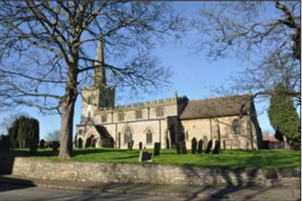
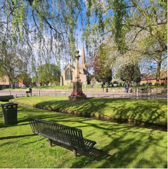
The Parish Church, Church of St Mary’s (see Figure 8), retains possible elements of Saxon brick work but is essentially Norman in design, being restyled in the first half of the 13th century in the Early English style. The south aisle arcade is from the 14th century and the clerestory, tower and battlements added in the 15th century. The chancel was largely rebuilt in 1886 and a reordering to remove the pews done in the early part of the 21st century has resulted in the church we see today.
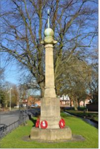
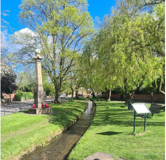
There is also a War Memorial (see Figure 7), erected around 1919, composed of ashlar and incorporates copper elements. It stands on a hexagonal platform, with a chamfered octagonal base and a stepped hexagonal plinth. The central hexagonal column features a moulded base and scalloped capital, topped by a single copper cross.
Meadow Park, a green space of six fields of flood plain managed for wildlife, is a valued village amenity and allows for key views over the landscape.
Substantial houses can be seen in the part of the village, with Bley House (now called Manor House) built at the end of the 18th century and Church House, Glebe Farm and number 8 Main Street being typical Georgian buildings of significance.
More humble dwellings of historic importance are in this area, notably 1 and 3 Brookside (cottages converted from a former barn), Honeypot Cottage, the old Workhouse (now a single private dwelling) and St Mary’s Hall. Together they form a charming part of the village.
4.3 Open Spaces, Trees and Landscape
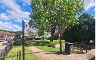
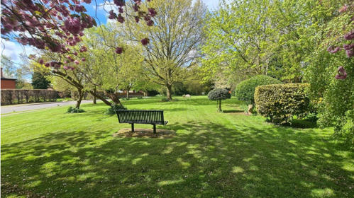
Nestling within a natural basin of hills, East Leake aims to preserve its connection into the countryside by restricting building heights within this geographical depression, thus retaining views and blending harmoniously with its surroundings. After housing expansion some development is now visible in places on the village's skyline, but the “green rim” remains largely intact. Amidst this transformation, the East Leake Conservation Area still boasts various green spaces and mature trees, a Friendship Garden (see Figure 9), playgrounds, and a naturalised wetland area for flood alleviation, all of which contribute to the character of the area. There is also The Glebe and memorial garden.

Main Street follows the line of the brook, with the Glebe (see Figure 11), pinfold (see Figure 10) and war memorial alongside the brook (see Figure 12), providing a peaceful green setting for the Church. Within The Glebe, there is a Millennium Stone, a large piece of gypsum, donated by British Gypsum, marking the spot of the buried village time capsule, buried in 2000 and due to be opened in 2045.
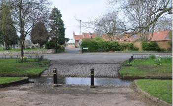
The lantern lights, Victorian in character, along the pathway by the Brook (see Figure 15) and the recently renovated ford showing the old cobbles (see Figure 14) highlights the historic old centre of the village and the ambience it holds.
Willow trees line the Brook and serve as a reminder of the 19th century/early 20th century basketworks industry in the village (see Figure 13).

4.3.1 Open Spaces, Trees and Landscape SWOT Analysis
Strengths - what are the positives of the open spaces, trees, and landscape
- East Leake retains its core village area with surrounding housing developments.
- Extensive footpaths make walking a pleasure and it is easy to walk into the wider countryside from a number of points.
- The open spaces, such as the village green, playing fields and children’s playgrounds along with other green spaces at intervals in the village, create a series of pleasant areas.
- Mature trees within in the village, and especially along with Sheepwash Brook, contribute a pleasant rural mixed atmosphere.
- A series of benches at intervals throughout the village enables those less mobile to walk more safely and enables everyone to take life at a slower pace, should they wish to.
- Recent tree planting (e.g., on the Oldershaw Trust land, Costock Road) contributes to the ‘greening’ of the village.
Weaknesses - what are the negatives of the open spaces, trees, and landscape
- In a few places, buildings rising above the natural bowl of the village (when the 5-year housing land supply could not be met) have impacted negatively on the historical sheltered rural setting of the village.
- Some of the open spaces maintained by private companies, e.g., builders of housing estates, are not maintained to a good standard.
- Some screening of the new housing developments would enhance the landscape and cut down traffic noise for residents.
- Green spaces could be improved with planting of bulbs, trees etc.
- Little screening of new housing developments.
Opportunities – what could make the open spaces, trees, and landscape better?
- The council may be able to take in-house the maintenance of green spaces currently managed by housing developers. Possibly adopting the roads.
- Additional green spaces e.g., at the entrance to the Parish Office car park and School Green/Three Horseshoes which currently have a lot of tarmac.
- The Sheepwash Brook running through Meadow Park is about to be re-routed and it may present opportunities for improving the park.
- More trees and shrubs in some gardens would improve screening and increase wildlife potential.
- Better maintenance of pathways linking housing estates to each other and to the village centre.
- Continue the free tree scheme.
Threats - what would make open spaces, trees and landscapes worse?
- Further housing development in the village would have a negative impact on the open spaces.
- The management of the brooks running through the village must be improved so that sewerage is not released into them in times of high rainfall.
- The pumping station on Gotham Road is to be upgraded, but not to such an extent that it would prevent raw sewage from releasing into Kingston Brook. The upgrade is intended as a short-term fix rather than a long-term solution.
Works to Trees
You must contact the Local Planning Authority (LPA), Rushcliffe Borough Council before any works (cutting OR pruning) are carried out to trees within the East Leake Conservation Area.
Six weeks’ notice is required before any works to trees within the Conservation Area is carried out, even if they are not protected by a Tree Preservation Order (TPO).
You can use a Standard notification forms (a section 211 notice), to inform us of the works you would like to undertake.
This flow chart of the decision-making process regarding works to trees.
4.4 Public Realm
The heart of East Leake, features a mix of shops, cafes, and services. The village centre often serves as a focal point for community activities and events. So, while the architectural interest of this area could be improved, there is social value to this area, being the central point for many of the amenities within the area.
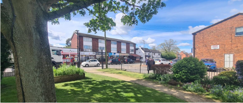
The streets of East Leake are characterised by a mix of residential, and commercial properties. The pavements within the village core are paving slabs, with some are red block paving. Away from the T-junction, tarmacked surfaces are more common.
The Costock Road/Castle Hill junction retains the ‘non-conformist’ aspect of the village with the Baptist Chapel and remaining framework knitters’ cottages. Ryber House and the older houses at the bottom of Castle Hill are more substantial dwellings in this part of the village (Zone 5).
Some of the buildings at the T-junction on Gotham Road/Main Road have associations with the past basketworks industry and a blue plaque has been placed to indicate the location of the basket makers workshops (one on either side of Main Street in this area).
Black and white finger posts topped with a country roundel can be found along the brook, along with some other metal street furniture (see Figure 17).
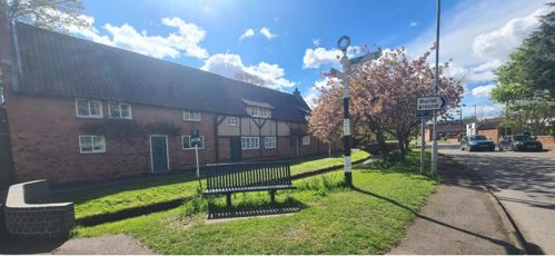
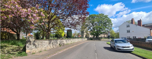
Boundary treatments include brick walls and metal railings (see Figure 20), with stone walls around the Church.
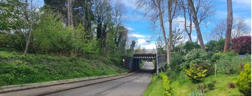
In this review of 2023, the boundary was extended to include the railway bridge and part of the platform that forms the entrance to the village from West Leake Road. The line is built along a very attractive, large, wooded cutting and had the Great Central style island platform. The platform was built on top of a road bridge (rather than a bridge with a road going over) which was a rare type with only a few of these on the Great Central Railway Line (other examples being Lutterworth and Finmere stations).
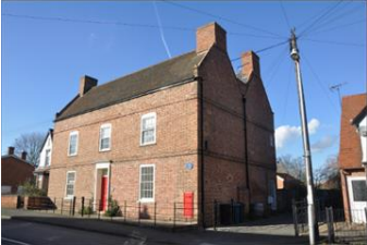
The conservation area within East Leake has three blue plaques within it. Two of which relate to John Bley (c. 1674–1731), the son of the curate at St. Mary's, who became wealthy as a distiller and was a major benefactor to the village.

5 Buildings of the Conservation Area and Key Characteristics
5.1 Building Types and Activity
The architectural styles and building types within East Leake span many centuries and includes a large manor house, converted farmhouses and barns, framework knitters’ cottages, the Baptist chapel, the site of the old basketworks industry, the medieval Church of St Mary, St Mary’s Hall, the village hall, school buildings dating from the 1870s, Church House and a Pinfold.
Georgian and Victorian Leake was a thriving mixed community whose more varied economic growth was further helped by the Great Central Railway (1898, linked Nottingham and London St Pancras) and a growing gypsum industry (BPB).
In 1945 the village population was about 1,500 but grew rapidly from the 1950s with a Secondary Modern (1956), then a Comprehensive school (the Harry Carlton, now East Leake Academy), a second primary school (Lantern Lane) and more recently a third primary school (the Millside Spencer Academy opened in 2022), the Catholic church (Our Lady of the Angels), a supermarket and a bus service (South Notts from the 1930s and taken into the Nottingham City Transport in 1991).
The Consortium of Local Authorities Special Program (CLASP) endeavoured to assemble resources and share initiatives. One such initiative was a light, steel framed, low cost, CLASP Building, which were standardised, easy to construct and simple to adapt. The Telephone Exchange in East Leake is believed to be based on CLASP design. The Telephone Exchange is largely unaltered in design since it was first built. New louvres were installed in 2012. Apart from that alteration, visually, the building is a complete example of the
style which is a subset of Brutalism.
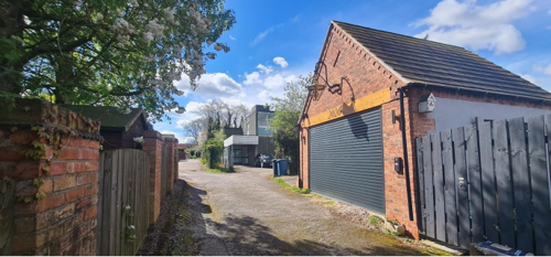
The Great Central Railway closure in 1969 was much regretted as a valuable transport resource, though a single line remains open to limited gypsum and leisure use.
A number of housing developments in recent decades has taken the population to around 9,000 with thriving local shops and business, good medical provision with the health centre, an optician and two dentists.
There are a number of children’s playgrounds dotted throughout the village as well as a playing field with pavilion on Costock Road.
East Leake has a leisure centre with sports facilities including a swimming pool.
Other buildings of interest include:
- A number of large, detached houses of historical interest (Ryber House and Belton House among them).
- A number of smaller terraced houses along the main roads through the village with significant architectural features.
- The railwaymen’s cottages on West Leake Road.
- The railway bridge with its blue engineering bricks on Station Road.
- Rushcliffe Halt on Gotham Road.
- The former Co-op building on St Mary’s Crescent.
- The commercial heart of the village is around the T-junction of Gotham Road and Main Street. The architecture of the small shops and businesses here is mixed, but many do not contribute positively to the character of the area.
5.1.1 Building types and Activity SWOT Analysis
Strengths - what activities/places can you go that make the village/town great?
- The wide range of sporting activities held on Costock Road playing fields with the new pavilion and good parking area at the bottom of Cornflower Way.
- The vibrant church communities which work well together and provide a variety of social activities outside times of religious services. Children’s groups, coffee mornings, ‘memory’ clubs, lunch clubs, school holiday clubs etc.
- Good health care provision with Gotham Road Health Centre, two dentists, a pharmacist, an optician and a physiotherapist.
- A good mix of independent shops, cafes, pubs, take away meal providers and a thriving local Coop which together can provide all necessities without leaving the village.
- A variety of small local businesses. A Post Office, and public toilets in the centre of the village Several good play areas for children of different ages and physical abilities.
- Several good play areas for children of different ages and physical abilities.
- Village events throughout the year, including May Day celebrations, a carnival and Christmas Fayre.
- A monthly Market in the centre of the village with a variety of foods, gifts and local products.
- Good car parks in the centre of the village.
- A regular bus service to Nottingham and Loughborough.
Weaknesses - what activities/places exist that detract from making the village/town great?
- There is parking outside of designated car parks and parking spaces causing congestion on the roads.
- Congestion and conflict between pedestrians and vehicles at the T-junction at the village centre.
Opportunities - what activities/places could exist that would village/town even better?
- The village health centre and the library on Gotham Road are currently under review and will probably move to another location within the village. It is planned to demolish the old CLASP buildings that currently house these amenities. It is uncertain what will replace these buildings, but it is an opportunity to consider how any new building(s) could be a community facility which is
central and accessible in keeping with the historic character of the village.
Threats - what activities/places would make village/town worse?
- Traffic is increasing and is impacting on residents in many ways. The opening of the new commercial area near the airport will probably impact on traffic flow through the village.
- Poor maintenance of many areas under the management of building developers. For example, where balance ponds are not maintained.
- Inconsiderate dog walkers who do not clean up after their pets and/or allow them off the lead in inappropriate places.
5.2 Key Characteristics and Building Materials
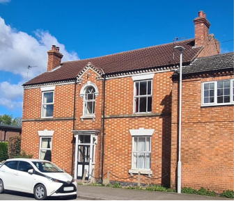
East Leake contains a range of architectural styles and although many original features have been lost, many still remain. The most prevalent types of vernacular architecture are cottages and farmhouses and a number of these have been statutorily Listed. There are some examples of timber framed buildings and bricks are generally red, with some properties having blue brick detailing. Roofing materials are mixed and largely include pantile, plain tile and Welsh slate. The original windows that have survived are largely timber framedsliding sashes, with some older cottages having smaller Yorkshire sashes.
5.2.1 Key Characteristics: Main Street - Zone 1
Main Street from St Mary’s church along Brookside). Buildings include St Marys’ church (Grade I), with the Bley chest tomb (Grade II), St Mary’s Hall, 1 & 3 Brookside cottages (a barn conversion, formerly three dwellings originally known as Wass’s cottages and designated Grade II), the War Memorial (Grade II) and properties 1 to 11 Main Street which are houses developed from the original farmhouse, barn and dovecote.
Materials:
Walls: St Mary’s Church is built of stone and is a Grade I listed building with Saxon features. St Mary’s Hall is a Victorian structure of Victorian brick. The Pinfold was repaired in the late 20th Century and is of stone. The two cottages on Brookside (1 and 3 Brookside) were originally three cottages, then combined into two. The older part is timber framed with red brick noggin, the extensions are in stone and brick, partly rendered. Bley’s chest tomb, in the churchyard of St Mary’s.
Roofs: St Mary’s church has a lead roof. Slate (mostly Welsh) and pan tiles on other buildings are common.
Windows: The windows in St Mary’s Hall are original Victorian and very elaborate. Victorian bow windows with lintels with some replacement windows of UPVC.
St Mary’s Hall is a mid 19thC building built from locally sourced bricks (Lord Belper’s brickworks).
Key Characteristics / Architectural Features:
The character of this historic core is defined by a linear village green, bordered by the Sheepwash Brook with its picturesque tree-lined grassy banks, and featuring a solemn war memorial within a chained-off enclosure. Serving as the venerable "heart" of the village, this area boasts characterful buildings and well-kept green spaces.
Among the architectural highlights are St. Mary's Church, adorned with the notable Bley chest tomb, alongside St. Mary's Hall and the charming 1 & 3 Brookside cottages, converted from barn structures. Properties 1 to 11 Main Street offer a glimpse into the village's past, having been developed from the original farmhouse, barn, and dovecote, preserving their historical significance.
The street furniture within this zone bears a distinctive aesthetic, including low metal fencing along the grass verges, finger posts directing travellers out of the village, and Victorian lantern-style streetlamps adorning the area by the brook.
Other buildings include Old Hall Farm (1 – 11 Main Street) where the houses have been developed from the original farmhouse complex to include Dovecote Cottage, Old Mill Farm, Old Hall Farm Cottage and Dove Cottage; St Mary’s church (Grade I), with the Bley chest tomb (Grade II); St Mary’s Hall; 1 & 3 Brookside cottages (a barn conversion, formerly three dwellings originally known as Wass’s cottages and designated Grade II); the War Memorial (Grade II). This zone is the historic heart of the nucleated village, where there
was easy access to fresh water from the Sheepwash Brook.
5.2.2 Key Characteristics: Station Road and Brookside - Zone 2
Materials:
Walls: Most of the houses and bungalows are brick. Some of the original stone and timber work has been infilled with brick. Some dwellings are rendered. A Victorian railway bridge of blue Staffordshire engineering brick spans the road.
Roofs: There is a mixture of tiled and slate roofs.
Windows: are predominantly uPVC but largely in keeping with their original design with some bay windows.
Key Characteristics / Architectural Features:
Overall, this character area is defined by its established landscape, and natural features.
Station Road: The distinctive character of Station Road is largely shaped by its well-established landscape, featuring mature trees and hedgerows that lend a sense of history and natural beauty to the area. Notable among its architectural landmarks is Church House, a Grade II-listed building adding historical significance. The houses on the south side of the road exhibit individualised designs, contributing to the overall charm and character of Station Road. Additionally, developments such as Walnut Gardens, comprising of houses and flats, as well as the Arley Close development, seamlessly blend in with the area's aesthetic, further enhancing its character.
Brookside (up to and including 36 Brookside) where Kirk Lea and Woodgate intersect: The stretch of Brookside leading to the roundabout is adorned with characterful houses and bungalows, each adding to the area's distinctive ambiance. Some of these dwellings boast Victorian-era origins, exemplified by properties like 26 Brookside, while others were constructed in the 1920s. This collection of homes serves as a welcoming entry point into the village from the southwest. The presence of green spaces, including the flood alleviation areas serving the Sheepwash Way/Leveret Way housing estate, enhances the rural mixed character of the village, further enriching its appeal.
5.2.3 Key Characteristics: Main Street 1- 17 and 2 - 94 - Zone 3
Main Street 12-121 and 2 - 94, running eastwards from the bridge over Sheepwash Brook to the junction with Castle Hill, the shops, health centre and library at the T-junction. The old telephone exchange in Starch Close is an example of a CLASP building.
Materials:
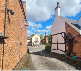
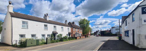
Walls: Many of the buildings are brick built, however there are a number that are rendered and painted white. Within this character area, there is a property with a timber frame exposed on the side elevation (see Figure 25).
Roofs: Tile or slate roofs.
Windows: Most of the windows have been replaced with uPVC. Some dwellings retain their original lintels, and some retain their original arched heads. One or two commercial buildings have recently renovated/replaced original doors and windows.
Most of the windows have been replaced with uPVC. Some dwellings retain their original lintels, and some retain their original arched heads. One or two commercial buildings have recently renovated/replaced original doors and windows.
Key Characteristics / Architectural Features:
This area includes an important mixture of historic features and community buildings. These include Bley House, 25 Main Street (Grade II), village hall, Pinfold (Grade II), Glebe Farmhouse, 2 Main Street (Grade II). Old Hall Farmhouse, Brookside (Grade II), 8,10 & 12 Main Street (all Grade II buildings). A distinctive 1950s R.C. church, along with buildings formerly used for the village industry of basket-making.
There is a sense of harmony in the buildings along Main Street to the T-junction. The 1930s bungalows on Main Street (numbers 84-88) at the bottom of Oldershaw Road enhance the area.
5.2.4 Key Characteristics: The Green and The Nook - Zone 4
Materials:
Walls: A mixture of brick, stone and rendering with some timber beams can be seen in this area. Basketwork’s cottage and Honey Pot cottage (Grade II) have original beams with brick infill. The old Workhouse in the Nook is now a dwelling part rendered and part left as brick.
Roofs: Both tiles and slate have been used for roofs.
Windows: Most of the windows have been replaced with UPVC but are generally in keeping with the character of the area.
Key Characteristics / Architectural Features:
This area, while deserving of inclusion within the historic core, possesses a distinctive character that sets it apart. Its level street surface invites leisurely strolls along peaceful and secluded lanes, allowing for full immersion in its unique features. Among these are a series of charming cottages, an old schoolhouse, the 1870s-built Brookside School, Honeypot Cottage (Grade II), a former carpenters/joiner’s yard, and possibly a public house (recently sold and under development). Noteworthy landmarks include the old workhouse, now repurposed as a cottage, and the former telephone exchange at 6 The Nook, transformed into a bungalow dwelling. Leading southwest from this enclave is a pathway of historical significance, traceable back to early village maps, flanked by dense hedgerows that contribute significantly to the area's landscape. Though newer houses have filled some spaces, they seamlessly integrate with the
prevailing character, ensuring the area's architectural harmony is preserved.
5.2.5 Key Characteristics: Bottom of Castle Hill, along Costock Road - Zone 5
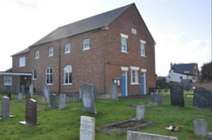
The bottom of Castle Hill, along Costock Road eastwards towards Costock. Buildings include the Baptist Chapel (Grade II), framework knitters’ cottages, a former framework knitters’ shed, Ryber House and some characterful houses as well as green spaces.
Materials:
Walls: The Baptist Chapel, which was enlarged in 1839, is in red brick with some stone, partly on a plinth, with dogtooth eaves and a slate roof. There are two storeys. Other houses and bungalows are a mixture of Victorian to 1930s build and are of brick.
Roofs: A mixture of slate and tile roofs.
Windows: Mostly UPVC but with original features such as bay windows mostly retained.
Key Characteristics / Architectural Features:
Located eastward from the village centre, a notable feature emerges: an L-shaped cluster of cottages. Positioned alongside a newly developed playground and enveloped by mature trees, hedgerows, and spacious paddocks, these cottages establish a distinctive character within the area. Together, they cultivate a rural ambiance, evoking a sense of tranquillity and heritage. The presence of well-tended green spaces and architecturally harmonious buildings further enhances the area's peaceful demeanour, reinforcing its historical significance and enduring charm.

Zone 1: Main Street
Zone 2: Station Road and Brookside Road
Zone 3: Main Street 1 to 17 and 2 to 94
Zone 4: The Green and The Nook
Zone 5: Bottom of Castle Hill, along Costock Road
5.2.7 Building Materials and Local Details
5.3 Key Characteristics SWOT Analysis
Strengths – what is it about most existing buildings that looks good and contributes to the character of the conservation area?
There are a number of historic buildings and buildings with character, including the timber framed buildings.
The historic walls and metal railings which create a pleasant boundary between gardens and the streetscape.
Weaknesses - what is it about existing buildings that does not look good and detracts from the character of the conservation area?
The shops in the centre of the village at the T-Junction of Main Street and Gotham Road, while they have social value, detract from the character of the village.
Opportunities - what could make existing buildings (or new builds) look good and contribute to the character of the area?
Some of the shops in the centre of the village could be improved e.g., replacing some windows and doors that are in poor repair.
Should and future redevelopment take place at the T-junction along Main Street and Gotham, it would be desirable that the standard of the architectural detail reflect the wider Conservation Area and not merely be a slight enhancement to what exists.
The village health centre and the library on Gotham Road are currently under review and will probably move to another location within the village. It is planned to demolish the old CLASP buildings that currently house these amenities. It is uncertain what will replace these buildings, but it is an opportunity to consider how any new building(s) could be a community facility which is central and accessible with a characterful visual appearance in keeping with the historic background/links of the village.
Threats - what could make existing buildings (or new builds) look worse and detract from the character of the area?
Multiple styles of double glazing/replacement doors in adjacent buildings/properties, ultimately detracting from the character of the area.
Bay windows added where they were/are not part of the original frontage.
Flat roofed extensions detract from the character of some areas.
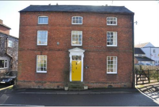
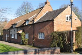
5.4 Listed buildings
Buildings on the Government’s List of Buildings of Special Architectural or Historic Interest are called “Listed” buildings and are protected by law. Consent is required from Rushcliffe Borough Council before any works of alteration, extension, or demolition can be carried out on any listed building.
Further information can be found in Listed Buildings in Rushcliffe.
There is also the complete and up-to-date list of the Secretary of State’s Statutory List of Buildings of Special Architectural Interest or Historic Interest.
Details of the Listed Buildings and structures in East Leake Conservation Area (correct as of December 2023) are detailed in Appendix 1. All Listed Buildings are shown on the Townscape Appraisal plan, but some smaller structures such as gravestones may not be shown.


5.5 Key Unlisted Buildings
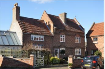
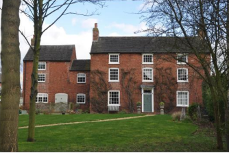
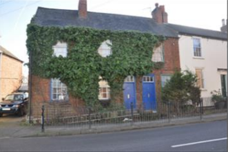
Contribution to the established character of the place can also come from buildings which are not recognised via listing or are not old. A plan with all of the positive contributions to the area can be found in Appendix 2 - Conservation Area Boundary and Townscape Appraisal Map.
6 Generic Management Plan for Conservation Areas in Rushcliffe
6.1 Introduction
In carrying out its planning functions, the Borough Council is required in law to give special attention to the desirability of preserving or enhancing the character or appearance of Conservation Areas. The Management Plan for a Conservation Area is a tool to ensure the special character of the area is preserved and enhanced. The management plans aim to:
- Outline a strategic management proposal for the preservation and enhancement of the East Leake Conservation Area.
- Act as a guide for professionals and residents alike regarding:
- features of value, worthy of preservation;
- characteristics worthy of preservation;
- opportunities for enhancement;
- development proposals which preserve and enhance the special character of the area.
- Inspire community commitment to conservation principles and reporting.
6.2 National and Local Policies and Guidance
There is a duty to formulate and publish management plans setting out policies and proposals for the preservation and enhancement of Conservation Areas. Many of these policies and proposals are common to all Conservation Areas, and these are set out in this document. The Central Government Guidance and Local policies applicable to Conservation Areas include:
- Rushcliffe Local Plan Part 1: Core Strategy, with a specific focus on:
- Design and Enhancing Local Identity [in part]
- Historic Environment
- Rushcliffe Local Plan Part 2: Development Policies, with a specific focus on:
- Conserving and Enhancing Heritage Assets
- Development Affecting Archaeological Sites
- The National Planning Policy Framework (NPPF) (Revised -2023) particularly, but not exclusively the chapter on Conserving and Enhancing the Historic Environment.
- The National Planning Practice Guidance ( Subject to Continual Review)
- By Design: Urban Design in the Planning System – Towards Better Practice (2000)
- The Planning (Listed Buildings and Conservation Areas) Act 1990
- Historic England “Historic England Advice Note 1: Conservation Area Designation, Appraisal and Management”
The council will utilise the full range of strategic policy and guidance documents to ensure that development in East Leake Conservation Area is of a standard that enhances the amenity of the local area. The council will always look to use the most up-to-date versions of the document.
Supplementary documents may be issued for individual Conservation Areas where specific policies or proposals are needed.
6.3 Article 4 Directions
There are extra consents required in Conservation Areas. For example, in addition to the general control of development, you will
need to get permission for:
- Any additions or alterations to the roof (for example, dormer windows)
- The installation of satellite dishes on chimneys, roofs or walls fronting a highway
- Any extension which extends beyond the side of the original dwelling house
- Any extension of more than one storey that extends beyond the rear wall of the original dwelling house
- Cladding the exterior of the dwelling
- Any demolishing of a building or part of a building that has a volume over 115 cubic metres
Article 4 of the Town and Country Planning (General Permitted Development) Order 1995, allows planning authorities to restrict
some permitted development rights within particular areas. This does not necessarily prevent development or change taking place
but enables the Local Authority to manage the design and detailing of the works, and potentially grant permission subject to appropriate conditions. The use of Article 4 Directions will be proposed where it is considered appropriate following the completion of each Area Appraisal across the borough.
Details of Article 4 Directions for East Leake Conservation Area
There are currently no Article 4 Directions for East Leake Conservation Area.
6.4 Building Design
Mimicking the local vernacular is not the only way to ‘fit in’ with the character of a conservation area. National policy makes clear that contemporary designed, provided it is sympathetically designed, cannot be dismissed as an option. Therefore, good contemporary design will be encouraged where it respects the context’s character, scale and massing. This must be demonstrated in the Design and Access Statement submitted with any planning application.
Extensions to buildings in Conservation Areas should respect:
- The key characteristics of the original building, including scale, mass, materials and proportions
- The contextual setting and character of the Conservation Area
Copying like for like can devalue and destroy the ability to “read” historic change, and dilutes our historic heritage. Pastiche designs, incorporating poor imitations of other styles, will be resisted, particularly where they incorporate details which are not locally appropriate. Careful high-quality replication may be required in a few very sensitive locations.
In particularly sensitive locations, such as uniform terraces, exact replication may be necessary to maintain compositional unity. In that case, attention to details, choice of materials and high-quality workmanship are the keynotes. However, in some cases, a direct relationship is not impossible. For example, Flemish Bond brickwork cannot be replicated in cavity walls, and narrow lime mortar joints cannot be replicated in modern metric brickwork.
Where a new building is appropriate, on infill sites or where an existing building detracts from the character of the area, the opportunity should be taken to re-establish the streetscape, reinforce enclosure, open up distant vistas or views of landmarks or hide unsightly views.
“New and old buildings can coexist happily without disguising one as the other, if the design of the new is a response to urban design objectives” (DETR – “By Design”, p19).
As with extensions, good contemporary design which respects local character, and the context of the site will be encouraged.
All new buildings should respond appropriately to the existing frontage and normally follow the established building line. Development or redevelopment will normally be resisted if:
“it blocks important views identified in the individual appraisals, uses important open spaces identified in the appraisals, adversely affects the setting of any Listed or key buildings, fails to maintain or re-establish the streetscape where appropriate dominates its Conservation Area background fails to recognise the context of
the site destroys important features identified in the individual appraisals such as boundary walls, fences,
hedgerows or trees”
Where the quantity of contemporary schemes in a small area becomes significant and outnumbers older buildings within the area, further contemporary schemes could fundamentally shift the architectural character of the area and thus be harmful, even if well designed as an individual project.
New development that stands out from the background of buildings may be appropriate in exceptional circumstances if it contributes positively as a landmark to enhance the street scene, to highlight a corner or to signal a visual change of direction such as along a curving vista.
Any external lighting should be carefully designed and sited to minimise light pollution.
Energy producing or saving devices are generally welcomed by the Council, but careful consideration is required when these are to be located in a Conservation Area and some may require planning permission. In particular, they should be positioned to minimise their impact on the building and on the local amenity.
6.5 Publicity and Knowledge Transfer
Ambiguity about additional controls within a Conservation Area raises the likelihood of inappropriate developments occurring which
may damage the integrity of the conservation area designations.
Efforts have been made to engage local community groups in the development and review of the character appraisals. Empowering
communities to define the special architectural and historic interest of the Conservation Area aims to raise awareness.
Whether the appraisal took a community-led or a council-led approach, upon reviewing all Conservation Areas, the public were invited to ask questions and comment during a public consultation.
A consultation event also aimed to diminish any ambiguity about restrictions within a Conservation Area and increase the likelihood of sensitive and appropriate developments, maintaining the character of the area.
The council recognise the potential issues of turnover in residency and ownership of properties in the conservation area. Therefore,
Rushcliffe Borough Council will periodically use their media outlets to highlight conservation area designations and the significant,
related planning controls.
The approach taken within East Leake Conservation Area was a Community Led. The consultation period took place between the following dates 26 April 2024 – 21 May 2024.
The date of the Consultation Event 08/05/2024.
If there are any queries about conservation areas, please email conservationareas@rushcliffe.gov.uk
6.6 Public Realm
General maintenance and upkeep to the public realm may include fixing damage to roads and pavements, and fixing issues with street lighting. Issues such as these can impact the quality of the Conservation Area.
The council aims to encourage works to the public realm that are in keeping with, or actively enhance the conservation area. Rushcliffe Borough Council can only advise on work within the public realm that does not require planning permission (for example work completed by statutory undertakers, such as the Highways Authority). In these instances, Rushcliffe borough council cannot prevent such work.
Nottinghamshire County Council are responsible for repairs to roads, pavements and street lighting. Report issues of repairs to roads, pavements and street lighting to Nottinghamshire County Council online.
Rushcliffe Borough Council will continue to undertake their duties in maintaining the public realm. Vandalism, fly tipping and street cleaning are all the responsibility of Rushcliffe Borough Council. Report issues to Rushcliffe Borough Council online.
Works to Trees
You must contact the Local Planning Authority (LPA), Rushcliffe Borough Council, before any works (cutting OR pruning) are carried out to trees within the East Leake Conservation Area
Six weeks’ notice is required before any works to trees within the Conservation Area is carried out, even if they are not protected by Tree Preservation Order (TPO).
You can use a Standard notification form (a section 211 notice) -to inform us of the works you would like to undertake.
A flow chart of the decision-making process regarding works to trees.
6.7 Boundary Treatments
Where there is a proposal for a new boundary treatment to be installed, the council would encourage the use of boundary treatments within the area.
Within conservation areas, planning permission is required to alter, maintain, improve, take down or build any new gate, fence, wall or other enclosure with:
- A height of one metre or more if next to a highway (including a public footpath or bridleway), waterway or open space; or
- A height of two metres or more elsewhere.
Where planning permission is required to remove a wall, Rushcliffe Borough Council will aim to protect those boundary walls and fences that have been identified as positively contributing to the area.
Hedgerows are significant habitats for wildlife in lowland Britain. Regulations are intended to protect important hedges in the countryside. The policy applies to hedges that are more than 20m long, (or less if connected to another hedge) on or adjacent to:
- Land used for agriculture or forestry, including the keeping of horses or donkeys
- Registered common land and village greens
- Local Nature Reserves and Sites of Special Scientific Interest.
The policy does not apply if the hedge is within or on the boundary of the curtilage of a house.
6.8 Buildings at risk
A few of the important buildings across the various Conservation Areas are currently vacant or not in regular use, which may lead to some being “at risk” of neglect or decay.
The Council will encourage and advise on renovation and repair work that is sensitive to the original or traditional historic character of the building and retains original features. The council will monitor the opportunity and potential for grant aid schemes to encourage the basic maintenance work necessary to ensure that key buildings within the conservation area are structurally sound and weather tight. However, given the current financial climate and outlook, such schemes are unlikely in the short to medium term.
There is a presumption against the demolition of buildings which contribute to the character of the area unless there are exceptional circumstances. It would benefit both the physical form and the function of the Conservation Area if these buildings were repaired, maintained and brought back into use.
Where the poor condition of a building or structure is as a result of neglect and lack of maintenance by its owner there is no requirement for the Borough Council to take its deteriorated condition into account when deciding whether demolition is appropriate. This is to avoid rewarding the deliberate neglect of buildings by representing such action as a way to obtain planning permission for demolition and redevelopment.
6.9 Enforcement
Rushcliffe Borough Council will, from time to time, assess and monitor changes in the appearance and condition of East Leake Conservation Area. This will ensure that where necessary enforcement action can be taken promptly to deal with problems as they arise.
Where co-operation cannot be gained by any other means, Rushcliffe Borough Council has the ability to use additional enforcement powers to tackle particular issues within conservation areas. The Council may take formal action if the condition of any building (listed or unlisted) which makes a positive contribution to the character of the Conservation Area is considered to be at risk.
The council will work in accordance with their enforcement policy, which aims to provide an efficient enforcement service in support of the Council’s statutory planning service. Rushcliffe Borough Council’s enforcement actions will remain transparent, consistent, and proportionate, as it is recognised that effective controls over unauthorised development assists in conserving the natural and built environment whilst helping to protect the quality of people’s lives and maintaining the Council’s integrity.
7 Appendix 1 – Listed Buildings (as of December 2023)
Grade: I
Listing entry number: 1260244
National grid reference: SK 55178 26215
Location: Church Of St Mary, Brookside
Grade: II
Listing entry number: 1241982
National grid reference: SK 55157 26175
Location: Church House, Station Road
Grade: II
Listing entry number: 1260243
National grid reference: SK 55216 26170
Location: 1 and 3 Brookside
Chest Tomb Single Metre East of The Chancel of Church of St Mary
Grade: II
Listing entry number: 1017404
National grid reference: SK 71406 36206
Location: Chest Tomb Single Metre East of The Chancel of Church of St Mary, Brookside
Grade: II
Listing entry number: 1260279
National grid reference: SK 55229 26216
Location: 1914-18 War Memorial, Brookside
Grade: II
Listing entry number: 1241981
National grid reference: SK 55322 26157
Location: Honeypot Cottage, The Nook
Old Hall Farmhouse and Old Hall Squash Club
Grade: II
Listing entry number: 1241960
National grid reference: SK 55182 26266
Location: Old Hall Farmhouse, Brookside
Grade: II
Listing entry number: 1241971
National grid reference: none
Location: The Pinfold, Main Street
Grade: II
Listing entry number: 1241969
National grid reference: SK 55309 26232
Location: Glebe Farmhouse, 2, Main Street
Number 25 Main Street Incorporating the Post Office
Grade: II
Listing entry number: 1241980
National grid reference: SK 55327 26315
Location: Number 25 Main Street
Grade: II
Listing entry number: 1241975
National grid reference: SK 55339 26296
Location: 8 Main Street, East Leake
Grade: II
Listing entry number: 1241977
National grid reference: unknown
Location: 10 And 12, Main Street, East Leake
Grade: II
Listing entry number: 1241966
National grid reference: SK 55860 26188
Location: Baptist Church, Costock Road
*The titles of these listings may not make it clear that all listed buildings always include all attached structures and extensions, regardless of age, and all detached outbuildings built before 1 June 1948 which are, or were at the time of listing, ancillary to the function of the primary listed building and were in the same ownership at the time of listing.
For example, when a house is listed, the listing will apply to extensions, porches, detached historic stables, barns, wash houses, privies etc. Such outbuildings and extensions are only exempt from the provisions of listing where the listing specifically excludes them. Appendix 2 - Conservation Area Boundary and Townscape Appraisal Map.
8 Appendix 2 – Conservation Area Boundary and Townscape Appraisal Map

The East Leake Townscape Map above shows:
- Locations of listed buildings
- Locations of key unlisted buildings
- Open space
- Locations of trees, hedges, and significant hedges and fences
- Viewpoints
Conservation Areas
- Bingham Conservation Area
- East Bridgford Conservation Area
- East Leake Conservation Area
- Hawksworth Conservation Area
- Hickling Conservation Area
- Ruddington Conservation Area
- Thoroton Conservation Area
- Wiverton Conservation Area
- Langar Conservation Area
- West Leake Conservation Area
- Whatton in the Vale Conservation Area
- Sutton Bonington Conservation Area
- Upper Saxondale Conservation Area
- Wysall Conservation Area