Whatton in the Vale Conservation Area
Whatton in the Vale Conservation Area Appraisal and Management Plan February 2023

Contents
1.1 Conservation Areas
1.2 The Purpose of a Conservation Area Character Appraisal
1.3 The Planning Policy Context
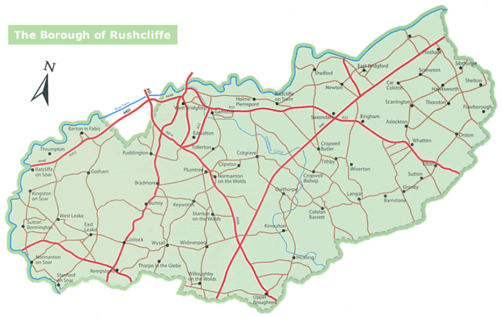
2 Whatton Location and Landscape Setting
2.1 The Relationship of the Whatton Conservation Area to its Surroundings
3.1 Historical Overview
3.2 Archaeology
3.3 Location and Historic Activities
3.4 Historical Mapping
4.1 Plan, Form and Layout
4.2 Landmarks, Focal Points and Views
4.3 Open Spaces, Trees and Landscape
4.3.1 Open Spaces, Trees and Landscape SWOT Analysis
4.4 Public Realm
5 Buildings of the Conservation Area and Key Characteristics
5.1 Building Types and Activity
5.1.1 Building types and Activity SWOT Analysis
5.2 Key Characteristics and Building Materials
5.2.1 Key Characteristics: Unique Street Layout - Zone 1
5.2.2 Key Characteristics: Formal Landscape - Zone 2
5.2.3 Key Characteristics: Rural, Hedge Lined Lane - Zone 3
5.2.4 Key Characteristics: Rural Mixed adjacent to A52 - Zone 4
5.3 Characteristic Zone Map
5.3.1 Key Characteristics SWOT Analysis
5.4 Listed buildings
5.5 Key Unlisted Buildings
5.6 Local Details
5.6.1 TDH Carved Above the Doorways of Cottages
5.6.2 Chimneys and Bargeboards
5.6.3 Timber Cladding
6.1 Introduction
6.2 National and Local Policies and Guidance
6.3 Article 4 Directions
6.4 Building Design
6.5 Publicity and Knowledge Transfer
6.6 Public Realm
6.7 Boundary Treatments
6.7.1 Walls and Fences
6.7.2 Hedges
6.8 Buildings at risk
6.9 Enforcement
7 Appendix 1 – Listed Buildings (as of February 2023)
8 Appendix 2 – Conservation Area Boundary and Townscape Appraisal Map
1 Introduction
1.1 Conservation Areas
Rushcliffe Borough Council has an obligation under Section 69 of the Planning (Listed Buildings and Conservation Areas) Act 1990 to review, from time to time, its Conservation Area designations.
A Conservation Area, as defined under Section 69, is ‘an area of special architectural or historic interest the character or appearance of which it is desirable to preserve or enhance’.
Whatton Conservation Area was designated in 1973. Prior to this review of 2023, the most recent appraisal of the Whatton Conservation Area was carried out in 2007.
Section 71 of the Planning (Listed Buildings and Conservation Areas) Act 1990 highlights the local planning authority’s duty to formulate and publish proposals for the preservation and enhancement of the conservation areas. This document, therefore, aims to identify and
reaffirm (or redefine) the special architectural or historic interest of the area which warrants its designation.
A Conservation Area Appraisals are not, and never have been, tools for to fossilise a place against change, instead, the processes of change which allow places to grow and evolve are recognised as being unavoidable, and it is also recognised that change can be a positive and desirable force. The designation instead allows greater scrutiny and control to manage change to positive effect and to ensure that any changes which require planning permission do not harm, and ideally serve to actively enhance, the existing character of the place.
Whatton Conservation Area: Summary of Special Interest
Whatton-in-the-Vale is characterised by its collection of narrow lanes, high hedges, paddocks, and scattered cottages and the absence of a discernible main street.
The most notable landmark within the village is the church of St John of Beverley, however the capless tower of Whatton Mill is
visible from various points throughout the village.
Timber cladding within the Borough is not common, however Whatton has a number of properties that use waney edge timber cladding. Other styles of timber cladding are also evident within the village.
Fields and paddocks within the village strengthen the connection to the countryside that surrounds it.
There are a significant number of properties with tall chimney stacks, and decorative barge boards many of which are Victorian in character.
Tree lined street along Old Grantham Road.
1.2 The Purpose of a Conservation Area Character Appraisal
The purpose of a Conservation Area Character Appraisal is to:
- Identify and record the special interest of the Conservation Area to ensure there is public awareness and understanding of what is
worthy of preservation. - To define and reassess current boundaries to accurately reflect what is now perceived to be of special interest.
- To identify opportunities to safeguard and enhance the special interest of the Conservation Area.
It should be noted that the content in this document is not a comprehensive account of every significant building, structure, tree, wall, feature, or space. Therefore, any omission should not be assumed to imply that they are of no interest.
Generally, the character and appearance of a Conservation Area will be preserved or enhanced by:
- Providing controls and regulating development through the planning system.
- Applying the extra controls that designation provides over demolition, minor development, and the protection of trees.
- Environmental enhancement schemes and possibly providing financial assistance for the repair and restoration of specific buildings.
- Encouraging public bodies such as the local highways authority or utility companies to take opportunities to improve the street scene through the appropriate design and sensitive sighting of street furniture (and retention of historic features of interest), or the removal of eyesores and street features that have a negative impact such as overhead wires.
1.3 The Planning Policy Context
This appraisal provides a firm basis on which applications for development within the Whatton in the Vale Conservation Area would be
assessed. It should be read alongside the wider development plan policy framework produced by Rushcliffe Borough Council and other
National Planning Policy Guidance documents. The relevant documents include:
- Rushcliffe Local Plan Part 1: Core Strategy, with a specific focus on:
- Policy 10 (Design and Enhancing Local Identity) [in part]
- Policy 11 (Historic Environment)
- Rushcliffe Local Plan Part 2: Development Policies, with a specific focus on:
- Policy 28 (Conserving and Enhancing Heritage Assets)
- Policy 29 (Development Affecting Archaeological Sites)
- The National Planning Policy Framework (NPPF) (Revised -2024)
- The National Planning Practice Guidance (2015 - Subject to Continual Review)
- By Design: Urban Design in the Planning System – Towards Better Practice (2000)
- The Planning (Listed Buildings and Conservation Areas) Act 1990
Whatton Conservation Area: Summary of Key Issues
Bungalows and new builds which are out of character and offer little architectural contribution to the character of the area.
There are very few amenities within the village
2 Whatton Location and Landscape Setting
Rushcliffe Borough forms the southern tip of Nottinghamshire, which borders Leicestershire. It is predominantly a rural Borough that contains a mixture of city suburbs, market towns and villages. Rushcliffe is located about half a mile South of Nottingham city centre, with the River Trent forming the majority of its northern boundary and the River Soar defining its western boundary.
The A46, a distinctive Roman Road, runs through the centre of the Borough and leads to Newark in the North and Leicester in the South. In the northern half of the Borough, the A52 forms Nottingham’s primary transport link to Grantham and the East of England. Junction 24 of the M1 and East Midlands Airport are located about 1 mile from the western border.
Whatton is located in the East of the Borough, in between the railway line along with the neighbouring village a few hundred metres to the north and the A52 to the south. The village lies within the Vale of Belvoir, a name which derives from the Norman-French for ‘beautiful view’ and dates back from the Norman times (a period between 1066 -1154 CE). The village has a church (St John of Beverley) and a Village Hall, the Jubilee Hall.
2.1 The Relationship of the Whatton Conservation Area to its Surroundings
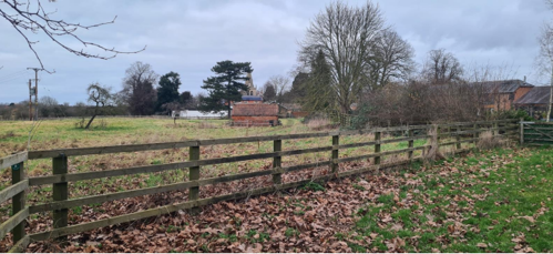
The Whatton-in-the-Vale conservation area has a very strong relationship with the countryside that surrounds it. Views can be taken from the edges of the conservation area, looking out over large gardens, paddocks, fields and the open countryside, known as the South Nottinghamshire Farmlands (Nottinghamshire Landscape Guidelines, Nottinghamshire County Council).
While Whatton is adjacent to the A52, the hedges and trees act as a buffer, softening the effects of the passing traffic nearer the boundaries of the conservation area. From the centre of the village, there is little evidence of the proximity to a major road.
- Conservation Area Boundary covers - 34.87 hectares (approximate)
- Number of Grade I listed buildings - 0
- Number of Grade II* listed buildings - 1
- Number of Grade II listed buildings - 4
A full list of Whatton Conservation Area’s Listed buildings can be found in Appendix 1 Details accurate as of February 2023.
3 Historical Contexts
3.1 Historical Overview
Whatton boasts an ancient history, as evidenced by archaeological findings near the border of Aslockton and Whatton. These discoveries suggest the presence of an ancient settlement in Whatton during the late Iron Age. Although the precise location of this settlement remains undiscovered, it is presumed to lie beneath the A52 road. It's worth noting that these archaeological findings date back to the 1st Century BC and do not extend into the subsequent period known as Romano-British (1st to 5th Century AD).
William I (also known as William the Conqueror) granted the Manor of Whatton to Gilbert de Ghent in 1066.
The Domesday Survey of 1088, documented the presence of 28 villagers, who were members of the peasant class and held a significant amount of land, alongside 12 smallholders, however Domesday Survey figures specifically pertained to able-bodied adults. Consequently, the true population of Whatton was likely much larger than the documented 40 individuals, possibly even reaching around 120 inhabitants.
The Manor of Whatton encompassed not only the present-day parish of Whatton, but also had jurisdiction of one of the five Manors in Aslockton and one of the two Manors in Hawksworth.
Minimal tangible remains of Norman Whatton exist, however there are a few noteworthy exceptions. These include the Norman Arch situated within the Parish Church of St John of Beverley, as well as alabaster sculptures portraying Sir Richard de Whatton, Adam Newmarch, and Sir Hugh Newmarch, which are also housed within the church.
1375 is the earliest reference to Whatton that includes its suffix, "Whatton-in-the-Vale." This additional designation signifies the village's location within the Vale of Belvoir, highlighting the geographical context that has remained a part of its identity throughout its rich history.
3.2 Archaeology
A number of the fields surrounding the village contain archaeologically important earthworks, including ridge and furrow. There is a Scheduled Ancient Monument to the North of the conservation area; evidence suggests that this consists of a moat, two fishponds, boundary bank and ditch and two leats (more information can be found at Historic England).
There is a medieval cemetery located to the rear of 5 Burton Lane. This is possibly connected to the Parish Church. Among the many remains found in the area there were glass beads, 2 bronze shroud pins, pieces of bronze chain. There were also fragments of Roman pottery found in the grave fill.
3.3 Location and Historic Activities
The Anglican Church of St John of Beverley, 11th and 14th century building, underwent significant restoration, with sections rebuilt in 1846 and again in 1870. The building is now Grade II* (two star) listed. A mid-19th Century Grade II Listed boundary wall surrounds the church and the graveyard which contains a group of Grade II Listed headstones dated 1710 – 1748. Arranged in line, the seven stones of Leicestershire slate are all to the Carpendale family. A service is held in Whatton once a month.
Whatton Mill was a five-storey brick tower windmill with four patent sails (sails with shutters instead of cloth), two of which were double. The mill was built in 1820 however milling ceased around 1916. The capless tower is now a listed building.
In 1840, ownership of the Whatton Manor estate, situated approximately a kilometre the south of the A52, and outside of the conservation area, passed into the hands of philanthropist Thomas Dickinson Hall (1808–1879). During his ownership, a substantial manor house was constructed in the "Elizabethan style", and approached from Hall Lane by a wide carriage drive (the drive was lined with Scotch Firs and Cedars) and was built of brick from the Isle of Axholme. Whilst the Manor could not be called a stately home, it was quite substantial. Notably, the Hall family actively supported charitable initiatives and played a vital role in the construction of local churches within the district.
The manor house and its surrounding grounds underwent a transition in 1919 when they were acquired by Samuel Ernest Chesterman and subsequently, William Goodacre Player, the son of John Player (known for his association with the renowned cigarette manufacturing company, John Player & Sons).
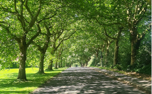
It is rumoured that members of the Player family planted the trees first along Manor Lane and then Old Grantham Road.
Unfortunately, the manor building itself, which had deteriorated significantly by that time, was demolished circa 1964.
Despite the loss of the manor house, remnants of its historic legacy remain visible along Manor Lane. Specifically, the original stables have been preserved and can still be observed today. These stables have been repurposed to house a stud farm, thereby contributing to the continuation of the site's historical significance.
The mid-1960s and 1970s saw a number of properties being built within the village. It was particularly evident with the establishment of residential areas such as The Lawns, Conery Lane, Conery Gardens, as well as developments on the western fringes of the parish, including Dark Lane, Beverleys Avenue, Cottage Avenue, and Smite Close.
These additions significantly contributed to both the housing inventory and the local population. Additionally, smaller housing projects, such as those at Griffins End (located on the site of a former public house, The Griffins Head) and Whipling Close, were introduced in the 1990s. The adaptive reuse of former farmhouses into 'barn conversions' further enriched the housing options available within the area.
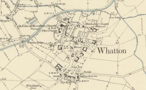
3.4 Historical Mapping

4 Spatial Analysis
The relationship between open spaces and the built form within a conservation area can be central to its character. This section describes the village’s layout, highlighting the significant views, landmarks and historical focal points. The contribution of open green spaces, trees and other natural elements to the conservation area’s character is also described within this section.
4.1 Plan, Form and Layout
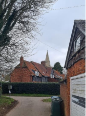
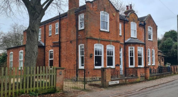
Whatton-in-the-Vale is unusual in that it has no discernible main street, but rather a collection of narrow lanes, high hedges, paddocks, and scattered cottages. As can be seen in this map, in comparison to the historical maps, Whatton has retained its form and layout along with many of the original structures over the recent centuries.
Below is a map that describes the current plan, form and layout of the Whatton.
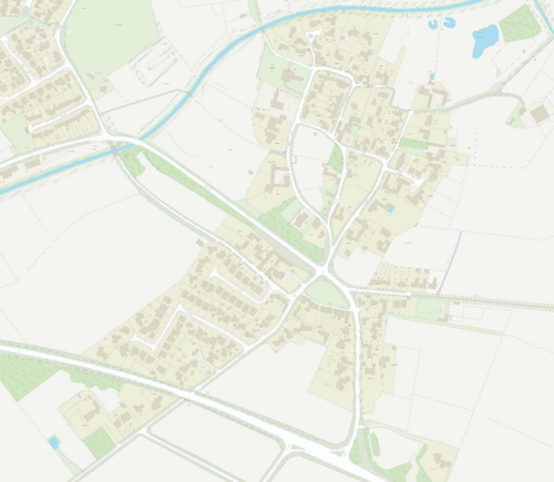
This map is reproduced from Ordnance Survey material with the permission of Ordnance Survey on behalf of the Controller of Her Majesty’s Stationary Office © Crown Copyright. Unauthorised reproduction infringes Crown Copyright and may lead to prosecution or civil proceedings. Rushcliffe Borough Council - 100019419
4.2 Landmarks, Focal Points and Views
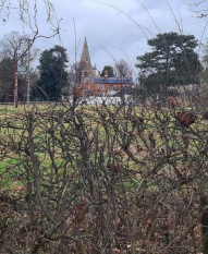
The most noticeable landmark within the village is the church of St John of Beverly (see Figure 5). Its spire, prominently rising above the landscape and other built structures, serves as a visual landmark that can be seen from various vantage points throughout the village. It not only adds to the architectural significance of St. John of Beverley Church but also plays a role in contributing to the village's character and sense of place.
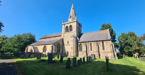
In addition to its noteworthy architectural features, St. John of Beverley Church boasts several historical and artistic elements of significance:
There is a tablet dedicated to Thomas Cranmer, the father of the archbishop, who was born in the neighbouring village of Aslockton in 1489.
The font, dates back to 1662. Notably, one of the 19th-century stained-glass windows was designed by the Pre-Raphaelite artist Edward Burne-Jones.
The church's peal of eight bells (the frame of which was modified in 1966), includes five bells cast by Henry Oldfield of Nottingham in 1590 and 1618, contributes to its intangible (auditory) heritage. Additionally, the installation of an early clock in 1683 by Richard Roe, replaced in 1910, reflects the church's historical role in timekeeping for the community.
4.3 Open Spaces, Trees and Landscape
The main access road through Whatton is Old Grantham Road. When accessed from the North, via Aslockton, the road is lined with mature trees and hedges which occasionally reveal views across the adjacent fields. At a few points along this road, The St John of Beverly Church is visible.
There are grass verges throughout the village. Many meet the road or the pavement without a hard boarder, such as a curb stone or edging strip, contributing to the rural character (see Figure 14, Figure 15 and Figure 17).
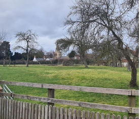
Openness, with views across paddocks and fields is significant to the character throughout Whatton.
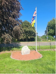
The village green contributes to the openness within the village and is visible from the public realm. Within it there is a War Memorial (see Figure 12).
4.3.1 Open Spaces, Trees and Landscape SWOT Analysis
Strengths - what are the positives of the open spaces, trees, and landscape
- They enhance the sense of calm, which is already a character of the village.
- There are many large trees as well as smaller ones which are great for people and for wildlife and contributes to the character of the area
Weaknesses - what are the negatives of the open spaces, trees, and landscape
- None identified.
Opportunities – what could make the open spaces, trees, and landscape better?
- Management for biodiversity (avoid over manicuring)
Threats - what would make open spaces, trees and landscapes worse?
- If the verges continue to be eroded by traffic.
- Loss of open spaces to over urbanisation or industrialisation.
- The loss of hedging and planting adjacent to the A52 which acts as a buffer for the noise.
- Any intensive, large scale industrialisation or commercialisation on the land (or of the land)
surrounding the conservation area.
Works to Trees
You must contact the Local Planning Authority (LPA), Rushcliffe Borough Council before any works (cutting OR pruning) are carried out to trees within the Wiverton Conservation Area.
Six weeks’ notice is required before any works to trees within the Conservation Area is carried out, even if they are not protected by a Tree Preservation Order (TPO).
If there is a tree which undergoes annual maintenance, include this information with the notice. It may be possible, upon agreement with the tree officer, that only one notice is required to cover the future annual maintenance.
Standard notification forms (a section 211 notice), further information and contact details.
A flow chart of the decision-making process regarding works to trees.
4.4 Public Realm
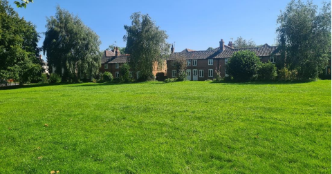
At the heart of the village is the village green which is owned and maintained by the parish council. Adjacent to Grantham Road is a metal railing which acts as a boundary to the green while maintaining visual permeability, and contributing the sense of openness and the character of the area. To the south, the green is bounded by Ivy Row and its early 19th Century cottages.
The Parish Council have held various events on the village green. It is also valued by the local community as a place to visit and relax. Within the green there is war memorial (see Figure 12).
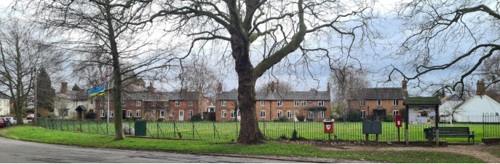
While railings contribute to the character of the green, the boundaries to residential properties are mixed, with many having hedges and wooden fences. There are also a number of walls throughout the village which contribute to the character of the area.
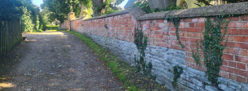
To the north of the village, there are a number of low stone walls that contribute to the character of the conservation area (see Figure 15 and Figure 17).

5 Buildings of the Conservation Area and Key Characteristics
5.1 Building Types and Activity
Farming has been a part of the community in Whatton, and while it is not as prominent, sheep and cattle and the wonderful colour of the rape fields in the early summer can be seen.
Racehorses are part and parcel of the village scene as there are training stables just out of the conservation area and those who work at the stables can be found exercising the horses.
5.1.1 Building types and Activity SWOT Analysis
Strengths - what activities/places can you go that make the village/town great?
- The village hall
- The village green
Weaknesses - what activities/places exist that detract from making the village/town great?
- There are very few amenities
- Proximity of the A52 – noise and pollution from road traffic
Opportunities - what activities/places could exist that would village/town even better?
- Community generated activities/events for the villagers so people don’t have to travel.
- Speed limit reduced on the A52
Threats - what activities/places would make village/town worse?
- Expansion of the prison
5.2 Key Characteristics and Building Materials
5.2.1 Key Characteristics: Unique Street Layout - Zone 1
Materials:
Walls: Brick walls, many of which are whitewashed. There are a number of properties with red brick which have waney edge timber cladding to the first floor or dormer windows.
Roofs: Slate roofs with tall chimney stacks. Pantile roofs are also present within the character area, although they are less common than slate.
While hedges form the majority of boundary treatments, there are a number of stone walls which are below a metre, that contribute to the character of the area.
Key Characteristics / Architectural Features:
This character area has a distinct layout, featuring paddocks at its core. This unusual and historic arrangement reflects the village's agricultural heritage.
The paddocks provide a tangible link to the village's past and highlight its enduring connection to
agriculture.
The character area also boasts a network of narrow lanes lined with traditional cottages. These lanes are a charming representation of the area's historical character, reminiscent of its heritage and rural past.
The row of cottages opposite the church are typical of the village and create a strong sense of place. The continuity of features such as chimney stacks, slate roofs and whitewashed walls create an attractive streetscape with a strong rhythm.
5.2.2 Key Characteristics: Formal Landscape - Zone 2
Materials:
Walls: Brick in various bonds.
Roofs: Slate or pantile roofs with tall chimney stacks.
Boundary treatments: The boundary treatments within this character area is mixed, with fields and farm lands having hedges and timber fences. The village green has metal railings and there are also some significant walls which contribute to the character of the area.
Key Characteristics / Architectural Features:
Formalised landscaping along Old Grantham Road with its tree lined street leading to the village green. The uniformly planted trees line the street and create a dramatic archway (see Figure 9).
Views across open space with glimpses the St John Church of Beverly to the North-East and views across open space with views of the Windmill at Hillyside House to the South-West.
A scheduled monument, Moat and Fishponds to the North of the River Smite.
5.2.3 Key Characteristics: Rural, Hedge Lined Lane - Zone 3
Materials:
Walls: Brick in various bonds
Roofs: Pantile
Boundary Treatments: Hedges are characteristic of this character area.
Key Characteristics / Architectural Features:
This character zone consists of a single-track lane lined with hedges and grass verges.
Where there are gaps within the hedges, or during the winter months when the trees are not in leaf, there are views across the adjacent fields.
The area is rural in character, and this is enhanced by the wooden and metal field gates along the lane.
5.2.4 Key Characteristics: Rural Mixed adjacent to A52 - Zone 4
Materials:
Walls: Red brick, and white washed brick. Many properties in the east of the character area have dentillated brick work to the eaves.
Roofs: Slate
Boundary Treatments: Mostly hedges although there are a few walls in the east of the character area.
Key Characteristics / Architectural Features:
The views out across fields and to the countryside.
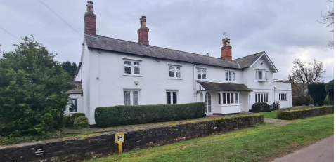
The linear roads, with mainly detached properties (including a large Victorian house in the east of this character zone).
Despite being located close to the A52, this area has a largely rural character, with a linear tree-lined view that extends over the A52 and views into a large paddock. The remains of the Grade II Listed windmill are also within this character area.
5.3 Character Zone Map

Zone 1 – Unique Street Layout - blue boarder
Zone 2 - Formal Landscape - green boarder
Zone 3 - Rural, Hedge Lined Lane - purple boarder
Zone 4 – Rural Mixed adjacent to A52 -red boarder
5.3.1 Key Characteristics SWOT Analysis
Strengths – what is it about most existing buildings that looks good?
- Unique place to visit, with no through road
- Older buildings with a shared sense of character
- The cluster of buildings with timber cladding, which contributes to the character of the area
- The small details on some of the buildings, such as the engravings of TDH above the doorways of some of the cottages throughout the villages (see Figure 27 and Figure 28)
Weaknesses – what is it about most existing buildings that does not look good?
- The bungalows which are out of character and little architectural merit
Opportunities – what could make existing buildings (or new builds) look good and contribute to the character of the area?
- Rigorous scrutiny at planning level
- Potential for the implementation of Article 4. Directions to prevent the loss of walls that would not require planning permission to remove.
Threats – what could make existing buildings (or new builds) look worse and detract from the character of the area?
- Infill development that detracts from the character
- The loss of walls below 1 metre
5.4 Listed buildings
Buildings on the Government’s List of Buildings of Special Architectural or Historic Interest are called “Listed” buildings and are protected by law. Consent is required from Rushcliffe Borough Council before any works of alteration, extension, or demolition can be carried out on any listed building.
Further information can be found in Rushcliffe Borough Council’s publication Listed Buildings in Rushcliffe.
The complete up-to-date list of the Secretary of State’s Statutory List of Buildings of Special Architectural Interest or Historic Interest.
Names of the Listed Buildings and structures in Whatton Conservation Area (correct as of October 2023) are detailed in Appendix 1. All Listed Buildings are shown on the Townscape Appraisal plan, but some smaller structures such as gravestones may not be shown.
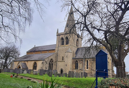
Parish Church 11th century and 14th century with major renovations during 1846.
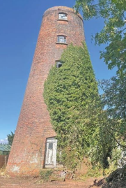
Built approximately 1820. Has five stages, battered round tower and a flat roof. Iron casement windows in chamfered reveals with
segmented heads.

Early 17th century house with late 17th and 18th century extension and additions. Two storeys, brick with whitewashed roughcast render. Steep pitched, hipped, and gabled pantile roof.
5.5 Key Unlisted Buildings
Contribution to the established character of the place can also come from buildings which are not recognised via listing or are not old. A plan with all of the positive contributions to the area can be found in Appendix 2 - Conservation Area Boundary and Townscape Appraisal Map.

5.6 Local Details
5.6.1 TDH Carved Above the Doorways of Cottages
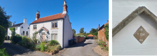
Thomas Dickinson Hall was philanthropist who endeavoured to enhance the quality of life for the residents. Cottages along Sunbeam and throughout the village bear the initials "TDH" carved above the doorways.
5.6.2 Chimneys and Bargeboards
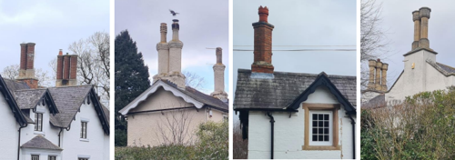
- Figure 29 – Barge Boards and Chimney Stacks at The Gables, Church Street, (Zone 1)
- Figure 30 – Barge Board and Chimney at Elmcote, School Lane, (Zone 1)
- Figure 31 – Barge Boards and Chimney Stack at The Forge, Conery Lane, (Zone 2)
- Figure 32 – Chimney Stack at Whatton House, Conery Lane, (Zone 2)
Timber cladding within the Borough is not common, however Whatton has a number of properties that use waney edge timber cladding. Other styles of timber cladding are also evident within the village.
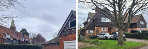
- Figure 33 – Timber Cladding at Penrose, 4 Burton Lane and Chapel Walk , (Zone 1)
- Figure 34 – Timber Cladding at 5 and 7 Conery Lane, (Zone1)
6 Generic Management Plan)
6.1 Introduction
In carrying out its planning functions, the Borough Council is required in law to give special attention to the desirability of preserving or enhancing the character or appearance of Conservation Areas. The Management Plan for a Conservation Area is a tool to ensure the special character of the area is preserved and enhanced. The management plans aim to:
- Outline a strategic management proposal for the preservation and enhancement of the Whatton in the Vale Conservation Area.
- Act as a guide for professionals and residents alike regarding:
- features of value, worthy of preservation;
- characteristics worthy of preservation;
- opportunities for enhancement;
- development proposals which preserve and enhance the special character of the area.
- Inspire community commitment to conservation principles and reporting.
6.2 National and Local Policies and Guidance
There is a duty to formulate and publish management plans setting out policies and proposals for the preservation and enhancement of Conservation Areas. Many of these policies and proposals are common to all Conservation Areas, and these are set out in this document. The Central Government Guidance and Local policies applicable to Conservation Areas include:
- Rushcliffe Local Plan Part 1: Core Strategy, with a specific focus on:
- Design and Enhancing Local Identity [in part]
- Historic Environment
- Rushcliffe Local Plan Part 2: Development Policies, with a specific focus on:
- Conserving and Enhancing Heritage Assets
- Development Affecting Archaeological Sites
- The National Planning Policy Framework (NPPF), particularly, but not exclusively the chapter on Conserving and Enhancing the Historic Environment.
- The National Planning Practice Guidance (NPPG) (updated 2021 and subject to continual review)
- By Design: Urban Design in the Planning System – Towards Better Practice (2000)
- The Planning (Listed Buildings and Conservation Areas) Act 1990
- Historic England “Historic England Advice Note 1: Conservation Area Designation, Appraisal and Management”
The council will utilise the full range of strategic policy and guidance documents to ensure that development in Whatton Conservation Area is of a standard that enhances the amenity of the local area. The council will always look to use the most up-to-date versions of the document.
Supplementary documents may be issued for individual Conservation Areas where specific policies or proposals are needed.
6.3 Article 4 Directions
There are extra consents required in Conservations Areas. For example, in addition to the general control of development, you will
need to get permission for
- Any additions or alterations to the roof (for example, dormer windows)
- The installation of satellite dishes on chimneys, roofs or walls fronting a highway
- Any extension which extends beyond the side of the original dwelling house
- Any extension of more than one storey that extends beyond the rear wall of the original dwelling house
- Cladding the exterior of the dwelling
- Any demolishing of a building or part of a building that has a volume over 115 cubic metres
Article 4 of the Town and Country Planning (General Permitted Development) Order 1995, allows planning authorities to restrict
some permitted development rights within particular areas. This does not necessarily prevent development or change taking place
but enables the Local Authority to manage the design and detailing of the works, and potentially grant permission subject to appropriate conditions. The use of Article 4 Directions will be proposed where it is considered appropriate following the completion of each Area Appraisal across the Borough.
Details of Article 4 Directions for Whatton Conservation Area
There are currently no Article 4 Directions for Whatton Conservation Area.
6.4 Building Design
Mimicking the local vernacular is not the only way to ‘fit in’ with the character of a conservation area. National policy makes clear that contemporary designed, provided it is sympathetically designed, cannot be dismissed as an option. Therefore, good contemporary design will be encouraged where it respects the context’s character, scale and massing. This must be demonstrated in the Design and Access Statement submitted with any planning application.
Extensions to buildings in Conservation Areas should respect:
- The key characteristics of the original building, including scale, mass, materials and proportions
- The contextual setting and character of the Conservation Area
Copying like for like can devalue and destroy the ability to “read” historic change, and dilutes our historic heritage. Pastiche designs, incorporating poor imitations of other styles, will be resisted, particularly where they incorporate details which are not locally appropriate. Careful high-quality replication may be required in a few very sensitive locations.
In particularly sensitive locations, such as uniform terraces, exact replication may be necessary to maintain compositional unity. In that case, attention to details, choice of materials and high-quality workmanship are the keynotes. However, in some cases, a direct relationship is not impossible. For example, Flemish Bond brickwork cannot be replicated in cavity walls, and narrow lime mortar joints cannot be replicated in modern metric brickwork.
Where a new building is appropriate, on infill sites or where an existing building detracts from the character of the area, the opportunity should be taken to re-establish the streetscape, reinforce enclosure, open up distant vistas or views of landmarks or hide unsightly views.
“New and old buildings can coexist happily without disguising one as the other, if the design of the new is a response to urban design objectives” (DETR – “By Design”, p19).
As with extensions, good contemporary design which respects local character, and the context of the site will be encouraged.
All new buildings should respond appropriately to the existing frontage and normally follow the established building line. Development or redevelopment will normally be resisted if:
“it blocks important views identified in the individual appraisals, uses important open spaces identified in the appraisals, adversely affects the setting of any Listed or key buildings, fails to maintain or re-establish the streetscape where appropriate dominates its Conservation Area background fails to recognise the context of
the site destroys important features identified in the individual appraisals such as boundary walls, fences,
hedgerows or trees”
Where the quantity of contemporary schemes in a small area becomes significant and outnumbers older buildings within the area, further contemporary schemes could fundamentally shift the architectural character of the area and thus be harmful, even if well designed as an individual project.
New development that stands out from the background of buildings may be appropriate in exceptional circumstances if it contributes positively as a landmark to enhance the street scene, to highlight a corner or to signal a visual change of direction such as along a curving vista.
Any external lighting should be carefully designed and sited to minimise light pollution.
Energy producing or saving devices are generally welcomed by the Council, but careful consideration is required when these are to be located in a Conservation Area and some may require planning permission. In particular, they should be positioned to minimise their impact on the building and on the local amenity.
6.5 Publicity and Knowledge Transfer
Ambiguity about additional controls within a Conservation Area raises the likelihood of inappropriate developments occurring which
may damage the integrity of the conservation area designations.
Efforts have been made to engage local community groups in the development and review of the character appraisals. Empowering
communities to define the special architectural and historic interest of the Conservation Area aims to raise awareness.
Whether the appraisal took a community-led or a council-led approach, upon reviewing all Conservation Areas, the public were invited to ask questions and comment during a public consultation. A consultation event also aimed to diminish any ambiguity about
restrictions within a Conservation Area and increase the likelihood of sensitive and appropriate developments, maintaining the character
of the area.
The council recognise the potential issues of turnover in residency and ownership of properties in the conservation area. Therefore,
Rushcliffe Borough Council will periodically use their media outlets to highlight conservation area designations and the significant,
related planning controls.
The approach taken within Whatton Conservation Area was Council Led The consultation period took place between the following dates
23/02/2024 and 19/03/2024
The date of the Consultation Event - 13/03/2024
If there are any queries about conservation areas, please email conservationareas@rushcliffe.gov.uk
6.6 Public Realm
General maintenance and upkeep to the public realm may include fixing damage to roads and pavements, and fixing issues with street lighting. Issues such as these can impact the quality of the Conservation Area.
The council aims to encourage works to the public realm that are in keeping with, or actively enhance the conservation area. Rushcliffe Borough Council can only advise on work within the public realm that does not require planning permission (for example work completed by statutory undertakers, such as the Highways Authority). In these instances, Rushcliffe borough council cannot prevent such work.
Nottinghamshire County Council are responsible for repairs to roads, pavements and street lighting. Report issues of repairs to roads, pavements and street lighting to Nottinghamshire County Council online.
Rushcliffe Borough Council will continue to undertake their duties in maintaining the public realm. Vandalism, fly tipping and street cleaning are all the responsibility of Rushcliffe Borough Council. Report issues to Rushcliffe Borough Council online.
Works to Trees
You must contact the Local Planning Authority (LPA), Rushcliffe Borough Council, before any works (cutting OR pruning) are carried out to trees within the Whatton Conservation Area
Six weeks’ notice is required before any works to trees within the Conservation Area is carried out, even if they are not protected by Tree Preservation Order (TPO).
Standard notification forms (a section 211 notice) - further information and contact details.
A flow chart of the decision-making process regarding works to trees.
6.7 Boundary Treatments
Where there is a proposal for a new boundary treatment to be installed, the council would encourage the use of boundary treatments within the area.
Within conservation areas, planning permission is required to alter, maintain, improve, take down or build any new gate, fence, wall or other enclosure with:
- A height of one metre or more if next to a highway (including a public footpath or bridleway), waterway or open space; or
- A height of two metres or more elsewhere.
Where planning permission is required to remove a wall, Rushcliffe Borough Council will aim to protect those boundary walls and fences that have been identified as positively contributing to the area.
Hedgerows are significant habitats for wildlife in lowland Britain. Regulations are intended to protect important hedges in the countryside. The policy applies to hedges that are more than 20m long, (or less if connected to another hedge) on or adjacent to:
- Land used for agriculture or forestry, including the keeping of horses or donkeys
- Registered common land and village greens
- Local Nature Reserves and Sites of Special Scientific Interest.
The policy does not apply if the hedge is within or on the boundary of the curtilage of a house.
6.8 Buildings at risk
A few of the important buildings across the various Conservation Areas are currently vacant or not in regular use, which may lead to some being “at risk” of neglect or decay.
The Council will encourage and advise on renovation and repair work that is sensitive to the original or traditional historic character of the building and retains original features. The council will monitor the opportunity and potential for grant aid schemes to encourage the basic maintenance work necessary to ensure that key buildings within the conservation area are structurally sound and weather tight. However, given the current financial climate and outlook, such schemes are unlikely in the short to medium term.
There is a presumption against the demolition of buildings which contribute to the character of the area unless there are exceptional circumstances. It would benefit both the physical form and the function of the Conservation Area if these buildings were repaired, maintained and brought back into use.
Where the poor condition of a building or structure is as a result of neglect and lack of maintenance by its owner there is no requirement for the Borough Council to take its deteriorated condition into account when deciding whether demolition is appropriate. This is to avoid rewarding the deliberate neglect of buildings by representing such action as a way to obtain planning permission for demolition and redevelopment.
6.9 Enforcement
Rushcliffe Borough Council will, from time to time, assess and monitor changes in the appearance and condition of Whatton in the Vale Conservation Area. This will ensure that where necessary enforcement action can be taken promptly to deal with problems as they arise.
Where co-operation cannot be gained by any other means, Rushcliffe Borough Council has the ability to use additional enforcement powers to tackle particular issues within conservation areas. The Council may take formal action if the condition of any building (listed or unlisted) which makes a positive contribution to the character of the Conservation Area is considered to be at risk.
The council will work in accordance with their enforcement policy, which aims to provide an efficient enforcement service in support of the Council’s statutory planning service. Rushcliffe Borough Council’s enforcement actions will remain transparent, consistent, and proportionate, as it is recognised that effective controls over unauthorised development assists in conserving the natural and built environment whilst helping to protect the quality of people’s lives and maintaining the Council’s integrity.
7 Appendix 1 – Listed Buildings (as of February 2023)
Grade: II*
Listing entry number: 1243823
National grid reference: SK 74501 39674
Location: Church of St John of Beverley, Church Street
Boundary Wall at Church of St John of Beverley
Grade: II
Listing entry number: 1244675
National grid reference: SK 74478 39712
Location: Boundary Wall at Church of St John of Beverley, Church Street
Group of 7 Headstones 10 Metres West of West End Of Nave at Church of St John of Beverley
Grade: II
Listing entry number: 1272248
National grid reference: SK 74520 39660
Location: Group of 7 Headstones 10 Metres West of West End Of Nave at Church of St John of Beverley, Church Street
Grade: II
Listing entry number: 1272693
National grid reference: SK 74601 39567
Location: Tyler's Cottage, Burton Lane
Grade: II
Listing entry number: 1272694
National grid reference: SK 74333 39168
Location: Windmill At Hillyside House, Conery Lane
Moat, two fishponds, boundary bank and ditch and two leats
Scheduled Monument
Listing entry number: 1008260
National grid reference: SK 74228 39647
*The titles of these listings may not make it clear that all listed buildings always include all attached structures and extensions, regardless of age, and all detached outbuildings built before 1 June 1948 which are, or were at the time of listing, ancillary to the function of the primary listed building and were in the same ownership at the time of listing.
For example, when a house is listed, the listing will apply to extensions, porches, detached historic stables, barns, wash houses, privies etc. Such outbuildings and extensions are only exempt from the provisions of listing where the listing specifically excludes them. Appendix 2 - Conservation Area Boundary and Townscape Appraisal Map.
8 Appendix 2 – Conservation Area Boundary and Townscape Appraisal Map

The Whatton in the Vale Townscape Map above shows:
- Locations of listed buildings
- Locations of key unlisted buildings
- Open space
- Locations of trees, hedges, and significant hedges and fences
- Viewpoints
Conservation Areas
- Bingham Conservation Area
- East Bridgford Conservation Area
- East Leake Conservation Area
- Hawksworth Conservation Area
- Hickling Conservation Area
- Ruddington Conservation Area
- Thoroton Conservation Area
- Wiverton Conservation Area
- Langar Conservation Area
- West Leake Conservation Area
- Whatton in the Vale Conservation Area
- Sutton Bonington Conservation Area
- Upper Saxondale Conservation Area
- Wysall Conservation Area