Contaminated Land
Rushcliffe Borough Council Contaminated Land Inspection Strategy 2024-2029
Contents
- Executive Summary
- 1.0 Introduction and Overview
- 1.1 National Objectives of the Contaminated Land Regime
- 1.2 General Policy of Rushcliffe Borough Council
- 1.3 The Neighbourhoods Service Plan
- 1.4 Rushcliffe Local Development Framework
- 1.5 Strategy Priorities and Objectives
- 2.0 Characteristics of Rushcliffe
- 2.1 Geology
- 2.2 Topography
- 2.3 Land use and industry in Rushcliffe
- 2.4 Waterways
- 2.5 Hydrogeology
- 2.6 Protected sites
- 3.0 Strategic approach to the identification of contaminated land
- 3.1 Action Plan 2024-29
- 3.2 Investigation of land identified through the development control process
- 3.3 Complaints
- 3.4 Dealing with Urgent Sites
- 3.5 Review of Prioritised List
- Appendix 1
Executive Summary
This document is a revision of the Council’s Contaminated Land Inspection Strategy last reviewed in 2018. This revision follows a routine five yearly review. The overall basis of the Strategy remains unchanged from the previous Strategy in that the Planning Regime will primarily be used to deal with land contamination issues in the Borough. This approach followed the decision by central government in 2013 to withdraw funding under the Contaminated Land Capital Grants Scheme used to support Local Authorities in undertaking site investigations and remediation under Part 2A of the Environmental Protection Act 1990 (the Part 2A regime).
With the changes in funding, investigation and potentially remediation costs under the Part 2A regime now fall entirely to the Local Authority except perhaps for emergency cases and even then, any financial help from Defra is subject to internal budget clearance and the funds may simply not be available. These reductions in funding have also occurred at a time of significant cuts to Local Authority Budgets.
The UK has a legacy of land contamination arising from past industrial development. Various industrial practices have led to substances being in, on or under land such as tars, heavy metals, organic compounds, and mining materials. In addition, landfilling of waste sometimes took place without adequate precautions against the escape of landfill gases and leaching of materials.
This Strategy document details how Rushcliffe Borough Council, under regulations inserted into the Environmental Protection Act 1990, will inspect the land in its Borough for contamination. After consultation, the Strategy was published in 2024. It details how the Council will take a rational, ordered, and efficient approach to this inspection.
Department for Environment, Food & Rural Affairs (Defra) have indicated that they now expect the vast majority of land contamination to be remediated through the planning process, where (after remediation) as a minimum, land should not be capable of being determined as Contaminated Land under Part 2A of the Environmental Protection Act 1990.
The investigation of potentially contaminated land under Part 2A of the Environmental Protection Act 1990 will now be extremely limited. It is likely that for future contaminated land investigations and remediation, the responsibility to fund the majority of such work will fall on the landowner and their insurance companies.
The Council has used all available information and a risk-based approach during the initial screening process and will continue to do so in the detailed inspection of sites to identify Contaminated Land. A rolling inspection programme will be undertaken, running for the duration of this strategy, with the Council producing a public register of any land designated as contaminated.
The process of investigating and remediating land will ensure that all land in the Borough is suitable for use and does not pose unacceptable risks to people, the environment, water, and property.
This revision to the Strategy has been written to reflect this change in emphasis and update on progress made to date.
1.0 Introduction and Overview
Industrial change and demographic shift during the 20th century resulted in the need for large-scale re-organisation of our towns and cities. Industries moved out or disappeared altogether leaving large, ‘Brownfield’, gaps in our urban landscape. Inevitably, these changes have left behind a legacy of land contamination, which in some cases may be harmful.
1.1 National Objectives of the Contaminated Land Regime
The overarching objectives of the Government’s policy on contaminated land and the Part 2A regime are:
- To identify and remove unacceptable risks to human health and the environment.
- To seek to ensure that contaminated land is made suitable for its current use.
- To ensure that the burdens faced by individuals, companies and society are proportionate, manageable and compatible with the principles of sustainable development.
The objectives outline the ‘suitable for use approach’ with respect to the remediation of contaminated land and achieving sustainable development. This means that the risk is assessed in the context of a specific use with the aim of maintaining an acceptable level of risk at minimum cost, thereby, “not disturbing social, economic and environmental priorities.”
The regime provides a means of dealing with unacceptable risks posed by land contamination to human health and the environment, and enforcing authorities should seek to find and deal with such land. Under Part 2A the starting point should be that land is not contaminated land unless there is reason to consider otherwise. Only land where unacceptable risks are clearly identified, after a risk assessment has been undertaken in accordance with Statutory Guidance, should be considered as meeting the Part 2A definition of contaminated land.
Enforcing authorities should seek to use Part 2A only where no appropriate alternative solution exists. The Part 2A regime is one of several ways in which land contamination can be addressed.
Department for Environment, Food & Rural Affairs (Defra) have advised that they now expect the vast majority of land contamination to be remediated through the planning process, where (after remediation) as a minimum, land should not be capable of being determined as Contaminated Land under Part 2A.
As such land contamination is largely addressed using two routes:
Clean Land
- Contaminated Land Regime - Part 2A of the Environmental Protection Act 1990
- Planning - The Town and Country Planning Act 1990
Other legislative regimes may also provide a means of dealing with land contamination issues, such as building regulations (Part C); the regimes for waste, water, and environmental permitting (PPC); and the Environmental Damage (Prevention and Remediation) Regulations 2009.
1.2 General Policy of Rushcliffe Borough Council
Rushcliffe Borough Council welcomed the introduction of Part 2A of the Environmental Protection Act 1990 which complements the Council’s own corporate aims and objectives.
Rushcliffe’s current Corporate Strategy was published in December 2023, giving the following four priorities for the Council:
1. The Environment
The Council knows that the natural environment is precious and not something anyone can afford to take for granted. The Council is fully committed to playing its part in protecting the environment today and enhancing it for future generations.
2. Quality of Life
Residents’ quality of life will always be a priority for the Council. Quality of life is all about how residents feel about living in the Borough, its environment, and the community facilities they can access.
3. Sustainable Growth
Rushcliffe is determined to play its part in shaping the future of the Borough ensuring the needs and aspirations of Rushcliffe residents are met in all future developments.
4. Efficient Services
As an organisation it is always the Council’s intention to deliver the best services for residents in the most efficient way possible.
1.3 The Neighbourhoods Service Plan
The goals and priorities from the Corporate Strategy are developed into key actions
within the Neighbourhoods Service Plan.
“To consistently provide services which protect and enhance the local environment,
promote housing choice and minimise the risks to the safety, health and well-being of
our citizens”
Two key aims of the service that are relevant are:
- To protect the local environment from harm;
- To protect the health, well-being and safety of residents, visitors, and workers.
In the context of contaminated land, the aim is to investigate and where appropriate ensure land is remediated that may already be contaminated.
In December 2013, Defra announced that funding for site investigations under the Contaminated Land Capital Grants Scheme would be withdrawn. Consequently, the Council’s ability to fund remediation works is now extremely limited. The focus of any investigations will therefore be directed towards the highest priority sites and those posing a significant risk to public health.
1.4 Rushcliffe Local Development Framework
The National Planning Policy Framework sets out the Government’s Planning Policies for England and how these are expected to be applied. It sets out the Government’s requirements for the planning system and it provides a framework within which local people and their accountable councils can produce their own distinctive local and neighbourhood plans, which reflect the needs and priorities of their communities.
Planning law requires that applications for planning permission must be determined in accordance with the development plan unless material considerations indicate otherwise. The National Planning Policy Framework must be taken into account in the preparation of local and neighbourhood plans and is a material consideration in planning decisions.
One of the important core principles of the framework is to encourage the effective use of land by reusing land that has been previously developed (brownfield land).
The inspection of the Borough will identify areas of potentially contaminated land, which may be developed, awaiting development, derelict, protected or green belt. This may result in the need to re-examine past development control files or identify development routes for contaminated sites, which may subsequently impact on the Local Development Framework.
1.5 Strategy Priorities and Objectives
The Part 2A regime requires that where a local authority considers that there are reasonable grounds for believing that any land may be contaminated, it shall cause the land to be inspected for the purpose of identifying whether it is contaminated land.
Authorities must act in accordance with guidance issued by the Secretary of State which has been published by Defra.
The statutory guidance makes clear that Authorities must produce a formal contaminated land inspection strategy document. It must set out how and when land which merits inspection, will be identified in an ordered, rational, and efficient manner and in what time scale.
The Council’s priorities in dealing with contaminated land will be:
- To protect human health;
- To protect controlled waters;
- To protect designated ecosystems;
- To prevent damage to property;
- To prevent any further contamination of land;
- To encourage voluntary remediation prior to taking enforcement action;
- To encourage re-use of brownfield land.
In order to provide a focus for future actions, the following objectives have been established:
- To ensure that the Strategy is compatible with the Council’s Corporate Policies, sustainability, development and community objectives.
- To ensure that planning policies and procedures deal effectively with any land contamination where development takes place and to render it suitable for its intended use.
- To make information readily available to all relevant services to enable potential liability issues associated with their own land to be fully assessed.
- To ensure that the Council is aware of any associated potential land contamination liabilities, prior to proposed acquisition or disposal.
- To provide a mechanism whereby the Strategy is reviewed on a regular basis to allow for changes in statutory guidance and corporate policy.
2.0 Characteristics of Rushcliffe
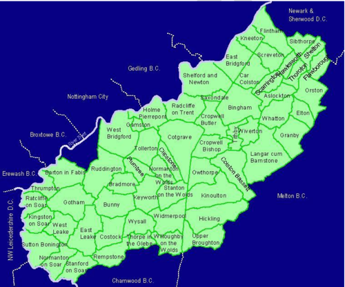
The Borough of Rushcliffe is situated in the Southeast of Nottinghamshire, covers 157 square miles, and has a population of 119,000. Its area stretches from the River Trent to the Leicestershire borders to the east and the south, and northwards to within a few miles of Newark.
The largest town is West Bridgford with a population of 44,100 (including Gamston & Edwalton), and it is separated from the City of Nottingham by the River Trent. Other major settlements include Bingham, Cotgrave, Radcliffe on Trent, Keyworth, Ruddington and East Leake, and throughout the Borough there are approximately 50,000 dwellings.
2.1 Geology
Geology plays an important role in the establishment of pollutant linkages between the source and receptor. It is therefore necessary to establish the underlying geology within Rushcliffe.
Rushcliffe is situated upon superficial deposits of clay, sand, gravel, alluvium and on bedrock of mudstone, sandstone and carboniferous limestone. There are coal measures, gypsum beds and a geological feature called the Westbury bed which is associated with uranium mineralisation and the radioactive gas, radon. There are two geological faults called the Harlequin Fault and the Flawforth Fault and a small number of minor complex faults.
2.2 Topography
Much of Rushcliffe is rural and agricultural. The western half of the Borough is characterised by the Wolds, with higher undulating land in the south. The remainder of the Borough is flatter and lower with the rivers Trent, Soar and Smite forming shallow valleys running through the Borough. There are mixed areas of woodland, except for the north-eastern part and the area west of Ruddington which are characterised by an open, flat landscape where many trees and hedgerows have been removed. Other prominent features are Gotham Hill, Hickling Standard, Wilford Hill, Barton Gap and Cropwell Bishop Gap.
2.3 Land use and industry in Rushcliffe
Most of Rushcliffe is rural and agricultural, with areas of mixed woodland.
Brick clay has been extracted in the past, and the main sites were situated at Harlequin (Radcliffe on Trent), West Bridgford and Wilford. Sand and gravel has been extensively extracted at Holme Pierrepont and Bassingfield. At the present the only active site is at East Leake.
Gypsum has been extracted in many areas of Rushcliffe as early as the 17th Century. Early workings were based around outcropping gypsum and there are many pits and shafts, particularly around the East Bridgford areas. Later methods of extraction used pillar and stall methods with mines at Barton, East Leake, Gotham and Thrumpton. Quarrying for gypsum was carried out on a large scale at Cropwell Bishop until 1995, and British Gypsum at East Leake is the only active site currently extracting mined gypsum.
Cotgrave colliery opened in 1964, but production ceased in 1993 and the site has been developed for industrial, residential use and recreational use. There is the possibility that in the past coal was extracted on a small scale elsewhere in the Borough, but there are no records of such activities.
Oil is currently extracted at Rempstone and there are other small fields at Cropwell Bishop and Langar, but production is relatively small. Exploratory drilling has also been carried out near Radcliffe in Trent.
Although mainly rural, there are areas of light industry spread about the Borough, with industrial sites at Bingham, Bunny, Cotgrave, Keyworth, Langar, Normanton on Soar, Ruddington, West Bridgford and Wilford.
The Borough has 28 processes currently permitted under the Environmental Permitting Regulations 2010; these include Ratcliffe on Soar Power Station and Tarmac Cement Works at Barnstone.
There are also four large closed landfill sites in the Borough, and several smaller filled areas, but others may be present throughout the Borough.
2.4 Waterways
The River Trent forms the western boundary of the Borough with the River Soar to the South West. The Rivers Devon, Smite and Fairham and Kingston Brooks meander across the central and eastern parts of the Borough. The Grantham canal, now disused, bisects the Borough and runs into the River Trent near Lady Bay Bridge.
Most of the land adjacent to the rivers in the Borough is classed as floodplain, with major flooding in 1947 and more recently in 2000, 2012, 2023 & 2024. River water quality in the Borough is classed as fair to very good.
2.5 Hydrogeology
There are no principal aquifers, only secondary and B designated for the bedrocks in the borough. There are no Environment Agency groundwater protection zones in the Borough.
There are a small number of private water supplies, mainly serving single properties with springs or shallow wells. There are also a small number of borehole supplies, but only one is used for human consumption.
2.6 Protected sites
The Borough has many protected sites, including 8 Sites of Special Scientific Interest (SSSIs). Full details can be found on our Nature Conservation Strategy webpage Nature Conservation Strategy - Rushcliffe Borough Council
It is likely that some contaminated land sites will have been colonised by wildlife which are legally protected. Consequently, prior to remediation measures being implemented, it will be necessary to ensure that appropriate action is taken to ensure that the legislation protecting certain species of wildlife is complied with. The main species likely to be found in the Borough, identified as being protected by the Wildlife and Countryside Act 1981 (as amended), are badgers, bats, great crested newts, water voles and breeding birds.
3.0 Strategic approach to the identification of contaminated land
The Council is required to take a strategic approach to inspecting land in its area for contamination. Therefore, it is necessary to consider both the extent to which any specified receptors are likely to be found in the district and the history, scale and nature of industrial or other potentially contaminative uses.
This work was carried out in the early 2000s and 1873 potential sites were identified along with relevant receptors and these were prioritised on a risk basis into a ‘prioritised list’. The vast majority of these sites were very low risk and included farms, ponds that had been filled, electrical substations and sites where remediation had already taken place and land had been re-developed.
3.1 Action Plan 2024-29
The updated action plan (Appendix I) represents the progress that is anticipated in the context of current resources and expertise available to the Council in the next 5 years. It is the intention to keep this Strategy under regular review so that performance can be monitored within the Neighbourhoods Service Plan.
As of 2024, two sites have been formally classified as contaminated land within the framework and definitions of Part 2A of the Environmental Protection Act 1990 and placed on the Public Register. One of these sites was made suitable for use by full remediation and the other has been secured to prevent any receptors coming into contact with the contamination. A significant number of sites have been dealt with through the planning process, and under the current economic climate, this will remain the most appropriate means of dealing with land contamination, and only the most serious and urgent sites dealt with through the Part 2A regime.
3.2 Investigation of land identified through the development control process
The Land Contamination Risk Management (LCRM) was published by the Environment Agency in 2020 and replaced the Model Procedures for the Management of Land Contamination (CLR11). Both have been developed to provide the technical framework for applying a risk management process when dealing with land affected by contamination.
The process involves identifying, making decisions on, and taking appropriate action to deal with land contamination in a way that is consistent with government policies and legislation within the UK.
Each phase of the risk assessment process will conclude by assessing whether any contaminant linkage(s) exists, and if so whether it is considered to be ‘significant’. If it is considered that any such linkage exists then the inspection process will move onto the next phase of risk assessment ultimately reaching a proposal for remediation and/or risk management, if required.
The Environmental Health Service and the Development Control Service will continue their close working relationship to ensure that all land highlighted as a potential site of contamination is subject to the required risk assessment, site investigation and remediation to ensure it is suitable for the proposed use.
Potentially contaminated land will continue to be identified and remediated through the planning process according to good practice. Recommendations will be made for conditions to be attached to any sites identified as requiring assessment relative to the proposed use of the site. A booklet “A Guide to Developing Land within Nottinghamshire – Guidance for Landowners and Developers” has been revised and is available on the Councils website.
3.3 Complaints
A complaint regarding any suspected land contamination will be dealt with following the same procedure as other service requests. The Council does not normally undertake any investigation based on anonymously supplied information and this general policy will be adopted for land contamination issues. This policy does not, however, preclude investigation of an anonymous complaint in exceptional
circumstances. An initial desktop study will likely be undertaken, and further action is only likely if it appears that the site may be deemed an ‘urgent site’.
3.4 Dealing with Urgent Sites
Urgent action will be taken when the Council is satisfied that there is imminent risk of serious harm. The Council will consider undertaking remediation in urgent cases where it is the enforcing Authority and is of the opinion that the risk would not be
mitigated unless by the Council’s voluntary action. In the case of a Special Site, the Council will declare the land contaminated and notify the Environment Agency who will then be responsible for the remediation.
3.5 Review of Prioritised List
A review of the list of potentially contaminated sites will take place during the period of this strategic document to determine if any of these require ‘urgent action’ in line with the action plan attached as Appendix I. Potential sites will be reviewed as a desktop exercise focusing on the defined risks developed through the original risk prioritisation model and updated with any new information that has more recently come to light. Where sites are identified and are to be developed they will be dealt with through the planning regime and re-risked accordingly. Only sites that are considered to be the highest priority and likely to be posing an imminent risk of serious harm will be considered for further inspection and remediation.
Appendix 1 - Action Plan 2024 - 2029
As it is likely the majority of sites impacted by land contamination will be dealt with via the planning regime, we will explore options to ensure land dealt with this way can be recorded on our data management system and cross referenced with the prioritised list of sites. This will ensure the prioritised list of sites is kept up to date and we can record the number of sites dealt with via the planning regime each year.
Work can then commence on assessing the current highest priority sites to see if further detailed and intrusive investigations are required. It is likely that the highest priority sites will take the longest to assess and by definition are the sites most likely to require further work.
2024: Review previous work and assess the top 5 priority sites
2025: Assess the top 6-10 priority sites
2026: Assess the top priority 10-20 sites
2027: Assess the top priority 20-35 sites
2028: Assess the top priority 35-50 sites
Accessible Documents
- Air Quality Action Plan 2021
- Air Quality Annual Status Report 2024
- Air Quality Annual Status Report 2023
- Air Quality Annual Status Report 2022
- Air Quality Annual Status Report 2021
- Air Quality Strategy for Nottingham and Notts
- Annual Governance Statement 2023-24
- Annual Governance Statement 2021-22
- Annual Governance Statement 2020-21
- Asset Management Strategy
- Auditor's Annual Report 2021
- Internal Audit Annual Report 2021/22
- Auditor's Annual Report 2021-22
- Become a Councillor 2022
- Budget and Financial Strategy 2021-22
- Budget and Financial Strategy 2022-23
- Budget and Financial Strategy 2023-24
- Budget and Financial Strategy 2024-25
- Capital and Investment Strategy
- Climate Change Strategy 2021-2030
- Complaints Policy
- Compulsory Purchase Order Procedure Protocol
- Confidential Reporting Code
- Council Constitution
- Contaminated Land
- Corporate Enforcement Policy
- Corporate Strategy 2024-2027
- Council Tax Recovery and Enforcement Policy 2023
- Customer Access Strategy
- Design Code Baseline Appraisal
- Discretionary Housing Payments Policy 2023-2024
- Disabled Facilities Grant Policy 2022
- Disclosure and Barring Service Policy
- Economic Growth Strategy 2024
- Empty Homes Strategy
- Environment Policy 2023
- Equalities Scheme 2021-25
- External Audit Completion Report 2024
- External Audit Completion Report 2023
- External and Internal Communications Strategy
- Freedom Of Information Policy
- HB Recovery and Enforcement Policy
- Hackney Carriage and Private Hire Licensing Policy 2020 - 2025
- Homelessness and Rough Sleeping Strategy
- Housing Allocations Policy
- Housing Enforcement Policy
- ICT Strategy 2022 -25
- Information Management and Governance Strategy 2022-25
- Rushcliffe Borough Council Information Retention Schedule
- Internal Audit Annual Report 2023/24
- Leisure Strategy 2021-2027 review
- Local Code of Corporate Governance 2024/25
- Local Plan Part 1: Core Strategy
- Local Plan Part 2: Land and Planning Policies
- Local Plan Monitoring Report
- Local Scheme of Validation
- Off-street Car Parking Strategy
- Pay Policy Statement
- People Strategy 2021-26
- Planning Enforcement Policy
- Play Strategy
- Procurement Strategy
- Playing Pitch Strategy 2022
- 2021-22 Public Inspection Notice
- RIPA Policy and Guidance
- Risk Management Strategy 2023-26
- Rushcliffe Nature Conservation Strategy
- Solar Farm Landscape Sensitivity and Capacity Study
- Statement of Gambling Licensing Principles
- Statement of Accounts 2019-20
- Statement of Accounts 2020-21
- Statement of Accounts 2021-22
- Statement of Accounts 2021-22 (unaudited)
- Statement of Accounts 2022-23 (unaudited)
- Statement of Accounts 2022-23 (audited)
- Statement of Accounts 2023-24 (audited)
- Statement of Licensing Policy
- Street Trading Policy
- Supplementary Planning Documents
- Tenancy Strategy 2019
- Transformation Strategy and Efficiency Plan
- Tree Management and Protection Policy 2023
- WISE Agreement
- Conservation Areas
- Neighbourhood Plans
- The Nature of Rushcliffe 2021
- The Nature of Rushcliffe 2019
- Anti-Slavery Policy
- Modern Slavery & Human Trafficking Transparency Statement 2024-2025