Design Code Baseline Appraisal
Draft Rushcliffe Design Code Baseline Appraisal
Contents
What is a baseline appraisal?
Engagement strategy
Policy Context
Rushcliffe and the wider Nottinghamshire
Landscape and Townscape Character
Area code plan
Urban
Riverside
Key Settlements
Settlements
New Neighbourhoods
High Streets
Rural and Farmland
What is a baseline appraisal?
The following document provides the Appraisal which underpins the preparation of the Rushcliffe Authority-wide Design Code. It forms Stage 1 in the process of adopting a design code as set out in the National Model Design Code.
Stage 1. Analysis: Scoping and Baseline
Scoping
The Council has undertaken an Engagement Strategy over the previous months in order to determine the scope of the Design Code. This has involved both internal and external stakeholders, including residents, and provides the Council with a good understanding of what the Borough’s strengths and weaknesses are and what the design code’s priorities should be. The design priorities have informed the draft Design Vision and objectives which will be consulted on as part of Stage 2. The Engagement Strategy is set out in more detail in the following pages.
Baseline
A Baseline Analysis of the function, character, constraints and opportunities of places within the Borough has been carried out. This analysis informs how the Council has divided the Borough into a series of zones or Area Types. The Area Types are set out in a draft Coding Plan which will be consulted on as part of Stage 2. At Stage 3, a set of design codes or guidance will be written for each Area Type, in addition to the general code which will apply everywhere. The full Baseline Analysis is set out in the following pages.
Deciding what to code
Process for designing the code.
- Appraising Local Context
- Applying the necessary skills and resources
- Applying Policy and Guidance
- Engaging with stakeholders and the public
- Taking Account of other regulatory regimes
- Understanding what will be viable
- Deciding what is important
- Deciding what elements will be mandatory or discretionary
Engagement strategy
Engagement activities
To establish a robust baseline for the Rushcliffe Design Code, this requires the input of those stakeholders directly involved in planning decision making in the Borough. To begin the process, work on the design code has been underpinned by a series of engagement exercises that combined in-person events with digital consultation. The events took place between late 2023 and April 2024. Rushcliffe Borough Council also ran supplementary engagement activities with councillors and staff.
Internal stakeholder surveys
At the initiation stage, internal stakeholders within the Council were surveyed on what they considered to be the priorities for the code, both in terms of design quality and geographical coverage. The key stakeholders comprised: officers from planning, ecology, landscape and housing; all of the councillors; and the Council’s Executive Management Team. This initial scoping of opinion has helped to frame the baseline and inform subsequent engagement activities.
Internal stakeholder surveys identifying local priorities
- Quality
- Area-wide
- Beauty
- Ecology
- Wildlife
- Varied
- Identity
- Shared bins
- Management
- Accessibility
- Digital
- Design
- Mixed tenure
- Car parking
- Vehicles on pavements
- Management of parking
- Reduce street parking
- Limit frontage parking
- Biodiversity
- Solar panels
- Unambiguous
- Place making
- Permeable
- Robustness
- Community
- Character
- Creative
- Local
- Clear
- SUDs
- Inclusivity
- Soakaways
- Imageability
- Prescriptive
- Connectivity
- Landscaping
PlaceChangers digital engagement
PlaceChangers is our digital engagement partner, providing a dedicated online portal open to all. PlaceChangers increases the audience by offering respondees the opportunity to shape the design code by contributing to the interactive and open forum map of Rushcliffe.
In the first online consultation, which took place between 26 January - 7 March 2024, participants were invited to make borough-wide, ward and site specific suggestions, commenting on the strengths and weaknesses of the area. The comments provide the Council with a good data set for current public opinion, particularly with regards to design quality of settlements.
PlaceChangers survey indicated key comments and concerns
- Trees
- Quality
- Biodiversity
- Green space
- Safety
- Car parking
- Adequate provision
- Improve infrastructure
- Limit parking
- Vehicles on pavements
- Pollution
- Flooding
- Public transport
- Ageing population
- Blue and green infrastructure
- Sustainability
- New developments
- Accessibility
- Needs local infrastructure
- Ensure quality
- In keeping with vernacular
- Cycleways
- Active travel
Overview
Respondents outlined demand for a progressive Design Code, with a focus on sustainability, provision and access to green space, and quality design that could benefit local communities. Transport, and active travel, was seen as important in order to improve connectivity with the wider borough and Nottingham.
Strengths
Respondents commented heavily on the quality of Rushcliffe’s green space and landscape, with emphasis on its relative accessibility from most settlements in the borough. Additionally, the architectural character and heritage of established villages and towns was seen as a particular strength with comments outlining thriving communities within these areas.
Rushcliffe’s strengths identified by PlaceChangers respondents
- Landscape
- Character
- Community
- Green space
- Connectivity
- Quality
- Heritage
- Cycleways
- Transport
Weaknesses
Participants frequently commented on car parking in the borough, with concerns about adequate provision, and poor parking on streets and pavements that creates challenges. This related to further comments on traffic density impacting both drivers and the safety of cyclists.
Participants commented on the threat, and impact, of flooding, with questions about appropriate local drainage systems. Respondents
also indicated a need for greater connectivity between settlements, specifically by means of active travel.
Weaknesses in Rushcliffe outlined in PlaceChangers survey
- Car parking
- Adequate provision
- Parking is exacerbated by new developments
- Vehicles on pavements
- Flooding
- Traffic
- Cars
- Trees
- Drainage
- Pavements
- Landscape
- Character
- Quality
There were 139 participants and they provided 168 responses. These are shown in Ward order.
Abbey
- Too many cars cause problems with visibility.
- We need more trees and should adapt roads to support them.
Bingham North
- New builds should have a foot and cycling paths connecting with town centres.
Bunny
- Most of the area does not have sufficient infrastructure to cope with further development.
Cranmer
- Less intensification and repetition of suburban design & layout in villages.
Compton Acres
- Not enough cycle paths - commuter cyclists need travel corridors.
- Flooding on Wilford Lane is frequent and results in road closure.
Cotgrave
- Accessibility should be a priority, with an emphasis on inclusive spaces for all abilities.
Cropwell
- Developments need to respect the strong local vernacular.
- High environmental standards should be in place for new developments.
East Bridgford
- Limit parking spaces on new developments to encourage public transport use.
Edwalton
- New developments should be sympathetic to the local area.
Gamston
- A main route into Nottingham should not be so easily impassible by floodwater.
Gotham
- Too much of our green belt is disappearing rapidly along with the wildlife living within.
- Beautiful green countryside immediately adjacent to the main urban area of Nottingham.
Keyworth and Wolds
- The Borough should focus on building higher quality houses.
- Only 41% of homes in Keyworth have an energy efficiency rating of C or above.
- Old trees and hedgerows should be well maintained.
Lady Bay
- New developments should provide decent outside space for bins, cars, bikes, etc.
- Loss of many front gardens to provide off street parking
Leake
- Stewardship and management plans for new developments are unsatisfactory.
Musters
- Tree lined streets have been reduced and lost over time and need reinstatement.
Nevile and Langar
- New developments don’t often follow the local character of buildings.
Newton
- There is a lack of local amenities.
Radcliffe on Trent
- Need cycleways between major settlements on a protected cycle path.
Ruddington
- Far too many cars in the village centre, not enough protection of trees/hedgerows.
Soar Valley
- Poor drainage and flood risks in the area.
Tollerton
- Connectivity between villages and the city is poor for non motorized traffic.
Trent Bridge
- New developments should fit in with the style of the area.
Event 1:Community representatives and ward Councillors
30 January 2024
The design team took part in a walk around West Bridgford led by community representatives and ward Councillors to see the design issues identified by local residents including accessibility concerns, problems such as parking for vehicles and cycles and concerns about a perceived erosion of local character as a result of unsympathetic developments.
Event 2: Council’s planning team
30 January 2024
The workshop provided an opportunity to introduce the project in greater detail and build on the feedback from the initial stakeholder surveys. It also provided an opportunity to explain the concept of Area Types and test this in the context of Rushcliffe with those with a greater working knowledge of the Borough. Using lessons learned from the Pathfinder pilots enabled the group to navigate the process and determine Area Types based largely on urban form.
The workshop also provided an opportunity to consider and discuss design issues and priorities to be addressed within the code. It was
also possible to refine these findings further by starting to debate how the identified issues could be addressed in terms of design ‘shoulds’ and design ‘musts’.
Comments on: Guidance and Priorities
Comment 1:
- Legibility – avoiding barriers between developments.
Comment 2:
- More architects involved in designs.
Comment 3:
- Need green and blue infrastructure/ corridors.
Comments on: Code Priorities
Comment 1:
- Integrating renewables into the design of new buildings and places.
Comment 2:
- Landscaping: full detail and future management described.
Comment 3:
- Form and scale – no of storeys (subject to areas)
Event 3: County Council Highways Development Management team and the Borough Council waste and recycling team
19 March 2024
The workshop was an opportunity to discuss reoccurring design issues relating to streets and movement in new developments and to clarify design priorities relating to a host of elements such as landscaping, SuDS and tree planting, waste storage and collection, traffic speeds and street geometry, street hierarchy, car parking and electric vehicle charging. It was an opportunity to understand the design priorities and ‘musts’ from a highway design perspective including designing for speeds of 20 mph and lower, maintaining visibility, ensuring sufficient parking and connected street networks.
Event 4: Local Agents’ and Developers’ Forum
20 March 2024
The workshop provided an opportunity to introduce the project in greater detail and to discuss benchmarks in good design processes and design quality (local, regional and national). It also provided an opportunity to discuss with those with experience of submitting planning applications to the local planning authority how the design code could aid this process and what design issues should be addressed in order to create specific, visual and measurable instructions.
Comments on: Benchmarks in Design Quality
Comment 1: Using Building for a Healthy Life during pre-app.
Comment 2: Review of pre-app service, site meetings would be useful.
Comments on: Design issues to be addressed
Comment 1: Concise codes with rules
Comment 2: Scale: new developments are monotonous.
Comment 3: Clearly worded, no ambiguity.
Event 5: Councillors Rushcliffe Borough Council
23 April 2024
This was an opportunity to introduce the project in greater detail and build on the feedback from the initial stakeholder surveys by discussing design issues and priorities to be addressed within the code. The workshop was an opportunity for Councillors to give views on the proposed Area Types and another chance to identify and discuss the design issues and challenges most prevalent throughout the district.
Issues raised by councillors:
- Parking
- Connectivity
- Biodiversity
- Trees
- Active travel
- Street hierarchy
- Green energy
- EVs
- Larger gardens
- Street lighting
- Varying house types
- Space for Work From Home
- Scope for extending
- Defibrillators
- Corner shops
Event 6: Council’s planning team
24 April 2024
A meeting to re-engage with a critical stakeholder group recognising that stakeholder engagement is a continuous process as opposed to a moment in time. It provided an opportunity to inform officers of progress and allows us to begin ‘soft’ testing proposals for the code structure and content. It also prompted a critical discussion about the approach to defining boundaries around area types
Event 7: Design Review
24 April 2024
An opportunity to invite a panel of independent expertise from Design Midlands to peer review the work undertaken to date and to offer guidance on next steps. At the review the design team and panel discussed design code vision, Area types and ideas on how to structure the content of the design code.
Feedback to follow
Event 8: PlaceChangers
20 May 2024
Feedback to follow
Policy Context
The above diagram illustrates the key planning policy documents and strategies at local, county and national level that frame this baseline analysis and will inform the Rushcliffe Design Code. Included at a local level is the Borough’s development plan consisting of the Local Plan (part 1 and 2) and a number of Neighbourhood Plans. Beneath the development plan are a series of Supplementary Planning Documents (SPDs) on areas such as sustainable design, affordable housing and wind energy.
The design code also sits within a wider framework of design policy and guidance at county and national level and is informed by a plethora of recognised best practice guidance.
Key Planning Policy Documents informing Rushcliffe Design Code
Best Practice Guidance
Documents will be endorsed and used to support high quality and sustainable design for Rushcliffe.
National and Regional
- National Design Guide
- National Model Design Code
- Nottinghamshire County Council Highways design guide
Rushcliffe Design Code
Will be adopted initially as an SPD and later as a Supplementary Plan.
Rushcliffe Development Plan
- Adopted Local Plan
- Neighbourhood plans Best Practice Guidance
Best Practice includes: Best Practice Guidance, National and Regional and Rushcliffe Design Code
National and Regional includes: National and Regional and Rushcliffe Design Code
Rushcliffe Development Plan includes: Rushcliffe Design Code and Rushcliffe Development Plan
Rushcliffe and the wider Nottinghamshire
Rushcliffe sits south of the river Trent in South Nottinghamshire, located in close proximity to Nottingham City to the north, Derby to the west, Leicester City and Loughborough to the south and Grantham to the east.
One of the Borough’s key strengths is its proximity to major economic centres of activity and housing which makes it a desirable place to live and work.
Formed in 1974, the borough covers West Bridgford, which acts a suburb of Nottingham, six key settlements (Bingham, Cotgrave, East Leake, Keyworth, Radcliffe on Trent and Ruddington), smaller settlements, farmland and countryside.
West Bridgford acts as a key service centre for a number of the surrounding smaller settlements, and contains the Borough’s largest retail centre that is relatively well performing. Outside of West Bridgford, the six towns and larger villages provide a range of facilities and services. Several of the medium sized villages such as East Bridgford, Gotham, Tollerton, Aslockton, Sutton Bonington and Cropwell Bishop have some local facilities to serve their population.
Rushcliffe’s landscape is largely rural and generally comprises rolling lowland farmland. Variation in character is provided through the higher land of the Nottinghamshire Wolds, the edges of the Vale of Belvoir and parts of the Trent Valley. Rushcliffe has a rich heritage with 29 Conservation Areas, 4 Registered Parks and Gardens, 25 Scheduled Ancient Monuments, over 650 Listed Buildings and structures and numerous other non-designated assets including those listed on the Nottinghamshire Historic Environment Record.
Rushcliffe acts, to an extent, as a residential area serving the Greater Nottingham employment area, with a lot more workers in the Borough than there are jobs. A certain level of imbalance is not surprising given the proximity of West Bridgford to Nottingham City, where around a third of Rushcliffe’s residents work.
The area is also the home of several nationally important sports facilities, including Trent Bridge Cricket Ground, and Nottingham Forest football ground.
Transport and Movement
Rushcliffe has a range of transport options from trains, trams, bus and cycle networks to roads.
Two train lines flank east and west of Rushcliffe; the Midland Main Line to the west, with East Midlands Parkway station passing through Rushcliffe, and the East Coast Mainline to the east. In addition, the Nottingham-Grantham-Peterborough line passes through Rushcliffe with stations at Radcliffe-on-Trent, Bingham, Aslockton and Elston and Orston, and connects to the East Coast Mainline at Grantham.
Network Rail is responsible for the rail network infrastructure, whilst there are four train operating companies with services running through the county – Cross Country,London North East Railways (LNER), East Midlands Railways and Northern trains.
To the west of West Bridgford, the NET Trams (Nottingham Express Transit) network forms a 20 mile light transit system connecting to Nottingham City Centre (train station), Toton, Basford, Bulwell and Hucknall to the north. There are three NET stops within Rushcliffe on the line to Clifton.
Whilst there is a dense network of bus routes in the more built up areas of West Bridgford and Key Settlements, rural settlements are often without any access to public transport or at best an infrequent service. The public transport isochrone demonstrates that the majority of the borough is relatively inaccessible using public transport as a means of travel resulting in a dependency on private car use for mobility. However, surrounding towns and cities such as Derby, Leicester and Grantham have are greater accessibility due to the
region’s train network.
Rushcliffe has limited designated cycle networks that primarily encircle the borough (routes 15, 48, 64) connecting to Loughborough and Melton Mowbray. Within West Bridgford, routes connecting to Nottingham City Centre appear to be indirect or fragmented. The Grantham canal provides a traffic free route but is as yet not continuous and terminates in Gamston with no connecting route on the A6011 and A52.
The existing highway network is managed by Nottinghamshire County Council and The Highways Agency (HA) is responsible for the national strategic road network (SRN) - M1, A1, A453, A46 and A52.
To the west is the M1 (connecting to Leicester, Northampton, Milton Keynes and London to the south and Sheffield, Rotherham and Barnsley to the north). The car isochrone demonstrates that the entirety of Rushcliffe is accessible within 45 minute car journey. However, its strength is its proximity and relationship to Lincoln, Grantham, Derby and Leicester allowing residents of Rushcliffe to a wide geographical job market.
At a more micro level, Rushcliffe is host to two major sport stadiums at Trent Bridge and City Ground which create peak stresses on the local infrastructure. As there is little parking infrastructure within West Bridgford, the stadiums rely on Nottingham city centre and on-street parking for private car parking and public transport for those travelling further afield.
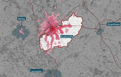
Methodology
An isochrone is an isoline for travel time, that is a curve of equal time travel from a specific geographical point (in this instance, Central Avenue, West Bridgford).
The outline catchment of each shape of the isochrone is defined by the time it takes to travel to Central Avenue in 15 minutes increments using public transport and short walks.
Traditionally, these catchment shapes would have been drawn as perfect circles without taking into account the context and conditions of the built environment. The isochrone takes into account the actual travel time by analysing the time it takes to travel based on public data and influenced by physical barriers such a trainlines, canals, rivers and motorways.
Source: QGIS+Travel Time
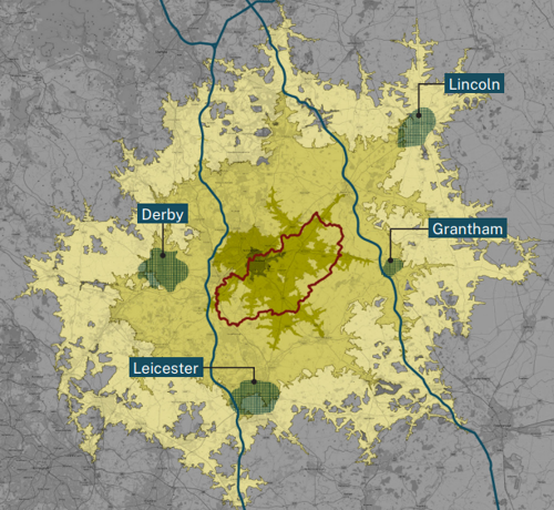
As Rushcliffe grows, developments will need to take into account the accessibility of how new housing and employment is designed around access to sustainable means of public transport or is built in compact forms that allows viable public transport to service new developments. Although not yet implemented, it is foreseeable that in the near-term future that stresses on air quality in city centres and the move towards low-emission zones across England emphasise the strategic need for Rushcliffe to enhance public transport
infrastructure to meet the needs and demands for growth.
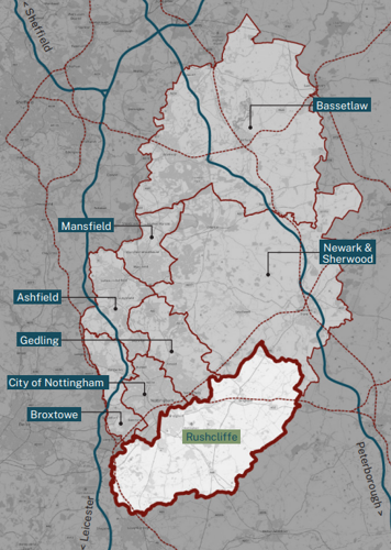
Landscape and Townscape Character
West Bridgford, the Trent Valley and the Soar Valley
West Bridgford, Compton Acres, Gamston and Edwalton form the largest built-up area within the Borough. The bridges over the River Trent at West Bridgford links the settlement with the city of Nottingham, and has been an important crossing point for centuries.
Land use and settlement patterns throughout the Trent Valley is formed by the physical character of the valley, with settlements situated on the margins of the valley and on the raised river terraces. Beyond the urban areas, the settlement pattern is characterised by a nucleated pattern of villages and isolated farmsteads. Arable cultivation now dominates much of the Trent Valley, whilst the Soar Valley is home to meadows and pasture lands.
South Nottinghamshire Farmlands
A band of rolling lowland landscape that sweeps from west of Ruddington across the Borough to Flintham in the northeast. Larger villages and key settlements introduce more suburban characteristics to an otherwise rural landscape and large-scale development of mass market housing – including the Romans Quarter near Bingham, and Hollygate Park at the former Cotgrave colliery – introduce pockets of ‘could be anywhere’ volume house building that continues to pervade all parts of the UK.
Nottinghamshire Wolds
Moving southward into rolling clay hills – dispersed villages, isolated farmsteads, narrow country lanes, medieval sites, extensive ridge and furrow grassland, historic parkland and species rich hedgerows – each combine to create the distinctive landscape character of the Wolds. To the west, East Leake and the industrial influences of the gypsum mining industry and power station at Ratcliffe on Soar, impact upon the rural character of the landscape. Cotgrave and Keyworth form larger commuter settlements on the northern edge of the Wolds.
The Vale of Belvoir
Forms a lower lying landscape of gently undulating landform, extensive areas of pasture and land for grazing with a nucleated settlement pattern of interconnecting country lanes. A smaller scale pastoral landscape generally exists immediately around many of these villages and whilst woodland is sparse, hedgerows and hedgerow trees form the principal vegetation.
Key settlements
The growth of six larger settlements – Ruddington, Bingham, Keyworth, Radcliffe on Trent, Cotgrave and East Leake – was partly due to their proximity to major roads and later the arrival of the railways which provided access to Nottingham, Melton Mowbray and Loughborough, as well as to Newark.
Ruddington and to a lesser extent East Leake were predominantly working villages influenced by the rapid growth of the Framework Knitting industry in the late 19th century. East Leake also grew in the 20th century as a result of gypsum mining. Bingham grew up as an important Market Town serving a large farming catchment and later due to its proximity to major transport links, also attracting the aforementioned mass housing developments. Cotgrave expanded rapidly from a small rural village into a mining community when the colliery opened in the 1960s. Keyworth’s growth was a combination of its colliery and more rapidly, post 1950, of a planning policy decision to allow expansion.
Villages
Within any pattern of settlement there is usually a hierarchy of forms: single-farmstead, hamlet, village and market town. Rushcliffe is comprised of varied quantities of each category, with far more small settlements than large ones. There are three main types of villages found in the Borough – dispersed, linear and nucleated. Each have distinguishable characteristics in terms of their morphology, location,
terrains, and potential for change. Additionally, many villages throughout the Borough have Conservation Area designations.
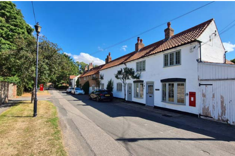
Village types
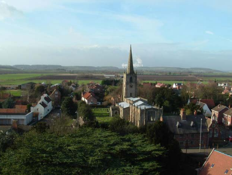
In a nucleated village most of the individual farmsteads and dwellings are concentrated into clusters often around a central nodal point – a church, market cross or public house for example. There are as many as 15 nucleated villages within the Borough with Cropwell Bishop as a good example.
In a dispersed village each farmstead and dwelling is set at a distance from its neighbours, a pattern dominated by dispersion. There are fewer examples of dispersed villages within the Borough, with 6 having been identified of which Car Colston and Orston are good examples.
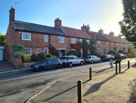
A linear village (often curvilinear) is an arrangement of farmsteads and dwellings laid out in a system of rectangular enclosures (or burgage plots), sometimes referred to as a ‘ladder settlement’, which commonly follows a linear route that may have originated as a rural lane or track, developing over time into a main thoroughfare connecting to a larger settlement. Linear villages are the most common in the Borough, with 26 having been identified including Aslockton and Flintham.
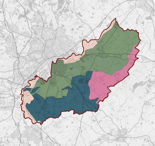
Key
- Trent Washland = orange dots
- South Notts Farmlands = green
- Nottinghamshire Wolds = dark blue
- Vale of Belvoir = pink
Area code plan
Proposed Area Types
The coding plan has been developed from the workshops held with the wider planning and policy team at Rushcliffe and through the baseline analysis and site visits from the consultant team around the borough.
The dominant preference from discussions was towards forming area types based upon urban form. Using lessons learned from the Pathfinder pilots, the focus has been on simplicity of area types, so as to not over complicate the sub-division and zoning of Rushcliffe. We are proposing the following:
Urban
The area defined as West Bridgford excluding the Riverside site along the River Trent.
Riverside
Defined as the area of West Bridgford that follows the Trent in the built up area where large existing structures such as Trent Bridge and the City Ground sit alongside large administrative buildings of Nottinghamshire County Council.
Key Settlements
Defined as the larger key settlements of the borough, these include Ruddington, Keyworth, Bingham, Radcliffe on Trent, East Leake and Cotgrave. These more established settlements are distinct through their well-established existing infrastructure such as high streets, historic centres and size.
Settlements
Settlements defined by the three characteristic settlement types:
Nucleated;
- Shelford
- East Bridgford
- Kneeton
- Cropwell Bishop
- Cropwell Butler
- Tithby
- Tollerton
- Plumtree
- Bunny
- Bradmore
- Owthorpe
- Granby
- Langar
- Gotham, and
- Barton-in-Fabis
Dispersed;
- Car Colston
- Orston
- Whatton-in-the Vale
- Colston Bassett
- Widmerpool, and
- Stanford-on-Soar
Linear;
- Flintham
- Sibthorpe
- Flawborough
- Hawksworth
- Screveton
- Scarrington
- Thoroton
- Aslockton
- Elton-on-the-Hill
- Sutton
- Barnstone
- Kinoulton
- Hickling
- Upper Broughton
- Clipston-on-the-Wolds
- Normantonon-the-Wolds
- Wysall
- Willoughby-on-the-Wolds
- Rempstone
- Costock
- West Leake
- Thrumpton
- Ratcliffe-on-Soar
- Sutton Bonington
- Normanton-on-Soar and,
- Kingston-on-Soar
New Neighbourhoods
New neighbourhoods are defined as new housing developments (circa 2000) and significant extensions to existing key settlements. They also include future housing allocations under construction, in planning or pre-planning. They have been separated from existing settlements due to design decision focused on car movement, rather than active travel or basic connectivity principles.
High Streets
These are the designated district centres; Bingham and West Bridgford alongside Local centres Cotgrave, East Leake, Keyworth (The Square), Keyworth (Wolds Drive), Radcliffe on Trent and Ruddington.
Rural and Farmland
Defined as the rural landscape and farmland in-between all other area types featuring small hamlets and agricultural related buildings.
Local Development Order (LDO)
The LDO exists to shape the plans for redevelopment of the Radcliffe on Soar power station site. We recognise the existing order, but will not be coding for it.
Next Steps
We will be consulting on the coding plan as part of ‘event 8’ of our engagement plan using the online Placechangers tool. It will be an
opportunity for the general public, agents, landowners and developers to comment on the proposed area types proposal and shape the content/ priority.
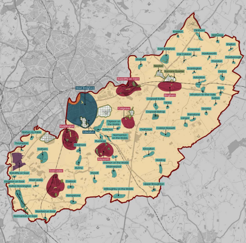
Key
- Urban = dark blue
- High Streets = green - shown in Cotgrave, East Leake, Keyworth, Radcliffe on Trent and Ruddington
- Riverside = orange - West Bridgford boundary with the river Trent
- Key Settlements = dark red - Bingham, Cotgrave, East Leake, Keyworth, Radcliffe on Trent, Ruddington
- Settlements = blue/green - small villages
- New neighbourhoods = grid pattern
- Local Development Order = purple - Ratcliffe on Soar Power Station site
Urban
Urban Area - West Bridgford
Overview
West Bridgford is part of the Nottingham Urban Area, Population of 36,487 (ONS, 2021). It is encircled by the River Trent to the north and A52 to the south. Development through the early 1900s has followed Melton Road towards Edwalton. Housing stock doubled post 1960 with large suburbs developing to the east and west.

Land use
West Bridgford is defined by moderately dense Victorian and Edwardian housing blocks of predominantly semi-detached two and three storey houses with enclosed private gardens running east-west in the Trent Bridge and Abbey wards with the remaining predominantly
north-south with the topography, framing views towards Nottingham City centre. Post 1960s developments are less coherent with cul-de-sacs and disorientating patterns focused on car movement.
Key opportunities
These are opportunities across the urban area for sensitive infill and intensification of plots, as well as utilising larger, but limited brownfield sites for intensification. The NET tram provides low carbon public transport and provides wide access to employment.
Key constraints
The A52 represent a physical barrier in terms of connecting planned growth to emerging peripheral development such as the Gamston
extension. Some poor quality 20th century buildings do not contribute to the wider character. Movement is dominated by private car transport little, poor or fragmented walking and cycling infrastructure.
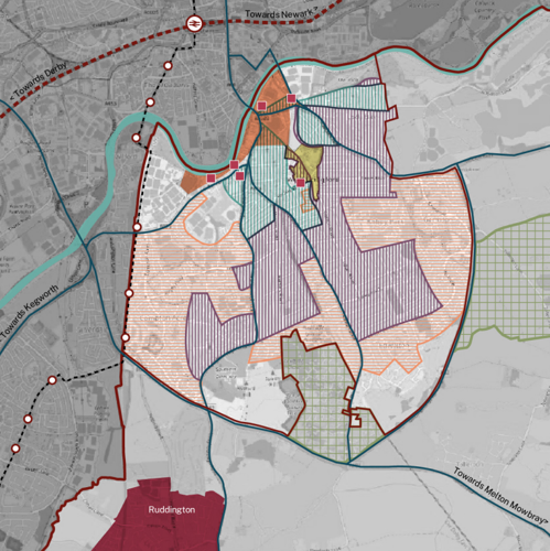
Key
- New build apartments = dark red boxes
- New neighbourhoods = green box grid
- Properties 1900 and earlier = light blue hatched
- Suburbs 1901 - 1960 = purple hatched
- Suburbs post 1960 = orange hatched
Social Fabric
Central Avenue is the primary commercial high street for West Bridgford alongside smaller, potted short runs of shops on Earlswood Drive, Edwalton and A60/Eton Road. The remaining shopping fabric is via car-orientated large supermarkets or Compton Acres.
Well-dispersed facilities can be found across West Bridgford, however public access is limited with private membership required for club facilities or enclosed within school grounds.
Access to designated play areas is inconsistent with some large housing estates such as parts of the Edwalton expansion without provision. What areas are provided are unimaginative and reliant on catalogue equipment. There are a number of allotments across the area, particularly around estates of Compton Acres and Abbey wards. There is a notable absence in southern West Bridgford.
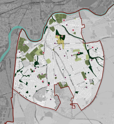
Key
- High streets = pale green
- Outdoor sport facilities = green
- Local green space - dark green
- Allotments = yellow box
- Schools = purple dot
- Playspace = red dot
Planning and resilience
Tightly encircled by the Green Belt to south and east and flood zone 2 from the River Trent to the north which is defended as part of the West Bridgford Flood Alleviation Scheme in 2008. The Edwalton conservation area is located to the south encompassing a large area of two distinct character areas: the 18th and 19th century old village of Edwalton and high quality Victorian, Edwardian and inter-war housing.
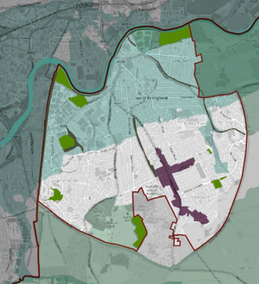
Key
- Flood zone 2 = light green in upper map area
- Natural and Semi-natural green spaces = green
- Green corridors = dark grey
- Green belt = pale green outside boundary
Transport and movement
Frequent and well dispersed bus network provides easy access to Nottingham City centre and Nottingham train station. There is limited network and less frequent access to nearby villages. The NET tram network runs alongside the western boundary of Rushcliffe.
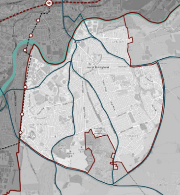
Community concerns
Common concerns arose around:
- servicing of refuse and accessibility on collection days
- poor quality new builds
- safety and visibility at junctions
- general lack of cycle infrastructure
- installation of hard standing surfaces in front gardens and the removal of garden walls
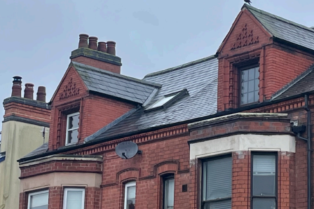
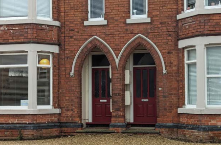
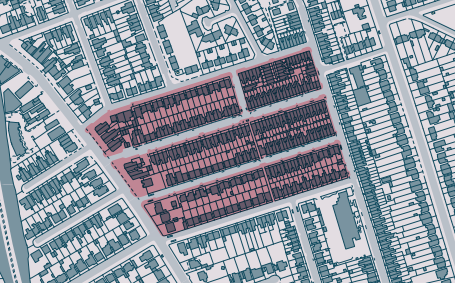
Semi-detached brick properties
Typical Block
- Typically characterised as two-storey or three-storey homes.
- Approximately 36 dwellings per hectare.
Architectural Features
- Red brick with single storey timber bay windows and paired recessed door entrances (vaulted and arched).
- Ornate clay and brick detailing surround recessed entrances, and brick or timber eaves detailing.
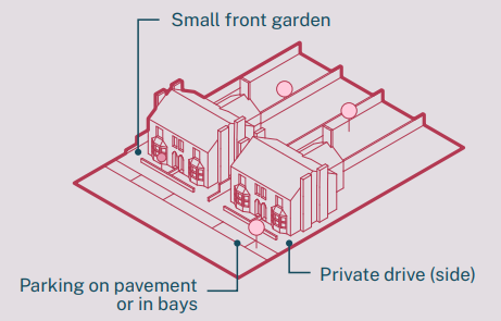
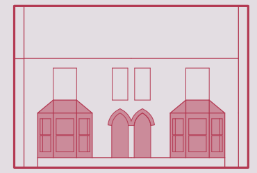
Streetscape
- Typically, 12m wide roads (inclusive of pavement).
- On-street parallel parking bays, or cars partially parked on pavements is commonplace.
Landscape
- There are street trees on a number of roads, either in small pavement build outs, or within the pavement footprint.
- Properties have front gardens abutted by brick walls; however, where deep enough, residents have typically converted the spaces into private parking, removing garden walls and planting.
Servicing
- Bins are stored at the front or side of properties, and wheeled out for collection resulting in obstruction of highways.
- Gardens and the rear of properties can be accessed through side gates.
Walkability
- Residents can easily walk to local centres.
Access to Services
- Typically within close proximity to local amenities, including newsagents, restaurants and medical practices.
Detached properties
Typical Block
- Typically characterised as two-storey or three-storey homes.
- Approximately 9 dwellings per hectare.
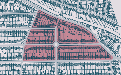
Architectural Features
- Commonly brick homes with pantile roofing.
- Some arts and crafts housing with white render and distinctive, steep symmetrical roofs.
- Some larger homes have extensive front gardens/drives with housing having little street presence.
- Large bay windows and recessed or porch entrances are typical (depending on the construction era).
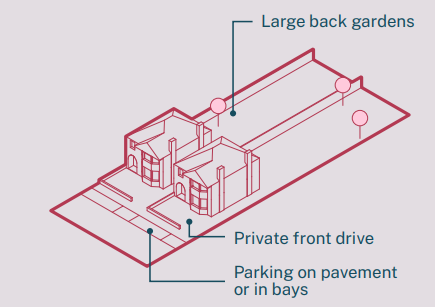
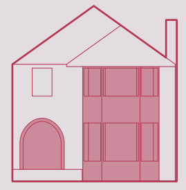
Streets
- Typically, 12m wide roads (inclusive of pavement).
- On-street parallel parking bays, or cars partially parked on pavements is commonplace.
Landscape
- There are a number of large street trees, planted within the pavement footprint.
- The scale of homes can accommodate private drives and permeable front gardens. However, it is typical for front gardens to
be completely paved, allowing residents to park 2-3 vehicles onsite.
Servicing
- Bins are stored on private drives, and wheeled out for collection.
- Where properties haven’t been extended, rear of properties can be accessed through side entrance.
Walkability
- Wide pavements,and local centres, support movement by foot.
Access to Services
- Within walking distance, or short drive, of local amenities.
Multi-storey residential properties
Typical Block
- Multi-storey (3 storey plus) flats, accessed via shared entrances and communal stairwells.
- Majority constructed within the past decade
- Approximately 120 dwellings per hectare
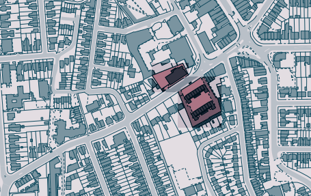
Architectural Features
- Although there is predominant use of brick, these blocks are also characterised as being partially rendered, with architectural ‘flair’
provided by the addition of timber or metal elements. - Mainly located to the north of West Bridgford, in areas that border on the river Trent.
- Some have balconies that are supported by free standing steel frames. Some are too small or irregular in shape to be usable.
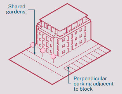

Streetscape
- Typically sit adjacent to large, busy roads, 14m wide or larger (inclusive of pavement).
- Private parking is typically provided adjacent to the property, with perpendicular parking bays.
Landscape
- Typically small private balconies, and shared gardens with limited landscaping.
Servicing
- Large shared bins are stored externally to the property, or in designated bin store areas within the buildings. Bin workers will have access to this on bin day.
Walkability
- Properties are flanked by the river embankment and busy roads, both offering routes to local centres.
Access to Services
- Residential block within a short distance of West Bridgford high street, and with easy access to Nottingham’s services.
Post-war estates (1960s – 2000s)
Typical Block
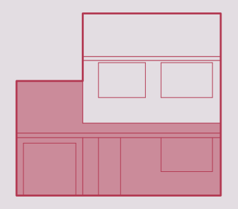
- Typically, two-story cul-de-sac estates that sit independent from their surroundings.
- Approximately 16 dwellings per hectare.
- Limited access to social and retail spaces within a short walking distance of properties.
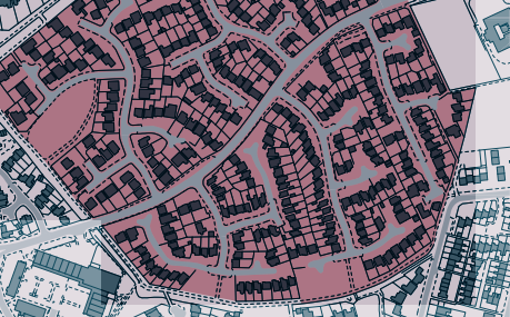
Architectural Features
- Detached and semi-detached red brick homes with private driveways accommodating one or two vehicles.
- Dependent on the era and housebuilder, properties have bay or large front windows.
- Lean-to tiled roof porches are common, projecting beyond the main structure of the homes.
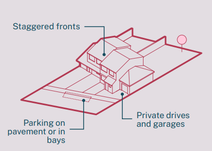
Streetscape
- Typically, 9m wide roads (inclusive of pavement).
- On-street parallel parking bays, or cars partially parked on pavements is commonplace.
Landscaping
- Street trees are infrequent. Trees primarily sit within curtilages.
- Small lawns and low level hedgerow is commonplace, and sit the length of the private drives.
Servicing
- Bins are frequently stored at the front or side of properties, and wheeled out for collection.
Walkability
- Cul-de-sacs and dead-ends inhibit ease of movement, with cars offering an easier means of navigation.
Access to Services
- Services are not integrated within the developments footprint, with residents typically needing to travel further to access retail and medical facilities.
Riverside
Overview
The urban riverside area type is defined by the largest of built structures in Rushcliffe with the Trent Bridge Cricket Ground, The City Ground and Nottinghamshire County Council offices. The legacy of post-war development and investment leaves the trace of taller office structures which are used today or have been adapted into housing. Notably, Trent Bridge House, a ten storey Nottinghamshire County Council (NCC) property to north east edge of the cricket ground and the former Civic Centre, now Waterside Apartments along the Trent. The municipal buildings of NCC are prominent inter-war structures constructed of Portland Stone and a distinctive copper roof. This sits within a large car park with some post-war low-rise concrete administrative buildings. NCC are currently completing a new County Hall near Hucknall and announced an intention to sell the buildings and land for redevelopment.
Land use
The riverside area is defined by its boundaries east and west with designated natural and semi-natural open space.
Key opportunities
The proximity to Nottingham City centre, major sporting grounds and Central Avenue make the riverside a significant and desirable destination. The scale of the River Trent, the treelined embankments of Nottingham City, the scale and openness of Meadows Recreation Grounds and emerging Trent Bridge Quays housing developments are signs that there are opportunities for increased capacity and density.
County Hall presents a key opportunity to deliver new housing and employment in the area in close proximity to Nottingham City Centre. There are a number of large vacant or boarded up properties and some limited brownfield land provide opportunities for housing and employment.
Key constraints
The stark contract between large scale sport grounds and immediate residential neighbourhoods will be a limiting factor in how to integrate new, denser and taller development so as to be considerate of the existing neighbourhood and urban grain.
The entirety of the riverside area type is within flood zone 2 (although defended) and will require considerable design consideration in relation to flood risk provision and mitigation.
Social Fabric
The riverside has good access to local shops including limited eateries on Rushcliffe Road, but is primarily a short walk south to Central Avenue high street or north to Nottingham City centre. County Hall provides limited greenery and access to the River Trent, whilst Trent Bridge and Wilford suspension bridge provide quick access to The Meadows. A short walk west provides access to the Wilford Meadow wildlife area and Gresham playing fields or east alongside the River Trent to the Hook Nature Reserve at Lady Bay. There is good access to a wide range of sports facilities including cricket, hockey, rugby, football, basketball and tennis courts, although the majority are
private clubs and professional training grounds.
Planning and Climate
The riverside area is located within flood zone 2 and flanked east and west by Natural and Semi-natural Green Spaces.
Transport and Movement
Riverside has good access to public transport, primarily through buses to Nottingham city centre to the north or through West Bridgford to the key settlements (Ruddington Keyworth, Cotgrave) and Clifton in Nottingham.
Community concerns
Common concerns arose around:
- poor quality of new builds
- local ecology, landscape and resilience to flooding
- pollution and car movement dominating the landscape
- impact of new tall buildings
- international significance of stadiums
- heritage value of existing structures and buildings
Terraced brick properties
Typical Block
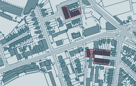
- The terraces are commonly comprised of runs of 4 to 11 2-storey homes.
- Approximately 40 dwellings per hectare.
Architectural Features
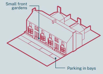
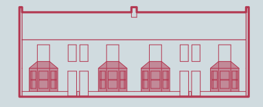
- Red brick properties with single storey timber bay windows with paired recessed door entrances.
- Typically stone lintels and sills above and below windows and doors.
Streetscape
- Commonly 10m wide roads (inclusive of pavement).
- On-street parallel parking bays.
Landscape
- The properties typically have small front gardens (deep enough for bins) with private gardens to the back.
Servicing
- Bins are typically stored externally to the front of homes.
- Some terraced homes have rear access through small alleys.
Walkability
- Properties are within walking distance of River Trent, Nottingham and central West Bridgford.
Access to Services
- Properties can easily access local services, both within Rushcliffe and in neighbouring Nottingham, by foot and car.
Retrofit apartments
Typical Block
- Large multi-storey landmark building retrofitted to accommodate private apartments.
- Approximately 120 dwellings per hectare.
- ‘Doubled loaded’ floor plan results in single aspect homes.
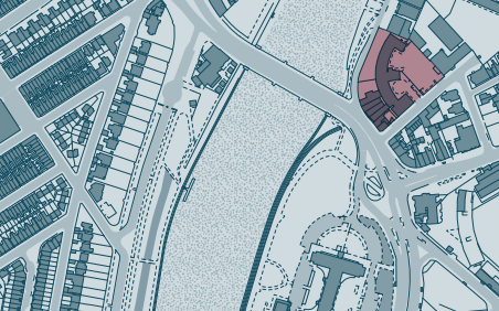
Architectural Features
- Contemporary wide span glazed windows overlooking the River Trent, with openable Juliet balconies.
- Smaller windows look easterly over Rushcliffe.
- Additional floors constructed to offer high value rooftop suites.
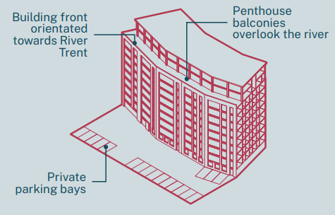
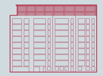
Streetscape
- Adjacent to major arterial roads, with roads between 8 and 25m wide (inclusive of pavement).
Landscape
- Immediate proximity to River Trent and abutting landscape, providing connectivity to local greenspace and parks.
Servicing
- Private bin store accessible to apartment residents.
- Access to residents provided at the rear of the building.
Walkability
- Residents within short distances of local retail and leisure spaces, and a short distance of Nottingham.
Access to Services
- Well connected to local services by foot and car. Access to services in Rushcliffe or adjacent Nottingham.
Local authority post-war apartments
Typical Block
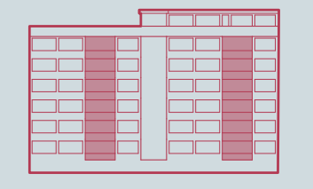
- Large uniform buildings, formed of 7-storeys, offering affordable private and socially rented flats.
- Approximately 110 dwellings per hectare.
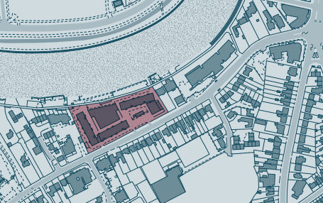
Architectural Features
- Post-war apartment blocks providing high density living on the Riverside.
- Brick and concrete grid facade, with regimented placement of windows and balconies on all sides.
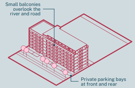
Streetscape
- Adjacent to a busy arterial road, connecting West Bridgford with Clifton and surrounding area. Commonly 10m wide roads
(inclusive of pavement). - Private car parking is provided onsite for residents use.
Landscape
- Limited formal greenspace onsite for residents, but with mature trees abutting the major road.
- Within close proximity of the River Trent and riverside embankment, connecting the site with local landscape.
Servicing
- Shared bins are provided on external hardscaping at the ground level of properties.
- Properties are accessed from regular stair cores at the front of each building.
Walkability
- Within walking distance of West Bridgford’s high street, and near to pedestrian crossings to Nottingham.
Access to Services
- Local access to medical facilities, schools, and supermarkets. Bus routes and roads provide additional quick connections to local services.
Modern new build apartments
Typical Block
- 3-6 storey residential blocks delivering privately rented and owned apartments.
- Approximately 40 dwellings per hectare.
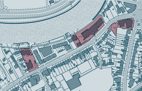
Architectural Features
- New developments typically with brick slip façades, or light-coloured rendering.
- Larger windows tend to be northfacing, with views towards the River Trent. Balconies are typically similarly orientated northerly, or
away from major arterial roads.
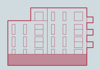
Streetscape
- Parallel to a busy arterial roads, connecting Nottingham and West Bridgford with neighbouring areas to the West. Typically 10m wide roads (inclusive of pavement).
- Private car parking is provided onsite for residents use.
Landscape
- Modest provision of shared landscaping, with hedgerow or mature trees against major roads.
Servicing
- Shared bins are accessed in private bin stores.
- Apartments are accessed through shared entrances.
Walkability
- Connected to West Bridgford and Nottingham by wide pavements and pedestrianised riverside walkways.
Access to Services
- Short distance by foot or car to retail, leisure and medical spaces
Detached unique
Typical Block
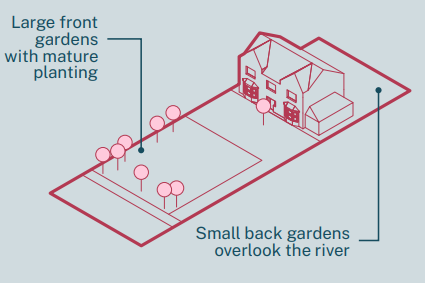
- Large unique detached homes set back from the arterial roads, with extended gardens typically backing onto the River Trent.
- Approximately 5 dwellings per hectare.
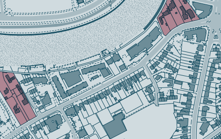
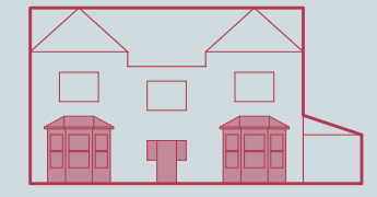
Architectural Features
- Typically period properties or contemporary new-build developments.
- Architectural features bespoke to each property, with brick commonplace, as well as timber and rendered façades.
Streetscape
- Properties sit back from busy streets. Adjacent roads are typically 10m wide roads (inclusive of pavement).
Landscape
- Large private gardens occupy space at the front and rear of home’s. Often trees sit against a homes boundaries with the road, creating privacy and limiting noise pollution.
Servicing
- Private drives with the capacity for multiple cars to be parked onsite.
- Bins are stored on each property, and wheeled out onto publicly accessed pavement on collection day.
Walkability
- Local shops along Radcliffe Road, but within walking distance Central Ave or to Nottingham City Centre.
Access to Services
- Within close proximity of retail, leisure and medical spaces.
Key Settlements
Ruddington
Overview
Ruddington, pop. 7,498 (ONS, 2021) lies to the southwest of West Bridgford and 5 miles from the city of Nottingham. Historically, the village was a textile manufacturing hub. Today Ruddington functions as a commuter settlement to Nottingham but also offers employment over a wide range of sectors and has a number of smaller independent businesses.
Built character
Ruddington transformed in the 19th century from a predominantly agricultural community into a thriving centre of commerce and industry thanks to the emergence of the framework knitting industry. The form of the settlement echoes its industrial heritage and comprises narrow roads with many old workers’ cottages still remaining. A wealth of listed buildings are located in the village, many of which are related to the framework knitting industry, a museum of the framework knitting industry is located on Chapel Street.

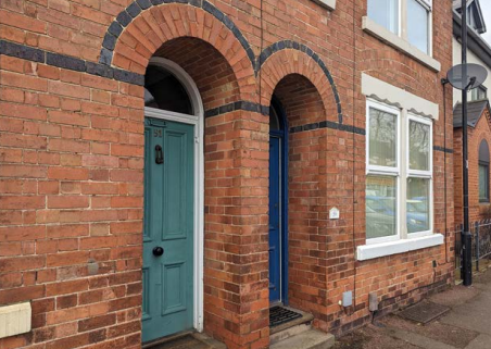
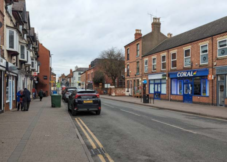
The centre of the village has a distinctive and compact grid layout comprised of a network of narrow streets. A complex of framework knitters’ cottages, workshops, Chapel and outbuildings now form the museum on Chapel Street and date from c.1829 and c.1840. Open green spaces within and towards the edge of the historic centre, including Ruddington Green and the grounds and cemetery of St Peter’s and the Old Cemetery make an important contribution to preserving and enhancing the built character.
Outside of the village centre there are four main arterial roads along which the settlement grew in the first half of the twentieth century and later infilled with post 1960 housing developments.
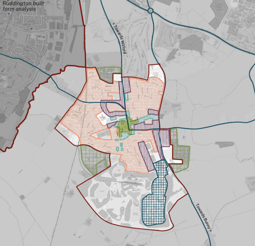
Key
- High streets = bright green
- New neighbourhoods = green grid lines
- Properties 1900 and earlier = light blue vertical hatched
- Suburbs (1901 - 1960) = purple vertical hatched
- Suburbs (post 1960) = orange horizontal hatched
- Employment Areas = blue grid lines
Key opportunities and constraints
Ruddington is one of Rushcliffe’s key settlements. It is inset in the Green Belt, which prevents the village from merging with the nearby settlements of Clifton, Wilford, and West Bridgford.
Ruddington benefits from a number of historic buildings, spaces, street patterns, and architectural detailing, which together contribute to the village’s local character and form part of the Ruddington Conservation Area designated in 1970.
Social fabric
Rushcliffe Borough Council development plan has identified Ruddington as a Local Centre, providing both shops and services for
the surrounding settlements. There are a number of community facilities including the village hall, places of worship, public houses, children’s play areas, outdoor sports facilities and allotments. The village also contains several health facilities, schools and a range of shops. On the south side of the village is Rushcliffe Country Park and Nottingham Heritage Transport Centre and Heritage Railway.
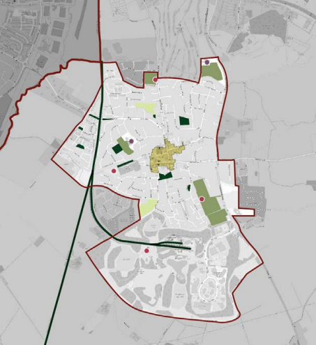
Key
- High streets = olive green
- Outdoor sport facilities = green
- Local green space - dark green
- Allotments = light green
- Schools = purple dot
- Playspace = red dot
Transport and movement
The settlement is typical of a car-based community, although it is served by bus routes. The A60 connects the village with Nottingham city centre and the A52 is a direct route to nearby Derby. The A453 follows the river south westwards connecting Ruddington to the M1
motorway, East Midlands Airport, East Midlands Parkway Railway Station and the A50.
Neighbourhood planning
The Ruddington Neighbourhood Plan (2021) contains objectives to:
- Deliver a mix of housing, including affordable housing, to meet the needs of Ruddington, whilst enhancing the character of the village through sensitive, sustainable, and good quality design, without overly burdening the village infrastructure.
- Promote sustainable alternatives to the use of private vehicles, with particular focus on improving infrastructure for walking and
cycling and encouraging good access for all to public services, facilities, and other connections.
The Plan includes a plethora of well-considered policies impacting the design of new development including consideration of the pedestrian network; cycling; safe routes to schools; key views; landscape and biodiversity in new development; and village setting.
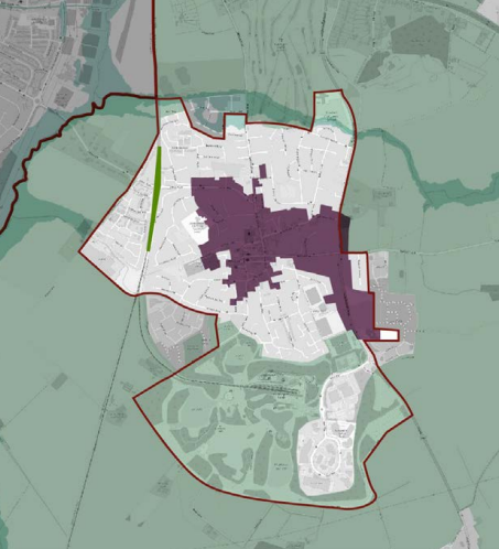
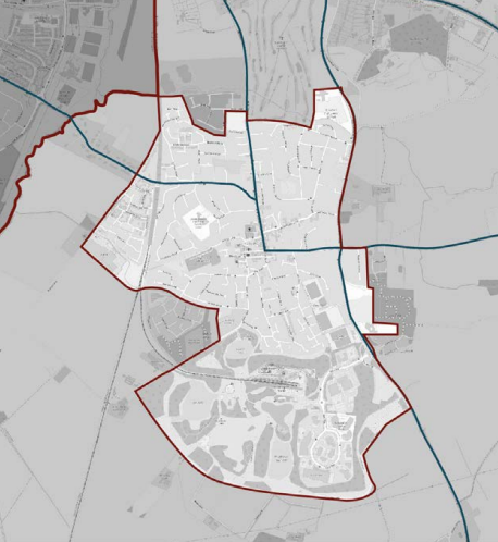
Key
- Flood zone 2 = light green in upper map area
- Natural and Semi-natural green spaces = green (former railway line)
- Conservation Area = purple
- Green belt = pale green - Rushcliffe Country Park
Community concerns
- Concerns about high volumes of traffic in the town
- Cycle infrastructure required
- Impact of new development
Keyworth
Overview
Keyworth is a large village and parish 7 miles south-east of Nottingham with a population of approximately 7000. Until 1800 Keyworth was almost entirely an agricultural village working the medieval Open Field system. The 19th century saw the growth of domestic framework knitting in the village. The opening of Keyworth Colliery in the mid-20th century saw an increase in the population and the development of new housing for the miners. Today Keyworth functions as a commuter settlement to Nottingham but also offers employment supported by its role as an important local retail, community centre and home to the British Geological Survey.
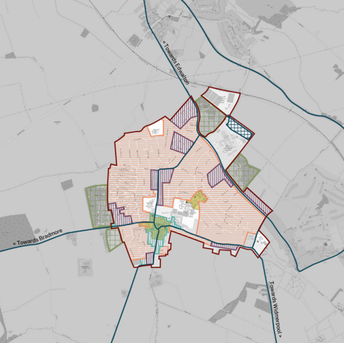
Key
- High streets = bright green
- New neighbourhoods = green grid lines
- Properties 1900 and earlier = light blue vertical hatched
- Suburbs (1901 - 1960) = purple vertical hatched
- Suburbs (post 1960) = orange horizontal hatched
- Employment Areas = blue grid lines
Built character
The settlement is at least a 1000 years old and is named in Domesday (1086). It originated as a hilltop farming settlement around the
present Square and Parish Church, on a spur of the South Nottinghamshire Wolds. Keyworth’s historic street pattern consists of a linear central thoroughfare with a north-south orientation (Main Street) and an open junction at its northern end (The Square). Running east and west from The Square are Selby Lane and Bunny Lane respectively.
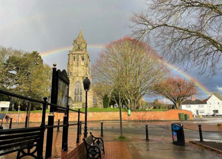
As the framework knitting industry grew so did the building of cottages and workshops, infilling along Main Street and connecting lanes. Much of the infilling was arranged around ‘Yards’ just off Main Street, of which Attenborough’s Yard (cottages) and The Courtyard (workshops) are surviving examples. The older buildings of Keyworth tend to reflect the local geology. There is little good building stone nearby, so that, with the exception of the Parish Church, all buildings are made of red clay brick.
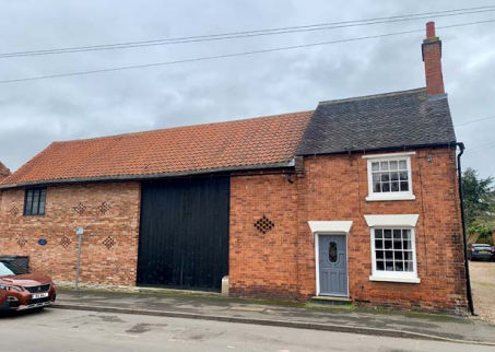
Between the Wars widely spaced ribbon development occurred along or just off Selby Lane, Nicker Hill and Nottingham Road, to be near bus routes and to take advantage of newly laid electricity, water and sewage mains. From the middle point of the twentieth century Keyworth grew dramatically, mostly in four estates:
- the Manor Road estate (started 1955, in part to house Cotgrave miners),
- Wolds Drive (1959),
- Brookview Drive (1968), and
- Crossdale Drive (1970).
Manor Road estate is typical of 1950s public housing estates designed as a modest interpretation of the earlier Garden Village movement. The latter three are variations on 1960s and 1970s private housing estates of informal suburban blocks of predominantly detached houses in large plots. Today the mature landscape and trees elevate a sense of place, and creates a green and pleasant character that tethers the housing to the land.
Key opportunities and constraints
The Conservation Area was designated in 1999 and lies at the heart of the village. It comprises mostly of the retail and commercial core, and is focused on the church and the remains of five Grade II Listed houses and barns along Main Street. Keyworth’s hilltop location means that, despite its modest elevation, far reaching views in all directions are readily accessible from many places around the village. This means that there are also pleasant vistas towards the village from within the wider landscape. These views are highly valued locally and help to give a strong sense of place as a rural village set within the surrounding Wolds countryside.
Social fabric
There is a range of facilities and amenities in Keyworth including a range of shops focused on Main Street, health centre, health club,
leisure centre, tennis club, bowls club and four schools. Nevertheless, Keyworth is still primarily a commuter satellite of Nottingham.
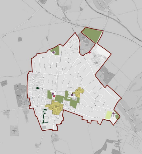
Key
- High streets = olive green
- Outdoor sport facilities = green
- Local green space - dark green
- Allotments = light green
- Schools = purple dot
- Playspace = red dot
Transport and movement
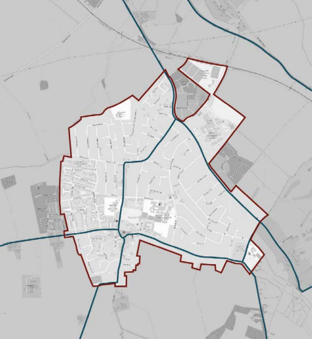
Keyworth is not connected by railway and is beyond reach of the Nottingham Express Transit (NET) tram system. The railway through
Plumtree started operations in 1879 along the Melton Mowbray to Nottingham line but closed to passengers as early as 1949. Residents have easy access to Nottingham by a regular bus service. However, today the settlement is typical of a car-based commuter community.
Neighbourhood planning
The Keyworth Neighbourhood Plan (2018) and Village Design Statement (2011) contain a plethora of well-considered policies and analysis of the village including consideration of pedestrian network; public realm; shop fronts; parking; key views and village setting.
The Neighbourhood Plan vision seeks to sustain a safe, friendly, inclusive environment in Keyworth.
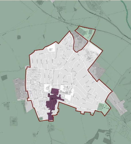
Key
- Flood zone 2 = light green - surrounding village
- Conservation Area = purple
- Green belt = pale green
Community Concerns
- Infill/’terracing’ of streets detrimental to character of area
- Keyworth square an opportunity for improvement
- Opportunities to draw out history of Keyworth
- Concerns about high volumes of traffic in the town
- Support for owners of trees and hedgerows to maintain
- Support for cycle infrastructure and wider pavements required.
Bingham
Overview
Bingham is a market town and civil parish located 9 miles east of Nottingham with a population of over 9,000. The town is located near to the Fosse Way, an old Roman Road and now the A46 between Leicester and Newark-on-Trent. Bingham was granted a Market Charter in 1314 and a market was held here until the end of the 19th century. The market was revived in 1975.
Whilst other settlements across the borough were industrialised during the nineteenth century Bingham remained predominantly rural. A small amount of weaving and framework knitting is known to have taken place, but apart from this no other manufacturing activities are recorded. The railway line was opened in 1850 and resulted in a small amount of development in Bingham, including housing for middle-class commuters. Bingham did not expand to any great extent until after 1960 when the town underwent a rapid expansion in housing that continues today.
Built character
In the core of the town around the Market Place the regular plan form is still evident today with the principal east-west axis through the town along Long Acre, with Church Street running parallel to the north and The Banks parallel to the south. Connecting streets along the north-south axis are now less coherent but Market Street and Cherry Street complete the grid pattern.
Market Place is at the heart of the town with its octagonal Butter Cross providing a distinctive focal point. The open market is enclosed on all sides by 2 and 3 storey buildings with ground floor shops as it has always been.
There are number of early cottages and agricultural outbuildings discernible throughout the town centre. Traditional buildings in Bingham are predominantly of red brick, Flemish bond being common with some good examples of patterns being created by using different shades of brick. Mature trees, hedgerows, a paddock, a hollow way and traditional red brick boundary walls all make a positive contribution to the character of old Bingham.
Following Church Street east to East Street and Long Acre to Long Acre East, the grain becomes a little coarser with informal suburban blocks of post-1960 largely detached houses in deep plots. To the west of the town’s core are more post-1960 suburbs and further west along Nottingham Road the street pattern takes on the curvilinear and cul-desac dominated form of typical 1980s and 1990s housing development.
The railway line to the north, bypass to the south and A46 to the west form pronounced edges to the existing key settlement of Bingham.
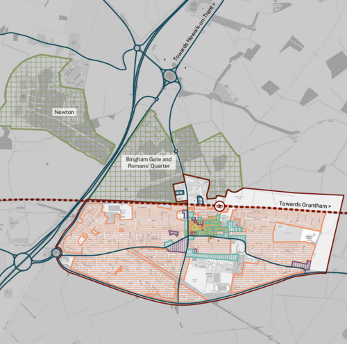
Key
- High streets = bright green
- New neighbourhoods = green grid lines
- Properties 1900 and earlier = light blue vertical hatched
- Suburbs (1901 - 1960) = purple vertical hatched
- Suburbs (post 1960) = orange horizontal hatched
- Employment Areas = blue grid lines
Key opportunities and constraints
Bingham was the first Conservation Area to be designated in Rushcliffe in 1970 and contains 24 Listed Buildings or structures mostly located between the 13th/14th century Church of St Mary and All Saints and the Market Place, around the Market Place itself and along Long Acre, the former main route through the town.
Margidunum, a former Roman settlement and Scheduled Ancient Monument, lies approximately 1.5km north of the centre of present-day Bingham. Margidunum was settled as a Roman fort in around AD 50-55, becoming a civilian settlement around AD 75.
To the north of Bingham is a henge monument buried beneath an industrial development. During the 1970s, protective clay was placed over the Henge, and a car park was built over it. It is one of three Scheduled Ancient Monuments within the area surrounding Bingham. None are within the Conservation Area, but all receive strong protection from their scheduled designation.
Social fabric
The Thursday market is an attractive feature of Bingham serving neighbouring communities in Radcliffe-on-Trent, East Bridgford, Car Colston, Scarrington, Aslockton, Whatton-in-the-Vale, Tithby and Cropwell Butler. There is a large business and industrial park located to the north of the railway line off Chapel Lane providing employment opportunities to the town and its catchment area.
There are several sports and recreational sites including Bingham Arena leisure centre, athletics club, bowling club, football club, lawn tennis club and rugby clubs. Bingham has one Secondary school and one Junior School in the town, with a second – Bingham Primary School – opened in 2022 on the site of a major housing development to the north of the town.

Key
- High streets = olive green
- Outdoor sport facilities = green
- Local green space - dark green
- Allotments = light green
- Schools = purple dot
- Playspace = red dot
Transport and movement
Bingham is served by a railway station located on the line between Nottingham and Grantham and both destinations can be accessed by bus routes. Notwithstanding the relatively compact and walkable core of the town around Market Place and the town’s rail connection, Bingham still displays the hallmarks of a car-based commuter community.
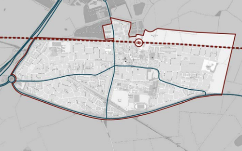
Bingham Masterplan
A ten year vision was commissioned by RBC and delivered by Urbed in 2018. Its findings are to:
- Strengthen the market square and its access for residents
- Focus on sustainable travel via the train station, but station accessibility needs improving first
- Opportunities for brownfield development and a business park
- Improved walking and cycling routes
- Linear surrounding park
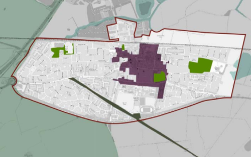
Key
- Flood zone 2 = light green in upper map area
- Natural and Semi-natural green spaces = green
- Conservation Area = purple
- Green corridors = dark green - Linear Park
Community Concerns
- Improvements to access the station required
- New estates poorly integrated for cyclists and pedestrians
Radcliffe on Trent
Overview
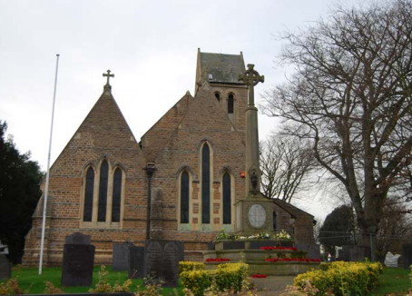
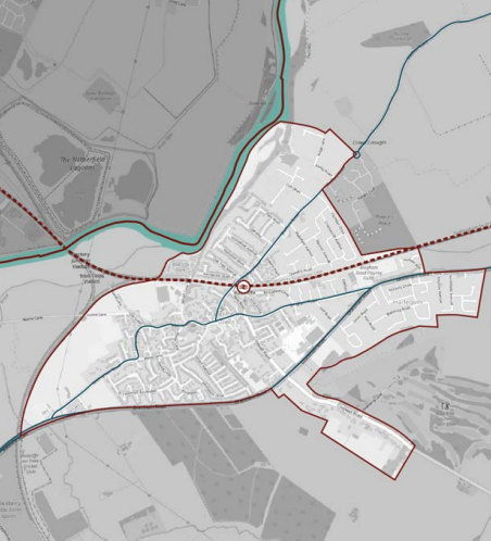
Radcliffe on Trent is a key settlement on the south bank of the River Trent with a population 8144 (2021, ONS). The town grew out of the village centre along Main Road, Shelford Road and New Road, but underwent major expansion in twentieth century and latterly post-war expansion. The settlement is predominantly residential in character. Growth is planned on the eastern boundary to provide approximately 400 new homes.
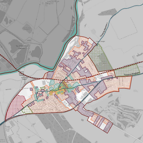
Key
- High streets = bright green
- New neighbourhoods = green grid lines
- Properties 1900 and earlier = light blue vertical hatched
- Suburbs (1901 - 1960) = purple vertical hatched
- Suburbs (post 1960) = orange horizontal hatched
- Employment Areas = blue grid lines
Key opportunities
The high street provides an essential community function to the key settlement and beyond to nearby villages. The train station offers low carbon transport to major regional stations within a short journey, running through the heart of Radcliffe on Trent.
Key constraints
Infrequency of train journeys and poor condition of the station and immediate area including accessibility issues, make the wider desire to move away from private car journeys problematic. Investment is needed around the station and to make routes to and from it desirable.
Social fabric
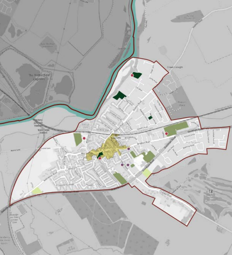
The settlement has a good range of local facilities from community spaces (Grange Hall) to parks (Rockley Memorial), play, allotments
and skate parks. Facilities include football and cricket clubs with Holme Pierrepont, the home of British Canoeing to the west. The village centre on Main Road has a wide range of independent shops, however the Neighbourhood Plan refers to the poor quality of public realm and narrow pavements stating that it needs to be more pedestrian friendly, with access to cycle parking. In principle the Neighbourhood Plan seeks the concentration of retail uses (as opposed to dispersal).
Key
- High streets = olive green
- Outdoor sport facilities = green
- Local green space - dark green
- Allotments = light green
- Schools = purple dot
- Playspace = red dot
Neighbourhood plan
The Radcliffe on Trent Neighbourhood Development Plan 2014-2018 sets out a vision to be a ‘vibrant and sustainable village with a pedestrian focused approach to land-use planning’. The vision prioritises:
- Promote Village Centre - as an attractive, safe retail area supporting independent shops.
- Public Realm – pedestrian-friendly centre, with improved pedestrian and cycle routes.
- Transport and Services - prioritise sustainable modes of transport, with particular focus on improving bus and rail provision.
- Significantly improve the sports and leisure facilities for all residents by providing for new facilities including places for young and old.
- Support existing businesses and promote opportunities for new development encouraging the creation of small and medium sized enterprises.
- Protect and enhance heritage and architectural assets.
- Protect and enhance the rural setting and local biodiversity of the village.
Key
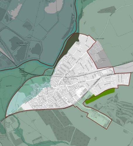
- Flood zone 2 = light green in upper map area
- Natural and Semi-natural green spaces = green
- Conservation Area = purple
- Green corridors = grey - Cliff Walk
- Green Belt = pale green
Community Concerns
- Borough wide cycle network connecting towns on protected routes with ‘terminus’ storage at the centre ie. between Radcliffe and Bingham.
- Historic green core to be preserved and enhanced.
- Empty high street shops and poorly maintained buildings.
- Brownfield opportunity sites suggest the removal of unused surface car parking.
Cotgrave
Overview
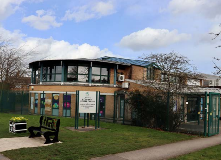
Located 5 miles south east of Nottingham, this key settlement sits elevated on South Nottinghamshire Wolds with 8206 residents (ONS,2021). Centred around the prominent 12th century All Saints church and the intersection of Main Road/Bingham Road and Plumtree Road around a small settlement. Cotgrave underwent significant expansion in the 1950-60s due to the discovery of coal seams and the establishment of the Cotgrave Colliery. Developed by the National Coal Board, new housing was developed to the south of the historic centre changing the population from around 500 to 7000 residents. The colliery was closed in 1994, but the town has nonetheless seen incremental growth year on year.
Land use
The geographical centre of the key settlement is focused around community and social fabric – schools, shopping precinct, playing fields and sports facilities. Surrounding this centre, the land use is predominantly residential. To the north-eastern edge is some land designated for employment alongside land designated for future housing.
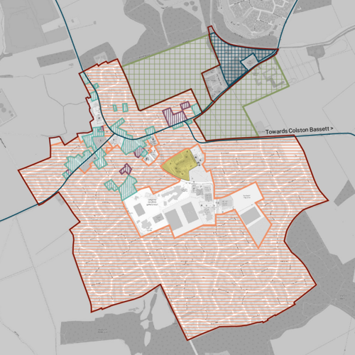
Key
- High streets = bright green
- New neighbourhoods = green grid lines
- Properties 1900 and earlier = light blue vertical hatched
- Suburbs (1901 - 1960) = purple vertical hatched
- Suburbs (post 1960) = orange horizontal hatched
- Employment Areas = blue grid lines
Key opportunities
The current employment sites could in the future see possible intensification for job creation.
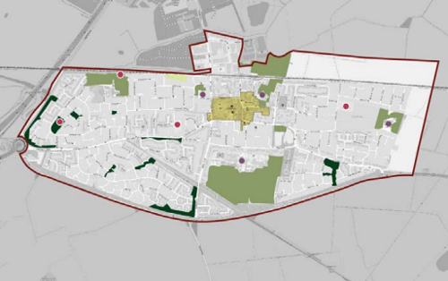
Key
- High streets = olive green
- Outdoor sport facilities = green
- Local green space - dark green
- Allotments = light green
- Schools = purple dot
- Playspace = red dot
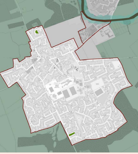
Key
- Flood zone 2 = light green - Grantham Canal
- Natural and Semi-natural green spaces = green
- Green corridors = grey - Grantham Canal
- Green Belt = pale green
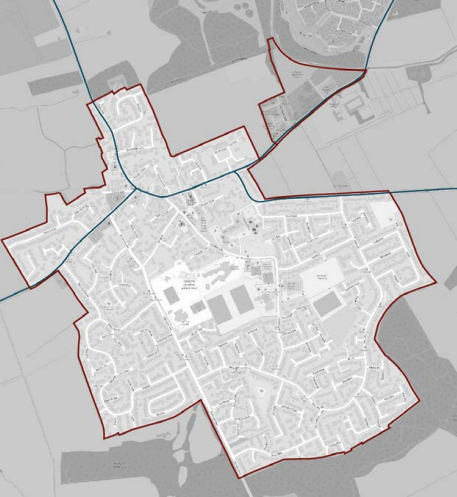
Community Concerns
- Concerns about the future of the leisure centre.
- Concerns about affordable housing provision and diversity (or lack thereof) in new housing.
- Concerns about sustainability of new developments.
- New central ‘hub’ celebrated for facilities and for providing space for new businesses.
- Lack of secondary school.
East Leake
Overview
East Leake is an historic rural village to the southern edge of Rushcliffe, located to nearby Loughborough in Leicestershire to the south. The heart of the town centres around Main Street and Gotham Road down to the 12th century St Mary's Church and has expanded outwards, first to connect to Victorian/Edwardian residential areas to the north south and west with 1960s suburban housing. The town is dispersed along the major roads – Gotham Road, Brookside and Costock Road, separated east-west by Kingston Brook and Meadow Park. More recent growth to the south (The Skylarks) has seen the town develop around farming land alongside the Sheepwash Brook.
Land use
East Leake is predominantly residential,with some large industries on its peripheries. Gypsum mining was established in 1910s in East Leake manufacturing plasterboard products for the construction industry which continues on a significant site to the north of the town.
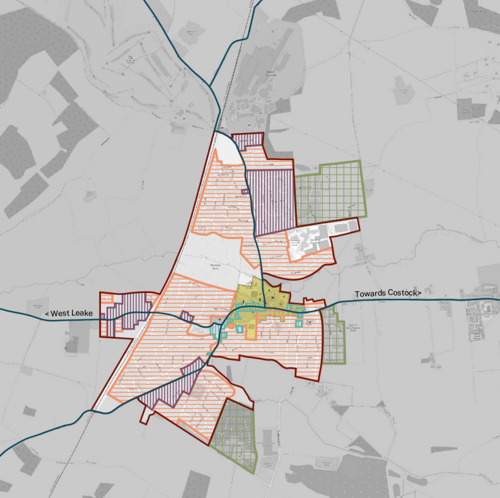
Key
- High streets = bright green
- New neighbourhoods = green grid lines
- Properties 1900 and earlier = light blue vertical hatched
- Suburbs (1901 - 1960) = purple vertical hatched
- Suburbs (post 1960) = orange horizontal hatched
- Employment Areas = blue grid lines
Key opportunities
The town is divided by the formation of isolated developments that have not connected to the heart of East Leake. Despite this, there is an opportunity to consolidate the land around Sheepwash Brook either through sensitive development or via improved active travel connections.
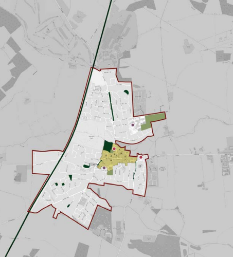
Key
- High streets = olive green
- Outdoor sport facilities = green
- Local green space - dark green
- Allotments = light green
- Schools = purple dot
- Playspace = red dot
Key constraints
New developments to the south (Meadowcroft and The Skylarks), although built within a few years of one another alongside each other, do not connect up, leaving communities isolated and more dependent upon private car journeys. Future developments must be connected up with the existing and planned developments.
Currently there is poor access to designated play areas north and south of the geographic centre. Meadow Park offers good provision, but is dependant upon children walking a long distance or having to be supervised to access the play site.
Notably, there is no cycle provision or segregated routes that offer children greater freedoms. What play is provided is in isolated sites with poor surveillance. At the time of writing, the new housing developments that have delivered larger family sized dwellings offer no play facilities on-site.
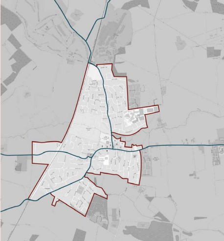
Neighbourhood
East Leake has a Neighbourhood Plan 2013-2028. The neighbourhood plan covers policies on land use and adopted within local planning
framework using an evidence base. The Neighbourhood Plan focuses on supporting new housing (but with the provision of new health and education facilities), employment, open space and the town centre for improvements.
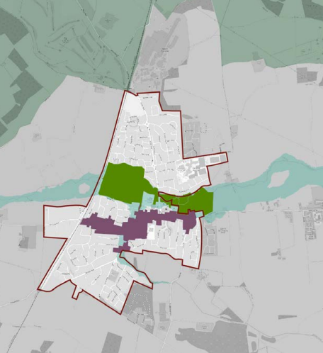
Key
- Flood zone 2 = light green - Kingston Brook
- Natural and Semi-natural green spaces = green
- Conservation Area = purple
- Green Belt = pale green
Community Concern
- Impact of new housing on community access to open space
- Lack of affordable housing
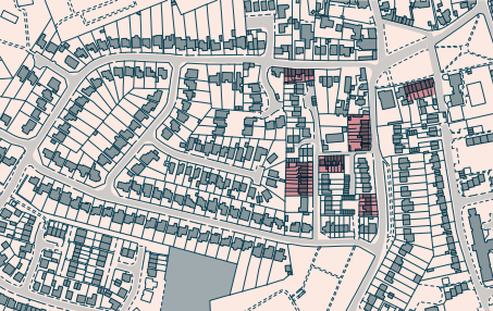
Pre-1900 Terraced Cottages
Typical Block
- Short stretches of terraced cottages, typically around 7 homes.
- Approximately 52 dwellings per hectare.
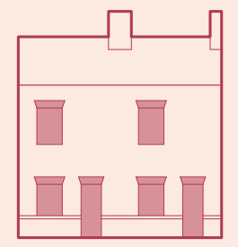
Architectural Features
- Two-storey red brick cottages, commonly a single room wide.
- Stone lintels and sills are commonplace, as well as low-rise brick walls fronting the pavement.
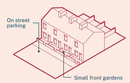
Streetscape
- Small front gardens customarily abut the pavement.
- Roads parallel to cottages are typically 8.5m wide roads (inclusive of pavement).
Landscape
- Residents have access to rear and front gardens, with low density shrubbery and planting.
- Landscaping is contained to small areas of street-side planting.
Servicing
- Parallel parking spaces sit adjacent to homes.
- Bins are stored in shared side and rear alleys, and moved to the front of properties collection day.
Walkability
- Within short distances of settlements centres.
Access to Services
- Residents can access some local amenity and retail spaces. For some services, such as supermarkets and larger medical facilities, residents will need to travel further.
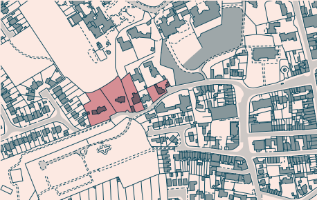
Pre-1900 Detached Cottages
Typical Block
- Unique detached homes set back from adjoining roads.
- Approximately 1 dwellings per hectare.
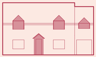
Architectural Features
- Site specific architectural features. Brick buildings with white façades is common, as well as large contemporary homes with metal and timber façades.
Streetscape
- Properties are set back, with limited overlooking and engagement with adjacent roads.
- Roads parallel to cottages are typically 10m wide roads (inclusive of pavement).
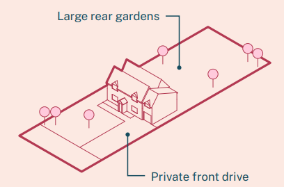
Landscape
- Properties typically have private driveways, with properties surrounded on all sides by large gardens with planting and mature trees.
- Trees, to the front of property, enable great privacy for residents.
Servicing
- Cars will typically sit within an owners curtilage, however, there is capacity for cars to parallel park on street.
Walkability
- Residents can walk short distances to local centres. Whilst there is typically pavements, some properties lead straight onto country roads.
Access to Services
- Some local services can be accessed, however, for larger shopping opportunities and leisure facilities, residents will need to travel further.
Pre-1900 Semi-Detached Cottages
Typical Block
- Typically characterised as two-storey brick homes that sit within a mix of other residential and retail typologies.
- Approximately 17 dwellings per hectare.

Architectural Features
- Frequently properties have low ceilings and roof pitches, with ridge lines lower than neighbouring properties.
- Stone sills and lintels are commonplace, with casement windows typical.

Streetscape
- Small front gardens with low brick walls are typical.
- Roads adjacent to cottages are typically 10m wide roads (inclusive of pavement).

Landscape
- Cottages have larger gardens to the rear, often with mature planting.
- Trees and planting on pavements is not typical, with this typically contained to curtilages.
Servicing
- Bins are customarily stored at the rear of properties, and wheeled to the front on collection day.
Walkability
- Cottages are within walking distance of local centres.
Access to Services
- Residents can access a number of services locally, but with travel required for major retail, leisure and medical services.
20th Century detached brick properties
Typical Block
- Routinely 2-storey brick homes in curvilinear road formations.
- Approximately 16 dwellings per hectare.
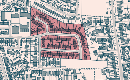
Architectural Features
- Homes frequently have bay windows to the front, with recessed, vaulted and arched, front doors.
- It is typically for side driveways to be infilled by garages or carports.
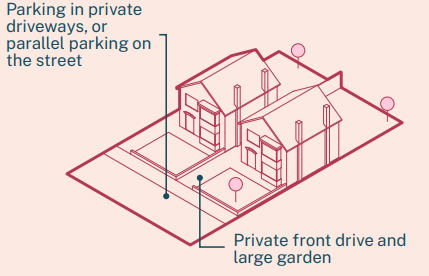
Streetscape
- On-street parallel parking bays, or cars partially parked on pavements is commonplace.
- Roads parallel to properties are typically 9m wide roads (inclusive of pavement).

Landscape
- Front gardens have areas of small planting, with the capacity for a parked car on the drive. It is, however, commonplace for front gardens to be wholly paved, with residents parking multiple cars onsite.
Servicing
- Bins are stored at front of the properties.
- Where infill has not occurred between properties, residents can access the rear of properties through side entrances.
Walkability
- Residents can walk into local centres.
Access to Services
- There is access to a limited number of local services, with more major services outside of the local area.
Post-war estates (1960s – 2000s)
Typical Block
- Detached and semi-detached brick properties, either as single storey bungalows, or two-storey houses.
- Typically organised as cul-de-sacs.
- Approximately 10 dwellings per hectare.
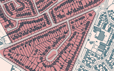
Architectural Features
- Projected porches and garages are typical, leading onto private driveways.
- Typically casement windows, with some examples of ground floor bay or bow windows.
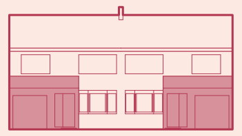
Streetscape
- Each property has access to parking within their curtilage, with additional capacity for parallel parking on the road.
- Roads adjacent to properties are typically 10m wide roads (inclusive of pavement).
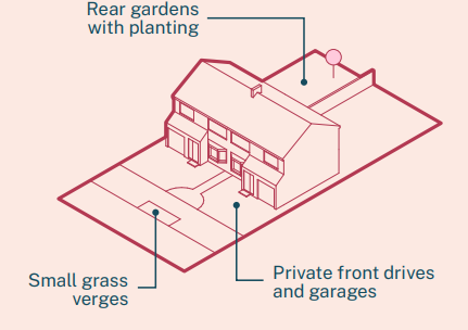
Landscape
- Portions of grass on road verges is common.
- Low level planting and small trees in private front gardens is typical, with larger planting contained to the rear of properties.
Servicing
- Bins are stored at the front and side of properties, and moved off driveways on collection day.
- The rear of properties can typically be accessed from the sides of homes.
Walkability
- Whilst properties are within short walking distances of town centres, the cul-de-sac and curvilinear street patterns impede on ease of walking routes.
Access to Services
- Residents can access a finite number of services in the local area, but will need to travel to access larger facilities.
Settlements - Typical linear
Overview
In contrast to their dispersed or nucleated counterparts, a linear settlement’s urban structure has a linear configuration that has grown alongside roads, or watercourses. Linear settlements commonly start life as farmsteads and dwellings laid out in a system of rectangular
enclosures (or burgage plots), following a particular route along a rural lane or track, developing over time into a main thoroughfare
connecting to a larger settlement.
Besides the historic linear pattern other common characteristics of a linear settlement include: a High Street spreading out from the centre of the main through route; smaller streets branching off the main thoroughfare; a convergence of routes at either end; a focal space – such as a green – often located at one (or both) ends; and following a watercourse such as a swale or drainage ditch.
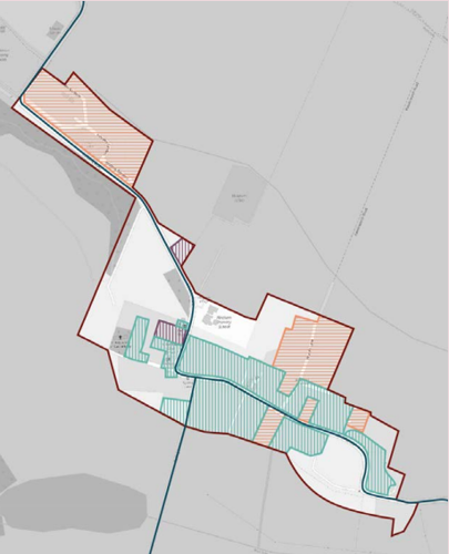
Focal and Polyfocal Linear structures
In contrast to their nucleated counterparts, linear settlements tend not to thrive as local centres as they lack the focal point, or nucleus, in which to pause and dwell, and the linear structure tends to promote the perpetual motion of traffic passing through. However, a variation on the linear structure is the focal linear settlement where structures often contain focal areas within the middle of the village, often situated at the point of deflection on a bend on the main route, or at the convergence of lateral routes crossing the main thoroughfare.
These focal points are generally more successful at supporting social and commercial interaction and can also extend to public realm spaces. A linear settlement with more than one of these focal points is known as a polyfocal linear settlement.
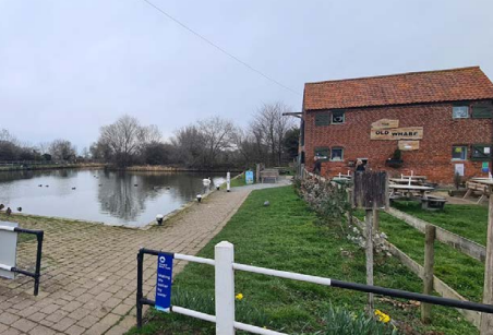
South Nottinghamshire Farmlands
- Flintham
- Sibthorpe
- Flawborough
- Hawksworth
- Screveton
- Scarrington
- Thoroton
- Aslockton
- Elton-on-the-Hill
Vale of Belvoir
- Sutton
- Barnstone
- Kinoulton
- Hickling
- Upper Broughton
Nottinghamshire Wolds
- Clipston-on-the-Wolds
- Normanton-on-the-Wolds
- Wysall
- Willoughby-in-the-Wolds
- Rempstone
- Costock
- West Leake
Trent and Soar Valley
- Thrumpton
- Ratcliffe-on-Soar
- Sutton Bonington
- Normanton-on-Soar
- Kingston-on-Soar
Settlements - Typical Dispersed
Dispersed settlements originate from farmsteads, hamlets and late medieval settlements and scattered buildings, barns and agricultural
buildings with occasionally workers cottages. Many of these settlements have remained unchanged for hundreds of years. Some have
undergone piecemeal infill post 1960s, partly expanding the village through detached houses in-between the land of farmsteads and along arterial roads.
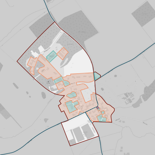
The landscape that surrounds these settlements is a mix of small irregular small holdings and larger intensive agricultural fields. The larger fields have led to the clearance of trees in lieu of hedgerows creating more open landscape character.
More modern expansion has resulted in the conversion of barns and agricultural outbuildings to dwellings and occasionally wholesale
replacement to new build private detached houses.
There is little social infrastructure due to the small populations that make shops, pubs and cafés unviable. However, diversification in farming has led to a rise in farm shops closely tied to arable and pastural farming which is positive and attracts residents and passer-by.
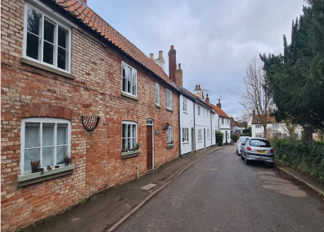
As a result, these settlements are dependant upon private car ownership for mobility. In rare instances, there is public transport, but it is limited. There is no cycle infrastructure connecting up settlements to one another or large key settlements with high streets.
South Nottinghamshire Farmlands
- Car Colston
- Orston
- Whatton-in-the Vale
Vale of Belvoir
- Colston Bassett
Nottinghamshire Wolds
- Widmerpool
Trent and Soar Valley
- Stanford-on-Soar
Settlements - Typical Nucleated
Nucleated settlements by nature are often the largest and most cohesive of the three settlement types owing to the evolution of their growth. These developments are more likely to have evolved from a focal farmhouse or cluster of farmhouses, parish buildings, church or even school.
Nucleated settlements display more ‘planned’ and staged development in their evolution and can be distinguished by semi-cohesive
subdivision of land to form small blocks of townscape. However, their architecture is often more ad-hoc with fragments of Victorian, Georgian and informal adaption over centuries.
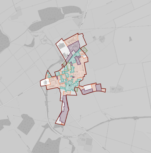
Located amongst modern, manufactured agricultural farmland. It is more likely that open fields on the edge of the town support local cricket or football clubs alongside occasional designated play areas.
Community concern
- Poor cycle links between settlements make travel dangerous
- Conserve and enhance existing strong qualities of settlements
- Strengthen and ensure connections to local countryside are conserved
Trent Washlands
- Shelford
South Nottinghamshire Farmlands
- East Bridgford
- Kneeton
- Cropwell Bishop
- Cropwell Butler
- Tithby
- Tollerton
- Plumtree
- Bunny
- Bradmore
Vale of Belvoir
- Owthorpe
- Granby
- Langar
Nottinghamshire Wolds
- Gotham
Trent and Soar Valley
- Barton-in-Fabis
Pre-1900 Detached brick properties
Typical Block
- Detached brick properties, typically two-storeys and double-fronted.
- Sit independently within a mix of other housing typologies.
- Approximately 4 dwellings per hectare.
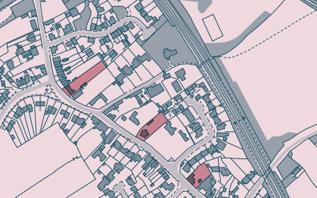
Architectural Features
- Bay windows with stone sills are commonplace on the ground floor.
- Soldier courses above window frames are typical, with built out front porches also routine.
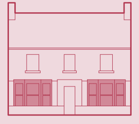
Streetscape
- Properties routinely have access to private drives at the side.
- Roads adjacent to cottages are typically 9m wide roads (inclusive of pavement).
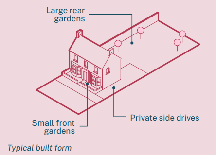
Landscape
- Landscaping is typically limited to residents private curtilages, with low level planting and trees at the front, and larger trees in private gardens.
Servicing
- Bins are ordinarily stored at the side or rear or properties, and brought out on collection day.
- The property can be accessed at the rear through the side entrance.
Walkability
- Settlement centres are within walking distance of homes.
Access to Services
- Local amenities can be accessed by foot, with travel needed for larger services.
Pre-1900 terraced cottages
Typical Block
- Terrace brick properties, commonly two-storeys high.
- Typically stretches of four homes.
- Approximately 24 dwellings per hectare.
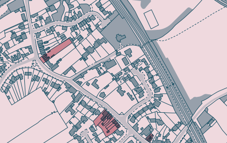
Architectural Features
- Cottages typically have low eaves and ridge, sitting beneath the height of neighbouring properties.
- Homes are customarily one room wide, with only a singular window on the front elevation of each floor.

Streetscape
- On street parallel parking is commonplace, with no access to private parking bays.
- Roads adjacent to cottages are typically 9m wide roads (inclusive of pavement).
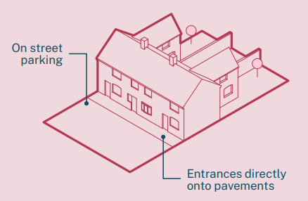
Landscape
- A portion of terraced cottages have direct frontages onto pavements, with no formal garden. Where properties do have front
gardens, they are small.
Servicing
- Bins are stored in shared side alleys, with side access allowing rear access to end properties on the terrace.
Walkability
- Local centres are within walking distance of properties.
Access to Services
- A few local amenities can be accessed, however, for greater shopping opportunities and medical facilities residents will need to travel.
Post-war semi-detached properties
Typical Block
- Red brick semi-detached homes, commonly two-storeys.
- Approximately 8 dwellings per hectare.
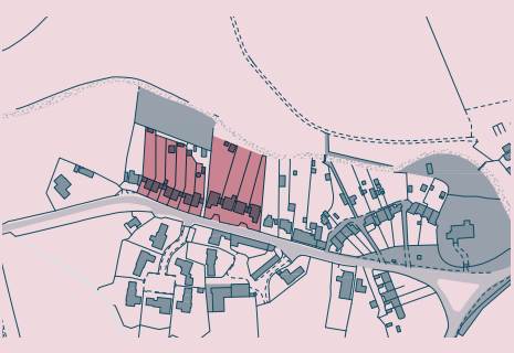
Architectural Features
- Houses mirror each other, with large ground floor windows, and doors typically at the outer edge of the building structure.
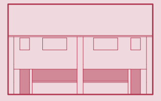
Streetscape
- Properties typically have side driveways, with the capacity for two vehicles to be parked in tandem.
- There is typically a pavement running on one side of the road.
- Roads parallel to homes are typically 7m wide, inclusive of pavements.
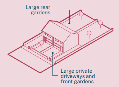
Landscape
- Properties have large front and back gardens, with low level hedgerow, planting and small trees to the front, and more mature planting at the rear.
Servicing
- Bins are stored at the side of properties.
- The rear of homes can be accessed through side entrances to gardens.
Walkability
- Residents are within short walking distances of village centres.
Access to Services
- There may be limited local amenities within proximity of homes, but residents will have to travel for more services.
Pre-1900 courtyard arrangement properties
Typical Block
- Properties are organised into long courtyard formations. These properties are formed of a number of homes, orientated inwards
towards the courtyard. - Approximately 10 dwellings per hectare.
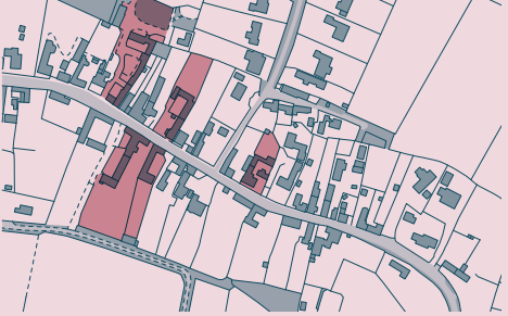
Architectural Features
- Brick two-storey properties with small frontages onto the street, whilst the property extends back into a protected courtyards.
- Individual homes have varying roof pitches and heights.
- Casement and awning windows are typical, with window frames divided by a number of muntins and mullions.

Streetscape
- Cars typically park at the side or rear of properties, with on street parallel parking available.
- There is typically a pavement running on one side of the road.
- Roads adjacent to homes are usually 8m wide, inclusive of pavements.
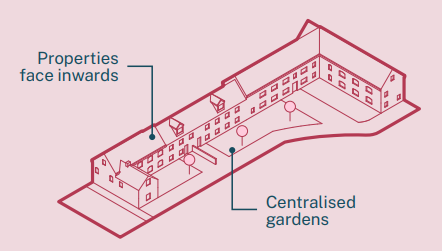
Landscape
- Properties routinely have centralised gardens, sitting within the courtyard.
- Planting sits with the properties curtilages, with minimal overlooking and engagement with the neighbouring street.
Servicing
- Bins are stored at the rear of properties.
- Properties are accessed at the side through shared drives.
Walkability
- Short walking distance to village centres.
Access to Services
- With limited local amenities, residents will need to travel for larger services.
Barn conversions
Typical Block
- 1 to 2 storey detached and semidetached brick properties.
- Approximately 5 dwellings per hectare.
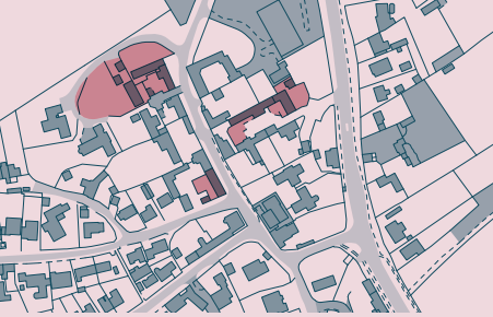
Architectural Features
- Former barns renovated into private residences. •
- Typically a portion of the front facade has large glazing overlooking a garden.
- Conversions routinely have window and door details that mimic barn typologies, such as arched frames, and dutch doors.
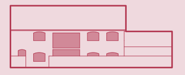
Streetscape
- Properties tend to sit back from the street, with private drives leading to the property’s garden and entrance.
- There is typically a pavement running on one side of the road.
- Roads parallel to homes are typically 8m wide, inclusive of pavements.
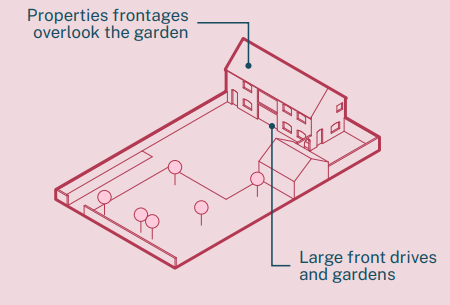
Landscape
- Typically properties overlook a singular large garden with mature planting and a lawn.
- Landscaping sits within properties curtilages.
Servicing
- Bins are stored within property’s curtilages.
- Primary access to homes is through front entrances, with some examples of rear entrances.
Walkability
- Within short walking distances of village centres.
Access to Services
- Some settlements will have access to some local services, with larger medical, retail and leisure facilities needing.
Country houses and manors
Typical Block
- Standalone 2 to 3 storey large homes surrounded by out buildings and large private gardens.
- Approximately 1 dwelling per hectare.
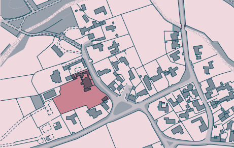
Architectural Features
- Typically large double fronted brick homes, with large casement windows and projected entrances.
- Features are bespoke to their period, with examples such as Georgian Palladian style, and Jacobean architecture.

Streetscape
- Properties are stepped back from roads with added security, such as large gates, and high brick walls.
- Typically roads adjacent do not have pavements, but instead grass verges and hedgerows beside roads.
- Adjacent roads are typically 5m wide, exclusive of pavements.
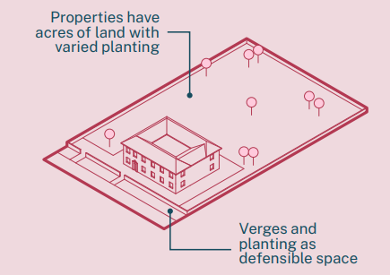
Landscape
- Some mature trees sit adjacent to roads (within a property’s curtilage), but with a majority planting at the rear of properties.
Servicing
- Bins stores are typically stored in private drives or outhouses.
- Access to properties can be obtained at the front and rear of homes.
Walkability
- Village centres within a short walk.
Access to Services
- Typically reliant upon private car
New Neighbourhoods
The New Neighbourhoods area type includes both new free-standing settlements and extensions to existing settlements, which typically
compromise of at least 50 units (in some cases much larger) built since the mid-2000s.
New neighbourhoods are typically located away from an urban core, in most cases built on greenfield sites. As a result they have been
developed in a vacuum without the surrounding urban structure provided by a pre-existing urban context – as would be the case with brownfield development. They also lack the existing infrastructure, heritage and natural assets, and a street network to plug into – which become either impossible or very expensive to replicate.
As a consequence new housing areas can feel relatively formless and are often the product of policy and economic forces that dictate
densities are kept to a modest level – typically around 25-30 dph maximum. This limits the scope to which the form and character of new housing development can vary as large developers have responded with standard development models to fit such requirements and mainstream their product. Once scaled-up and applied nationally, this has resulted in a repetitive form of development that is more the result of systemic forces, rather than a response to a particular built context or locale.
The design practices and priorities within and between separate developments of New Neighbourhoods in the borough do vary with regard to their built character, yet each share common and unifying characteristics. In analysing the built character of this area type the findings of A Housing Design Audit For England, UCL (Place Alliance) 2019 has provided a reference to describe the built character of new neighbourhoods in Rushcliffe.
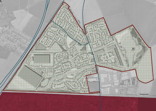
Observations
The team visited a number of new neighbourhoods across the borough and observed:
- Possible to identify the tenures from the appearance of the dwellings, with the affordable units distributed within clusters.
- Overly engineered highways infrastructure.
- Poor integration of storage, bins and car parking.
- Poor integration into surrounding context by foot, wheels or car.
- Convoluted pedestrian networks resulted in confusing fencing and signage to segregate public routes from private drives.
- Mono-scaled with an overwhelming majority of two-storey detached and semi-detached properties with side and frontage parking.
- Landscape monotonous throughout developments.
- Blue infrastructure tokenistic and poorly integrated. Tended to be detention ponds in the corner of a site surrounded by fencing.
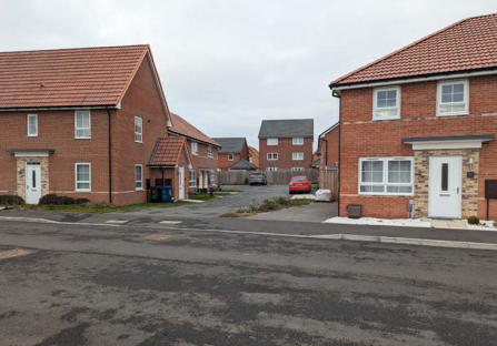
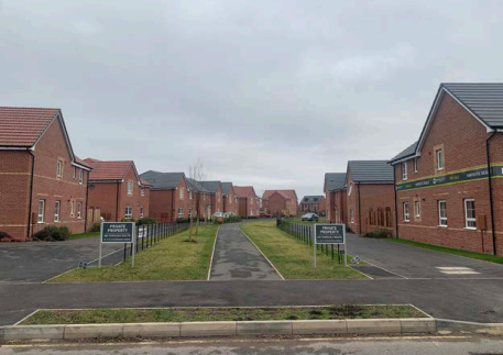
Area conditions
New neighbourhoods are relatively car-dependent developments with the negative health, social and environmental implications this can bring. A lack of connectivity to existing surrounding homes can result in insular places that create difficulties for residents to access
local services, schools and health services. Residents are rarely able to access these services owing to car-centric design and sprawling
densities.
On-site open space and play is often a requirement of the planning process and a majority of new neighbourhoods contain a open green, or grassed area with a play area inset. The play is often targeted at young children and is of basic quality, unimaginative,
design. In terms of outdoor environment there is typically an absence of facilities and landscaped areas designed for older children and
teenagers. There is also typically an absence of communal areas such as shared growing areas, and places designed especially for neighbours to meet in the public realm.
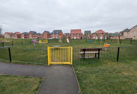
Community Concerns
New developments were the primary focus of consultation events with the general public, councillors and officers.
- Dominated by parked cars and wide roads.
- Mono-cultural and repetitive - each new development looks the same resulting in a sense of placelessness.
- Difficult to navigate due to standardisation of highway design.
- No/little cycling and pedestrian connections to existing neighbouring towns.
- No/little social infrastructure - poor quality play provision and open space.
- Poor connections to existing towns, nearby high streets, schools and shops.
- Low quality materials such as imitation products (i.e. felt used to imitate tiles) and over-dependence on asphalt.
- Poor refuse strategies result in bins littered across the development.
- Phased or parallel developments often don’t connect into one another resulting in divided communities.
- Poor site layouts promote the use of cars over active travel.
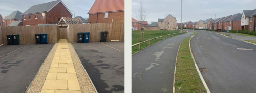
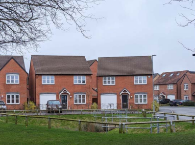
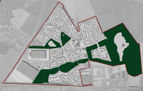
Key
- Schools = purple dot
- Local green space = dark green
- Playspace = red dot
Terraced
Typical Block
- Two to three storey brick terraced properties, in formations of 3-5 homes.
- Properties sit within cul-de-sac estates that sit independent from their surroundings.
- Approximately 27 dwellings per hectare.
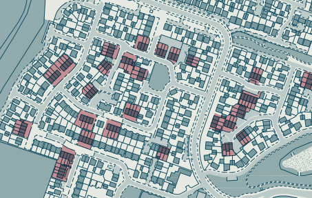
Architectural Features
- Brick and rendered homes typically with gable and hip end frontages, with examples of properties with dormer windows at third floor.
- Homes’ architectural details often pay homage to traditional Victorian and Georgian properties.
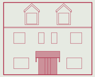
Streetscape
- Private parking bays typically sit in front of properties, with small private walkways to entrances. Where residents park on street,
they partially mount pavements. - Roads parallel to properties are typically 10m wide roads (inclusive of pavement).
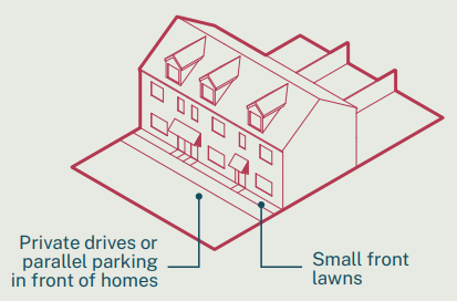
Landscape
- The front of properties have limited strip planting beds with larger gardens at rear.
- Properties tend to have low level planting, with trees not typical.
Servicing
- Bins are stored to the side of each run of terraces.
- Properties on the end of terraces have dual access to the front and rear of homes.
Walkability
- The nature of the cul-de-sacs and curvilinear estates limits ease in which residents can walk to neighbouring areas.
Access to Services
- Access to services is not provided within these neighbourhoods.
Detached
Typical Block
- Two to three storey brick homes.
- The new build estates are typically formed as interconnected cul-de-sacs, independent of their surroundings.
- Approximately 13 dwellings per hectare.
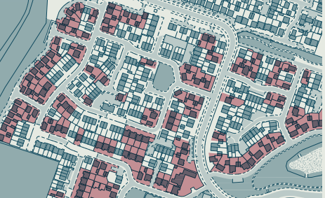
Architectural Features
- Double fronted homes, typically with pitched roof front porches.
- Properties routinely have private garages that sit back from the building elevation.
- Elevations details often reference Victorian or Georgian homes.
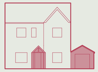
Streetscape
- Access to homes is typically via a shared road, leading onto a private road with neighbouring properties.
- Residents park in private drives or parallel park on adjacent roads.
- Roads adjacent to homes are typically 10m wide roads (inclusive of pavement).
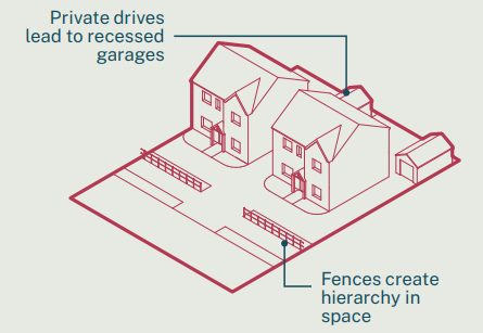
Landscape
- Small front lawns are typical, with some examples of low level planting.
- Gardens have larger lawns with planting, but trees are not typical.
- Small grass verges adjacent to streets is commonplace, with limited other planting in the public domain.
Servicing
- Bins are stored at the side of properties in private driveways.
- Homes can be accessed at the rear through side gates.
Walkability
- The cul-de-sacs and curvilinear estates form inhibits residents being able to easily walk to neighbouring areas.
Access to Services
- Access to services is not provided within these neighbourhoods.
Semi-detached
Typical Block
- Two storey brick properties that sit within cul-de-sac and curvilinear estates.
- Approximately 30 dwellings per hectare.
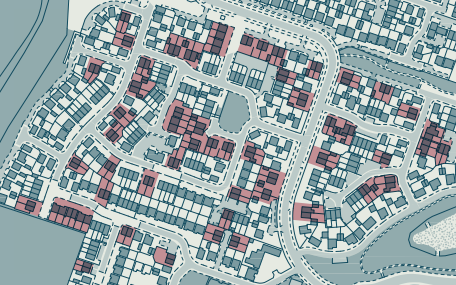
Architectural Features
- Properties are mirrored, typically with centralised covered porches, and large casement windows adjacent.
- Homes typically have brick garages set back from the building elevation.
- Homes architectural details routinely reference Victorian and Georgian properties.
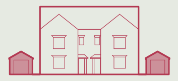
Streetscape
- Planting is routinely limited to private curtilages, with low level shrubbery.
- Where cars park on the street, they will typically partially mount the pavement.
- Roads parallel to properties are typically 9m wide roads (inclusive of pavement).
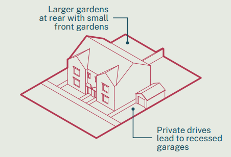
Landscape
- There are a limited number of trees in the public domain, with public greenspace typically limited to lawns, swales and rainwater ponds.
Servicing
- Bins are stored at the side of properties.
- Homes can be accessed at the rear through side gates.
Walkability
- The formation of the neighbourhoods limits the ease in which the area is navigated.
Access to Services
- Access to services is not provided within these neighbourhoods.
Apartments
Typical Block
- Three to four storey brick apartment block.
- Series of flats surrounded by private car parking, and neighbouring other housing typologies.
- Approximately 60 dwellings per hectare.
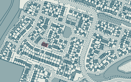
Architectural Features
- Residential blocks typically mimic adjacent housing typologies, such as detached homes, but at a scale that can accommodate multiple residences.
- Front and rear entrances provide access to back-to-back apartments.
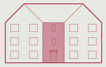
Streetscape
- Where cars don’t use parking bays, they will typically partially park on the pavement.
- Roads adjacent are typically 9m wide roads (inclusive of pavement).
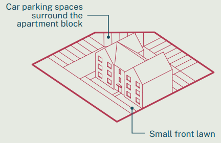
Landscape
- Very limited amount of shared landscaping, with car parking favoured over private gardens.
- Low level shrubbery on the residential perimeter, with trees in the vicinity uncommon.
Servicing
- Bins are stored at the rear of apartment blocks, in outside shared bins stores.
Walkability
- The design of neighbourhoods inhibits the ease in which residents can walk.
Access to Services
- Access to services is not provided within these neighbourhoods.
High Streets
Overview
At the top of the retail hierarchy is Nottingham City Centre with district centres and local centres designated below. This section will focus on District Centres; Bingham and West Bridgford alongside Local centres; Cotgrave, East Leake, Keyworth (The Square), Keyworth (Wolds Drive), Radcliffe on Trent and Ruddington.
There are a wide range of shopping areas and designated high streets across Rushcliffe from traffic controlled high streets, post-war
pedestrianised precincts and shopping centres to historic market squares. This diversity is positive for Rushcliffe, typically including
good accessibility to shops, and the presence of key services and employment opportunities. High Streets should be considered vital
centres of the social fabric and community – and essential to everyday life.
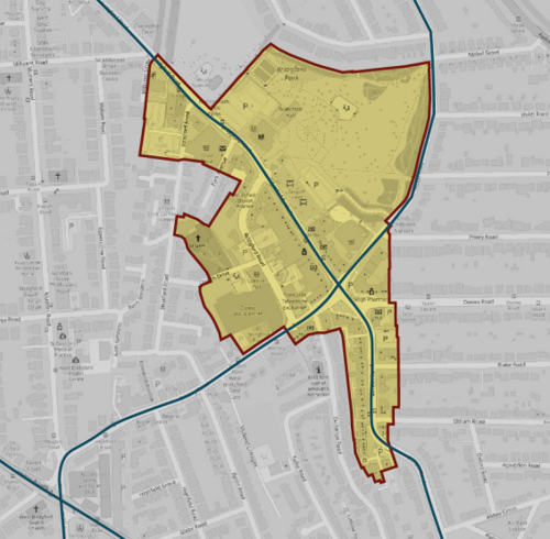
Land use
The high streets and market squares of Rushcliffe can be found at the historic centres of most key settlements. As a result, they are almost always immediately surrounded by a residential catchment which in turn supports those shops and facilities. Typically, there is
little on-street parking as these high streets are there to support primarily the immediate neighbours. The larger purpose-built precincts are slightly different and will be supported by surface car parking which can consume large central areas and often detract from the setting or enjoyment of commercial centres. In the instance of some settlements, high streets are built around primary through roads.
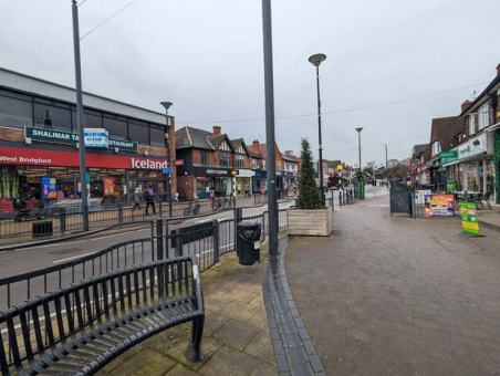
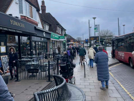
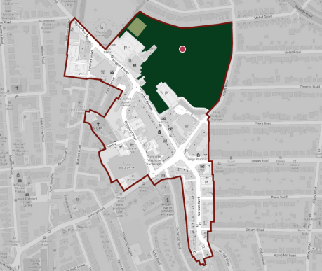
Key
- Outdoor sports facilities = olive green
- Local green space = dark green
- Playspace = red dot
Community Concern
- Lack of shops and facilities in new developments. When built nearby to existing shops, developments fail to connect to the infrastructure.
- Accessibility issues with some high streets as a result of pavement licences and street clutter making it difficult to navigate for families and older people.
- High streets need to be focused on quality of space and experience for residents, rather than for parking.
- Poor maintenance of high street shops.
- Lack of greenery and soft landscape on the high streets.
Rural and Farmland
Overview
Rushcliffe is predominantly defined by its rural and lowland farmland. It is a combination of natural physical landscape of the wider Trent Valley, Soar Valley, Nottinghamshire Farmlands, Wolds and the Vale of Belvoir (see Landscape and Townscape Character). Whilst this
area type is the largest geographical area, it is also dispersed and made up of fragmented and isolated buildings that have developed over time to farm the land.
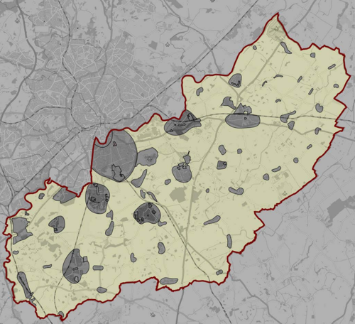
Land use
The building typologies are defined by their connection to the land for agricultural purposes and residential use. As such, land use consists of functioning or former functioning farms made of clusters of buildings from primary houses to agricultural outbuildings, sheds, structures, and barns surrounded by land divided up by hedgerows and small forested areas. Due to their isolation, these areas are dependent upon nearby larger settlements for food, services and leisure. Within these settlements are rich and diverse industries,
businesses and specialisms that go beyond traditional farming practices; veterinary services, vineyards, specialist automobiles services,
Chocolateries and a wide range supporting industries for agriculture.
Key opportunities and constraints
Approximately 40% of Rushcliffe is constrained by Nottingham-Derby Green Belt that encircles Greater Nottingham. The rural areas
make a significant contribution and play an important role in supporting Rushcliffe’s economy. The continued importance of agriculture and other countryside related activities contribute to its diversity. Development which helps to strengthen or assists with the
diversification of Rushcliffe’s rural economy and which provides a source of local employment opportunities, enterprise and educational
development should be supported. Affordability is a significant issue in the rural parts of the Borough where house prices tend to be higher. Poor access to essential services in rural areas can lead to significant deprivation, with people without access to a car, particularly the ageing population, especially vulnerable.
Bungalow
Typical Block
- Brick properties, typically neighbouring other detached homes.
- Approximately 1 dwelling per hectare.
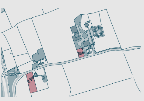
Architectural Features
- Typically post-war double fronted properties that extend out at either side.

Streetscape
- Properties lead directly onto adjacent roads, typically with no pavements.
- Roads adjacent to properties are typically 5m wide roads (exclusive of pavement.
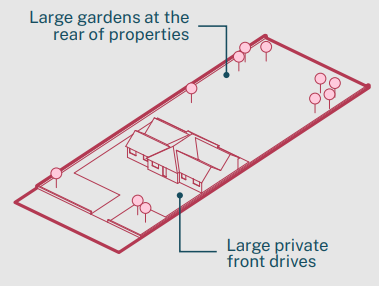
Landscape
- Surrounded by a large private garden with varied planting and mature trees.
- Typically adjacent to agricultural land.
Servicing
- Bins are stored within a property’s curtilage.
- The property can typically be accessed at all sides.
Walkability
- Resident leaving the premises by foot would be required to walk on parallel roads, or along public footpaths.
Access to Services
- Services will typically need to be accessed by private car or, where possible, local public transport.
Large barn conversions
Typical Block
- Standalone brick properties surrounded by fields.
- Approximately 1 dwelling per hectare.
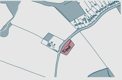
Architectural Features
- Former barns converted into private residences.
- Large barn doors are routinely replaced with large glazed windows and doors.
- Contemporary features often pay homage to the building’s typology.
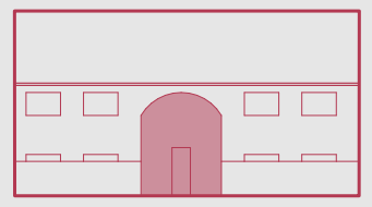
Streetscape
- Properties face onto roads, typically without pavements.
- Roads adjacent to properties are typically 5m wide roads (exclusive of pavement.
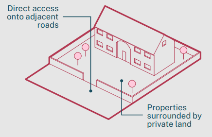
Landscape
- The property is generally enclosed by a private garden and driveway.
- Homes neighbour agricultural land.
Servicing
- Bins are stored in the property’s front garden.
- The property can typically be accessed at all sides.
Walkability
- To walk outside of the property residents would need to walk along roads running parallel, or use public footpaths.
Access to Services
- Services will typically need to be accessed by private car or, where possible, local public transport.
Farm houses and barns
Typical Block
- Remote property surrounded by farmland.
- Approximately 1 dwelling per hectare.
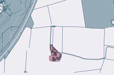
Architectural Features
- Typically a two storey brick home with projected porches.
- Property is surrounded by a complex of agricultural buildings.

Streetscape
- The property will typically sit adjacent to a farm track or minor road.
- Roads neighbouring properties are typically 6m wide roads (exclusive of pavement.

Typical built form - rural farmland - farm houses and barns
Landscape
- Property sits within land able to host agricultural work, as well as a garden that functions for residents of the property.
- Beyond the periphery of the property are neighbouring fields.
Servicing
- On site driveways allow the movement of agricultural vehicles and machinery.
- Waste is differentiated between domestic and agricultural.
- Residential properties can typically be accessed at all sides, whilst agricultural buildings have greater security, and typically one
form of entrance.
Walkability
- Residents or workers wanting to leave the site will need to walk along neighbouring roads, or use local footpaths.
Access to Services
- To access services will require residents, or employees, to travel by car or, where possible, public transport.
Accessible Documents
- Air Quality Action Plan 2021
- Air Quality Annual Status Report 2024
- Air Quality Annual Status Report 2023
- Air Quality Annual Status Report 2022
- Air Quality Annual Status Report 2021
- Air Quality Strategy for Nottingham and Notts
- Annual Governance Statement 2023-24
- Annual Governance Statement 2021-22
- Annual Governance Statement 2020-21
- Asset Management Strategy
- Auditor's Annual Report 2021
- Internal Audit Annual Report 2021/22
- Auditor's Annual Report 2021-22
- Become a Councillor 2022
- Budget and Financial Strategy 2021-22
- Budget and Financial Strategy 2022-23
- Budget and Financial Strategy 2023-24
- Budget and Financial Strategy 2024-25
- Capital and Investment Strategy
- Climate Change Strategy 2021-2030
- Complaints Policy
- Compulsory Purchase Order Procedure Protocol
- Confidential Reporting Code
- Council Constitution
- Contaminated Land
- Corporate Enforcement Policy
- Corporate Strategy 2024-2027
- Council Tax Recovery and Enforcement Policy 2023
- Customer Access Strategy
- Design Code Baseline Appraisal
- Discretionary Housing Payments Policy 2023-2024
- Disabled Facilities Grant Policy 2022
- Disclosure and Barring Service Policy
- Economic Growth Strategy 2024
- Empty Homes Strategy
- Environment Policy 2023
- Equalities Scheme 2021-25
- External Audit Completion Report 2024
- External Audit Completion Report 2023
- External and Internal Communications Strategy
- Freedom Of Information Policy
- HB Recovery and Enforcement Policy
- Hackney Carriage and Private Hire Licensing Policy 2020 - 2025
- Homelessness and Rough Sleeping Strategy
- Housing Allocations Policy
- Housing Enforcement Policy
- ICT Strategy 2022 -25
- Information Management and Governance Strategy 2022-25
- Rushcliffe Borough Council Information Retention Schedule
- Internal Audit Annual Report 2023/24
- Leisure Strategy 2021-2027 review
- Local Code of Corporate Governance 2024/25
- Local Plan Part 1: Core Strategy
- Local Plan Part 2: Land and Planning Policies
- Local Plan Monitoring Report
- Local Scheme of Validation
- Off-street Car Parking Strategy
- Pay Policy Statement
- People Strategy 2021-26
- Planning Enforcement Policy
- Play Strategy
- Procurement Strategy
- Playing Pitch Strategy 2022
- 2021-22 Public Inspection Notice
- RIPA Policy and Guidance
- Risk Management Strategy 2023-26
- Rushcliffe Nature Conservation Strategy
- Solar Farm Landscape Sensitivity and Capacity Study
- Statement of Gambling Licensing Principles
- Statement of Accounts 2019-20
- Statement of Accounts 2020-21
- Statement of Accounts 2021-22
- Statement of Accounts 2021-22 (unaudited)
- Statement of Accounts 2022-23 (unaudited)
- Statement of Accounts 2022-23 (audited)
- Statement of Accounts 2023-24 (audited)
- Statement of Licensing Policy
- Street Trading Policy
- Supplementary Planning Documents
- Tenancy Strategy 2019
- Transformation Strategy and Efficiency Plan
- Tree Management and Protection Policy 2023
- WISE Agreement
- Conservation Areas
- Neighbourhood Plans
- The Nature of Rushcliffe 2021
- The Nature of Rushcliffe 2019
- Anti-Slavery Policy
- Modern Slavery & Human Trafficking Transparency Statement 2024-2025