Solar Farm Landscape Sensitivity and Capacity Study
Solar Farm Landscape Sensitivity and Capacity Study
10 May 2024
This report takes into account the particular instructions and requirements of our client. It is not intended for and should not be relied upon by any third party and no responsibility is undertaken to any third party.
Ove Arup & Partners Limited
One Centenary
Birmingham
B3 3AY
Contents
- Introduction
- Policy context
- Defining the baseline
- General design principles
- Assessment of sensitivity, capacity and key migration principles for each Landscape Assessment Unit
- Summary Table
Appendices
Appendix A - Detailed methodology
Appendix B - Future baseline developments
Appendix C - Supporting figures
Appendix D - Supporting figures (context plans)
1. Introduction
The benefits of renewable energy production and storage are well known and widely accepted. This is evidenced by the National Planning Policy Framework1 (NPPF) [Department for Levelling up, Housing and Communities (2023) National Planning Policy Framework], which outlines the requirement for the transition to a low carbon future and an increase in the supply of renewable energy. The NPPF outlines a presumption in favour of sustainable development and this study sets out information to inform both plan-making and decision-making.
The government published Powering Up Britain, a document setting out its blueprint for delivering energy security and Net Zero in March 2023. This includes commitments to support the energy transition, including a fivefold increase in solar by 2035, noting that ground-mounted solar is one of the cheapest forms of electricity generation and is readily deployable at scale. Solar farm development below 50 megawatts (MW) is dealt with under the Town and Country Planning Act, 1990. Schemes exceeding the 50MW threshold are
considered Nationally Significant Infrastructure Projects (NSIP) and require a Development Consent Order (DCO). Such proposals often exceed 100MW, requiring substantial areas of land. The National Policy Statement for Energy (EN-1) makes specific reference to the landscape and visual considerations of energy infrastructure, applying a hierarchical approach to protection from nationally designated areas through to areas with no landscape designation.
Most solar farms which are operational in the UK today are well below the 50MW threshold and were developed to take advantage of the feed-in tariffs which were available in the 2010s. The economics of solar farm development has changed rapidly in recent years and there has been a push to promote and develop large-scale solar farms, often including ancillary infrastructure such as substations and battery storage. This is reflected in the large number of solar farm applications in Rushcliffe and the wider region. Since 2013 Rushcliffe Borough Council has granted permission for ten solar farms of five hectares or more at various sites across the Borough with generating capacities ranging from 4.2MW to 49.9MW. In recent years there has been increased interest from the renewable energy sector and further applications have been submitted. This has the potential to change the character of the landscape of Rushcliffe. A map of completed solar farms, EIA screening opinion requests for solar farms, and solar farms with planning permission granted, refused, or under consideration within Rushcliffe is shown on Figure C1 in Appendix C.
Rushcliffe Borough Council commissioned Arup in October 2023 to undertake a study to determine the sensitivity of the landscape to solar farm development across the Borough and to provide an indication of the capacity of the landscape for such development. This is to ensure that applications submitted to Rushcliffe Borough Council adhere to the principles of sustainable development and that decisions are informed by a robust understanding of the sensitivity of the landscape, informed by industry experts.
1.1 Aims and objectives of the study
The purpose of the study is to inform the review of Local Plan policies, the content of supplementary planning documents, supplementary plans and guidance notes and to inform the determination of planning applications for solar farm development across the borough.
The findings of this study do not determine whether planning applications are appropriate but rather provide an indicator of suitability based on likely effects to the landscape by area. For each existing or new solar farm development planning application, determination should be based on the character and sensitivity of the landscape (as outlined in Section 5 this study), an individual assessment of likely impacts to landscape and visual amenity as submitted by the prospective developer as part of their planning submission and the
appropriateness of mitigation and enhancement measures, which should align with the design principles outlined in this study.
The main aims of the study are to:
- Provide an assessment of landscape sensitivity of each landscape character area, specific to solar farm development;
- Provide a summary of indicative capacity for solar farm development;
- Visually illustrate the sensitivity and capacity of the landscape spatially through mapping;
- Provide guidance for the siting of solar farm development and set principles for appropriate design, mitigation and enhancement measures.
1.2 Approach
The diagram steps below set out the stages that have been followed to prepare the landscape sensitivity and capacity study. It is based on the four-step process outlined in An approach to landscape sensitivity assessment – to inform spatial planning and land management [Natural England 2019].
Step 1 - Defining the purpose and scope of the landscape sensitivity assessment
- Based on the requirements of Rushcliffe Borough Council and specific trends in solar farm development across the Borough.
- Draws upon and co-ordinates with existing studies and planning documents.
Step 2 - Gathering information to inform the landscape sensitivity assessment
- Includes the review, ground truthing and potential refinement of Landscape Assessment Units (LAU) that will be used in the study.
- Includes desk-based study and fieldwork studies.
Step 3 - Assess landscape sensitivity of assessment units and determine indicative capacity
- Follows the process outlined in the methodology to determine judgements on sensitivity and capacity.
- Includes desk-based and fieldwork studies.
Step 4 - Report and recommend
- Includes the collation of findings into a clear and concise report to be used as a tool for future plan-making and decision-making.
- Includes making recommendations for design and mitigation.
Final Deliverable - Landscape Sensitivity and Capacity Study
Final deliverable fit for purpose to inform:
- the review of Local Plan policies;
- the content of supplementary planning documents and guidance notes relating to solar farm development; and
- decisions on planning applications for solar farm development across the borough.
Further detail on the process is provided in Appendix A - Detailed Methodology. The approach taken to determine landscape sensitivity, indicative capacity and design principles has been informed by the following guidance:
- Natural England’s An approach to landscape sensitivity assessment – to inform spatial planning and land management
- The Landscape Institute and Institute of Environmental Management & Assessment’s Guidelines for Landscape and Visual Impact Assessment, third edition (GLVIA3)
- The Countryside Agency and Scottish Natural Heritage’s Landscape Character Assessment Guidance
- The Countryside Agency and Scottish Natural Heritage’s Topic paper 6: Techniques and Criteria for Judging Capacity and Sensitivity, a discussion
- The Landscape Institute’s Infrastructure Technical Guidance Note 04/20
- Natural England’s An Approach to Landscape Character Assessment
1.21 Definitions
For this study, the definitions for landscape sensitivity, capacity and landscape assessment units are derived from Natural England’s An approach to landscape sensitivity assessment – to inform spatial planning and land management, as set out below.
What is ‘Landscape Sensitivity’?
“Within the context of spatial planning and land management, landscape sensitivity is a term applied to landscape character and the
associated visual resource, combining judgements of their susceptibility to the specific development type / development scenario or other change being considered together with the value(s) related to that landscape and visual resource. Landscape sensitivity may be regarded as a measure of the resilience, or robustness, of a landscape to withstand specified change arising from development types or land management practices, without undue negative effects on the landscape and visual baseline and their value.”
What is ‘Landscape Capacity’?
“Landscape capacity refers to the amount of specified development or change which a particular landscape and the associated visual
resource is able to accommodate without undue negative effects on its character and qualities.”
What is a Landscape Assessment Unit (LAU)?
“Assessment units are reporting units which may be Landscape Character Areas or Landscape Character Types, or subdivisions of
either, depending upon the scale and purpose of the landscape sensitivity assessment.”
1.3 Limitations
The findings of this study do not determine whether planning applications for solar farm development are appropriate but rather provide an indicator of suitability based on likely effects to the landscape by area. Good design requires a thorough understanding of each prospective site and a clear demonstration of the impacts that are likely and mitigation to eliminate or reduce likely effects.
Glint and glare effects are a key factor that should be factored into the decision-making process when considering solar farm development. These effects are specific to each development based on location and specific receptors and therefore cannot be accurately factored into the assessment of sensitivity at this stage. It has therefore been assumed that glint and glare would be possible for all potential solar farm development across all LAUs for the purposes of this study.
This study provides an indication of the likely capacity for solar farm development proposals in a given area but does not replace the need for cumulative effects to be assessed within any Landscape and Visual Impact Assessment (LVIA). The process for determining landscape sensitivity and outlining indicative capacity can be used to inform the likelihood of cumulative impacts. As a general rule of thumb, LAUs where the study indicates a high capacity for a particular typology are less likely to be affected by cumulative impacts, though this still needs to be assessed on a case-by-case basis. Siting, inter-visibility, receptor types and sequential views can all contribute to the perceived sense of development in an area and are all site specific.
Landscape sensitivity and capacity judgements outlined in this study are based on the baseline scenario described in section 3. Capacity should be reviewed as and when new development is brought forward to understand the appropriateness of the landscape for further future developments.
2. Policy context
This section sets out a comprehensive review of relevant national and local planning policy for renewable energy development, particularly solar farms.
2.1 National policy
2.1.1 National Planning Policy Framework 2023
The National Planning Policy Framework (NPPF) sets out the Government’s planning policies for England and how these are expected to be applied. It is a material consideration in planning decisions, with the purpose of the planning system, as defined by the Framework, being to ‘…help achieve sustainable development’.
Chapter 14 of the NPPF includes policies that seek to meet the challenge of climate change, flooding and coastal change. Paragraph 157 states that:
“The planning system should support the transition to a low carbon future in a changing climate, taking full account of flood risk and coastal change. It should help to: shape places in ways that contribute to radical reductions in greenhouse gas emissions, minimise vulnerability and improve resilience; encourage the reuse of existing resources, including the conversion of existing buildings; and support renewable and low carbon energy and associated infrastructure”.
This evidences national policy’s support for renewables and the infrastructure required to enable low carbon energy generation. Concerning plan making, Paragraph 160 encourages Local Planning Authorities (LPAs) to develop plans which aid the increase in the use of renewable and low carbon energy and heat through:
- providing a positive strategy for energy from these sources, that maximises the potential for suitable development, and their future re-powering and life extension, while ensuring that adverse impacts are addressed appropriately (including cumulative landscape and visual impacts);
- identifying suitable areas for renewable and low carbon energy sources, and supporting infrastructure, where this would help secure their development; and
- identifying opportunities for development to draw its energy supply from decentralised, renewable or low carbon energy supply systems and for co-locating potential heat customers and suppliers.
At Paragraph 163, LPAs are also advised to determine planning applications for renewable and low carbon development, according to the following guidance:
- not require applicants to demonstrate the overall need for renewable or low carbon energy, and recognise that even small-scale projects provide a valuable contribution to significant cutting greenhouse gas emissions;
- approve the application if its impacts are (or can be made) acceptable. Once suitable areas for renewable and low carbon energy have been identified in plans, local planning authorities should expect subsequent applications for commercial scale projects outside these areas to demonstrate that the proposed location meets the criteria used in identifying suitable areas; and
- in the case of applications for the re-powering and life-extension of existing renewable sites, give significant weight to the benefits of utilising an established site, and approve the proposal if its impacts are or can be made acceptable.
Paragraph 156 of the NPPF concerns suitable locations for renewable energy development. It states that many elements of renewable energy projects located in the Green Belt will comprise inappropriate development. Subsequently, in this case, developers must “demonstrate very special circumstances if projects are to proceed. Such very special circumstances may include the wider environmental benefits associated with increased production of energy from renewable sources.”
A substantial proportion of the northern extent of Rushcliffe, closest to the built-up extent of Nottingham, is Green Belt, covering approximately 40% of the total area.
2.1.2 Planning Practice Guidance
The government’s Planning Practice Guidance on Renewable and Low Carbon Energy, relevant to solar farm development states that “renewable energy developments should be acceptable for their proposed location” in Paragraph 22. It is noted that large scale solar farms can have a negative impact on the rural environment, but that, if planned sensitively and well-screened the visual impact of solar farms can be properly addressed within the landscape. LPAs are advised to consider:
- focussing large scale solar farms on previously developed and non-agricultural land, provided that it is not of high environmental value;
- where a proposal involves greenfield land, whether the use of any agricultural land is necessary and poorer quality land has been used in preference to higher quality and whether the proposal allows for continued agricultural use where applicable and/or encourages biodiversity improvements;
- putting planning conditions on permission to ensure solar farms are temporary structures and removed when no longer in use;
- the proposal’s visual impact, the effect on landscape of glint and glare;
- additional impacts of the daily movement of the sun;
- the need for, and impact of, security measures such as lights and fencing;
- conserving heritage assets in a manner appropriate to their significance, including the impact of proposals on views important to their setting;
- opportunities to mitigate landscape and visual impacts through, for example, screening with native hedges; and
- the energy generating potential, which can vary for a number of reasons including, latitude and aspect.
Regarding visual impact, the Planning Practice Guidance refers to the guidance for assessing the impacts of wind turbine developments, which lists the following considerations for identifying impacts on the landscape:
- direct and indirect effects;
- cumulative impacts;
- temporary and permanent impacts;
- sensitivity of the landscape and visual resource to certain types of change; and
- magnitude or size of predicted change.
Paragraph 23 goes on to state “in assessing the impact on visual amenity, factors to consider include: establishing the area in which a proposed development may be visible, identifying key viewpoints, the people who experience the views and the nature of the views” and lists the type of information that can usefully inform assessments.
It is noted though that for ground-mounted solar panels with effective screening and appropriate land topography the area of a zone of visual influence could be zero.
2.1.3 National Policy Statement for Energy
The Overarching National Policy Statement (NPS) for Energy (NPS EN-1)11 and the NPS for Renewable Energy Infrastructure (NPS EN-3)12 set out the Government’s ambition to meet net zero by 2050 and recognise that solar has an important role in delivering the government’s strategy for low-cost decarbonisation of the energy sector. The Government expects a five-fold increase and combined ground and rooftop solar deployment by 2035, quoting a figure of up to 70GW. EN-5 sets out policy for electricity network infrastructure which is required to support the governments ambition for delivery of renewable energy generation as outlined in NPS EN-3.
NPS EN-3 sets out the threshold for solar farm development considered to be a Nationally Significant Infrastructure Project (NSIP), which for England is set at a generating capacity of 50MW or greater. NPS EN-1 and NPS EN-3 set out national policy for the delivery of nationally significant energy infrastructure, including renewable energy. The national policy statements set out policy for decisions by the Secretary of State on applications received for NSIPs and the information within is therefore not material to deciding planning applications for sub-50MW solar farms within England. However, they do contain useful information on siting and technical considerations, impacts and mitigation which are transferable to smaller sites and can be drawn upon to ensure good design and well integrated schemes.
NPS EN-3 outlines the likely influences of key considerations involved in the siting of a solar farm:
- Irradiance and site topography
- Network connection
- Proximity to dwellings
- Agricultural land classification and land type
- Accessibility
- Public rights of ways
- Security and lighting
It also outlines technical considerations, impacts and mitigation.
2.2 Local policy
The local development plan documents relevant to solar farm development covering Rushcliffe consist of the following:
- The Rushcliffe Local Plan Part 1: Core Strategy 2014 (LPP1);
- The Rushcliffe Local Plan Part 2: Land and Planning Policies 2019 (LPP2);
- Nottinghamshire Mineral Local Plan, 2021; and
- Adopted Neighbourhood Plans covering an application site, or part of it.
2.2.1 The Rushcliffe Local Plan Part 1: Core Strategy 2014 (LPP1)
Policy 2 of The Rushcliffe Local Plan Part 1 Core Strategy (adopted 2014)13 is a strategic development plan policy which is particularly relevant to decentralised, renewable and low carbon energy generation. A summary of this policy is shown below.
Policy name: Policy 2: Climate Change
Policy summary
Sets out Rushcliffe Borough Council’s overarching aim that all development will, amongst other things, be expected to mitigate against the effects of climate change and comply with national and local targets on reducing carbon emissions.
Also supports the development of new decentralised, renewable and low carbon energy schemes, appropriate for Rushcliffe, including from solar, where they are compatible with environmental, heritage, landscape and other planning considerations.
States that Rushcliffe Borough Council will identify suitable and unsuitable areas for renewable and low carbon energy sources, and supporting infrastructure, through policy in the Local Plan Part 2.
2.2.2 The Rushcliffe Local Plan Part 2: Land and Planning Policies 2019 (LPP2)
Policy 16 of Rushcliffe Local Plan Part 2 Land and Planning Policies draws on Policy 2 (of LPP1) to set out the policy requirements for renewable energy development in Rushcliffe, and outlines considerations for determining suitable development in greater detail for any planning application for renewable energy schemes, including solar.
Policy name: Policy 16: Renewable Energy
Policy summary
Proposals for renewable energy schemes will be granted planning permission where they are acceptable in terms of:
- compliance with Green Belt policy;
- landscape and visual effects;
- ecology and biodiversity;
- best and most versatile agricultural land;
- the historic environment;
- open space and other recreational uses;
- amenity of nearby properties;
- grid connection;
- form and siting;
- mitigation;
- the decommissioning and reinstatement of land at the end of the operational life of the development;
- cumulative impact with existing and proposed development;
- emissions to ground, water courses and/or air;
- odour;
- vehicular access and traffic; and
- proximity of generating plants to the renewable energy source.
States that if proposals are not acceptable in terms of one or more of the identified factors, a decision will be taken balancing the benefits and impacts of the proposal. The more significant the impact, the more likely it is that planning permission would be refused.
Notes that when located in the Green Belt, elements of many renewable energy projects will comprise inappropriate development and developers will need to demonstrate very special circumstances in order to proceed, in line with the NPPF.
Applicants may be expected to provide the following information as part of a planning submission:
- a landscape and visual impact assessment;
- a heritage impact assessment;
- noise assessments;
- ecological assessment; and
- evidence of consultation with utility providers.
2.2.3 Other relevant Local Plan policy
Dependant on the location and nature of a potential solar farm site proposal, other development plan policies may be relevant to the determination of planning applications for major solar development. The list below provides an overview of these polices, which are listed also by the Solar Farm Guide as potential policy considerations.
Local Plan Part 1: Core Strategy (LPP1)
- Policy 1 - Presumption in Favour of Sustainable Development
- Policy 4 - Nottingham-Derby Green Belt
- Policy 10 - Design and Enhancing Local Identity
- Policy 11 - Historic Environment
- Policy 16 - Green Infrastructure, Landscape, Parks and Open Spaces
- Policy 17 - Biodiversity
Local Plan Part 2: Land and Planning Policies (LPP2)
- Policy 1 - Development Requirements
- Policy 17 - Managing Flood Risk
- Policy 18 - Surface Water Management
- Policy 19 - Development Affecting Watercourses
- Policy 21 - Green Belt
- Policy 22 - Development within the Countryside
- Policy 28 - Conserving and Enhancing Heritage Assets
- Policy 29 - Development affecting Archaeological Sites
- Policy 34 - Green Infrastructure and Open Space Assets
- Policy 36 - Designated Nature Conservation Sites
- Policy 37 - Trees and Woodlands
- Policy 38 - Non-Designated Biodiversity Assets and the Wider Ecological Network
- Policy 40 - Pollution and Land Contamination
- Policy 42 - Safeguarding Minerals
2.2.4 Rushcliffe Solar Farm Development Planning Guidance
In 2022, Rushcliffe Borough Council published a Solar Farm Guide. The document provides guidance on the planning policy context for major, stand-alone ground mounted solar photovoltaic panel development that does not exceed 50MW generating capacity. This is a material planning consideration and sets out what Rushcliffe Borough Council expects to receive in terms of proposals.
2.2.5 Landscape and Visual
The Solar Farm Guide outlines the importance of Rushcliffe’s predominantly rural landscape:
“[It] is a key part of the Borough’s character and provides an attractive backdrop for its residents, visitors and investors to live and work. Such landscapes also form an important part of the Green Infrastructure network within the Borough. The landscape and visual effects of major solar farm developments are likely to be one of the most significant impacts arising from such development.”
Consequently, the Rushcliffe Solar Farm Development Planning Guidance requires that the site selection process and formulation of the design and layout of solar farm proposals are given proportionate consideration at the earliest possible stage. LPP2 Policy 22 Development within the Countryside, supports renewable energy within the Countryside, where outside of the Green Belt and where the development can conserve or enhance the appearance and character of the landscape, including any historic or ecological features and local distinctiveness.
LPP1 Policy 16 Green Infrastructure, Landscape, Parks and Open Spaces, outlines that the loss of green infrastructure and any removal of existing field boundaries such as hedgerows and trees through development should not alter the character of the existing landscape.
The Solar Farm Guide states that “all applications for major solar farm development will be expected to be supported by an appropriate assessment in the form of either a Landscape and Visual Assessment (LVA) or Landscape and Visual Impact Assessment (LVIA), if the proposal is EIA development.”
It also states Rushcliffe Borough Council’s preference for developers to follow the guidance set out in GLVIA3.
The sensitivity of the existing landscape, having regard to its condition and strength and the magnitude of the predicted change to the existing landscape character from the proposed development should be considered when assessing the significance of impacts.
The Planning Practice Guidance on Renewable and Low Carbon Energy outlines that in assessing the impact on visual amenity, factors to consider include establishing the area in which a proposed development may be visible, identifying key viewpoints, the people who experience the views and the nature of the views, and identifying cumulative zones and sequential effects that may occur. These factors should be clearly assessed within the LVIA or LVA submitted with the planning application.
2.2.6 Nottinghamshire Minerals Local Plan
Nottinghamshire’s Minerals Local Plan (Adopted 2021)17 sets out, under Policy DM10 Airfield Safeguarding that the visual impact of solar development can be a hazard to aviation and that “reflective surfaces such as solar panels…need to be carefully sited and angled to avoid glare”. NPS EN-3 provides further detail on this stating that solar panels are specifically designed to absorb, not reflect, irradiation and outlining that “applicants should map receptors qualitatively to identify potential glint and glare issues and determine if a glint and glare assessment is necessary as part of the application.”
2.2.7 Emerging Local Policy
The Greater Nottingham Strategic Plan (GNSP) will comprise Part 1 of each authority’s Local Plan, including Rushcliffe, replacing the Core Strategies (2014). The GNSP is currently at Preferred Approach stage and therefore its policies would not be given substantial weight in assessing proposals for solar farm development at present. The publication draft of this plan is planned to be submitted for examination by Government later in 2024, following another round of consultation. Therefore, this study does not consider the GNSP further.
3. Defining the baseline
3.1 Landscape Assessment Units
3.1.1 Analysis and refinement of existing character areas
The Greater Nottingham Landscape Character Assessment 2009 divides Rushcliffe into five Landscape Character Areas which are further divided into 14 Draft Policy Zones (DPZs); these are shown on Figure C2 in Appendix C. These DPZs have been analysed and, where required, refined to form Landscape Assessment Units (LAUs). The process for identifying LAUs involved desk-based and on-site analysis, as described in the methodology in Appendix A. Seven key changes to the DPZs were required to form LAUs, largely reflecting changes that have occurred in the landscape since the Greater Nottingham Landscape Character Assessment was published in 2009. These changes are set out below.
- Development south of Clifton, known as ‘Nottingham Gateway South of Clifton’ is under construction and extends the urban area to the south. This area has therefore been included in the wider urban area for the purposes of this study and the boundary of DPZ SN01 Clifton Slopes has been altered to form LAU F: Clifton Slopes
- The area identified as DPZ TW055 West Bridgford Recreational Fringe has undergone development since the Greater Nottingham Landscape Character Assessment was published. It contains a mix of residential and educational land use with open areas used as playing fields. Due to the overarching urban character of the area, which is unlikely to attract or be feasible for solar farm development, the DPZ has been scoped out of the assessment and the area enveloped into the wider urban area for the purposes of this study.
- DPZs identified within the Trent Washlands Regional Character Area as part of the Greater Nottingham Landscape Character Assessment are located at the northern fringe of Rushcliffe Borough. The DPZs were broken down into much smaller areas of character at a scale that was disproportionate to the rest of the borough. As the overall character of the area is defined by the Broad River Trent Valley, the DPZs were combined to create a continuous ‘Trent Washlands’ LAU, which is considered proportionate with the rest of the borough and therefore more appropriate for the study.
- The Greater Nottingham Landscape Character Assessment included a small, disconnected area defined as part of DPZ TW01, which covered Edwalton Golf Centre. The scale of the small, disconnected area was considered disproportionate to the study, and with limited likelihood of solar farm development. Therefore, the area has been included in the wider urban area for the purposes of this study.
- Residential development south of Edwalton extends the urban area to the south. This area has therefore been included in the wider urban area for the purposes of this study and the boundary of DPZ SN03 Mickleborough Fringe has been altered to form LAU H: Mickleborough Fringe.
- The urban extent of Bingham has extended north since the Greater Nottingham Landscape Assessment was published. This extension has been acknowledged, however, as the settlement is located within a much wider overall character area no change is proposed to the boundary of the existing DPZ.
- Ratcliffe-on-Soar Power Station sits within existing DPZ NW02. A Local Development Order was granted by Rushcliffe Borough Council in 2023 giving outline permission for a range of developments which includes the eventual demolition of the cooling towers. By 2030 the demolition of at least two cooling towers is anticipated to facilitate the development of the EMERGE energy recovery facility. Eventually all of the cooling towers and power station stack will be demolished, however, it is not clear what dates this will be achieved by. This study considers the LDO as part of the future baseline and whilst the LDO boundary differs to that of the existing power station, it is not considered that there would be a change to the DPZ NW02 boundary as a result.
The LAUs are shown on Figure C3 in Appendix C. LAUs utilise the same names as DPZs to broadly align with the Greater Nottingham Landscape Character Assessment.
3.1.2 Landscape Assessment Units (LAU) included in this study
The Landscape Assessment Units included in this assessment are listed below.
- LAU A: Gotham and West Leake Wooded Hills and Scarps
- LAU B: East Leake Rolling Farmland
- LAU C: Widmerpool Clay Wolds
- LAU D: Cotgrave Wooded Clay Wolds
- LAU E: Vale of Belvoir
- LAU F: Clifton Slopes
- LAU G: Ruddington Alluvial Farmland
- LAU H: Mickleborough Fringe
- LAU I: Cotgrave and Tollerton Village Farmland
- LAU J: East Bridgford Escarpment Farmland
- LAU K: Aslockton Village Farmland
- LAU L: Attenborough Wetlands
- LAU M: Soar Valley Farmlands
- LAU N: Trent Valley Washlands
3.2 Baseline scenario
The baseline against which the sensitivity and capacity of the landscape has been assessed is the existing landscape and:
- any planning applications with planning permission granted which are located on allocated land within the local plan, and
- 22/01339/LDO: Proposed Local Development Order for development at Ratcliffe on Soar Power Station, at Ratcliffe on Soar Power Station, Green Street, Ratcliffe on Soar, Nottinghamshire, NG11 0EE, and
- any solar farm development with planning permission granted.
Planning applications with permission granted which are located on allocated land, the LDO and solar farm planning applications with permission granted are described as ‘future baseline’ within this report and are outlined in the tables in Appendix B and shown on Figure C4 in Appendix C.
3.3 Development typologies
Typologies have been developed to inform the sensitivity of the landscape and to provide an indication of its likely capacity. These are summarised below. Further detail on the development of these typologies based on trends driven by national policy and solar farm development planning applications submitted to Rushcliffe Borough Council is available in Appendix A Detailed Methodology.
(i)Typical solar farm development – to inform landscape sensitivity
This study is focused on solar farm development and a summary of typical solar farm development is outlined below. These characteristics of development have been drawn from planning applications for solar farm development submitted to Rushcliffe Borough Council since 2013.
Solar farm development typically comprises the following features:
- Security or perimeter fencing up to 2.5m in height
- CCTV cameras on poles up to 4m in height;
- Solar panel arrays up to 3.1m in height;
- Solar panels arranged south-facing at 10-30 degrees with 2 – 6.3m between rows;
- Infrastructure including small-scale buildings for invertors, sub-stations or power storage facilities; typically up to 3m in height;
- Access tracks (typically 4-5m wide); and
- Battery Energy Storage Systems (BESS).
(ii)Parameters of solar farm development – to inform landscape capacity
The description of solar farm development has been further categorised by size to provide an indication of likely landscape capacity. In reality, not all solar farm developments will fall exactly into any one of these defined typologies and in such cases, decisions will need to be made to establish which typology most closely represents the proposed development.
| Parameter definition |
Size in hectares (ha) | Typical generating capacity (megawatts) |
Notes |
|---|---|---|---|
| Very small scale | Less than 5 hectares | Between 1.25MW and 2.5MW | This represents solar farm development that may typically fit into 1 to 2 agricultural fields based on scale of agricultural land across Rushcliffe Borough. |
| Small scale | 6 to 30 hectares | Between 1.5MW and 15MW |
Recent applications within this range have been submitted to Rushcliffe Borough Council. |
| Medium scale | 31 to 60 hectares | Between 7.75MW and 30MW | There has been one recent screening request for an application within this size range demonstrating the trend in applications to sit at either side of the spectrum and to maximise the potential power generated from sites without exceeding the NSIP threshold. |
| Large scale | 61 to 100 hectares | Between 15MW and 49.9MW |
This range represents solar farm development typical of a commercial enterprise looking to generate power up to the threshold of being considered an NSIP (49.9MW). |
| Very large scale (not included in the study) |
Over 100 hectares | Over 50MW | Developments of this size are NSIPs and applications for a Development Consent Order (DCO) are determined by the relevant Secretary of State. They are therefore outside the scope of this study, but guidance on how Rushcliffe Borough Council could engage with DCO applications will be provided. |
4. General design principles
This section outlines eight general design principles that have been developed for Rushcliffe based on desk-based and on-site observations of the landscape. The principles are briefly described in the context of the characteristics of the landscapes they would be best suited to. These general principles can be applied to development within all LAUs however, key principles have been picked out for each LAU based on its individual baseline conditions and these are presented in section 5.
To maximise the potential for positive outcomes of solar farm development, development should also draw upon and align with existing guidance available. This includes:
- Rushcliffe’s, Solar Farm Guide
- The Landscape Institute’s Infrastructure Technical Guidance Note 04/20
- Planning Practice Guidance on Renewable and Low Carbon Energy
Whilst not material to deciding planning applications for sub-50MW solar farms within England. The national policy statements for energy infrastructure (NPS-EN1, NPS EN-2 and NPS EN-3) also contain useful information on siting and technical considerations, impacts and mitigation which are transferable to smaller sites and can be drawn upon to ensure good design and well-integrated schemes.
Mitigation Principle 1 – Hedgerow restoration
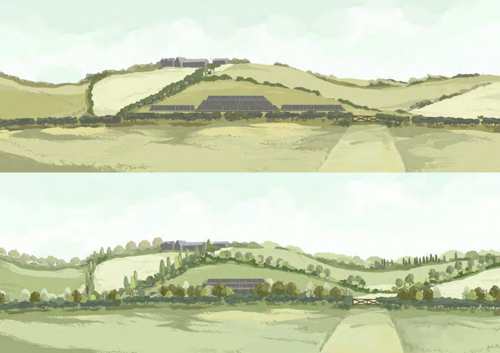
In landscapes with low or fragmented hedgerows, hedgerow restoration can provide additional screening benefits, help to integrate solar farm development into the landscape and reduce the potential for cumulative effects.
Mitigation Principle 2 – Long distance views
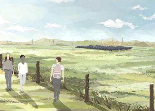
In flat, expansive landscapes with long-distance views, siting solar development away
from recreational routes can help to maintain the sense of openness and retain long
distance views.
Mitigation Principle 3 – Historic setting
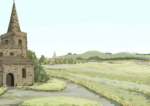
In landscapes with historic features, patterns and associations, which includes
connectivity to the wider landscape or intervisibility between historic features such as
church towers and spires. Historic setting should be considered by limiting solar farm
development within views.
Mitigation Principle 4 – Landmarks
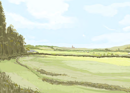
In views where there are significant landmarks or key views that are iconic, such as routes
into settlements or views of local landmarks. Visual connections with landmarks should
be considered and solar farm development sited sensitively to avoid degradation.
Mitigation Principle 5 – Exposed slopes
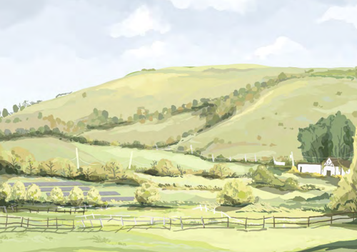
Solar farm development should be avoided on exposed slopes where it would be
prominent within the landscape. Solar farm development can be integrated well into lower,
flatter areas with less impact to the overall landscape.
Mitigation Principle 6 –Villages in the rural landscape
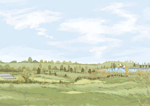
In rural landscapes with villages, solar farm development should be sensitively set back
from the settlement edge to minimise visual intrusion and sense of enclosure.
Mitigation Principle 7 – Field pattern restoration
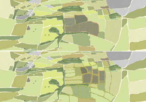
Field boundaries in fragmented landscapes should be restored to improve integration and
provide wider benefits to the landscape. Smaller parcels of development divided by field
boundaries are also less likely to result in cumulative impacts.
Mitigation Principle 8 – Industrial and urban fringe landscapes
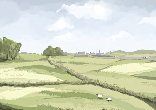
Solar farm development associated with existing urban fringe or industrial areas can limit
overall impacts to the rural landscape. Siting should be considered adjacent existing
built-form and industrial land use but careful consideration to people’s enjoyment of, and
access to the countryside on their doorstop should be given.
5. Assessment of sensitivity, capacity and key migration principles for each Landscape Assessment Unit
The following pages provide profiles for each LAU outlining a landscape character description, key
characteristics and future baseline development. Judgements for the value attached to the landscape and
susceptibility to change are outlined in each case and are combined to provide a judgement on the overall
sensitivity of the LAU to solar farm development.
Following the sensitivity assessment, judgements on indicative capacity are provided with a clear
explanation given in each case.
Key design principles have been proposed for each LAU based on the general principles developed through
the process and shown in Section 4. A written explanation of design principles specific to the LAU is given
in each case.
Further information supporting the assessment of each LAU is as follows:
- Appendix A - Detailed Methodology, sets out the approach taken to define the baseline landscape character and the assessment of sensitivity and capacity.
- Appendix C - Supporting Figures, Figure 03, sets out the LAU boundaries.
- Appendix D - Supporting Figures (Context Plans), provides context plans showing recreational routes, designations and local landmarks for each LAU.
LAU A: Gotham and West Leake Wooded Hills and Scarps

This LAU is located within the regional character area of the Nottinghamshire Wolds. The landscape is largely rural with mostly modern field patterns, though small pockets of irregular and smaller scale historic field pattern do exist. Settlements, such as Gotham and West Leake are located at the base of the hills at the fringes of the area, and East Leake is located centrally within the LAU. The British Gypsum Head Office is located just north of the settlement impacting the rural character locally. To the north of the LAU, the A453 Remembrance Way intersects the area; road infrastructure across the rest of the area comprises rural lanes. Landform comprises a series of prominent individual hills with steep and exposed slopes. Land use is a mixture of woodland, arable and pasture with arable land on the lower and gentle slopes and pasture close to settlements. Larger areas of woodland are generally on higher ground with smaller blocks at the fringes of settlements. Overhead lines are prominent on lower ground between hills. Overall, the condition of the landscape is good, with hedgerows, woodland, and agricultural land well managed. The relatively small scale of settlements which are nestled between prominent hillsides means that built form is generally well-integrated into the overall rural landscape character. Church towers and spires are prominent within views towards settlements. Views range from enclosed channelled views between hills to panoramic views from higher ground.
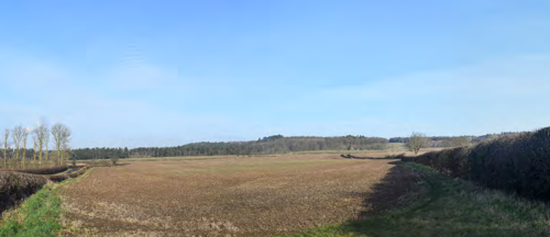
Key characteristics
LAU A is defined by the following key characteristics:
- Prominent hills.
- Largely rural character.
- Modern field pattern.
- Woodland on higher ground.
- Channelled views on lower ground and extensive views from higher ground.
Future baseline
22/01339/LDO: LDO granted providing outline planning permission for a range of developments. The LDO boundary intersects a small portion of the overall LAU to the north-west.
LP2 Policy 3.2 Land north of Lantern Lane, East Leake includes planning applications with permission granted. The applications would introduce housing development to the east of East Leake.
21/00703/FUL: Installation and operation of a solar farm together with all associated works, equipment and necessary infrastructure, at OS Field 8561, rear of Rushcliffe Grove, East Leake, Nottinghamshire. (10.80ha in size).
22/00303/FUL: Construction of a solar farm and battery stations together with all associated works, equipment and necessary infrastructure, together with the formation of a new vehicular access onto Bunny Hill (A60), at land to north-east of Highfields Farm, Bunny Hill, Costock, Nottinghamshire. (81.58ha in size).
Landscape sensitivity
Landscape value
The LAU is not covered by any landscape designations. The value attached to the landscape of LAU A has been considered in the table below against the factors defined in establishing landscape value in Appendix A.
| Factor | Value |
|---|---|
| Natural heritage | Prominent wooded hills with a strong strength of character and interest. |
| Cultural heritage | Largely modern agricultural landscape. Linear settlement of West Leake is a historic village but confined to the south-west corner of the LAU. |
| Landscape condition | The landscape is in overall good condition with hedgerows, woodland agricultural land well managed. |
| Associations | The village of Gotham has multiple mentions in literature including the legend of the ‘Wise Men of Gotham’ and acknowledgement of Gotham in relation to the fictional city in the Batman comics. Gotham sits at the north eastern fringe of the LAU. |
| Distinctiveness | The landscape is distinctive due to the unique topography and prominent hills that form one of its key defining characteristics. The LAU has a strong strength of character overall. |
| Recreational | There are a number of public rights of ways through the landscape which are valued at a local level. Routes are through agricultural land and not considered a draw at a national scale. The Midshires Way long-distance footpath passes through the LAU connecting West Leake and East Leake. |
| Perceptual (Scenic) | The LAU is predominantly of a typical rural character, though its prominent wooded hillside and winding lanes afford extensive views from higher ground and enclosed but often dramatic views from lower ground. |
| Perceptual (wildness and tranquillity) |
The LAU is predominantly rural and has some levels of peacefulness and tranquillity. Settlement such as East Leake and main roads such as A453 Remembrance Way result in local degradation of levels. |
| Functional | The LAU is primarily an agricultural landscape but is typical in nature / production. |
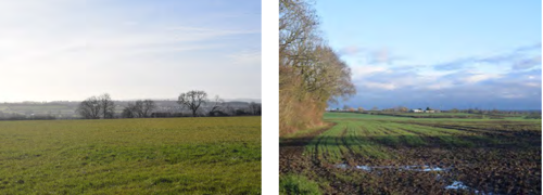
The LAU is not covered by any statutory or local landscape designations. Its value is recognised locally due to its distinctive features such as unique topography and prominent hills. The LAU is also valued locally for its recreational access to the rural landscape which is in overall good condition and contains scenic qualities such as dramatic views from lower ground and extensive views from higher ground. The value is therefore considered to be medium.
Susceptibility to change
The LAU has an overarching rural character though agriculture is commonly medium to large scale and of modern pattern. Settlement and urban influences are confined to the fringes of the area with East Leake being the exception, which is on lower ground, nestled between elevated landforms.
The following features and characteristics of the landscape are particularly susceptible to solar farm development:
- Prominent hills often wooded which are distinctive and visibility of exposed slopes from lower areas, through which winding lanes run.
- Largely rural character with settlement and urbanising features confined to the fringes of the LAU or on lower ground.
- Sense of place derived from locally distinctive landform.
The distinctiveness of the landform, which includes exposed hillsides contribute to a strong sense of place and the overall undeveloped, rural character of the landscape increase susceptibility. The modern nature and character of agricultural land decreases the susceptibility. Overall, the susceptibility is judged to be medium.
Sensitivity
The landscape is judged to be of medium sensitivity as a result of its medium value and medium susceptibility to change.
Landscape capacity
The LAU covers an area of approximately 3,400ha. Despite its large overall area its series of prominent, often wooded hills, reduces the overall capacity for solar farm development without undue consequences for the retention of its baseline character. The landscape does
contain areas of larger scale modern fields on lower ground and areas influenced by existing large-scale built form which are more appropriate for solar farm development however, future baseline development 22/00303/FUL utilises a substantial area of land to the
east of the LAU and this reduces its overall potential for large scale solar farm development.
| LAU Name | Sensitivity | Very small scale - less than 5 hectares | Small scale - 6 - 30 hectares | Medium scale 31 - 60 hectares | Large scale 61 - 100 hectares | Very large scale - over 100 hectares |
|---|---|---|---|---|---|---|
| LAU A: Gotham and West Leake Wooded Hills and Scarps | Medium | High | Moderate | Moderate | Low | See Appendix A, Paragraph A.1.6.2 |
Key design principles
The LAU includes prominent hills with exposed slopes, rural settlements, fragmented pattern and areas with localised degradation due to existing industrial or built-form influences. Mitigation principles 5, 6, 7 and 8 are therefore considered key to aiding the integration of any future solar development proposals within the LAU.
The prominent hills and exposed hillsides should be avoided for development. Development should instead be considered on lower
lying areas where there is greater potential for visual screening and integration within the LAU.
Settlements across the landscape have connections to the wider rural landscape that are valued by local communities and integral to
the character of the settlements. Intervisibility between settlements and the immediate environs should therefore be considered and
introduction of urbanising features avoided.
Due to areas of fragmented field boundaries within the LAU, opportunities for restoration of landscape pattern should be considered in any development proposals.
The northern extent of the LAU and central area around the British Gypsum Head Office are influenced by existing large-scale
industrial development. Sensitively designed development may be more appropriate at these locations, minimising impacts to the
overall rural character of the LAU.
LAU B: East Leake Rolling Farmland

This LAU is located within the regional character area of the Nottinghamshire Wolds. The landscape is largely rural though large-scale urban elements such as the LDO and Nottingham University (Sutton Bonington Campus) are visible and influence the sense of urbanisation locally. East Leake is the only large settlement within the landscape and is located centrally within the LAU. Further settlement comprises small rural villages and settlements such as Normanton on Soar, Kingston on Soar and Costock, which are located at the fringes of the LAU. Landform comprises gentle undulations formed by small streams and tributaries throughout the landscape. To the north, adjacent to the LDO, there are man-made earthworks influencing the sense of ruralness locally. Land use is predominantly arable with some pasture located along Kingston Brook and adjacent to East Leake. Across the landscape there is a combination of large, medium and small-scale field patterns with small-scale fields concentrated around watercourses and the fringes of settlements. Similarly, hedgerow trees and unmanaged hedgerows are generally around watercourses and settlement fringes, whereas agricultural land across much of the landscape is open, with large-scale fields, low managed hedgerows and a lack of hedgerow trees as a result of modern farming practices. Expansive views are often available from higher ground and enclosed, channelled views confined to watercourses in the landscape. The northern extent of the LAU is impacted by the LDO with built form visible.
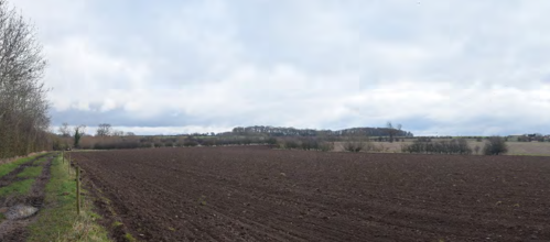
Key characteristics
LAU B is defined by the following key characteristics:
- Largely rural character.
- Gently undulating landform.
- Urban influence due to the LDO with built form visible in some views.
Future baseline
22/01339/LDO: Local Development Order (LDO) granted providing outline planning permission for a range of
developments. The LDO boundary covers a portion of the northern extent of the LAU. The development would result
in the encroachment of built-form further south into the LAU. The eventual demolition of cooling towers and power
station stack would however likely decrease the overall zone of influence of the industrial land use to the north of the
LAU.
LP2 Policy 3.1, Housing Allocation – Land north of Rempstone 28 Road, East Leake includes planning applications
with permission granted. The applications would introduce housing to the south of East Leake.
LP2 Policy 10 Housing Allocation – Land north of Park Lane, 62 Sutton Bonington, includes a planning application
with permission granted. The application would introduce housing to the south of Sutton Bonnington.
22/00809/FUL: The construction, operation and decommissioning of a solar photovoltaic (PV) farm and associated
infrastructure, including inverters, substation compound, security cameras, fencing, access tracks and landscaping at
land at Church Farm, Gotham Road, Kingston on Soar, Nottinghamshire. (60.94ha in size).
Landscape sensitivity
Landscape value
The LAU is not covered by any landscape designations. The value attached to the landscape of LAU B has been
considered in Table 7 below against the factors defined in Table 3 of the methodology in Appendix A .
| Factor | Value |
|---|---|
| Natural heritage | The landscape has modern influences such as large settlement (East Leake), University of Nottingham Sutton Bonington Campus and the LDO. It is largely rural but characterised by modern agricultural land use. |
| Cultural heritage | There are a number of historic villages within the LAU including Kingston on Soar, Normanton on Soar, Costock, East Leake and Stanford on Soar. Stanford Hall is an 18th century country house surrounded by estate parkland. Kingston Park is an example of a designed landscape and listed park and garden. |
| Landscape condition | The landscape is in overall moderate condition with some evidence of fragmentation due to modern farming practices or modern development. |
| Associations | The landscape does not have any particular connections to important people, events or the arts. |
| Distinctiveness | The LAU has a strong character but is fairly typical of the rural landscape and does not contain particularly distinctive features. |
| Recreational | The area is fairly well connected via linear public right of way routes. There are, however, substantial gaps between routes. The Midshires Way long-distance footpath passes through the LAU between Nottingham University Sutton Bonington Campus and West Leake. |
| Perceptual (Scenic) | The LAU is predominantly of a typical rural character. Expansive views are available from higher ground, but some views also contain urban features. |
| Perceptual (wildness and tranquillity) |
The LAU is predominantly rural and has some levels of peacefulness and tranquillity. Settlement such as East Leake, main roads such as A453 Remembrance Way, built-form such as Nottingham University Sutton Bonington Campus and the LDO are locally urbanising elements. |
| Functional | The LAU is primarily an agricultural landscape but is typical in nature / production. |
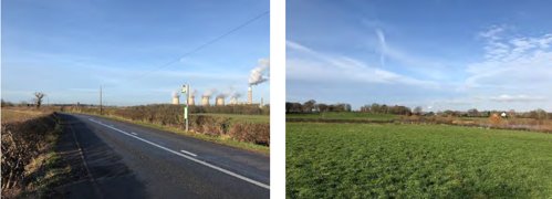
The LAU is not covered by any statutory or local landscape designations. Its value is recognised locally due to its cultural heritage features such as Stansford Hall and Kingston Park and number of small historic villages in a rural setting. It’s recreational access via public right of way routes and the Midshires Way long-distance footpath are also valued locally. The LAU also contains urban features such as A453, Nottingham University and the LDO which are frequently visible in expansive views lessening the sense of wildness and tranquillity from within the LAU. providing users with expansive views. The value is therefore considered to be medium.
Susceptibility to change
The LAU has an overarching rural character, though urban influences impact this character locally at the northern and eastern extent of the area.
The following features and characteristics of the landscape are particularly susceptible to solar farm development:
- Largely rural character outside of the localised areas of settlement and urbanising features adjacent the LDO to
the north, and East Leake and Costock to the east. - Expansive views.
- Number of historic rural villages often with designed landscapes or smaller scale historic field patterns.
Whilst the rural character, dispersed historic settlements, smaller scale, more complex and intact landscapes increase susceptibility, the areas of simple, larger scale agriculture and with localised urban influence decrease susceptibility. Overall, the susceptibility is judged to be medium.
Sensitivity
The landscape is judged to be of medium sensitivity as a result of its medium value and medium susceptibility to change.
Landscape Capacity
The LAU covers an area of approximately 2300 hectares. Its gently undulating landform and medium to large scale of fields provides high potential capacity for very small through to medium scale solar farms. Areas of the LAU are already influenced by large scale development particularly to the north, at the LDO and centrally at East Leake. Protecting the character and connections that villages have with the rural landscape is important for this LAU but well-designed solar farms can be accommodated. The potential for cumulative effects with future baseline development 22/00809/FUL also requires careful consideration in applications submitted.
| LAU Name | Sensitivity | Very small scale - less than 5 hectares | Small scale - 6 - 30 hectares | Medium scale 31 - 60 hectares | Large scale 61 - 100 hectares | Very large scale - over 100 hectares |
|---|---|---|---|---|---|---|
| LAU B: East Leake Rolling Farmland | Medium | High | High | High | Moderate | See Appendix A, Para. A.1.6.2 |
Key design principles
The LAU includes low hedgerows, historic assets, rural settlements, fragmented pattern, and areas with localised degradation due to existing industrial or built-form influences. Mitigation principles 1, 3, 6, 7 and 8 are therefore considered key to aiding the integration of any future solar development proposals within the LAU.
Hedgerows across the majority of large-scale arable land within the LAU are low and well managed. Hedgerow restoration including
incorporation of hedgerow trees and relaxed management routines could have benefits for landscape character and provide screening
benefits within the LAU, reducing the potential visual impacts of development.
The LAU contains historic assets including church towers and spires that have intervisibility within the landscape. These views and setting of assets should be considered when siting solar development within the LAU.
Settlements across the landscape have connections to the wider rural landscape that are valued by local communities and integral to
the character of the settlements. Intervisibility between settlements and the immediate environs should therefore be considered and
introduction of urbanising features avoided.
Due to areas of fragmented field boundaries within the LAU, opportunities for restoration of landscape pattern should be considered in any development proposals.
The northern extent of the LAU around the LDO is influenced by large-scale built form. Sensitively designed development may be more appropriate at this location, minimising impacts to the overall rural character of the LAU, though cumulative impacts would need careful consideration.
LAU C: Widmerpool Clay Wolds

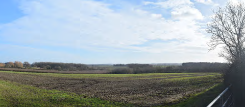
This LAU is located within the regional character area of the Nottinghamshire Wolds. The landscape is largely rural with larger settlement confined to the northern edge at Keyworth. The A46 dissects the area from north to south with Melton Road running south-east to north-west, followed closely by the route of the Old Dalby Test Track railway. Landform is rolling, with undulations formed by small streams cutting through softer mudstones and clay. Land use is predominantly agricultural, comprising a mix of arable and pasture. Land use near Widmerpool, Willoughby on the Wolds and Hickling is predominantly pasture and is particularly distinctive. Scale of pattern ranges from medium to large arable and smaller scale pasture. Hedgerows are generally intact around pasture but are often fragmented around larger scale arable fields to the north and west of the area. Keyworth is the largest settlement to the north but affects the sense of ruralness only at the fringe of the LAU. Views are rural in character, of a rolling landscape with scattered farmsteads and woodland copses situated on higher ground.
Key characteristics
LAU C is defined by the following key characteristics:
- Undulating topography.
- Distinctive pasture near Widmerpool, Willoughby on the Wolds and Hickling.
- Urbanising features including Keyworth, A46, Melton Road and the Old Dalby Test Track railway.
Future baseline
LP2 Policy 4.1 Housing Allocation – Land off Nicker Hill, Keyworth includes planning applications with permission granted. The applications would introduce housing to the east of Keyworth.
LP2 Policy 4.2 Housing Allocation – Land between Platt Lane and 34 Station Road, Keyworth includes a planning application with permission granted. The application would introduce housing to the north-east of Keyworth.
LP2 Policy 4.3 Housing Allocation – Land south of Debdale Lane, 35 Keyworth includes a planning application with permission granted. The application would introduce housing to the west of Keyworth.
LP2 Policy 15 Employment Development includes a planning application with permission granted. The application would introduce commercial development to the east of Keyworth.
Landscape sensitivity
Landscape value
The LAU is not covered by any landscape designations. The value attached to the landscape of LAU C has been considered in the table below against the factors defined in Table 3 of the methodology in Appendix A.
| Factor | Value |
|---|---|
| Natural heritage | The landscape has maintained some natural heritage across areas of smaller scale pasture, such as more complex pattern, woodland blocks interspersed with historic field boundaries. The rolling landform is a result of the underlying geology and small streams cutting through softer mudstones. The landscape also has a number of modern influences such as large settlement and road infrastructure. |
| Cultural heritage | There are a number of historic villages within the LAU including Willoughby on the Wolds, Upper Broughton, Hickling and Widmerpool. The Fosse way is a prominent Roman Road visible within the landscape. Thorpe in the Glebe is surrounded by some of the earliest forms of enclosure within Nottinghamshire, associated with the medieval village of Thorpe Le Glebe. |
| Landscape condition | The landscape is in overall good condition particularly around pasture fields. |
| Associations | The landscape does not have any particular connections to important people, events or the arts. |
| Distinctiveness | The LAU has some areas of particular distinctiveness, particularly due to the large areas of pasture around Willoughby on the Wolds, Widmerpool and Hickling. |
| Recreational | The area is well connected by public right of way routes and The Midshires Way long-distance footpath passes through the LAU. |
| Perceptual (Scenic) | The LAU is predominantly of a typical rural character. Areas of small-scale pasture with intact hedgerows are of particular scenic value. |
| Perceptual (wildness and tranquillity) |
The LAU is predominantly rural and has some levels of peacefulness and tranquillity. Settlement such as Keyworth and infrastructure such as A46, Melton Road and the Old Dalby Test Track railway result in localised lower levels. |
| Functional | The LAU is primarily an agricultural landscape but is typical in nature / production. |
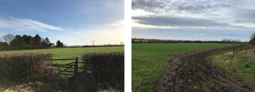
The LAU is not covered by any statutory or local landscape designations. Its value is recognised locally due to its recreational access via public right of way routes and the Midshires Way long distance footpath which runs through the LAU, these routes provide users with access to the rural landscape with undulating topography provide interest in the landscape. The LAU has areas that are of local distinctiveness from the surrounding rural landscape, such as the large expanse of pasture around Willoughby on the Wolds, Widmerpool and Hickling which provide a unique sense of place. There are a number of cultural heritage assets, including buildings and evidence of the LAUs history through the pattern of landscape, including some of the earliest enclosures within Nottinghamshire and The Fosse Way Roman Road. The value is therefore considered to be medium.
Susceptibility to change
The LAU has an overarching rural character, though urban influences such as built form, road and rail infrastructure impact this character locally.
The following features and characteristics of the landscape are particularly susceptible to solar farm development:
- Distinctive pasture near Widmerpool, Willoughby on the Wolds and Hickling.
- Undulating / rolling topography.
- Number of cultural heritage assets.
Whilst the distinctive pasture and cultural heritage assets increase the susceptibility, the wider modern rural character of the landscape, with influence from road and rail infrastructure and urban settlement to the north decreases the susceptibility. Overall, the susceptibility is judged to be medium.
Sensitivity
The landscape is judged to be of medium sensitivity as a result of its medium value and medium susceptibility to change.
Landscape Capacity
The LAU covers an area of approximately 5,400 hectares. Its rolling landform means that hillsides are extensively visible, which if developed, may result in a sense of urbanisation when travelling through the landscape. The LAU also contains distinctive areas of pasture which are small-scale in pattern and reduce potential capacity for large scale developments. Overall, the large size of the LAU means it still has substantial capacity for well-designed development away from the more sensitive areas described above.
| LAU Name | Sensitivity | Very small scale - less than 5 hectares | Small scale - 6 - 30 hectares | Medium scale 31 - 60 hectares | Large scale 61 - 100 hectares | Very large scale - over 100 hectares |
|---|---|---|---|---|---|---|
| LAU C: Widmerpool Clay Wolds |
Medium | High | High | High | Moderate | See Appendix A, Para. A.1.6.2 |
Key design principles
The LAU includes exposed slopes, rural settlements, historic assets and fragmented pattern. Mitigation principles 3, 5, 6 and 7 are
therefore considered key to aiding the integration of any future solar development proposals within the LAU.
The rolling topography throughout the LAU creates exposed slopes which should be avoided for development. Development would
instead be more suitable on lower lying areas where there is greater potential for visual screening and integration within the LAU.
Settlements across the landscape have connections to the wider rural landscape that are valued by local communities and integral
to the character of the settlements. Intervisibility between settlements and the immediate environs should therefore be considered and introduction of urbanising features avoided.
The LAU contains historic assets including church towers and spires that have intervisibility within the landscape. These views
and setting of assets should be considered when siting solar development within the LAU.
Due to areas of fragmented field boundaries within the LAU, opportunities for restoration of landscape pattern should be considered in any development proposals.
LAU D: Cotgrave Wooded Clay Wolds

This LAU is located within the regional character area of the Nottinghamshire Wolds. The landscape is largely rural with settlement
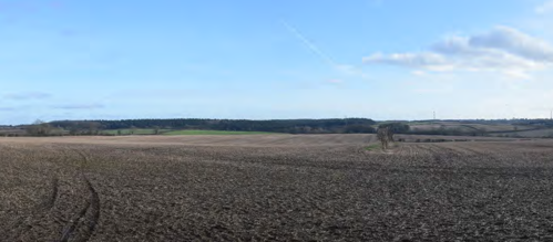
limited to scattered farmsteads and the rural village of Clipston. Cotgrave borders the LAU to the north but has little influence on the area due to the landform and woodland cover which provides a buffer. The A46 dissects the eastern extent of the area running along a north-south axis and the A606 crosses the south-western corner. Roads throughout the rest of the area are rural lanes or farm access tracks. Landform comprises distinctive steep slopes along the northern edge of the LAU. The rest of the area is characterised by gently undulating topography. Land use is predominantly arable land with smaller pockets of pasture at the fringes of Clipston as well as Normanton on the Wolds, Cotgrave and Owthorpe, the latter villages being located outside the boundary of the LAU. Arable fields are medium- to large scale and geometric whilst pasture fields around villages are smaller but retain geometric form. Field boundaries are generally managed at low height and show signs of fragmentation around larger fields. Land cover comprises small linear belts of woodland at village fringes with larger plantations on higher ground (Lorna Wood and Borders Wood east of the A46; Blackberry Wood,
Old Blackberry Wood and Cotgrave Forest, west of the A46; and Brickyard Plantation, Stone Pit Plantation and Cotgrave Gorse on the steep slopes to the north of the LAU). Views are generally rural in character though some are influenced by the A46, A606 and urban elements at village fringes, they vary from short distance views enclosed by woodland to open views from higher ground.
Key characteristics
LAU D is defined by the following key characteristics:
- Steep slopes at northern edge of the LAU.
- Gently undulating topography.
- Woodland cover on higher ground.
- Largely rural character.
Future baseline
There are no allocated sites with planning permission granted that would influence the future baseline of the LAU.
Landscape sensitivity
Landscape value
The LAU is not covered by any landscape designations. The value attached to the landscape of LAU D has been considered in the table below against the factors defined in Table 3 of the methodology in Appendix A.
| Factor | Value |
|---|---|
| Natural heritage | The landscape is predominantly modern agricultural land. The area has distinct slopes to the north due to the glacial plateau formed by underlying chalky boulder clay. |
| Cultural heritage | The area includes the historic village of Clipston to the north. The majority of farmsteads are of modern construction and agricultural pattern and scale is predominantly modern. |
| Landscape condition | The landscape is in moderate condition with some fragmentation of pattern due to large scale intensive farming. |
| Associations | The landscape does not have any particular connections to important people, events or the arts. |
| Distinctiveness | The LAU has distinctive steep slopes at its northern edge. |
| Recreational | The central and north-eastern extents of the LAU are well connected by public right of way routes. There are no further designated recreational routes within the LAU. |
| Perceptual (Scenic) | The LAU is predominantly of a typical rural character. |
| Perceptual (wildness and tranquillity) |
The LAU is predominantly rural and has some levels of peacefulness and tranquillity. The A46 and settlements in the wider landscape (Keyworth and Cotgrave) are locally urbanising elements. |
| Functional | The LAU is primarily an agricultural landscape but is typical in nature / production. |
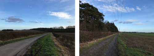
The LAU is not covered by any statutory or local landscape designations. Its value is recognised locally due to its recreational access via public right of way routes which provide users with views across gently undulating countryside. The LAU is predominantly rural but of a modern character but does contain some distinctive features such as steep slopes at its northern edge which adds visual interest. The value is therefore considered to be medium.
Susceptibility to change
The LAU has an overarching rural character with substantial woodland areas, though urban influences such as the A46 and A606 impact this character locally.
The following features and characteristics of the landscape are particularly susceptible to solar farm development:
- Distinctive steep slopes to the north of the LAU.
- Woodland cover on high ground.
Whilst the distinctive landform and woodland cover increase susceptibility, the wider modern rural character of the landscape with influence from road infrastructure (A46 and A606) decrease the susceptibility. Overall, the susceptibility is judged to be medium.
Sensitivity
The landscape is judged to be of medium sensitivity as a result of its medium value and medium susceptibility to change.
Landscape Capacity
The LAU covers an area of approximately 1400 hectares. A relatively large proportion of the LAU is covered by woodland limiting the amount and scale of development that could occur within the LAU without undue consequences to its overall character. The LAU
contains and area of steep slopes to the north which also reduces the potential capacity for large scale solar development. The areas beyond woodland have moderate capacity for small and medium well-designed development.
| LAU Name | Sensitivity | Very small scale - less than 5 hectares | Small scale - 6 - 30 hectares | Medium scale 31 - 60 hectares | Large scale 61 - 100 hectares | Very large scale - over 100 hectares |
|---|---|---|---|---|---|---|
| LAU D: Cotgrave Wooded Clay Wolds | Medium | High | Moderate | Moderate | Low | See Appendix A, Para. A.1.6.2 |
Key design principles
The LAU includes low hedgerows, exposed slopes, rural settlements, historic assets and fragmented pattern. Mitigation principles 1, 3, 5, 6 and 7 are therefore considered key to aiding the integration of any future solar development proposals within the LAU.
Hedgerows across the majority of large-scale arable land within the LAU are low and well managed. Hedgerow restoration including
incorporation of hedgerow trees and relaxed management routines could have benefits for landscape character and provide screening
benefits within the LAU, reducing the potential visual impacts of development.
The exposed slopes at the northern edge of the LAU should be avoided for development. Development would instead be more suitable in lower lying areas where there is greater potential for visual screening and integration within the LAU.
Settlements across the landscape have connections to the wider rural landscape that are valued by local communities and integral to
the character of the settlements. Intervisibility between settlements and the immediate environs should therefore be considered and
introduction of urbanising features avoided.
The LAU contains historic assets including church towers and spires that have intervisibility within the landscape. These views and setting of assets should be considered when siting solar development within the LAU.
Due to areas of fragmented field boundaries within the LAU, opportunities for restoration of landscape pattern should be considered in any development proposals.
LAU E: Vale of Belvoir

This LAU is located within the regional character area of the Vale of Belvoir. The landscape is largely rural with the largest settlement,
Kinoulton, located at the western edge of the LAU. Colston Bassett is a small historic rural village located centrally within the LAU. To the east of the LAU, the scale of built form and presence of urban features increases due to Langar Airfield and surrounding commercial land use. Road infrastructure includes a network of rural lanes throughout the area. Landform comprises low lying land with very gentle undulations and hills visible in the distance enclosing the LAU. Land use is predominantly arable agriculture in medium and large-scale fields, with larger fields to the east of the LAU. There is also a significant amount of pasture, particularly to the west and south-west of the LAU, adjacent Kinoulton and Hickling. Field pattern is regular throughout the LAU. Field boundaries are typically high, contain hedgerow trees, and are intact, though this changes around larger field systems where hedgerows are often fragmented and lacking in hedgerow trees. There are occasional woodland blocks and belts throughout the landscape which are small scale. Views are rural
in character, though pylons are often prominent in vistas due to the low-lying landform. Churches at Langar and Granby form prominent features on high ground and Hickling church tower is visible above the village. At the eastern edge of the LAU, the Belvoir ridgeline and Belvoir Castle are visible in longer distance views to the south.
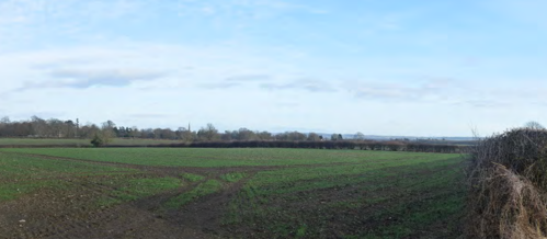
Key characteristics
LAU E is defined by the following key characteristics:
- Low lying landform.
- High hedgerows with hedgerow trees.
- Prominent features (church spires and towers) in views.
- Distinctive land use and historic field pattern surrounding villages.
Future baseline
There are no allocated sites with planning permission granted that would influence the future baseline of the LAU.
Landscape sensitivity
Landscape value
The LAU is not covered by any landscape designations. The value attached to the landscape of LAU E has been considered in the table below against the factors defined in Table 3 of the methodology in Appendix A.
| Factor | Value |
|---|---|
| Natural heritage | The landscape is predominantly modern agricultural land. The low-lying landform of the LAU makes it distinct from the surrounding landscape. |
| Cultural heritage | The area includes the historic villages of Colston Bassett, Kinoulton and Hickling. Visibility of church spires and towers is commonplace throughout the LAU. The large amount of historic pasture surrounding settlement is distinctive within the LAU and ridge and furrow is evident close to Kinoulton and Hickling. |
| Landscape condition | The landscape is in moderate condition with some fragmentation of pattern due to large scale intensive farming. Generally, the area appears well managed. |
| Associations | The landscape does not have any particular connections to important people, events or the arts. |
| Distinctiveness | The LAU has local distinctiveness due to its low-lying landform which is enclosed by raised topography in the surrounding landscape. |
| Recreational | The LAU is well connected by public right of way routes throughout. The Grantham Canal is a popular recreational route with intersects the LAU connecting Cropwell Bishop, Kinoulton and Hickling. |
| Perceptual (Scenic) | The LAU is predominantly of a typical rural character. The low-lying landform allows longer distance views with features such as church spires and towers and views of a wooded horizon. From the eastern edge of the LAU views of the Belvoir ridgeline and Belvoir Castle are available. |
| Perceptual (wildness and tranquillity) |
The LAU is predominantly rural and has moderate overall levels of peacefulness and tranquillity. Langar Airfield and visibility of pylons across the low-lying landform reduce tranquillity. |
| Functional | The LAU is primarily an agricultural landscape but is typical in nature / production. |
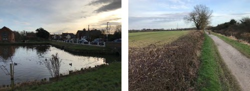
The LAU is not covered by any statutory or local landscape designations. Its value is recognised locally due to its recreational access via public right of way routes and the Grantham Canal which is a popular recreational route running though the borough, these routes provide users with views across low-lying landform with frequent visibility of historic villages throughout the LAU providing a connection with the wider landscape. Due to the surrounding landform in other LAUs, the low-lying landform is locally distinctive. The value is therefore considered to be medium.
Susceptibility to change
The LAU has an overarching rural character comprising modern agriculture and some urban influences such as Langar Airfield and pylons, overall the LAU has limited settlement.
The following features and characteristics of the landscape are particularly susceptible to solar farm development:
- Views of prominent and historic features (church spires and towers).
- Distinctive land use and historic field pattern surrounding villages.
Whilst the views of prominent features that should be considered, and the historic connections evidenced through field pattern and land use, increase the susceptibility. The modern, larger scale and fragmented field patterns and prominent urbanising features such as pylons and Langar Airfield (and associated hangars) decrease the susceptibility. Overall, the susceptibility is judged to be medium.
Sensitivity
The landscape is judged to be of medium sensitivity as a result of its medium value and medium susceptibility to change.
Landscape Capacity
The LAU covers an area of approximately 4,700 hectares. The overall size of the LAU, its flat topography, large scale agricultural land and gaps between recreational routes and rural settlements afford potential for well-designed solar farm development. Careful consideration of views of prominent features within the LAU and the connection of settlements to the rural landscape should be given to minimise potential impacts. The LAU includes large areas of pasture, which is locally distinctive, and the preservation of this localised character should be considered in the siting and design of solar farms within the LAU.
| LAU Name | Sensitivity | Very small scale - less than 5 hectares | Small scale - 6 - 30 hectares | Medium scale 31 - 60 hectares | Large scale 61 - 100 hectares | Very large scale - over 100 hectares |
|---|---|---|---|---|---|---|
| LAU E: Vale of Belvoir | Medium | High | High | High | High | See Appendix A, Para. A.1.6.2 |
Key design principles
The LAU includes historic assets, rural settlements and fragmented pattern. Mitigation principles 1, 3, 4, 6 and 7 are therefore
considered key to aiding the integration of any future solar development proposals within the LAU.
Hedgerows across the majority of the LAU are intact and high however some large-scale arable land within the LAU has low
well-maintained hedgerows that would benefit from restoration. Hedgerow restoration including incorporation of hedgerow trees and relaxed management routines could have benefits for landscape character and provide screening benefits within the LAU, reducing
the potential visual impacts of development.
The LAU contains historic assets including church towers and spires that have intervisibility within the landscape. These views and setting of assets should be considered when siting solar development within the LAU.
The LAU has views of Belvoir Castle to the south as well as local landmarks such as church spires and towers. These views are
important to the character of the LAU and should be considered through design.
Settlements across the landscape have connections to the wider rural landscape that are valued by local communities and integral to
the character of the settlements. Intervisibility between settlements and the immediate environs should therefore be considered and
introduction of urbanising features avoided.
Due to areas of fragmented field boundaries within the LAU, opportunities for restoration of landscape pattern should be considered in any development proposals.
LAU F: Clifton Slopes
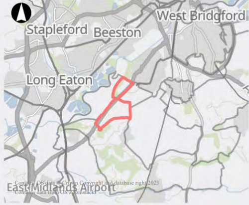
This LAU is located within the regional character area of the South Nottinghamshire Farmlands. The landscape comprises modern agricultural land with substantial urban influences due to proximity of built-up areas and the A453 Remembrance Way which runs along the western edge of the LAU. Landform comprises the distinctive escarpment bordering the River Trent with a steep slope down to the River Trent to the west and gentler slopes down to the south of the LAU towards Ruddington Moor. Land use is predominantly modern large-scale intensive agricultural with some smaller pasture fields on the escarpment slope to the north-west. Hedgerows are almost non existent across the majority of the LAU and are only present across the pasture fields to the north-west. Woodland cover is limited to woodland blocks on the escarpment slope which are distinctive locally. The southern extent of the LAU has no major vegetative land cover. The topography and views afforded from the A453 creates a distinctive route into Nottingham. Views are across modern arable farmland and contain urban features due to the built-up edge of Clifton, prominent pylons and the LDO.
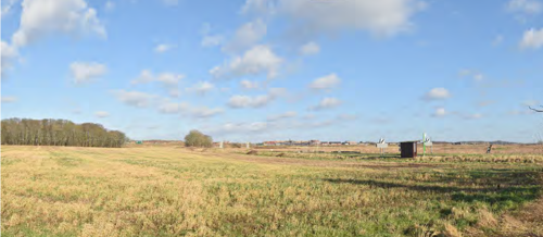
Key characteristics
LAU F is defined by the following key characteristics:
- Modern agricultural land.
- Steep escarpment to the north-west.
- Urbanising features such as A453 Remembrance Way, pylons and edge of built-up area.
Future baseline
There are no allocated sites with planning permission granted that would influence the future baseline of the LAU.
Landscape sensitivity
Landscape value
The LAU is not covered by any landscape designations. The value attached to the landscape of LAU F has been considered in the table below against the factors defined in Table 3 of the methodology in Appendix A.
| Factor | Value |
|---|---|
| Natural heritage | The landscape is predominantly modern agricultural land. The steep escarpment to the north-west is a distinctive natural feature of the LAU. |
| Cultural heritage | The area has some evidence of historic smaller scale pasture fields adjacent to Clifton. The majority of the landscape is however influenced by modern development / farming practices. |
| Landscape condition | The landscape is in moderate condition with little pattern definition across the majority of modern arable land but generally intact hedgerows and field pattern in smaller scale pasture adjacent to Clifton. |
| Associations | The landscape does not have any particular connections to important people, events or the arts. |
| Distinctiveness | The LAU has local distinctiveness due to the steep escarpment to the north-west. It is also a distinctive route into Nottingham. |
| Recreational | The LAU has few public right of way routes, and they are generally linear. There are no further designated recreational routes within the LAU. |
| Perceptual (Scenic) | The LAU is distinctive due to the landform but contains a large number of modern or urbanising features reducing its scenic qualities. |
| Perceptual (wildness and tranquillity) |
The LAU has low levels of wildness and tranquillity due to modern and urban influence, such as the A453 Remembrance Way and Clifton built-up area extent. |
| Functional | The LAU is primarily an agricultural landscape but is typical in nature / production. |
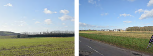
The LAU is not covered by any statutory or local landscape designations. Its value is recognised locally due to its distinctive escarpment landform and as a distinctive route into Nottingham only. The LAU is modern in character with little pattern definition due to modern and intensive farming practices. The value is therefore considered to be low.
Susceptibility to change
The LAU has an overarching character of modern agricultural land with frequent and highly visible urban influences such as road infrastructure, built form and pylons.
The following features and characteristics of the landscape are particularly susceptible to solar farm development:
- Steep escarpment to the north-west including smaller scale pasture.
Whilst the steep escarpment edge and distinctiveness of the landscape as a route into Nottingham increase the susceptibility. The existing substantial influence of urban features including road infrastructure, pylons and settlement edge decrease the susceptibility. Overall, the susceptibility is judged to be low.
Sensitivity
The landscape is judged to be of low sensitivity as a result of its low value and low susceptibility to change.
Landscape Capacity
The LAU covers an area of approximately 500 hectares. The small overall size of the LAU affords potential for some small scale and very small scale solar farm development. Despite its overall low sensitivity, medium and large scale development would result in substantial degradation of the character area due to the small size of the LAU.
| LAU Name | Sensitivity | Very small scale - less than 5 hectares | Small scale - 6 - 30 hectares | Medium scale 31 - 60 hectares | Large scale 61 - 100 hectares | Very large scale - over 100 hectares |
|---|---|---|---|---|---|---|
| LAU F: Clifton Slopes | Medium | High | Moderate | Low | Low | See Appendix A, Para. A.1.6.2 |
Key design principles
The LAU includes exposed slopes, and fragmented pattern. Mitigation principles 5, and 7 are therefore considered key to aiding the integration of any future solar development proposals within the LAU.
The steep escarpment at the north-western edge of the LAU results in areas of exposed slopes which should be avoided for development. Development would instead be more suitable in lower lying areas where there is greater potential for visual screening and integration within the LAU.
Hedgerow boundaries are almost non existent throughout the LAU, opportunities for restoration of landscape pattern should be
considered in any development proposals.
LAU G: Ruddington Alluvial Farmland

This LAU is located within the regional character area of the South Nottinghamshire Farmlands. The landscape is predominantly modern arable farming with settlement confined to Gotham at the western fringe and Bunny at the eastern fringe. The Great Central Main Line former railway dissects the LAU running along a north to south axis. Transport infrastructure across the rest of the area is limited to rural lanes through villages at the edges of the LAU and farm access tracks. Landform comprises a large expanse of low-lying alluvial land. Land use is a mix of large- and very large-scale arable fields with boundaries formed by ditches or fragmented hedgerows. Woodland cover is infrequent with the primary bands of vegetation or small copses confined to the former railway corridor or small watercourses. Expansive views are available across the area due to the low-lying landform and lack of field boundaries or woodland cover. Overhead lines are prominent due to the landform. Expansive views are enclosed by wooded hillside in the distance.
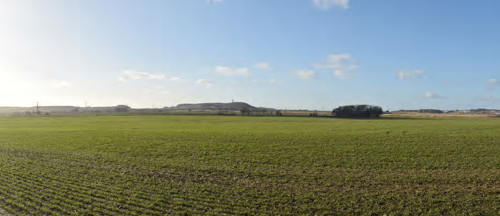
Key characteristics
LAU G is defined by the following key characteristics:
- Low lying alluvial land.
- Expansive views.
- Boundaries formed by ditches with vegetation infrequent.
- Lack of settlement.
- Pylons forming prominent features.
Future baseline
23/00254/FUL: Renewable Energy Park comprising ground mounted solar panels, access tracks, inverters,
transformers, substation, cables and conduits, battery energy storage system, perimeter fence, CCTV and planting
scheme at land at Fields Farm, Asher Lane, Ruddington, Nottinghamshire. (82 hectares in size).
Landscape sensitivity
Landscape value
The LAU is not covered by any landscape designations. The value attached to the landscape of LAU G has been
considered in the table below against the factors defined in Table 3 of the methodology in Appendix A .
| Factor | Value |
|---|---|
| Natural heritage | The landscape is predominantly modern agricultural land. The low-lying landform of the LAU makes it distinct from the surrounding landscape. |
| Cultural heritage | The area includes the historic villages of Gotham and Bunny, though these are confined to the eastern and western fringes of the LAU. The majority of the LAU is modern agricultural land. |
| Landscape condition | The landscape is in poor condition with degradation of hedgerows and substantial expansion of fields over time to make way for modern intensive farming practices. |
| Associations | The village of Gotham has multiple mentions in literature including the legend of the ‘Wise Men of Gotham’ and acknowledgement of Gotham in relation to the fictional city in the Batman comics. Gotham sits at the fringe of the LAU and has minimal influence on the overall character of the LAU. |
| Distinctiveness | The LAU has local distinctiveness due to its low-lying landform which is enclosed by raised topography in the surrounding landscape. |
| Recreational | The LAU has a number of long linear public right of way routes mostly towards the southern extent of the LAU. The Midshires Way runs along a section of the southern boundary of the LAU. |
| Perceptual (Scenic) | The nature of views across the LAU are largely monotonous. The low-lying landform provides expansive and impressive views however, they contain prominent modern features. |
| Perceptual (wildness and tranquillity) |
The LAU has is predominantly rural and has moderate overall levels of peacefulness and tranquillity. The Great Central Main Line former railway, prominence of pylons and visibility of industrial scale buildings in the distance reduce tranquillity. |
| Functional | The LAU is primarily an agricultural landscape but is typical in nature / production. |
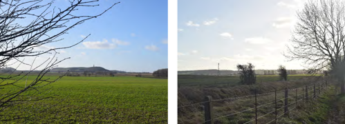
The LAU is not covered by any statutory or local landscape designations. Its value is recognised locally due to its distinctive expansive character but has limited access across large areas to the north due to lack of road or pedestrian routes. The LAU is characterised by modern agricultural land. Cultural heritage and associations are confined to the fringes of the LAU due its overall largely unsettled character. The value is therefore considered to be low.
Susceptibility to change
The LAU has an overarching character of modern agricultural land with frequent and highly visible urban influences such as former rail infrastructure and pylons. The following features and characteristics of the landscape are particularly susceptible to solar farm development:
- Expansive views.
Whilst the expansive views across the landscape and recreational access to the south increase the susceptibility, the substantial modern influences of the landscape such as pylons, former railway infrastructure and lack of settlement decrease the susceptibility. Overall, the susceptibility is judged to be low.
Sensitivity
The landscape is judged to be of low sensitivity as a result of its low value and low susceptibility to change.
Landscape Capacity
The LAU covers an area of approximately 1300 hectares. The relatively large size of the LAU, its flat topography, modern influences and unsettled character afford the potential for small scale through to medium scale solar farm development. The capacity for large scale
development is moderate due to future baseline development 23/00254/FUL which is 82 hectares and would fill a portion of the LAU centrally.
| LAU Name | Sensitivity | Very small scale - less than 5 hectares | Small scale - 6 - 30 hectares | Medium scale 31 - 60 hectares | Large scale 61 - 100 hectares | Very large scale - over 100 hectares |
|---|---|---|---|---|---|---|
| LAU G: Ruddington Alluvial Farmland | Medium | High | High | High | Moderate | See Appendix A, Para. A.1.6.2 |
Key design principles
The LAU includes long distance views and fragmented pattern. Mitigation principles 2 and 7 are therefore considered key to aiding
the integration of any future solar development proposals within the LAU.
The LAU has a number of linear public right of way routes that afford users expansive, long-distance views due to the low-lying
landform. Siting of development should consider distance from recreational routes to retain the overall character and composition of views.
Due to areas of fragmented field boundaries within the LAU, opportunities for restoration of landscape pattern should be considered in any development proposals.
LAU H: Mickleborough Fringe
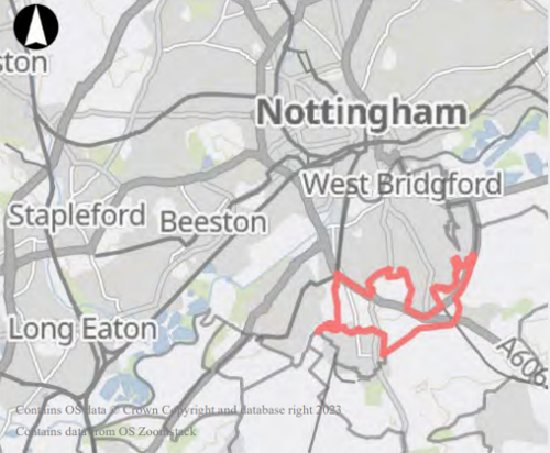
This LAU is located within the regional character area of the South Nottinghamshire Farmlands. The landscape is formed by a mix of
agricultural land and recreational land use. It is an area of open space influenced by its proximity to the built-up edge of Clifton, Ruddington and Edwalton. There is low density housing central to the LAU, surrounding Ruddington Grange Golf Club but adjacent dense settlements influence the overall character. The A60, A606 and A52 are main roads connecting suburban areas and the centre of Nottingham. Landform comprises two distinctive hills which are prominent from the surrounding landscape. Land use is mostly arable though there are land uses associated with the location at the suburbs of urban areas including Southern Cemetery, Clifton Playing
Fields Ruddington Grange Golf Club, and historic estate land associated with Ruddington Hall. Vegetation cover is mixed across the LAU with belts of woodland across the golf course, estate planting and woodland blocks on the hillside north of Lodge Farm and at Wilford Hill. Extensive views are available from higher ground ranging from views of undulating farmland to the south, to views of the Nottingham City to the north.
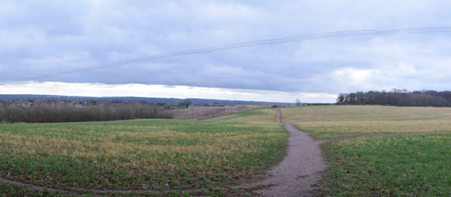
Key characteristics
LAU H is defined by the following key characteristics:
- Distinctive hills which are prominent from surrounding landscape.
- Marginal rural character at fringe of settlements.
- Busy main roads connecting suburban areas and Nottingham.
Future baseline
LP2 Policy 6.1 Housing Allocation – Land west of Wilford Road, Ruddington includes a planning application with permission granted. The application would introduce housing to the north of Ruddington.
Landscape sensitivity
Landscape value
The LAU is not covered by any landscape designations. The value attached to the landscape of LAU H has been considered in the table below against the factors defined in Table 3 of the methodology in Appendix A.
| Factor | Value |
|---|---|
| Natural heritage | The landscape has prominent landform and wooded hillsides but overall has a large number of built-form and modern influences. |
| Cultural heritage | The area includes Ruddington Hall and has close ties to the adjacent built-up area of Ruddington which contains a number of listed buildings which were former framework knitters’ workshops. |
| Landscape condition | The landscape is in moderate condition with degradation of pattern overtime due to modern influences. Woodland on higher ground is generally well managed. |
| Associations | The landscape does not have any particular connections to important people, events or the arts. |
| Distinctiveness | The LAU has local distinctiveness due to the prominence of the two hills that form its topography. |
| Recreational | The LAU has some public right of way routes around Ruddington Hall and on Wilford Hill. These are valued locally due to the proximity to adjacent built-up areas. The area also includes a golf course and playing fields. There are no further designated recreational routes within the LAU. |
| Perceptual (Scenic) | The LAU contains expansive views, however they frequently contain modern or built-form features that are not typically considered scenic. |
| Perceptual (wildness and tranquillity) |
The LAU is close to the urban fringe of Nottingham and its suburbs. The LAU also contains residential areas and a large number of people using recreational assets and road infrastructure. |
| Functional | The LAU contains areas of agriculture, but they are typical in nature / production. Other land uses are typical of a marginal rural landscape close to the urban fringe. |
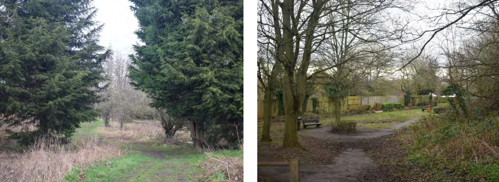
The LAU is not covered by any statutory or local landscape designations. Its value is recognised locally due to its distinctive landforms and recreational assets which are located at the urban fringe, providing doorstep access to the wider rural landscape and expansive views from high points. The value is therefore considered to be medium.
Susceptibility to change
The LAU has an overarching marginal rural character which is reflected by the mix of land uses throughout and number of urban influences.
The following features and characteristics of the landscape are particularly susceptible to solar farm development:
- Distinctive hills and exposed hillsides which are prominent from surrounding landscape.
- Marginal rural / settled character.
Whilst the distinctive hills and exposed hillsides and settled character increase susceptibility, the modern influences of the landscape such as road infrastructure and settled character decrease the susceptibility. Overall, the susceptibility is judged to be low.
Sensitivity
The landscape is judged to be of medium sensitivity as a result of its medium value and low susceptibility to change.
Landscape Capacity
The LAU covers an area of approximately 550 hectares. The small overall size of the LAU and medium sensitivity attributed in part to the value and susceptibility of open areas in a marginal landscape, affords potential for very small scale or some small scale solar developments. Medium or large scale solar development would affect a substantial portion of the overall LAU due to its small
size and is likely to result in substantial degradation of character.
| LAU Name | Sensitivity | Very small scale - less than 5 hectares | Small scale - 6 - 30 hectares | Medium scale 31 - 60 hectares | Large scale 61 - 100 hectares | Very large scale - over 100 hectares |
|---|---|---|---|---|---|---|
| LAU H: Mickleborough Fringe | Medium | High | Moderate | Low | Low | See Appendix A, Para. A.1.6.2 |
Key design principles
The LAU includes exposed slopes. Mitigation principle 5 is therefore considered key to aiding the integration of any future solar development proposals within the LAU.
Prominent hills in the LAU include views of exposed hillside which should be avoided for development. Development should instead be considered on lower lying areas where there is greater potential for visual screening and integration within the LAU.
LAU I: Cotgrave and Tollerton Village Farmland Landscape

This LAU is located within the regional character area of the South Nottinghamshire Farmlands. The landscape is largely rural though there are urban influences due to the proximity to Nottingham and towns and villages of Ruddington, Plumtree, Tollerton, Cotgrave, Ratcliffe on Trent and Upper Saxondale. The LAU also contains recreational features such as Rushcliffe Country Park, Cotgrave County Park, The Nottinghamshire Golf and Country Club and Ratcliffe on Trent Golf Club which all contribute to its overall settled character. Road infrastructure includes the A606 Melton Road, the A60 and the A46; there is a comprehensive network of rural lanes and roads connecting smaller villages across the rest of the LAU. Nottingham City Airport is another substantial urbanising feature of the landscape connecting its overall character with the urban fringe of Nottingham. Landform comprises very gently undulating land with localised steeper areas around watercourses at Upper Saxondale and localised plateaus. Land use is mostly arable and is medium to large in scale due to modern intensive farming. Smaller scale pasture is present at the edges of settlement. Though the landscape is predominantly rural there are frequent urbanising features throughout the landscape. Field boundaries are mostly hedgerows and are
often fragmented with few hedgerow trees present. Vegetation cover throughout the LAU is generally confined to recreational areas such as golf courses and country parks or at the outskirts of rural villages. The distance of views available varies across the landscape due to the undulating landform, urban features are commonplace in views and pylons are often prominent due to them breaking the horizon.
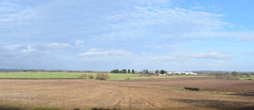
Key characteristics
LAU I is defined by the following key characteristics:
- Very gently undulating landform.
- Frequent urbanising features characteristic of marginal / urban fringe landscape.
- Modern large scale agricultural landscape.
- Marginal rural character at fringe of settlements.
Future baseline
LP1 Policy 23 Strategic Allocation at former Cotgrave Colliery, includes planning applications with permission granted. The applications would introduce housing and employment buildings with associated infrastructure and landscaping to the north-east of Cotgrave.
LP2 Policy 2.1 Housing Allocation – Land rear of Mill Lane/The Old 24 Park, Cotgrave includes planning applications with permission granted. The applications would introduce housing to the north of Cotgrave.
LP2 Policy 2.2 Housing Allocation – Land south of Hollygate Lane, 26 Cotgrave includes planning applications with permission granted. The applications would introduce housing to the north-east of Cotgrave.
LP2 Policy 6.3 Housing Allocation – Land opposite Mere Way, 50 Ruddington includes planning applications with permission granted. The applications would introduce housing to the east of Ruddington.
LP2 Policy 6.4 Housing Allocation – Land north of Asher Lane, Ruddington includes planning applications with permission granted. The applications would introduce housing to the south-west of Ruddington.
LP2 Policy 15 Employment Development – Hollygate Lane, Cotgrave, includes planning applications with permission granted. The applications would introduce a warehouse office space and associated infrastructure to the north-east of Cotgrave.
Landscape sensitivity
Landscape value
The LAU is not covered by any landscape designations. The value attached to the landscape of LAU I has been considered in the table below against the factors defined in Table 3 of the methodology in Appendix A.
| Factor | Value |
|---|---|
| Natural heritage | The landscape has frequent modern influences such as built-form and is a modern agricultural landscape with few significant natural heritage features. |
| Cultural heritage | The area includes a number of historic rural villages with evidence of historic landscape pattern. |
| Landscape condition | The landscape is in moderate condition with evidence of fragmented hedgerows around large-scale arable land use. Other areas are well managed such as parkland and areas around the Grantham Canal. |
| Associations | The landscape does not have any particular connections to important people, events or the arts. |
| Distinctiveness | The LAU is typical of a rural landscape at the fringes of urban settlement. |
| Recreational | The LAU has some linear public right of way routes but is not well connected or accessible overall. The Grantham Canal intersects the LAU and is a popular recreational route. The LAU contains a number of country parks and golf courses which are valued locally. |
| Perceptual (Scenic) | The LAU has s combination of enclosed and longer distance views afforded by the undulating topography. Views frequently include modern or built-form features that are not typically considered scenic. |
| Perceptual (wildness and tranquillity) |
The LAU is close to the urban fringe of Nottingham and contains a number of settlements that result in lower levels of wildness and tranquillity. Road infrastructure and Nottingham City Airport also contribute to lower overall levels. |
| Functional | The LAU is primarily an agricultural landscape but is typical in nature / production. Other land uses are typical of a marginal rural landscape close to the urban fringe. |
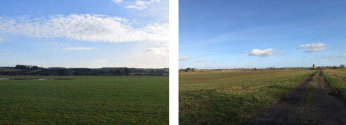
The LAU is not covered by any statutory or local landscape designations. Its value is recognised locally due to its rural character at the urban fringe and whilst it is not well connected or accessible overall it does contain a number of recreational features, such country parks and golf courses for which the wider rural landscape setting is important. The value is therefore considered to be medium.
Susceptibility to change
The LAU has an overarching marginal rural character which is reflected by the mix of land uses throughout and number of urban influences.
The following features and characteristics of the landscape are particularly susceptible to solar farm development:
- Marginal rural / settled character.
Whilst the marginal rural and settled character of the landscape increase the susceptibility, the gently undulating landform and existing modern influences decrease the susceptibility. Overall, the susceptibility is judged to be low.
Sensitivity
The landscape is judged to be of medium sensitivity as a result of its medium value and low susceptibility to change.
Landscape Capacity
The LAU covers an area of approximately 4,400 hectares. The large size of the LAU, with large areas of gently undulating land affords potential for well-designed solar farm development. Retaining the marginal rural character at the fringes of built-up areas should be
considered in any development. The sense that residents are located on the doorstep of open countryside is an important characteristic of the LAU and should be considered by retaining the nature of views at the urban fringe. Applications for development adjacent to recreational assets within the LAU such as Rushcliffe Country Park and Cotgrave County Park should also consider their connections to the wider rural landscape and contribution that the character of the LAU has to the experience of visitors.
| LAU Name | Sensitivity | Very small scale - less than 5 hectares | Small scale - 6 - 30 hectares | Medium scale 31 - 60 hectares | Large scale 61 - 100 hectares | Very large scale - over 100 hectares |
|---|---|---|---|---|---|---|
| LAU I: Cotgrave and Tollerton Village Farmland Landscape | Medium | High | High | High | High | See Appendix A, Para. A.1.6.2 |
Key design principles
The LAU includes low hedgerows, rural settlements, and fragmented pattern. Mitigation principles 1, 6 and 7 are therefore considered key to aiding the integration of any future solar development proposals within the LAU.
Hedgerows across the majority of large-scale arable land within the LAU are low or do not contain hedgerow trees. Hedgerow
restoration including incorporation of hedgerow trees and relaxed management routines could have benefits for landscape character
and provide screening benefits within the LAU, reducing the potential visual impacts of development.
Settlements across the landscape have connections to the wider rural landscape that are valued by local communities and integral to
the character of the settlements. Intervisibility between settlements and the immediate environs should therefore be considered and
introduction of urbanising features avoided.
LAU J: East Bridgford Escarpment Farmland
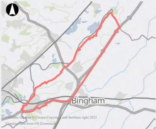
This LAU is located within the regional character area of the South Nottinghamshire Farmlands. The landscape is largely rural, comprising arable agricultural land. The western edge of the LAU is influenced by substantial built-form from the village of Radcliffe on Trent. Smaller villages of Newton and East Bridgford are located centrally and the historic rural village of Kneeton is situated close to the River Trent to the north-east. Bridgford Street and A46 Fosse Way form the main road infrastructure through the landscape with the rest of the road network formed by rural lanes. RAF Syerston is located at the north-eastern extent of the LAU. Landform comprises an escarpment with a steeply sloping northern edge down to the River Trent and a more gentle slope to the south to the A46, forming a broad plateau on which Kneeton Road is located. Land use comprises predominantly arable agricultural land beyond settlement edges, with fields of medium to large scale and boundaries formed by hedgerows. Field boundaries are often fragmented and contain few hedgerow trees. Woodland cover is confined to small-scale copses at the north-eastern edge of the LAU and some blocks around settlement edges; due to the lack of woodland cover small copses are often prominent in views. Extensive views are available along and across the River Trent valley from Shelford Road and Oatfield Lane.
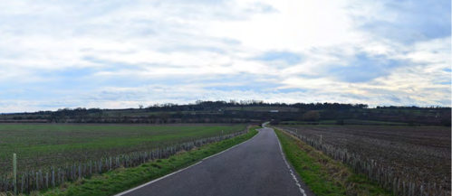
Key characteristics
LAU J is defined by the following key characteristics:
- Steep escarpment landform along the northern edge of the LAU.
- Modern agricultural landscape.
- Lack of woodland making smaller copses prominent.
Future baseline
LP1 Policy 22 Strategic Allocation at Former RAF Newton includes planning applications with permission granted. The applications would introduce commercial development to the north-west of Bingham.
LP2 Policy 5.2 Housing Allocation – Land adjacent Grooms Cottage, Radcliffe on Trent includes planning applications with permission granted. The applications would introduce housing to the east of Radcliffe on Trent.
LP2 Policy 5.3 Housing Allocation – Land off Shelford Road, Radcliffe on Trent includes planning applications with permission granted. The applications would introduce housing to the east of Radcliffe on Trent.
LP2 Policy 5.4 Housing Allocation – Land north of Grantham Road, Radcliffe on Trent includes planning applications with permission granted. The applications would introduce housing to the east of Radcliffe on Trent.
LP2 Policy 8.1 Housing Allocation – Land between Butt Lane and Closes Side Lane, East Bridgford includes a planning application with permission granted. The application would introduce housing to the south-east of East Bridgford.
LP2 Policy 8.2 Housing Allocation – Land south of Butt Lane, East Bridgford includes planning applications with permission granted. The applications would introduce housing to the south-east of East Bridgford.
Landscape sensitivity
Landscape value
| Factor | Value |
|---|---|
| Natural heritage | The landscape has a distinctive landform comprising steep slopes down to the River Trent valley and more gentle slopes to the south. |
| Cultural heritage | The area includes a number of historic rural villages. Agricultural land is predominantly modern in scale and pattern. |
| Landscape condition | The landscape is in moderate condition with evidence of fragmented hedgerows around large-scale arable land use. |
| Associations | The landscape does not have any particular connections to important people, events or the arts. |
| Distinctiveness | The LAU is formed by a distinctive landform that also affords distinctive views across the Trent Valley which is valued locally. |
| Recreational | The LAU is well connected by public right of way routes around East Bridgford and Kneeton. The rest of the LAU is largely inaccessible and not well connected by public right of way routes. There are no further designated recreational routes within the LAU. |
| Perceptual (Scenic) | The LAU has a combination of enclosed and longer distance views afforded by the undulating topography. Views frequently include modern or built-form features that are not typically considered scenic. |
| Perceptual (wildness and tranquillity) |
The LAU contains expansive views, however they frequently contain modern or built-form features that are not typically considered scenic. |
| Functional | The LAU is primarily an agricultural landscape but is typical in nature / production. |
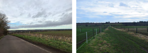
The LAU is not covered by any landscape designations. The value attached to the landscape of LAU J has been considered in the table below against the factors defined in Table 3 of the methodology in Appendix A.
The LAU is not covered by any statutory or local landscape designations. Its value is recognised locally due to its distinctive landform and long-distance views afforded. The LAU is a transitional landscape between LAU K: Aslockton Village Farmlands and LAU N: Trent Valley Washlands and is connected to both through views and its distinctive landform. The LAU is not particularly well connected by public right of way routes reducing its overall accessibility but contains scenic qualities for road users and those who live in the village in a rural setting. The value is therefore considered to be medium.
Susceptibility to change
The LAU has an overarching rural character, though urban influences impact this character locally throughout the
area. The visibility of built-form in views of the wider landscape also impacts the sense of ruralness.
The following features and characteristics of the landscape are particularly susceptible to solar farm development:
- Steep escarpment and distinctive landform with exposed slopes.
The distinctiveness of the landform and exposed slopes, which is a key characteristic of the LAU, increases the
susceptibility. The modern character of agricultural land and urban influences decrease the susceptibility. Overall, the
susceptibility is judged to be medium.
Sensitivity
The landscape is judged to be of medium sensitivity as a result of its medium value and medium susceptibility to change.
Landscape Capacity
The LAU covers an area of approximately 2,700 hectares. The overall scale of the LAU is large however its topography results in exposed slopes, decreasing the potential for solar farm development to be sensitively integrated in the landscape. There is potential for very small to small scale developments which are more likely to be able to be integrated to smaller isolated parcels of land away from recreational receptors, road users and residents for which the exposed topography comprising agricultural land is a key characteristic of
the landscape.
| LAU Name | Sensitivity | Very small scale - less than 5 hectares | Small scale - 6 - 30 hectares | Medium scale 31 - 60 hectares | Large scale 61 - 100 hectares | Very large scale - over 100 hectares |
|---|---|---|---|---|---|---|
| LAU J: East Bridgford Escarpment Farmland |
Medium | High | Moderate | Low | Low | See Appendix A, Para. A.1.6.2 |
Key design principles
The LAU includes low hedgerows, exposed slopes, rural settlements, and fragmented pattern. Mitigation principles 1, 5, 6 and 7 are therefore considered key to aiding the integration of any future solar development proposals within the LAU.
Hedgerows across the majority of large-scale arable land within the LAU are low or do not contain hedgerow trees. Hedgerow
restoration including incorporation of hedgerow trees and relaxed management routines could have benefits for landscape character
and provide screening benefits within the LAU, reducing the potential visual impacts of development.
Settlements across the landscape have connections to the wider rural landscape that are valued by local communities and integral to
the character of the settlements. Intervisibility between settlements and the immediate environs should therefore be considered and
introduction of urbanising features avoided.
The unique landform of the LAU including steep escarpment to the north and gentler slopes to the south results in views of exposed
hillside which should be avoided for development. Development would instead be more suitable in lower lying areas where there is
greater potential for visual screening and integration within the LAU.
LAU K: Aslockton Village Farmland
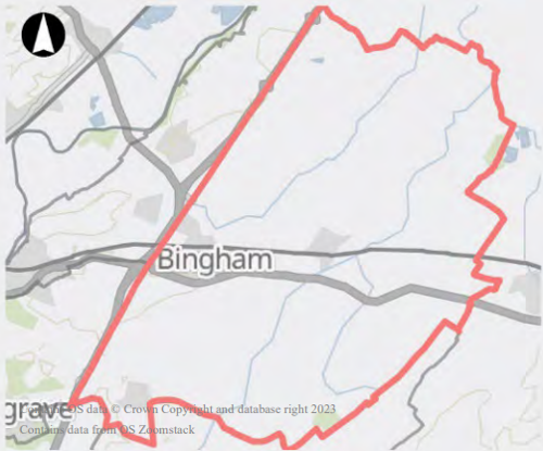
This LAU is located within the regional character area of the South Nottinghamshire Farmlands. The landscape is largely rural, comprising predominantly arable agricultural land. Bingham is the largest settlement within the LAU with the rest comprising small dispersed rural settlements. The A52 runs through the centre of the LAU connecting Bingham with Grantham to the south-east, and the A46 runs along the north-west boundary of the LAU, though its influence on the area is limited. Landform comprises a series of outcrops and thin bands of low-lying alluvial levels following rivers; the thin bands following rivers such as the River Smite and River Devon makes them difficult to discern in the landscape due to the surrounding raised levels. Land use comprises predominantly arable land with pasture adjacent to villages. Where villages are situated close to each other, pasture often extends between creating larger areas of smaller scale field patterns. The scale of fields ranges from small scale adjacent villages to large-scale modern agricultural fields in open countryside. Field boundaries are formed by hedgerows and are often fragmented in larger agricultural fields and intact around small-scale pasture. Woodland is confined to small irregular blocks scattered throughout and higher concentrations adjacent rural villages. Expansive views are available across the landscape, particularly to the south of the LAU and pylons are a constant feature due to the topography.
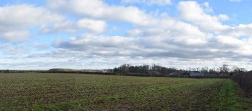
Key characteristics
LAU K is defined by the following key characteristics:
- Dispersed settlement.
- Modern agricultural landscape.
- Commuter town of Bingham.
- Small woodland blocks scattered throughout.
Future baseline
LP1 Policy 21 Strategic Allocation at North of Bingham includes planning applications with permission granted. The applications would introduce industrial development to the north-east of Cropwell Bishop.
LP2 Policy 7 Housing Allocation – Land east of Church Street, 52 Cropwell Bishop includes planning applications with permission granted. The applications would introduce housing to the north of Cropwell Bishop.
LP2 Policy 15 Employment Development – Chapel Lane Bingham (east) includes a planning application with permission granted. The application would introduce a leisure centre, community hall and office building and associated infrastructure to the north-east of Bingham.
Landscape sensitivity
Landscape value
The LAU is not covered by any landscape designations. The value attached to the landscape of LAU K has been considered in the table below against the factors defined in Table 3 of the methodology in Appendix A.
| Factor | Value |
|---|---|
| Natural heritage | The landscape has a number of watercourses, though they are difficult to discern within the landscape due to the topography. |
| Cultural heritage | The area includes a number of historic rural villages. Church towers and spires form prominent features within the landscape due to the landform. Agricultural land is predominantly modern in scale and pattern, though smaller scale pasture and historic field pattern is present adjacent to villages. |
| Landscape condition | The landscape is in moderate condition with evidence of fragmented hedgerows around large-scale arable land use. |
| Associations | The landscape does not have any particular connections to important people, events or the arts. |
| Distinctiveness | The LAU is typical of a rural agricultural landscape. |
| Recreational | The LAU is relatively well connected by public right of way routes connecting smaller rural villages. The Grantham Canal intersects a small section of the LAU to the west adjacent to Cropwell Butler and Cropwell Bishop. |
| Perceptual (Scenic) | The LAU affords long distance views across the landscape, though pylons are a frequent feature of views due to the topography. Smaller scale, scenic views are often available at the fringes of villages. |
| Perceptual (wildness and tranquillity) |
The LAU has a moderate sense of tranquillity due to the small scale of rural villages and expanse of agricultural land in between. Presence of urban features such as pylons and the modern scale of agriculture reduce the perception of wildness. |
| Functional | The LAU is primarily an agricultural landscape but is typical in nature / production. |
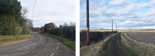
The LAU is not covered by any statutory or local landscape designations. Its value is recognised locally due to its levels of tranquillity, and historic rural villages. The LAU is relatively well connected by public right of way routes providing users with views across a typical rural landscape which is modern in character, particularly further away from villages. The value is therefore considered to be medium.
Susceptibility to change
The LAU has an overarching rural character with settlement dispersed throughout, the area around Bingham is impacted by the scale of the settlement and built-form.
The following features and characteristics of the landscape are particularly susceptible to solar farm development:
- Rural and tranquil character.
Whilst the distinctiveness of the landform and exposed slopes increase the susceptibility, the modern agricultural landscape and urban influences decrease the susceptibility. Overall, the susceptibility is judged to be medium.
Sensitivity
The landscape is judged to be of medium sensitivity as a result of its medium value and medium susceptibility to change.
Landscape Capacity
The LAU covers an area of approximately 10,000 hectares. The very large size of the LAU and dispersed nature of settlement affords potential for well-designed solar farm development. Careful consideration of settlements connection to the rural landscape should be given to minimise potential impacts.
| LAU Name | Sensitivity | Very small scale - less than 5 hectares | Small scale - 6 - 30 hectares | Medium scale 31 - 60 hectares | Large scale 61 - 100 hectares | Very large scale - over 100 hectares |
|---|---|---|---|---|---|---|
| LAU K: Aslockton Village Farmland |
Medium | High | High | High | High | See Appendix A, Para. A.1.6.2 |
Key design principles
The LAU includes rural settlements, and fragmented pattern. Mitigation principles 6 and 7 are therefore considered key to aiding the integration of any future solar development proposals within the LAU.
Settlements across the landscape have connections to the wider rural landscape that are valued by local communities and integral to the character of the settlements. Intervisibility between settlements and the immediate environs should therefore be considered and
introduction of urbanising features avoided.
Due to areas of fragmented field boundaries within the LAU, opportunities for restoration of landscape pattern should be considered in any development proposals.
LAU L: Attenborough Wetlands

This LAU is located within the regional character area of the Trent and Soar Valley. The landscape comprises a mix of arable and riverside pasture. Barton, a small rural village, is located centrally within the LAU and Thrumpton is located at the western edge. The A453 Remembrance Way runs along a section of the southern boundary of the LAU, with road infrastructure across the rest of the area limited to rural lanes around Barton and Thrumpton. Landform comprises the broad, low-lying river corridor of the River Trent which is enclosed by steep wooded ridges. Land use comprises a mix of large-scale arable land, riverside pasture, small scale pasture and horse paddocks adjacent to the rural villages and estate parkland surrounding Thrumpton which is associated with Thrumpton Hall. There are
higher concentrations of vegetation cover around Thrumpton Hall and to the north around riverside pasture. The river corridor is vegetated and provides a continuous corridor of mature vegetation along the northern boundary. Views are enclosed by the river corridors, wooded slopes around Thrumpton and north of Barton. To the south of Barton open views are available to the south-east increasing the influence of urban features such as the A453 Remembrance Way and pylons
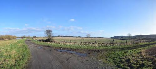
Key characteristics
LAU L is defined by the following key characteristics:
- River Trent.
- Riverside pasture.
- Thrumpton Hall and parkland.
- Wooded valley slopes.
Future baseline
There are no allocated sites with planning permission granted that would influence the future baseline of the LAU.
Landscape sensitivity
Landscape value
The LAU is not covered by any landscape designations. The value attached to the landscape of LAU L has been
considered in the table below against the factors defined in Table 3 of the methodology in Appendix A.
| Factor | Value |
|---|---|
| Natural heritage | The landscape is characterised by the River Trent which is valued locally as a natural feature. |
| Cultural heritage | The area includes the historic villages of Barton and Thrumpton within which Thrumpton Hall and associated parkland is situated. |
| Landscape condition | The landscape is in moderate condition with evidence of fragmented hedgerows around large-scale arable land, though smaller scale riverside meadow areas are present and are intact. |
| Associations | The landscape does not have any particular connections to important people, events or the arts. |
| Distinctiveness | The LAU is distinctive due to the River Trent, its valley landform and wooded ridges. |
| Recreational | The LAU has a few public right of way routes that extend out from Barton and one route that connects Barton and Thrumpton. Though limited in overall number, the routes are valued locally as they provide access to the River Trent. |
| Perceptual (Scenic) | The LAU affords scenic views along the River Trent and of the enclosed river valley. There are however, modern influences such as large scale built-form outside the LAU which are visible (Industrial units, A453 Remembrance Way and pylons). |
| Perceptual (wildness and tranquillity) |
The LAU has some sense of tranquillity adjacent to the rural villages and in enclosed areas of the valley. The exposed areas have lower levels due to modern influences outside the LAU. Enclosed areas of the river valley with wooded ridges have a moderate sense of wildness. |
| Functional | The LAU is primarily an agricultural landscape but is typical in nature / production. |

The LAU is not covered by any statutory or local landscape designations. Its value is recognised locally due to its
connection to the River Trent and access provided, the LAU also has scenic qualities which are valued by residents of
the historic villages of Thrumpton and Barton. Public right of way routes are limited overall throughout the LAU but
provide access to the River Trent which is valued for its scenic qualities. The value is therefore considered to be
medium.
Susceptibility to change
The LAU has an overarching rural character, though external urban influences are present. Small villages retain close connections to the rural landscape despite the surrounding urban features.
The following features and characteristics of the landscape are particularly susceptible to solar farm development:
- Overall small scale of the landscape.
- Riverside pasture.
- Historic villages with connection to surrounding rural landscape.
Whilst the distinctiveness of the landform and exposed slopes increase the susceptibility, the modern agricultural landscape and urban influences decrease the susceptibility. Overall, the susceptibility is judged to be high.
Sensitivity
The landscape is judged to be of high sensitivity as a result of its medium value and high susceptibility to change.
Landscape Capacity
The LAU covers an area of approximately 400 hectares. The small size of the LAU and its high sensitivity would afford the LAU potential for very small scale solar farm development. Some small scale developments could be accommodated provided they were well-designed and sited appropriately within he LAU.
Medium or large scale solar developments would be likely to result in substantial degradation of the overall character of the LAU due to the proportion of the LAU required.
| LAU Name | Sensitivity | Very small scale - less than 5 hectares | Small scale - 6 - 30 hectares | Medium scale 31 - 60 hectares | Large scale 61 - 100 hectares | Very large scale - over 100 hectares |
|---|---|---|---|---|---|---|
| LAU L: Attenborough Wetlands | Medium | High | Moderate | Low | Low | See Appendix A, Para. A.1.6.2 |
Key design principles
The LAU includes exposed slopes, rural settlements and historic assets. Mitigation principles 3, 5 and 6 and are therefore considered
key to aiding the integration of any future solar development proposals within the LAU.
The LAU contains historic assets including church towers and spires that have intervisibility within the landscape. These views and setting of assets should be considered when siting solar development within the LAU.
The valley topography at the fringes of the LAU results in areas of exposed slopes which should be avoided for development. Development would instead be more suitable in lower lying areas where there is greater potential for visual screening and integration
within the LAU.
Settlements across the landscape have connections to the wider rural landscape that are valued by local communities and integral to
the character of the settlements. Intervisibility between settlements and the immediate environs should therefore be considered and
introduction of urbanising features avoided.
LAU M: Soar Valley Farmlands

This LAU is located within the regional character area of the Trent and Soar Valley. The landscape comprises rural pasture land adjacent to the River Soar. Settlement is generally linear and confined to the higher ground along the eastern boundary of the LAU including, Ratcliffe on Soar, Kingston on Soar, Normanton on Soar and Sutton Bonington, the latter being the largest settlement within the area. Landform comprises the low-lying narrow valley landform of the River Soar with the Midland Main Line railway standing out locally as it is set on a raised embankment. Land use is predominantly riverside pasture, though some areas of arable are present, particularly at the northern and southern extents of the LAU. Fields are generally medium in scale with boundaries formed by intact hedgerows with frequent hedgerow trees. Woodland is confined to small clusters around villages and linear belts along field boundaries with more regular vegetation following the River Soar corridor. Views are enclosed by the river valley and frequently include urban influences; pylons due to the low-lying landform; the Midland Main Line railway due to its raised embankment; and village fringes due to the position of settlement of elevated topography.
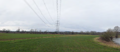
Key characteristics
LAU M is defined by the following key characteristics:
- River Soar.
- Linear settlement on raised landform.
- Midland Main Line railway.
- Riverside pasture.
Future baseline
There are no allocated sites with planning permission granted that would influence the future baseline of the LAU.
Landscape sensitivity
Landscape value
The LAU is not covered by any landscape designations. The value attached to the landscape of LAU M has been considered in the table below against the factors defined in Table 3 of the methodology in Appendix A .
| Factor | Value |
|---|---|
| Natural heritage | The landscape is characterised by the River Soar which is value locally as a natural feature. |
| Cultural heritage | The area includes the historic villages of Ratcliffe on Soar, Kingston on Soar, Normanton on Soar and Sutton Bonington. Sutton Bonington has clearly visible connections to the wider landscape with designed landscape visible adjacent Sutton Bonington Hall. |
| Landscape condition | The landscape is in moderate condition with evidence of fragmented hedgerows around large-scale arable land as though smaller scale riverside meadow areas are present and are generally in good condition. |
| Associations | The landscape does not have any particular connections to important people, events or the arts. |
| Distinctiveness | The LAU is distinctive due to the River Soar, its valley landform and linear historic villages and riverside pasture throughout. |
| Recreational | The LAU has a few public right of way routes that extend out from villages connecting to a route that runs alongside the River Soar. The Midshires Way intersects the LAU north of Sutton Bonington. Routes are valued locally as they provide access to the River Soar. |
| Perceptual (Scenic) | The LAU affords scenic views along the River Soar, though modern and built-form influences are commonplace such as villages and pylons which are prominent due to the low-lying landform. |
| Perceptual (wildness and tranquillity) |
The LAU has some sense of tranquillity adjacent to the rural villages and in enclosed areas of the valley. Overall levels of tranquillity and wildness are reduced however due to the presence of built form and modern influences. |
| Functional | The LAU is primarily an agricultural landscape but is typical in nature / production. |
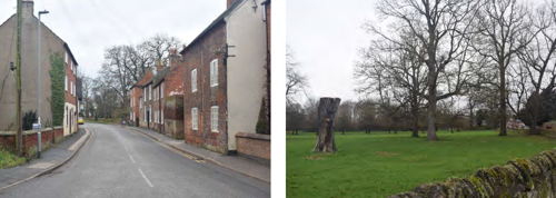
The LAU is not covered by any statutory or local landscape designations. Its value is recognised locally due to its connection to the River Soar and access provided. The LAU has some scenic qualities but also contains frequent views of built-from and infrastructure. The LAU also contains a number of historic villages with are closely connected to the river valley landscape. The value is therefore considered to be medium.
Susceptibility to change
The LAU has an overarching rural character which is heavily influenced by the River Soar and adjacent pasture. Due to its narrow landform urban influences are frequent throughout.
The following features and characteristics of the landscape are particularly susceptible to solar farm development:
- Overall small scale of the landscape.
- Riverside pasture.
- Historic villages with connection to surrounding rural landscape.
Whilst the distinctiveness of the landform and exposed slopes increase the susceptibility, the modern agricultural landscape and urban influences decrease the susceptibility. Overall, the susceptibility judged to be high.
Sensitivity
The landscape is judged to be of high sensitivity as a result of its medium value and high susceptibility to change.
Landscape Capacity
The LAU covers an area of approximately 800 hectares. The small size and narrow nature of the LAU and its high sensitivity would afford the LAU capacity for very small scale solar farm development. Some small scale developments could be accommodated provided they were well-designed and sited appropriately within he LAU. Medium or large scale solar developments would be likely to result in substantial degradation of the overall character of the LAU.
| LAU Name | Sensitivity | Very small scale - less than 5 hectares | Small scale - 6 - 30 hectares | Medium scale 31 - 60 hectares | Large scale 61 - 100 hectares | Very large scale - over 100 hectares |
|---|---|---|---|---|---|---|
| LAU M: Soar Valley Farmlands | Medium | High | Moderate | Low | Low | See Appendix A, Para. A.1.6.2 |
Key design principles
The LAU includes rural settlements and historic assets. Mitigation principles 5 and 6 and are therefore considered key to aiding the
integration of any future solar development proposals within the LAU.
The LAU contains historic assets including church towers and spires that have intervisibility within the landscape. These views and setting of assets should be considered when siting solar development within the LAU.
Settlements across the landscape have connections to the wider rural landscape that are valued by local communities and integral to
the character of the settlements. Intervisibility between settlements and the immediate environs should therefore be considered and
introduction of urbanising features avoided.
LAU N: Trent Valley Washlands

This LAU is located within the regional character area of the Trent Washlands. The landscape comprises arable, pasture and nature
conservation use alongside the River Trent. Settlement includes Adbolton, Bassingfield, Holme Pierrepont and Shelford. The western extent of the LAU is dominated by Holme Pierrepont Country Park and Skylarks Nature Reserve, comprising large bodies of water both naturalistic and clearly man-made and surrounded by areas of woodland. The area around Shelford comprises medium- to large-scale arable land with woodland blocks scattered throughout. The north-eastern extent of the LAU comprises riverside pasture and linear belts of woodland across the narrow valley. Landform across the LAU comprises the narrow low-lying River Trent valley. Land use is a mix of recreational and nature conservation, medium to large-scale arable and small-scale riverside pasture. The landscape is generally intact with some evidence of fragmentation at arable fields around Shelford. Views comprise enclosed scenic views along the River Trent at the
north-eastern extent of the LAU and views enclosed by woodland throughout the western extent of the LAU.
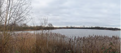
Key characteristics
LAU N is defined by the following key characteristics:
- River Trent.
- Valley landform.
- Skylarks Nature Reserve.
- Holme Pierrepont Country Park.
- Wooded slopes and areas of exposed slopes.
Future baseline
LP2 Policy 5.1 Housing Allocation – Land north of Nottingham Road, Radcliffe on Trent includes planning applications with permission granted. The applications would introduce housing and employment land use and associated infrastructure to the west of Radcliffe on Trent.
LP2 Policy 15 Employment Development – Land north of Nottingham Road, Radcliffe on Trent includes a planning application with permission granted. The application would introduce housing and employment land use and associated infrastructure to the west of Radcliffe on Trent.
22/01511/FUL: Erection of solar photovoltaic farm including fencing, internal service tracks, inverter and transformer stations, cabling, CCTV, landscaping and customer substation and ancillary cabins, at land south of Radcliffe Road, Holme Pierrepont, Nottinghamshire. (7.1 ectares in size).
Landscape sensitivity
Landscape value
The LAU is not covered by any landscape designations. The value attached to the landscape of LAU N has been
considered in Table 31 below against the factors defined in Table 3 of the methodology in Appendix A .
| Factor | Value |
|---|---|
| Natural heritage | The landscape is characterised by the River Trent which is valued locally as a natural feature. The washlands also contain restored landscape areas with naturalistic features that are valued. |
| Cultural heritage | The area includes restored gravel pits reflecting he area’s history where sand and gravel has been quarried for hundreds of years. |
| Landscape condition | The landscape is in good condition. It contains some degradation around large scale arable areas but riverside pasture and restored areas are well managed. |
| Associations | The landscape does not have any particular connections to important people, events or the arts. |
| Distinctiveness | The LAU is distinctive due to the River Trent, its valley landform and wooded slopes. |
| Recreational | The LAU has few public right of way routes overall, though the landscape is accessible due to the recreational land use around Holme Pierrepont and the Trent Valley Way which intersects the LAU. |
| Perceptual (Scenic) | The LAU affords scenic views along the River Trent, as well as scenic spots around Syklarks Nature Reserve with are popular for bird watching. |
| Perceptual (wildness and tranquillity) |
The LAU has some sense of tranquillity and wildness due to the restored habitats and narrow enclosed valley. Levels are lower at the western extent of the LAU due to the proximity to the urban fringe of West Bridgford and Radcliffe on Trent. |
| Functional | The LAU provides functionality as a recreational, nature conservation and productive landscape. |
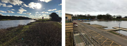
The LAU is not covered by any statutory or local landscape designations. Its value is recognised locally due to its connection to the River Trent, scenic qualities and recreational access to the nature reserve, water sports centre and River Trent Valley Way. The LAU has limited public right of way routes but contains a number of designed routes through restored areas of landscape with ecological value recognised through the nature reserve. The value is therefore medium.
Susceptibility to change
The overarching character of the LAU is influenced by the River Trent and its valley landform the area contains a mix of land uses.
The following features and characteristics of the landscape are particularly susceptible to solar farm development:
- Overall small scale of the landscape.
- Restored landscape.
- Recreational access to the landscape.
Whilst the distinctiveness of the landform and exposed slopes increase the susceptibility, the modern agricultural landscape and urban influences decrease the susceptibility. Overall, the susceptibility is judged to be high.
The following areas have lower susceptibility:
- The area south of the A52 which reflects the overall landform of the LAU but has a higher concentration of modern influences.
Sensitivity
The landscape is judged to be of high sensitivity as a result of its medium value and high susceptibility to change.
Landscape Capacity
The LAU covers an area of approximately 1800 hectares. The relatively small size and narrow nature of the LAU and its high sensitivity would afford the LAU capacity for very small scale solar farm development. Some small scale developments could be accommodated provided they were well-designed and sited appropriately within the LAU (away from areas of higher sensitivity within the LAU such as the nature reserve). Medium or large-scale solar developments would be likely to result in substantial degradation of the overall character of the LAU.
| LAU Name | Sensitivity | Very small scale - less than 5 hectares | Small scale - 6 - 30 hectares | Medium scale 31 - 60 hectares | Large scale 61 - 100 hectares | Very large scale - over 100 hectares |
|---|---|---|---|---|---|---|
| LAU N: Trent Valley Washlands | Medium | High | Moderate | Low | Low | See Appendix A, Para. A.1.6.2 |
Key design principles
The LAU includes exposed slopes and rural settlements. Mitigation principles 5 and 6 and are therefore considered key to aiding the
integration of any future solar development proposals within the LAU.
The valley topography at the fringes of the LAU results in areas of exposed slopes which should be avoided for development. Development would instead be more suitable in lower lying areas where there is greater potential for visual screening and integration
within the LAU.
Settlements across the landscape have connections to the wider rural landscape that are valued by local communities and integral to
the character of the settlements. Intervisibility between settlements and the immediate environs should therefore be considered and
introduction of urbanising features avoided.
6. Summary Table
A summary of the findings and judgements of the study for each LAU. Additional information is shown in Appendix C.
| LAU Name | Value | Susceptibility | Sensitivity | Very small scale - less than 5 hectares | Small scale - 6 - 30 hectares | Medium scale 31 - 60 hectares | Large scale 61 - 100 hectares | Very large scale - over 100 hectares |
|---|---|---|---|---|---|---|---|---|
| LAU A: Gotham and West Leake Wooded Hills and Scarps |
Medium | Medium | Medium | High | Moderate | Moderate | Low | See Appendix A, Para. A.1.6.2 |
| LAU B: East Leake Rolling Farmland | Medium | Medium | Medium | High | High | High | Moderate | See Appendix A, Para. A.1.6.2 |
| LAU C: Widmerpool Clay Wolds | Medium | Medium | Medium | High | High | High | Moderate | See Appendix A, Para. A.1.6.2 |
| LAU D: Cotgrave Wooded Clay Wolds | Medium | Medium | Medium | High | Moderate | Moderate | Low | See Appendix A, Para. A.1.6.2 |
| LAU E: Vale of Belvoir | Medium | Medium | Medium | High | High | High | High | See Appendix A, Para. A.1.6.2 |
| LAU F: Clifton Slopes | Low | Low | Low | High | Moderate | Low | Low | See Appendix A, Para. A.1.6.2 |
| LAU G: Ruddington Alluvial Farmland | Low | Low | Low | High | High | High | Moderate | See Appendix A, Para. A.1.6.2 |
| LAU H: Mickleborough Fringe | Medium | Low | Low | High | Moderate | Low | Low | See Appendix A, Para. A.1.6.2 |
| LAU I: Cotgrave and Tollerton Village Farmland | Medium | Low | Medium | High | High | High | High | See Appendix A, Para. A.1.6.2 |
| LAU J: East Bridgford Escarpment Farmland | Medium | Medium | Medium | High | Moderate | Low | Low | See Appendix A, Para. A.1.6.2 |
| LAU K: Aslockton Village Farmland | Medium | Medium | Medium | High | High | High | High | See Appendix A, Para. A.1.6.2 |
| LAU L: Attenborough Wetlands | Medium | High | High | High | Moderate | Low | Low | See Appendix A, Para. A.1.6.2 |
| LAU M: Soar Valley Farmlands | Medium | High | High | High | Moderate | Low | Low | See Appendix A, Para. A.1.6.2 |
| LAU N: Trent Valley Washlands | Medium | High | High | High | Moderate | Low | Low | See Appendix A, Para. A.1.6.2 |
Appendices
Appendix A - Detailed methodology
Contents
- A1.1 Guidance and industry standards
- A1.2 Key definitions
- A1.3 Process
- A1.4 Step 1 – Defining the purpose and scope of the landscape sensitivity assessment
- A1.5 Step 2 - Gathering information to inform the landscape sensitivity assessment
- A1.6 Step 3 - Assess landscape sensitivity of LAUs and determine indicative landscape capacity
- A1.7 Step 4 - Report and recommendations
- A1.8 Desk study and fieldwork – standard approach
A1.1 Guidance and industry standards
This methodology primarily draws upon Natural England’s An approach to landscape sensitivity assessment – to inform spatial planning and land management as the most relevant and recently published approach in relation to spatial planning accounting for landscape sensitivity at a strategic level. This guidance document allows a more strategic assessment of landscape sensitivity, often across a very large area, with regard to the principle of a particular type of change scenario.
The Landscape Institute and Institute of Environmental Management and Assessment’s Guidelines for Landscape and Visual Impact Assessment, Third edition (GLVIA3) has also informed the approach set out by Natural England and is frequently cross-referenced throughout.
Other guidance, clarifications and technical notes relevant to this study area as follows:
- The Countryside Agency and Scottish Natural Heritage’s Landscape Character Assessment Guidance
- The Countryside Agency and Scottish Natural Heritage’s Topic paper 6: Techniques and Criteria for Judging Capacity and Sensitivity, a discussion
- Landscape Institute’s Technical Guidance Note (TGN) 02/21: Assessing landscape value outside national designations
- Landscape Institute’s Technical Guidance Note (TGN) 04/20: Infrastructure
A1.2 Key definitions
A full list of definitions is provided in section A.1.9. However, there are a number of key terms derived from industry standard guidance that are outlined upfront for clarity throughout the methodology.
Landscape Assessment Unit
Landscape Assessment Units (LAU) are areas of broadly similar characteristics which are used as reporting units in this study to assess sensitivity and landscape capacity.
LAUs are derived from the Draft Policy Zones (DPZ) which were developed and presented in the Greater Nottingham Landscape Character Assessment and are defined as "an individual area of character". This character assessment was published in 2009 and therefore a review and update, where applicable, was required to ensure suitability for this study.
Landscape value
GLVIA3 defines landscape value as the relative value or importance attached to different landscapes by society on account of their landscape qualities.
Paragraph 174 of the National Planning Policy Framework makes reference to protecting and enhancing valued landscapes in a manner commensurate with their statutory status or identified quality in the development plan. Landscape Institute Technical Guidance Note (TGN) 02/21: Assessing landscape value outside national designations defines a ‘valued landscape’ as an area identified as having sufficient landscape qualities to elevate it above other more everyday landscapes.
Landscape susceptibility
Landscape susceptibility is the degree to which a defined landscape and its associated visual qualities and attributes might respond to the specific development type, development scenario or other change without undue negative effects on landscape character and the visual resource. This definition is derived from An approach to landscape sensitivity assessment – to inform spatial planning and land management.
Landscape sensitivity
Landscape sensitivity is a term applied to landscape character and the associated visual resource, combining judgements of their susceptibility to the specific development type, development scenario or other change being considered together with the value(s) related to that landscape and visual resource. Landscape sensitivity may be regarded as a measure of the resilience, or robustness, of a landscape to withstand specified change arising from development types or land management practices, without undue negative
effects on the landscape and visual baseline and their value. This definition is derived from An approach to landscape sensitivity assessment – to inform spatial planning and land management.
Landscape capacity
Landscape capacity refers to the amount of specified development or change which a particular landscape and the associated visual resource is able to accommodate without undue negative effects on its character and qualities. This description is derived from An approach to landscape sensitivity assessment – to inform spatial planning and land management. This guidance also notes that there has been confusion over the years concerning the use of the words ‘sensitivity’ and ‘capacity’ and that they have often been used
interchangeably. It questions whether the concept of capacity may be too simplistic when it comes to making complex decisions to inform objectives and guidance regarding place-based planning, design, and management. When dealing with landscapes and change it notes that it is not easy to simply quantify exactly how much development a specific area can accommodate and that many important factors come into play, including professional judgement.
A1.3 Process
The diagram steps below set out the stages that have been followed to prepare the landscape sensitivity and capacity study. It is based on the four-step process outlined in An approach to landscape sensitivity assessment – to inform spatial planning and land management [Natural England 2019].
Step 1 - Defining the purpose and scope of the landscape sensitivity assessment
- Based on the requirements of Rushcliffe Borough Council and specific trends in solar farm development across the Borough.
- Draws upon and co-ordinates with existing studies and planning documents.
Step 2 - Gathering information to inform the landscape sensitivity assessment
- Includes the review, ground truthing and potential refinement of Landscape Assessment Units (LAU) that will be used in the study.
- Includes desk-based study and fieldwork studies.
Step 3 - Assess landscape sensitivity of assessment units and determine indicative capacity
- Follows the process outlined in the methodology to determine judgements on sensitivity and capacity.
- Includes desk-based and fieldwork studies.
Step 4 - Report and recommend
- Includes the collation of findings into a clear and concise report to be used as a tool for future plan-making and decision-making.
- Includes making recommendations for design and mitigation.
Final Deliverable - Landscape Sensitivity and Capacity Study
Final deliverable fit for purpose to inform:
- the review of Local Plan policies;
- the content of supplementary planning documents and guidance notes relating to solar farm development; and
- decisions on planning applications for solar farm development across the borough.
A1.4 Step 1 – Defining the purpose and scope of the landscape sensitivity assessment
A.1.4.1 Aims and objectives
The purpose of the study is to inform the review of Local Plan policies, the content of supplementary planning documents and guidance notes and the determination of planning applications across the Borough.
The main aims of the study were to:
- Provide an assessment of landscape sensitivity of each LAU, specific to solar farm development;
- Provide an indication of the capacity of the landscape to accommodate solar farm development;
- Visually illustrate the sensitivity and capacity of the landscape through spatial mapping;
- Provide guidance for the siting of solar farm development and set principles for appropriate design and mitigation.
The findings of this study do not determine whether planning applications for solar farm development are appropriate but rather provide an indicator of the sensitivity of the landscape to such development by area. An individual assessment of the likely impacts to landscape and visual amenity should be submitted by the applicant as part of their planning submission. This should include details of appropriate mitigation measures to avoid or minimise potential adverse effects and to integrate the development with, and where possible enhance, the landscape. Such measures should align with the design principles outlined in this study.
A.1.4.2 Study area and landscape assessment units (LAU)
Study area
The study area is defined as the borough boundary of Rushcliffe, as illustrated on Figure A1.
Landscape Assessment Units (LAU)
The study is based on the existing Landscape Character area and Draft Policy Zones (DPZ) that were developed as part of the Greater Nottingham Landscape Character Assessment. DPZs are defined as “an individual discrete area of character. It has a unique identity although it shares similar characteristics to other areas within the broader regional area.” As DPZs represent unique character areas at a local scale, they are well aligned with the purposes of this study.
The DPZs which are the subject of this study are outlined below and shown on Figure A2. Whilst the existing DPZs form a logical starting point and reference basis for the assessment, these were published in 2009 and were therefore reviewed and ground-truthed through desk-based study and fieldwork studies, to ensure appropriateness for use. The detail of desk-based and fieldwork studies is outlined in section A.1.8.
A.1.4.2.1 The Nottinghamshire Wolds
- NW01 Gotham and West Leake Wooded Hills and Scarps
- NW02 East Leake Rolling Farmland
- NW03 Widmerpool Clay Wolds
- NW04 Cotgrave Wooded Clay Wolds
A.1.4.2.2 Vale of Belvoir
- BV01 Vale of Belvoir
A.1.4.2.3 South Nottinghamshire Farmlands
- SN01 Clifton Slopes
- SN02 Ruddington Alluvial Farmland
- SN03 Mickleborough Fringe
- SN04 Cotgrave and Tollerton Village Farmland
- SN05 East Bridgford Escarpment Farmland
- SN06 Aslockton Village Farmland
A.1.4.2.4 Trent Valley
- TSV01 Attenborough Wetlands
- TSV02 Soar Valley
A.1.4.2.5 Trent Washlands
- TW01 Trent Washlands: Gamston and Edwalton River Meadowlands
- TW02 Trent Washlands: Polser Brook River Meadowlands
- TW03 Trent Washlands: Holme Pierrepont and Bassingfield Village Farmlands
- TW04 Trent Field River Meadowlands
- TW07 Shelford Village Farmlands
- TW51 Stoke Lock River Meadowlands
- TW055 West Bridgford Recreational Fringe
A1.5 Step 2 - Gathering information to inform the landscape sensitivity assessment
1.1.1 Step 2a – Describe the development types and scenarios to be considered
A.1.5.1.1 (i)Typical solar farm development – to inform landscape sensitivity
This study is focused on solar farm development and a summary of typical solar farm development is outlined below, which was used to inform the assessment. These characteristics of development have been drawn out from planning applications for solar farm development submitted to Rushcliffe Borough Council since 2013.
Solar farm development typically comprises the following features:
- Security or perimeter fencing up to 2.5m in height;
- CCTV cameras on poles up to 4m in height;
- Solar panel arrays up to 3.1m in height;
- Solar panels arranged south-facing at 10-30 degrees with 2 – 6.3m between rows;
- Infrastructure including small-scale buildings for invertors, sub-stations or power storage facilities, typically up to 3m in height;
- Access tracks (typically 4-5m wide); and
- Battery Energy Storage Systems (BESS).
Further detailed analysis of relevant applications submitted to Rushcliffe Borough Council along with a sample of national applications was undertaken to inform detailed descriptions of solar farm development to be assessed.
It is the typical descriptions of solar farm development that were used to inform the sensitivity of each LAU.
A.1.5.1.2 (ii)Parameters of solar farm development – to inform landscape capacity
The description of solar farm developments was further categorised by size to provide an indication of likely landscape capacity. In reality not all solar farm development applications submitted will fall exactly into any one of these defined typologies and in such cases decisions will need to be made to establish which typology most closely represents the proposed development.
The land required for solar farm development in relation power generation is likely decrease over time as technology becomes more efficient. Therefore, categorising typologies by size future proofs the relevance of the study.
Trends in solar farm development applications in the UK are largely driven by government energy and planning policy.
The National Planning Policy Framework (NPPF) outlines the requirement for the transition to a low carbon future and an increase in the supply of renewable energy and is relevant to plan-making and decision-making at all scales.
The overarching National Policy Statement (NPS) for Energy (NPS EN-1); and the NPS for Renewable Energy Infrastructure (NPS EN-3), set out the Government’s ambition to meet net zero by 2050 to achieve a five fold increase in solar PV capacity by 2035, quoting a figure of 70GW.
NPS EN-311 also sets out the threshold for solar farm development considered to be a Nationally Significant Infrastructure Project (NSIP), which for England is set at a generating capacity of 50MW or greater.
There is a clear trend in applications for solar farm development that seeks to maximise the potential productivity of sites in response to this policy and the increasingly favourable market conditions for renewable energy. As demonstrated in Table 1 below, recent planning applications for solar farm development in Rushcliffe have largely been just below the NSIP threshold at 49.9MW generating capacity.
Table 1: Recent solar planning applications received by Rushcliffe Borough Council
| Development Application Number | Power Generation (Megawatts) | Total Size of Site (Hectares) |
|---|---|---|
| 21/00703/FUL | 4.2 | 10.80 |
| 21/02163/SCREIA | 49.9 | 140 (across three parcels of land) |
| 22/00809/FUL | 49.9 | 60.94 |
| 22/00319/FUL | 49.9 | 80.65 |
| 22/00303/FUL | 49.9 | 81.58 |
| 22/01856/SCREIA | Information not available | Information not available |
| 22/01511/FUL | 4.2 | 7.1 |
| 22/02241/FUL | 49.9 | 94.24 |
| 23/00254/FUL | 49.9 | 82 |
| 23/01073/SCREIA | 49.9 | 70 |
| 23/01010/SCREIA | 49.9 | 97 |
| 23/01840/SCREIA | 20 | 48 |
| 24/00161/FUL | 49.9 | 101 |
| 23/02250/FUL | 20 | 56 |
On average solar farm development is considered to require between 2 hectares and 4 hectares of land per 1MW of energy production1 (National Farmers Union - NFU Energy Guide to solar energy and 5 Department for Energy Security & Net Zero (2023), National Policy Statement for Renewable Energy Infrastructure (EN-3). This broadly aligns with applications received by Rushcliffe Borough Council. However, there are anomalies due to field patterns, parcels of land utilised, landform and access, the density of solar panels and their arrangement based on site specific constraints. This means that in reality the size of solar farm development and generating capacity are not always closely linked. Furthermore, as stated above the efficiency of solar panels is improving. Establishing thresholds based purely on generating capacity could in time draw in applications that affect increasingly smaller areas or deliver larger gains for renewable energy. Therefore, it was deemed most appropriate to define parameters primarily based on the size of development with typical generating capacity provided for reference. These thresholds are set out in Table 2 below.
Table 2: Solar farm parameter definitions
| Parameter definition |
Size in hectares (ha) |
Typical generating capacity megawatts (MW) (see note) |
Notes |
|---|---|---|---|
| Very small scale | Less than 5 ha | Between 1.25MW and 2.5MW | This represents solar farm development that may typically fit into 1 to 2 agricultural fields based on scale of agricultural land across Rushcliffe Borough |
| Small scale | 6 to 30 ha | Between 1.5MW and 15MW |
Recent applications within this size range have been submitted to Rushcliffe Borough Council. |
| Medium scale | 31 to 60 ha | Between 7.75MW and 30MW |
There has been one recent screening request for an application within this size range demonstrating the trends in applications to sit at either side of the spectrum and to maximise the potential power generated from sites without exceeding the NSIP threshold. |
| Large scale | 61 to 100 ha | Between 15MW and 49.9MW |
This range represent solar farm development typical of a commercial enterprise looking to generate power up to the threshold of being considered an NSIP (49.9MW). |
| Very large scale (not included in the study) |
Over 100 ha | Over 50MW | Developments of this size are NSIPs and applications for a Development Consent Order (DCO) are determined by the relevant Secretary of State. They are therefore outside the scope of this study, but guidance on how Rushcliffe Borough Council could engage with DCO applications will be provided. |
Note: Approximate generating capacity is based on the average solar farm development requirement of 2 to 4 ha of land per 1MW. The figures provided assume the broadest span of smallest parameter value inefficient development site (i.e. 4ha per MW) to largest parameter value efficient development (i.e. 2ha per MW).
A.1.5.2 Step 2b – Establish and review the landscape and visual baseline, and identify associated value
Establishing the landscape and visual baseline
A list of key criteria has been identified that represents the key characteristics that are likely to be most affected by solar farm development. These criteria are outlined below and categorised by ‘landscape’, ‘aesthetic, perceptual and experiential’ and ‘visual’. This list will be revisited and refined as appropriate during the confirmation of LAUs.
A.1.5.2.1 Landscape
- Field pattern, scale and enclosure
- Landform
- Land cover
- Man-made influences and built-form
- Condition / intactness
- Historic features and cultural heritage
- Settlement distribution and scale
A.1.5.2.2 Aesthetic, Perceptual and Experiential
- Scenic quality and character
- Remoteness and peacefulness and tranquillity
A.1.5.2.3 Visual
- Visibility
- Key views
- Typical receptor types
Identifying associated value of the LAU
Landscape Institute Technical Guidance Note (TGN) 02/21: Assessing landscape value outside national designations (Landscape Institute, 2021) defines landscape value as “the relative value or importance attached to different landscapes by society on account of their landscape qualities”.
For assessing landscape value outside national designations, Landscape Institute Technical Guidance Note
02/21 is now the primary source of guidance. The approach to assessing the value attached to the landscape
has followed a three-stage process:
- Stage 1 identify if the landscape is covered by any landscape designations;
- Stage 2 consider each of the factors listed in Table 1 below which have been developed with reference to Table 1 of TGN 02/21 and are pertinent and most important to understanding its value; and
- Stage 3 make an assessment of the value attached to the landscape and assign value based on a five-point scale, clearly articulating the reasons for these judgements.
An overall conclusion has been drawn on the value attached to the landscape for each Landscape Assessment Unit considering the overall weight of evidence.
Establishing landscape value
Stage 1 – Landscape designations
- Landscape with statutory status or national policy protection: National Park, Area of Outstanding Natural Beauty, or World
Heritage Sites - Local landscape designation, such as Special Landscape Area or Area of Great Landscape Value, supported by policy and a detailed evidence base.
- No relevant designations.
Stage 2 - Define landscape value factors with reference to TGN 02/21
- Natural heritage - Landscape with clear evidence of ecological, geological, geomorphological or physiographic interest which contribute positively to the landscape.
- Cultural heritage - Landscape with clear evidence of archaeological, historical or cultural interest which contribute positively to the landscape.
- Landscape condition - Landscape which is in a good physical state both with regard to individual elements and overall
landscape structure. - Associations - Landscape which is connected with notable people, events and the arts.
- Distinctiveness - Landscape that has a strong sense of identity. Recreational - Landscape offering recreational opportunities where experience of landscape is important.
- Perceptual (Scenic) - Landscape that appeals to the senses, primarily the visual sense.
- Perceptual (wildness and tranquillity) - Landscape with a strong perceptual value notably wildness, tranquillity and/or dark
skies. - Functional - Landscape which performs a clearly identifiable and valuable function, particularly in the healthy functioning of
the landscape.
Value and description
- Very high: A designated landscape with statutory status (National Park or AONB). Valued landscape in the context of NPPF paragraph 174 (a)
- High: A locally designated landscape supported by a detailed evidence base or with other strong indicators of value, which may include other relevant designations such as ancient woodland or conservation areas, with identified quality in the development plan or evidence base. May be considered valued landscape in the context of NPPF paragraph 174(a) with strong supporting
evidence. - Medium: Unlikely to be a designated for landscape quality but may exhibit some indicators of value which are identified in the development plan or evidence base and are important at the community level.
- Low: Not designated for landscape quality and likely to exhibit few indicators of value which are identified in the development plan or evidence base.
- Very low: A landscape dominated by industry or infrastructure or which is damaged or degraded landscape, not designated for landscape quality and not likely to exhibit indicators of value which are identified in the development plan or evidence base.
Valued landscape
The principle of “valued landscape” in England is supported by the NPPF 2021 (Chapter 15). Paragraph 174 requires that planning policies and decisions should contribute to and enhance the natural and local environment by, inter alia, (a) “protecting and enhancing valued landscapes, sites of biodiversity or geological value and soils (in a manner commensurate with their statutory status or identified quality in the development plan)”.
According to paragraph A4.2.11 of TGN 02/21, a ‘valued landscape’ is an area identified as having sufficient landscape qualities to elevate it above other more everyday landscapes. There is therefore a high bar for an area to be considered valued landscape in the context of the NPPF.
Paragraph A4.2.5 of TGN 02/21 states that, “where a landscape has a statutory status, such as a National Park or AONB, it is self-evident that it is a valued landscape”. Therefore, where such landscapes are present within the study area, these have been attributed very high value and are recognised as valued landscapes in the context of the NPPF.
A different approach has been taken to determine whether landscapes outside of nationally designated landscapes can be considered valued landscape in the context of the NPPF. Paragraph A4.2.6 of TGN 02/21 states that the interpretation of ‘identified quality in the development plan’ is not clear and that there are two fundamentally different interpretations that have been adopted by inspectors, which are considered below in more detail:
- It means non-statutory, locally designated landscapes;
- It means any landscape where there is evidence to justify the identification of a ‘valued landscape’. Local designation alone may not be sufficient evidence.
For a landscape without statutory status to be considered valued landscape in the context of the NPPF it must be supported by strong evidence. The study will therefore consider each of the factors set out in Table 2, references in Local Plan policy and evidence base, including whether there are existing local landscape designations in forming an overall judgement. Landscapes with high value may also be considered valued landscape.
A.1.5.3 Step 2c – Identify indicators of susceptibility to be used when assessing landscape and visual
sensitivity to the development types
Tables 4a, 4b and 4c set out typical indicators of higher or lower susceptibility that have been used to determine the overall susceptibility of each LAU. ‘landscape’, ‘aesthetic, perceptual and experiential’ and ‘visual’ criteria are derived from Step 2b. Based on the identification of higher and lower susceptibility indicators within each LAU, each LAU has been determined as high, medium or low susceptibility.
Table 4a: Typical indicators of higher or lower susceptibility based on ‘landscape’ criteria
| Criteria | Indicators of higher susceptibility | Indicators of lower susceptibility |
|---|---|---|
| Field pattern, scale and enclosure |
|
|
| Landform |
|
|
| Land Cover |
|
|
| Man-made influences / Built-form |
|
|
| Condition / Intactness |
|
|
| Historic features and cultural heritage |
|
|
| Settlement distribution and scale |
|
|
Table 4b: Typical indicators of higher or lower susceptibility based on ‘aesthetic, perceptual and experiential’ criteria
| Criteria | Indicators of higher susceptibility | Indicators of lower susceptibility |
|---|---|---|
| Scenic quality and character |
|
|
| Remoteness and Peacefulness / Tranquillity |
|
|
Table 4c: Typical indicators of higher or lower susceptibility based on visual criteria
| Criteria | Indicators of higher susceptibility | Indicators of lower susceptibility |
|---|---|---|
| Visibility |
|
|
| Key Views |
|
|
| Receptor Types |
|
|
A1.6 Step 3 - Assess landscape sensitivity of LAUs and determine indicative landscape capacity
A.1.6.1 Step 3a – Determining sensitivity
The principle of measuring the sensitivity of the landscape of Rushcliffe to solar farm development follows the basic process and broad principles outlined in both GLVIA3 and An approach to landscape sensitivity assessment. This process relies on the assessment of:
- The value attached to the landscape and its visual characteristics.
- The susceptibility of the landscape and visual baseline to a specific change, in this case solar farm development.
- These quantified judgements can then be combined to understand landscape sensitivity.
The sensitivity of each LAU has been defined by combining professional judgements on the value attached to the landscape and its susceptibility to solar farm development supported by a clear evidence base and written narrative in each case.
Table 5 below outlines typical descriptors for each sensitivity type.
| Sensitivity | Typical descriptors |
|---|---|
| Very high | Likely to be LAUs with statutory status or national policy protection with very limited ability to accommodate solar farm development without undue consequences for the maintenance of the baseline situation and/or the achievement of landscape planning policies and strategies. |
| High | Likely to be LAUs which may be locally designated or otherwise supported by a detailed evidence base or landscape with other strong indicators of value with limited ability to accommodate solar farm development without undue consequences for the maintenance of the baseline situation and/or the achievement of landscape planning policies and strategies. |
| Medium | Likely to be LAUs which are not designated for landscape quality but may exhibit some indicators of value and which may have some ability to accommodate solar farm development without undue consequences for the maintenance of the baseline situation and/or the achievement of landscape planning policies and strategies. |
| Low | Likely to be LAUs not designated for landscape quality and likely to exhibit few indicators of value. These LAUs are likely to be able accommodate solar farm development with no or limited undue consequences for the maintenance of the baseline situation and/or the achievement of landscape planning policies and strategies. |
| Very low | Likely to be LAUs of very low value able to accommodate solar farm development without undue consequences for the maintenance of the baseline situation and/or the achievement of landscape planning policies and strategies. |
A.1.6.2 Step 3b – Determining indicative landscape capacity
Providing an indication of the capacity for each LAU to accommodate solar farm development relies upon
further judgements based on the following sources of information:
- The overall sensitivity of the LAU.
- Operational and consented solar farm development within or adjacent to the LAU.
- The overall scale of the LAU.
- Agreed typologies to be assessed.
Indicative capacity has been determined as high, moderate or low and is based on professional judgment
with a clear written narrative in each case The table below outlines typical descriptors for each level of
landscape capacity.
Table 6: Landscape capacity typical descriptors
| Landscape capacity | Typical descriptors |
|---|---|
| High | Combined judgements on the overall sensitivity of the LAU, the amount of existing solar development, and the overall scale of the LAU indicate that it could have potential to accommodate multiple solar farm developments within the defined parameters. Developments should align with the criteria for good design set out in EN-116, guidance set out in Solar Farm Development Planning Guidance17 and the general / LAU specific design principles outlined in this study. |
| Moderate | Combined judgements on the overall sensitivity of the LAU, the amount of existing solar development, and the overall scale of the LAU indicate that it could have potential for some solar farm developments within the defined parameters. Developments should align with the criteria for good design set out in EN-1, guidance set out in Solar Farm Development Planning Guidance and the general / LAU specific design principles outlined in this study. Cumulative impacts are likely and should be focused on in the decision-making process for planning applications. |
| Low | Combined judgements on the overall sensitivity of the LAU, the amount of existing solar development, and the overall scale of the LAU indicate that it has limited potential for solar farm developments within the defined parameters. Developments should align with the criteria for good design set out in EN-1, guidance set out in Solar Farm Development Planning Guidance and the general / LAU specific design principles outlined in this study. Cumulative impacts are likely and should be considered in the decision-making process for applications. |
Indicative capacity for solar farm development is illustrated in a table for each LAU, relating to the parameters identified in Step 2a(ii), Table 2. This report does not cover capacity judgements for very large scale (greater than 100ha) developments however, judgements for large scale (61 – 100ha) developments can be used as a guide to inform decisions for development in excess of 100ha or those which are considered NSIPs.
Addressing cumulative development
This study provides a broad understanding of the likely appropriateness of development proposals in a given area but does not replace the need for cumulative effects to be assessed within any Landscape and Visual Impact Assessment (LVIA).
The process for determining landscape sensitivity and outlining landscape capacity can be used to inform the likelihood of cumulative impacts as demonstrated in Table 6. As a general rule of thumb, LAUs with high capacity are less likely to be affected by cumulative impacts, though this still needs to be assessed on a case-by-case basis. Siting, intervisibility, receptor types and sequential views can all contribute to the perceived sense of development in an area and are all site specific.
A1.7 Step 4 - Report and recommendations
The findings of the study have been consolidated into a clear and concise report written in plain English. The report includes recommendations for design principles which are defined as ‘General Design Principles’ and ‘Key Design Principles’ which are applicable to individual LAUs.
The report follows the structure outlined below:
Introduction
Outlining the Purpose and effective use of the study to inform policy and planning application determinations.
Policy Context
Including review and assessment of the alignment with existing legislation, regulations, national and local policy, SPDs and guidance documents.
Baseline
Descriptions of landscape character areas character extracted from the Nottingham Landscape Character Assessment 2009 but updated where applicable.
Assessment
Judgements on the value, susceptibility and sensitivity will be made. A summary of capacity to solar farm development will be made for each landscape character area. Recommendations for mitigation for development will be made specific to the landscape character area that us being assessed.
General design principles / recommendations for development
Suggestions on appropriate mitigation measures and considerations for development defined as ‘general principles for development’ and an approach to developments that require statutory ES. This section will be highly visual and demonstrate approaches through sketches in relation to development. Guidance on how Rushcliffe Borough Council could engage with DCO applications will also be provided.
Summary of Findings
Provides a summary of the findings of the study and tabulated summary of all judgements.
Appendices
Including Detailed Technical Methodology, Supporting Figures and Evidence Base.
A1.8 Desk study and fieldwork – standard approach
Desk study and fieldwork studies informed Step 2 and 3 of the methodology. The approach to these is outlined below.
Desk study
Reference was made to the prevailing policy framework including local plans and evidence base documents to identify any designated landscapes or features of characteristics of value and their relationship to Rushcliffe.
Other information sources referenced as part of the baseline review included 1:50,000 and 1:25,000 Ordnance Survey mapping, three-dimensional topographical data, and site photographs and aerial photography.
The following sources of information were reviewed to inform the baseline.
- National Character Area profiles
- Greater Nottingham Landscape Character Assessment
- Public Rights of Ways, open access land and recreational areas
- Landscape, nature and heritage designations
- Existing solar farm developments within Rushcliffe
A detailed study of topography was undertaken to understand likely visibility of solar farm development and to inform mapping.
Designations relevant to landscape and visual amenity, nature and heritage were mapped to inform the value attributed to each LAU.
Areas with public access were mapped to inform visual amenity and important views across the landscape which contribute to character, value and therefore sensitivity.
A.1.8.1 Fieldwork surveys
Fieldwork surveys were undertaken in winter 2023 by qualified and experienced landscape architects to record the characteristics, features and views of the study area. The purpose of this fieldwork was to review the existing DPZ boundaries and key characteristics defined in the published landscape character assessments and to identify, record and map characteristics of the landscape not covered by published landscape character assessments.
All fieldwork has been recorded in ESRI Fieldmaps using a combination of predetermined criteria and free text fields to maximise consistency. Attributes recorded as part of the fieldwork surveys contributed to an understanding of the value attached to the landscape and views as set out in Step 2b and an understanding of the susceptibility of the landscape and visual baseline based on the criteria set out in Step 2c. Perceptual qualities of the landscape, such as tranquillity and time depth were also recorded. An example proforma
which was transposed to ESRI Fieldmaps is outlined in Table 8 below and was used during fieldwork surveys.
Fieldwork surveys were also used to identify visual factors and to clarify the extent of important views, taking account of the effect of intervening features such as buildings and vegetation within LAU. Fieldwork was undertaken in winter when deciduous vegetation was not in leaf to represent a worst-case scenario in relation to potential sensitivity to solar farm development.
Fieldwork surveys were used to ground-truth existing published data and to capture photography as an evidence base which will be included within the final report.
Table 7a: Example proforma for fieldwork - Landscape
| Criteria | Is there evidence of indicators of higher susceptibility? |
Is there evidence of indicators of lower susceptibility? |
What are the indicators? |
General Notes | Photography Evidence Reference Number |
|---|---|---|---|---|---|
| Field pattern, scale and enclosure |
Yes / No | Yes / No | - | - | - |
| Landform | Yes / No | Yes / No | - | - | - |
| Land Cover | Yes / No | Yes / No | - | - | - |
| Man-made influences / Built-form |
Yes / No | Yes / No | - | - | - |
| Condition / Intactness | Yes / No | Yes / No | - | - | - |
| Historic features and cultural heritage | Yes / No | Yes / No | - | - | - |
| Settlement distribution and scale |
Yes / No | Yes / No | - | - | - |
Table 7b: Example proforma for fieldwork - Aesthetic, Perceptual and Experiential
| Criteria | Is there evidence of indicators of higher susceptibility? |
Is there evidence of indicators of lower susceptibility? |
What are the indicators? |
General Notes | Photography Evidence Reference Number |
|---|---|---|---|---|---|
| Scenic quality and character |
Yes / No | Yes / No | - | - | - |
| Remoteness and Peacefulness / Tranquillity |
Yes / No | Yes / No | - | - | - |
Table 7c: Example proforma for fieldwork - Visual
| Criteria | Is there evidence of indicators of higher susceptibility? |
Is there evidence of indicators of lower susceptibility? |
What are the indicators? |
General Notes | Photography Evidence Reference Number |
|---|---|---|---|---|---|
| Visibility | Yes / No | Yes / No | - | - | - |
| Key Views | Yes / No | Yes / No | - | - | - |
| Receptor Types | Yes / No | Yes / No | - | - | - |
Appendix B - Future baseline developments
Applications considered as part of the future baseline.
Table 1.1: LP1 Policy 21 Strategic Allocation at North of Bingham
| Planning Reference | Description |
|---|---|
| 10/01962/OUT | Up to 1050 residential dwellings (C3); 15.6 hectares of employment development (B1, B2 and B8); local centre comprising up to 300m sq of retail floor space (A1); primary school (D1); and community centre (D2); a 1.6 hectare mixed use site (B1, B2, B8 and car parking); allotments and open space (including play areas and community park); flood management and drainage works; transport and access works; and ancillary works. |
| 17/02106/REM | Reserved matters application for 317 residential dwellings (phase 1 of the wider approved development as originally approved under application 10/01962/OUT) including details of access, appearance, landscaping, layout and scale of development. |
| 18/01468/REM | Reserved matters submission for 733 residential dwellings (Phase 2 of the wider approved development as originally approved under application 10/01962/OUT) including details of access, appearance, landscaping, layout and scale of development. |
| 18/01750/FUL | Construction of 34 no. industrial units with associated car parking and new access road. |
| 18/02630/REM | Re-plan of 21 plots approved under Reserved Matters application 17/02106/REM. |
| 19/01247/FUL | Erection of new light industrial (B1(c)) building to comprise 4 separate units, with associated landscaping, parking and access. |
| 20/00650/REM | Re-plan of 294 plots approved under Reserved Matters application 18/01468/REM. |
| 20/03086/FUL | New build warehouse unit including mezzanine level and ancillary accommodation. Flexible use B2 & B8. |
| 20/03212/REM | Reserved matters application for the re-plan of 254 plots (Parcels 4 and 5) approved under Reserved Matters application 18/01468/REM (originally approved under 17/01170/VAR) including details of access, appearance, landscaping, layout and scale of development. |
| 21/00232/REM | Reserved matters submission for 172 residential dwellings (Part of Phase 2 of the wider approved development as originally approved under application 10/01962/OUT and 18/01468/REM) including details of appearance, landscaping, layout of development and minor bridge relocation on landscaping scheme for Car Dyke Reservoir area. |
| 21/01247/REM | Re-plan of plots 337, 384, 450-455 inclusive, 468 and 503-509 inclusive pursuant to planning permission 20/00650/REM, and temporary sales arena at plots 503 and 504 to comply with conditions imposed under planning permission 17/01170/VAR. |
| 21/03060/REM | Application for approval of matters reserved under application reference 17/01170/VAR relating to appearance, landscaping, layout and scale of 263 dwellings (Re-plan of 228 of plots previously approved under Reserved Matters applications 18/01468/REM, 20/00650/REM and 21/01247/REM). |
| 21/03063/REM | Application for approval of matters reserved under application reference 17/01170/VAR relating to appearance, landscaping, layout and scale for 44 dwelling (substitution from David Wilson to Barratt housetypes) (Phase 2) (Re-plan of details previously approved under Reserved Matters applications 18/01468/REM) |
| 22/01475/NMA | Non-material amendment of planning application 20/03212/REM to allow for changes to plots 213, 214, 216, 219, 220, 221, 222, 223 & 225. | Land West of Chapel Lane Bingham Nottinghamshire |
Table 1.2: LP1 Policy 22 Strategic Allocation at Former RAF Newton
| Planning Reference | Description |
|---|---|
| 10/02105/OUT | Outline proposals with all matters reserved seeking the delivery of: up to 500 dwellings; up to 50 live/work units; up to 5.22ha of new employment land (B1, B2 & B8); up to 1000sqm of space for ancillary A1, A3, & A4 uses and community uses; retention of existing hangars for employment purposes; a perimeter cycle track; provision of land for new primary school; and associated public open space, recreation space and landscaping. |
| 19/02689/REM | Reserved matters application for outline permission 19/01871/VAR to seek approval for the access, appearance, landscaping, layout and scale of the development. |
| 19/01871/VAR | Variation of conditions 2, 3, 4, 5, 6, 8, 10, 11, 12, 13, 15, 16, 21, 22, 24, 26, 29, and 43, and removal of condition 41 of 16/02864/VAR to relocate village centre and memorial, remove bus gate, replace play areas with 'hierarchy of play space', removal of TPO trees, relocation of public art focal point, removal of references to 'green squares/squares' and to focal building in village centre, revision to swales/ponds, retention of bridleway in existing alignment, retention of north west car park, and revised access to allotments. |
| 22/01468/REM | Application for matters reserved under permission 19/01871/VAR to seek approval for access, appearance, landscaping, layout and scale of commercial development. |
Table 1.3: LP1 Policy 23 Strategic Allocation at Former Cotgrave Colliery
| Planning Reference | Description |
|---|---|
| 10/00559/OUT | Redevelopment of site for up to 470 dwellings; employment uses (B1, B2 & B8); open space; landscaping; footbridge crossing the canal; associated works including roads, cycleways, footpaths and car parking (revised scheme). |
| 13/01973/REM | Residential development of 450 dwellings with associated infrastructure, public open space and access (reserved matters associated with outline permission 10/00559/OUT). |
| 13/02479/FUL | Develop site for 3 dwellings and associated works, including roads, cycleways, footpaths and car parking (revision to layout submitted under 13/01973/REM) |
| 14/00661/FUL | 18 dwellings and associated works including roads, cycleways, footpaths and car parking and including 3 access points onto Hollygate Lane. |
| 14/01405/FUL | Residential development for Phase 1 (part), for 116 homes (75 x 2, 3, 4 & 5 bed homes for sale and 41 affordable 1, 2 & 3 bed homes) with associated highways, landscape design and access (revisions to approved scheme). |
| 15/00658/FUL | Residential application for phase 2 (part) for 175 new homes (comprising 121 new 2, 3, 4 and 5 bed homes for sale and 54 affordable 1, 2 and 3 bed homes) with associated highways, landscape design and access. |
| 16/01335/REM | Reserved Matters Application for 15 industrial/warehouse units contained within 3 blocks (B1(c)/B2/B8) including ancillary facilities, service yard, car and cycle parking, landscaping, service road and other infrastructure works. |
| 19/00788/REM | Reserved Matters Application for outline permission 10/00559/OUT to seek approval for one industrial/warehouse units (under B1(c)/B2/B8) including ancillary facilities, service yard, car and cycle parking, landscaping, service road and other infrastructure. |
| 23/00229/FUL | Construction of 11 Employment (Use Class E(g) and B8 storage) units in two buildings with associated external works. |
Table 1.4: LP2 Policy 2.1 Housing Allocation – Land rear of Mill Lane/The Old Park, Cotgrave
| Planning Reference | Description |
|---|---|
| 20/03248/OUT | Application for Outline Planning Permission for the construction of up to 210 dwellings (all matters reserved except for access). |
| 22/02336/REM | Application for the Approval of Reserved Matters - 210 no. dwellings (Appearance, Landscaping, Layout & Scale) pursuant to outline planning permission 20/03248/OUT |
Table 1.5: LP2 Policy 2.2 Housing Allocation – Land south of Hollygate Lane, Cotgrave
| Planning Reference | Description |
|---|---|
| 20/02508/OUT | Application for Outline Planning Permission for up to 100 dwellings with all Matters Reserved other than access/means of access. |
| 21/01203/OUT | Outline planning application for up to 90 dwellings with all matters reserved except for means of access. |
| 22/02335/REM | Application for the Approval of Reserved Matters - 74 no. dwellings (Appearance, Landscaping, Layout & Scale) pursuant to outline planning permission 20/02508/OUT |
Table 1.6: LP2 Policy 3.1 Housing Allocation – Land north of Rempstone Road, East Leake
| Planning Reference | Description |
|---|---|
| 16/01881/OUT | Outline application for up to 235 dwellings, primary school, infrastructure, green space, associated surface water attenuation & landscaping. |
| 19/01770/REM | Application for approval of access, appearance, landscaping, layout and scale of outline permission 16/01881/OUT for the erection of 235 dwellings (partial re-plan of approved application reference 19/01770/REM). |
| 20/02300/REM | Application for approval of access, appearance, landscaping, layout and scale of outline permission 16/01881/OUT for the erection of 235 dwellings (partial re-plan of approved application reference 19/01770/REM). |
| 21/03223/FUL | The erection of 47 dwellings with associated access, parking and landscaping. |
Table 1.7: LP2 Policy 3.2 Housing Allocation – Land off Lantern Lane, East Leake
| Planning Reference | Description |
|---|---|
| 17/02292/OUT | Outline planning application for the erection of up to 195 dwellings, with public open space, landscaping and sustainable drainage system (SuDS) and vehicular access point from Lantern Lane LE12 6QN. All matters reserved except for means of access. |
| 19/01770/REM | Application for approval of access, appearance, landscaping, layout and scale of outline permission 16/01881/OUT for the erection of 235 dwellings (partial re-plan of approved application ref 19/01770/REM). |
Table 1.8: LP2 Policy 4.1 Housing Allocation – Land off Nicker Hill, Keyworth
| Planning Reference | Description |
|---|---|
| 18/02524/OUT | Residential development of up to 151 dwellings (including 20% affordable housing) with vehicular access from Nicker Hill, associated open space, allotments, children's play area, surface water attenuation and ancillary works (Outline application with all matters reserved except for access). |
| 19/02894/FUL | Demolition of existing buildings, alteration to access and erection of 9 dwellings (revised scheme). |
| 20/00428/REM | Application for approval of matters reserved under application reference 18/02524/OUT relating to appearance, landscaping, layout and scale |
Table 1.9: LP2 Policy 4.2 Housing Allocation – Land between Platt Lane and Station Road, Keyworth
| Planning Reference | Description |
|---|---|
| 18/02412/FUL | Proposed development of 187 no. dwellings with access off Platt Lane and Station Road, associated landscaping, drainage and highway infrastructure, and a 40 space grasscrete car park to serve the neighbouring sporting facilities; 3m high fence / ball stop netting. |
Table 1.10: LP2 Policy 4.3 Housing Allocation – Land south of Debdale Lane, Keyworth
| Planning Reference | Description |
|---|---|
| 18/02515/FUL | Erection of 221 dwellings with landscaping, public open space and associated infrastructure. |
Table 1.11: LP2 Policy 5.1 Housing Allocation – Land north of Nottingham Road, Radcliffe on Trent
| Planning Reference | Description |
|---|---|
| 18/02806/OUT | Residential development for around 200 dwellings alongside a minimum of 3ha employment land, formation of primary access, infrastructure, open space provision, surface water attenuation and formation of surface water storage ponds (outline application with all matters reserved except for access). |
| 23/01024/REM | Application for matters reserved under application reference 18/02806/OUT for approval of layout, scale, landscaping and appearance for phase 1. |
Table 1.12: LP2 Policy 5.2 Housing Allocation – Land adjacent Grooms Cottage, Radcliffe on Trent
| Planning Reference | Description |
|---|---|
| 18/02269/OUT | Outline planning application for the development of 55 residential dwellings with all matters reserved with the exception of access. |
| 20/02652/REM | Application for approval of matters reserved under Outline Planning Permission 18/02269/OUT relating to appearance, landscaping, layout and scale of 55 residential dwellings. |
Table 1.13: LP2 Policy 5.3 Housing Allocation – Land off Shelford Road, Radcliffe on Trent
| Planning Reference | Description |
|---|---|
| 13/02329/OUT | Outline application for development of up to 400 dwellings, a primary school, health centre and associated infrastructure including highway and pedestrian access, open space and structural landscaping. |
| 18/02688/REM | Development of 103 dwelling (Use Class C3), reserved sites for a health centre (Use Class D1) and associated infrastructure, including highway and pedestrian access, open space, structural landscaping and SUDS features (application for approval of matters reserved under outline application reference 13/02329/OUT). |
| 20/02587/REM | Application for approval of matters reserved under application reference 13/02329/OUT relating to access, appearance, landscaping, layout and scale of 31 dwellings and associated car parking, secondary roads and incidental landscape planting (Phase 2A). |
| 21/00945/REM | Application for matters reserved under application reference 13/02329/OUT for approval of access, appearance, scale, landscaping and layout of 86 proposed dwelling houses. |
| 22/02266/REM | Application for approval of matters reserved under application reference 13/02329/OUT for approval of access, appearance, scale, landscaping and layout of 152 dwellings (Phase 3). |
Table 1.14: LP2 Policy 5.4 Housing Allocation – Land north of Grantham Road, Radcliffe on Trent
| Planning Reference | Description |
|---|---|
| 19/01353/OUT | Residential development of up to 280 dwellings, including remodelled junction to the A52 (Outline application with all matters reserved except for access). |
| 22/01600/REM | Application for matters reserved under application reference 19/01353/OUT for approval of appearance, landscaping, layout and scale for the residential development of up to 280 dwellings including remodelled junction to the A52. |
Table 1.15: LP2 Policy 6.1 Housing Allocation – Land west of Wilford Road, Ruddington
| Planning Reference | Description |
|---|---|
| 19/01287/FUL | Residential development of 167 new homes on land south of Packman Dyke together with associated infrastructure, including ground remodelling for flood compensation works, landscaping and public open space, and vehicular access via Wilford Road. Watercourse realignment, ground remodelling and other sustainable drainage measures, landscaping and public open space on land north of Packman Dyke. |
Table 1.16: LP2 Policy 6.2 Housing Allocation – Land south of Flawforth Lane, Ruddington
| Planning Reference | Description |
|---|---|
| 19/01063/FUL | Demolition of existing buildings, construction of 56 dwellings, creation of new vehicular and pedestrian access and provision of associated public open space, landscaping, drainage and highways infrastructure. |
Table 1.17: LP2 Policy 6.3 Housing Allocation – Land opposite Mere Way, Ruddington
| Planning Reference | Description |
|---|---|
| 19/00535/OUT | Outline application (with all matters reserved apart from access) for residential development of around 180 homes with associated landscaping, public open space and infrastructure. |
| 19/02909/REM | Application for approval of matters reserved under application reference 19/00535/OUT relating to appearance, landscaping, layout and scale. |
Table 1.18: LP2 Policy 6.4 Housing Allocation – Land north of Asher Lane, Ruddington
| Planning Reference | Description |
|---|---|
| 18/00300/OUT | Outline planning application for proposed development of 175 dwellings including vehicular access (via 75 Musters Road), pedestrian links, public open space, car parking, landscaping and drainage. |
| 19/01983/REM | Reserved matters application for outline permission 18/00300/OUT to seek approval of the access, appearance, landscaping, layout and scale for the development of 175 new dwellings. |
Table 1.19: LP2 Policy 7 Housing Allocation – Land east of Church Street, 52 Cropwell Bishop
| Planning Reference | Description |
|---|---|
| 18/02700/OUT | Residential development of up to 85 dwellings with associated access (Outline planning application with all matters are reserved except for access). |
| 20/02281/REM | Approval of reserved matters (appearance, landscaping, layout and scale) pursuant to outline planning permission 18/02700/OUT for residential development of 85 dwellings. |
Table 1.20: LP2 Policy 8.1 Housing Allocation – Land between Butt Lane and Closes Side Lane, East Bridgford
| Planning Reference | Description |
|---|---|
| 20/02465/FUL | Full planning permission for the erection of 88 dwellings, access and associated infrastructure. |
Table 1.21: LP2 Policy 8.2 Housing Allocation – Land south of Butt Lane, East Bridgford
| Planning Reference | Description |
|---|---|
| 19/00784/OUT | Outline application (all matters reserved except for access) for the development of the site for residential use, the formation of an access onto Butt Lane, the provision of car parking associated with the Medical Centre together with the landscaping of the site and associated infrastructure works. |
| 21/00664/VAR | Variation of Condition 2 and 9 (to allow an alternative access to be constructed at the eastern end of the application site) of planning permission 19/00784/OUT. |
| 22/01268/REM | Approval of reserved matters in respect of appearance, landscaping, layout and scale for the construction of 59 dwellings alongside associated site infrastructure, works and public open space pursuant to Variation of Condition permission 21/00664/VAR for the Variation of Condition 2 and 9 (to allow an alternative access to be constructed at the eastern end of the application site) of planning permission 19/00784/OUT. |
Table 1.22: LP2 Policy 10 Housing Allocation – Land north of Park Lane, Sutton Bonington
| Planning Reference | Description |
|---|---|
| 21/02283/FUL | Erection of 70 dwellings with associated access, drainage infrastructure, substation and public open space. |
Table 1.23: LP2 Policy 15 Employment Development – Chapel Lane, Bingham (east)
| Planning Reference | Description |
|---|---|
| 19/02914/FUL | Construction of new leisure centre with swimming pool and fitness suite, new community hall sharing entrance and common facilities with the leisure building, new separate office building, and new car park to serve these buildings. |
Table 1.24: LP2 Policy 15 Employment Development – Hollygate Lane, Cotgrave
| Planning Reference | Description |
|---|---|
| 20/02920/FUL | Erection of Palisade metal fence around the side perimeters of premises. Erection of five 6 meter poles with monitoring cameras. Erect one additional Portakabin. (Part retrospective) |
| 15/02829/FUL | Proposed new warehouse with office space and car parking - to replace warehousing following fire. |
Table 1.25: LP2 Policy 15 Employment Development – Land north of Nottingham Road, Radcliffe on Trent
| Planning Reference | Description |
|---|---|
| 18/02806/OUT | Residential development for around 200 dwellings alongside a minimum of 3ha employment land, formation of primary access, infrastructure, open space provision, surface water attenuation and formation of surface water storage ponds (outline application with all matters reserved except for access). |
Table 1.26: Local Development Order
| Planning Reference | Description |
|---|---|
| 22/01339/LDO | Proposed Local Development Order for development at Ratcliffe on Soar Power Station, at Ratcliffe on Soar Power Station, Green Street, Ratcliffe on Soar, Nottinghamshire, NG11 0EE. |
Table 1.27: Solar farm developments with planning permission granted
| Planning Reference | Description |
|---|---|
| 21/00703/FUL | Installation and operation of a solar farm together with all associated works, equipment and necessary infrastructure, at OS Field 8561, rear of Rushcliffe Grove, East Leake, Nottinghamshire. |
| 22/00303/FUL | Construction of a solar farm and battery stations together with all associated works, equipment and necessary infrastructure, together with the formation of a new vehicular access onto Bunny Hill (A60), at land to north-east of Highfields Farm, Bunny Hill, Costock, Nottinghamshire. |
| 22/01511/FUL | Erection of solar photovoltaic farm including fencing, internal service tracks, inverter and transformer stations, cabling, CCTV, landscaping and customer substation and ancillary cabins, at land south of Radcliffe Road, Holme Pierrepont, Nottinghamshire. |
| 22/00809/FUL | The construction, operation and decommissioning of a solar photovoltaic (PV) farm and associated infrastructure, including inverters, substation compound, security cameras, fencing, access tracks and landscaping at land at Church Farm, Gotham Road, Kingston on Soar, Nottinghamshire. |
| 23/00254/FUL | Renewable Energy Park comprising ground mounted solar panels, access tracks, inverters, transformers, substation, cables and conduits, battery energy storage system, perimeter fence, CCTV and planting scheme at land at Fields Farm, Asher Lane, Ruddington, Nottinghamshire. |
Appendix C - Supporting figures
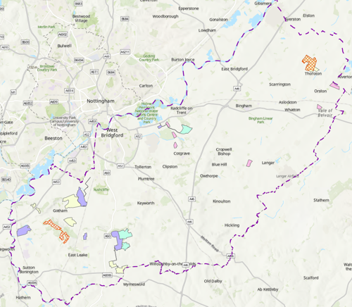
Allocated Sites with Planning Permission Granted
- Pink zones - completed
- Yellow zones - EIA screening opinion requests
- Green zones - planning application under consideration
- Lilac zones - permission granted
- Red grid zones - permission refused
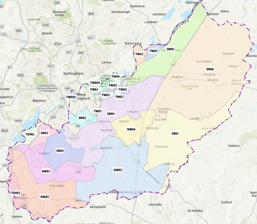
Draft Policy Zones (from Greater Nottingham Landscape Character Assessment 2009)
- NW01 Gotham and West Leake Wooded Hills and Scarps
- NW02 East Leake Rolling Farmland
- NW03 Widmerpool Clay Wolds
- NW04 Cotgrave Wooded Clay Wolds
- SN01 Clifton Slopes
- SN02 Ruddington Alluvial Farmland
- SN03 Mickleborough Fringe
- SN04 Cotgrave and Tollerton Village Farmlands
- SN05 East Bridgford Escarpment Farmlands
- SN06 Aslockton Village Farmlands
- TSV01 Attenborough Wetlands
- TSV02 Soar Valley
- TW01 Gamston and Edwalton Meadowlands
- TW02 Polser Brook Meadowlands
- TW03 Holme Pierrepont and Bassingfield Village Farmlands
- TW04 Trent Fields Meadowlands
- TW054 Colwick Country Park
- TW055 West Bridgford Recreational Fringe
- TW07 Shelford Village Farmlands
- TW51 Stoke Lock Meadowlands
- VB01 Vale of Belvoir
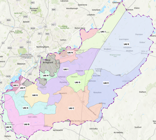
Solar Farm Landscape Sensitivity and Capacity Study
Landscape Assessment Units
- LAU A: Gotham and West Leake Wooded Hills and Scarps
- LAU B: East Leake Rolling Farmland
- LAU C: Widmerpool Clay Wolds
- LAU D: Cotgrave Wooded Clay Wolds
- LAU E: Vale of Belvoir
- LAU F: Clifton Slopes
- LAU G: Ruddington Alluvial Farmland
- LAU H: Mickleborough Fringe
- LAU I: Cotgrave and Tollerton Village Farmland Landscape baseline description
- LAU J: East Bridgford Escarpment Farmland
- LAU K: Aslockton Village Farmland
- LAU L: Attenborough Wetlands
- LAU M: Soar Valley Farmlands
- LAU N: Trent Valley Washlands
The hatched areas are classified as urban.
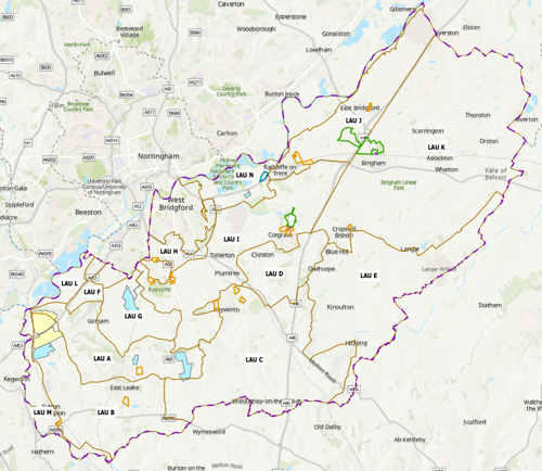
Allocated Sites with Planning Permission Granted
- Yellow zone - Local Development Order (granted)
- Blue zones - Solar Farm Planning Applications with Permission Granted
- Green outline - Strategic allocations
- Orange outline - housing allocations
- Blue outline - mixed use allocations
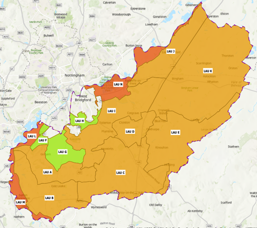
Landscape Sensitivity Judgements
- Green zones - low
- Orange zones - medium
- Dark orange zones - high
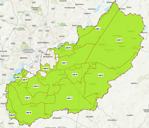
Capacity Judgements Very Small Scale
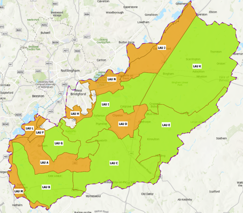
Capacity Judgements Small Scale
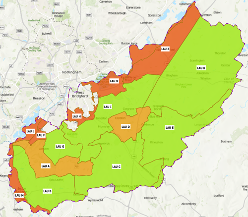
Capacity Judgements Medium Scale
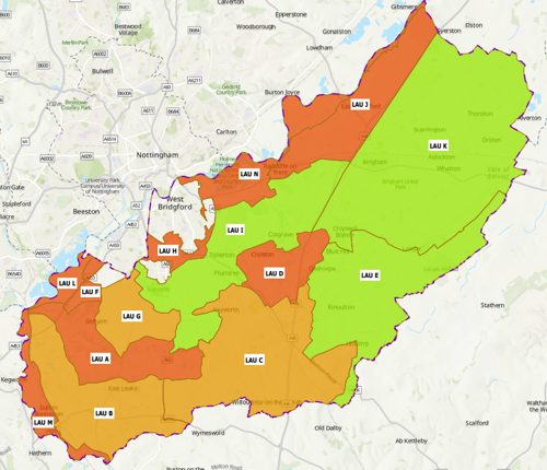
Capacity Judgements Large Scale
Appendix D - Supporting figures (context plans)
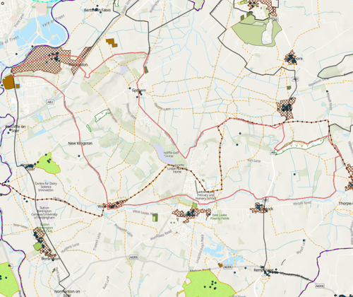
LAU A: Gotham and West Leake Wooded Hills and Scarps - Context Plan
- LAU boundary - light brown line
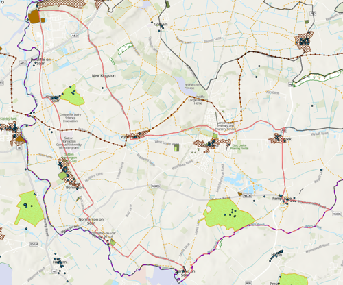
LAU B: East Leake Rolling Farmland - Context Plan
- LAU boundary - light brown line
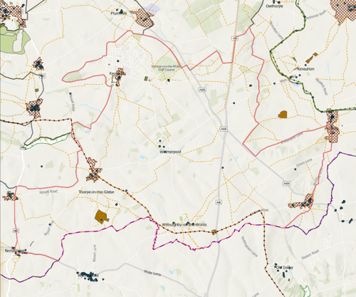
LAU C: Widmerpool Clay Wolds - Context Plan
- LAU boundary - light brown line
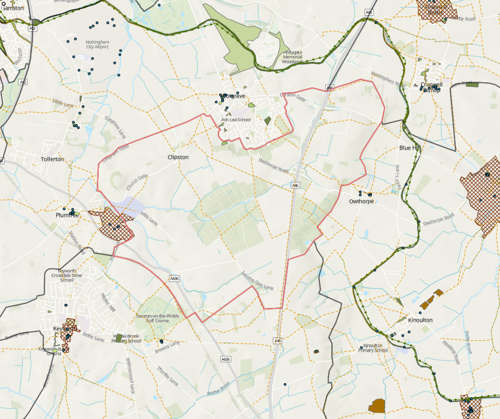
LAU D: Cotgrave Wooded Clay Wolds - Context Plan
- LAU boundary - light brown line
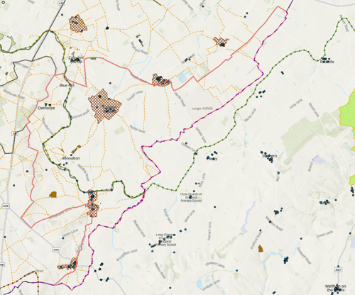
LAU E: Vale of Belvoir - Context Plan
- LAU boundary - light brown line
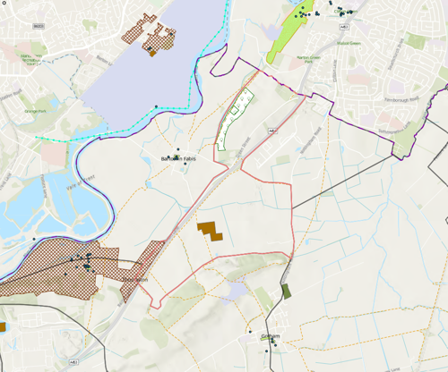
LAU F: Clifton Slopes - Context Plan
- LAU boundary - light brown line
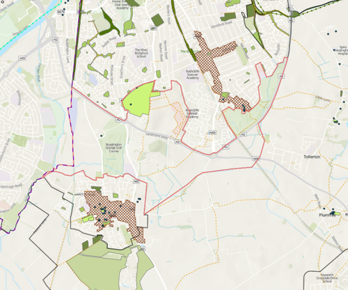
LAU G: Ruddington Alluvial Farmland - Context Plan
- LAU boundary - light brown line
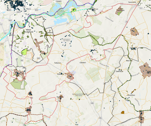
LAU H: Mickleborough Fringe - Context Plan
- LAU boundary - light brown line
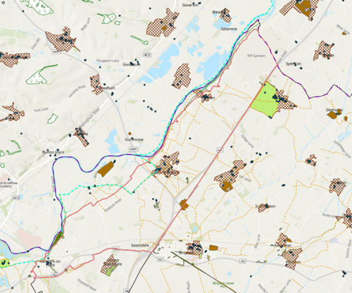
LAU I: Cotgrave and Tollerton Village Farmland - Context Plan
- LAU boundary - light brown line
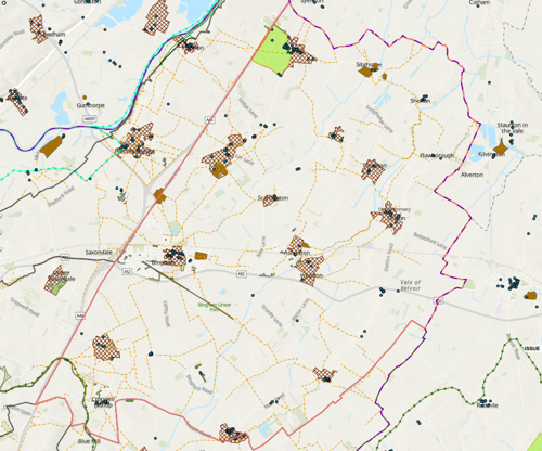
LAU J: East Bridgford Escarpment Farmland - Context Plan
- LAU boundary - light brown line
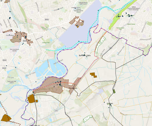
LAU L: Attenborough Wetlands - Context Plan
- LAU boundary - light brown line
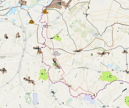
LAU M: Soar Valley Farmlands - Context Plan
- LAU boundary - light brown line
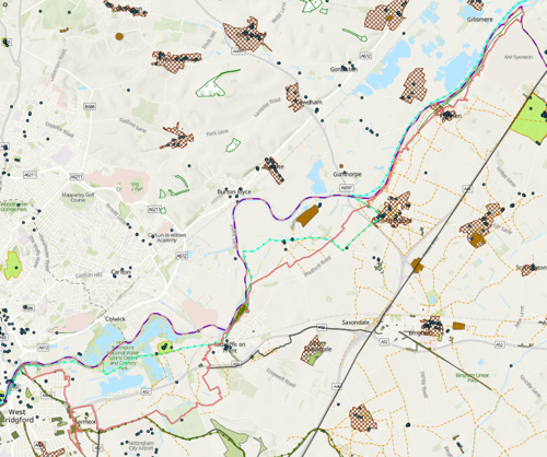
LAU N: Trent Valley Washlands - Context Plan
- LAU boundary - light brown line
Accessible Documents
- Air Quality Action Plan 2021
- Air Quality Annual Status Report 2024
- Air Quality Annual Status Report 2023
- Air Quality Annual Status Report 2022
- Air Quality Annual Status Report 2021
- Air Quality Strategy for Nottingham and Notts
- Annual Governance Statement 2023-24
- Annual Governance Statement 2021-22
- Annual Governance Statement 2020-21
- Asset Management Strategy
- Auditor's Annual Report 2021
- Internal Audit Annual Report 2021/22
- Auditor's Annual Report 2021-22
- Become a Councillor 2022
- Budget and Financial Strategy 2021-22
- Budget and Financial Strategy 2022-23
- Budget and Financial Strategy 2023-24
- Budget and Financial Strategy 2024-25
- Capital and Investment Strategy
- Climate Change Strategy 2021-2030
- Complaints Policy
- Compulsory Purchase Order Procedure Protocol
- Confidential Reporting Code
- Council Constitution
- Contaminated Land
- Corporate Enforcement Policy
- Corporate Strategy 2024-2027
- Council Tax Recovery and Enforcement Policy 2023
- Customer Access Strategy
- Design Code Baseline Appraisal
- Discretionary Housing Payments Policy 2023-2024
- Disabled Facilities Grant Policy 2022
- Disclosure and Barring Service Policy
- Economic Growth Strategy 2024
- Empty Homes Strategy
- Environment Policy 2023
- Equalities Scheme 2021-25
- External Audit Completion Report 2024
- External Audit Completion Report 2023
- External and Internal Communications Strategy
- Freedom Of Information Policy
- HB Recovery and Enforcement Policy
- Hackney Carriage and Private Hire Licensing Policy 2020 - 2025
- Homelessness and Rough Sleeping Strategy
- Housing Allocations Policy
- Housing Enforcement Policy
- ICT Strategy 2022 -25
- Information Management and Governance Strategy 2022-25
- Rushcliffe Borough Council Information Retention Schedule
- Internal Audit Annual Report 2023/24
- Leisure Strategy 2021-2027 review
- Local Code of Corporate Governance 2024/25
- Local Plan Part 1: Core Strategy
- Local Plan Part 2: Land and Planning Policies
- Local Plan Monitoring Report
- Local Scheme of Validation
- Off-street Car Parking Strategy
- Pay Policy Statement
- People Strategy 2021-26
- Planning Enforcement Policy
- Play Strategy
- Procurement Strategy
- Playing Pitch Strategy 2022
- 2021-22 Public Inspection Notice
- RIPA Policy and Guidance
- Risk Management Strategy 2023-26
- Rushcliffe Nature Conservation Strategy
- Solar Farm Landscape Sensitivity and Capacity Study
- Statement of Gambling Licensing Principles
- Statement of Accounts 2019-20
- Statement of Accounts 2020-21
- Statement of Accounts 2021-22
- Statement of Accounts 2021-22 (unaudited)
- Statement of Accounts 2022-23 (unaudited)
- Statement of Accounts 2022-23 (audited)
- Statement of Accounts 2023-24 (audited)
- Statement of Licensing Policy
- Street Trading Policy
- Supplementary Planning Documents
- Tenancy Strategy 2019
- Transformation Strategy and Efficiency Plan
- Tree Management and Protection Policy 2023
- WISE Agreement
- Conservation Areas
- Neighbourhood Plans
- The Nature of Rushcliffe 2021
- The Nature of Rushcliffe 2019
- Anti-Slavery Policy
- Modern Slavery & Human Trafficking Transparency Statement 2024-2025